
Puerto Deportivo de Marbella (Marbella)
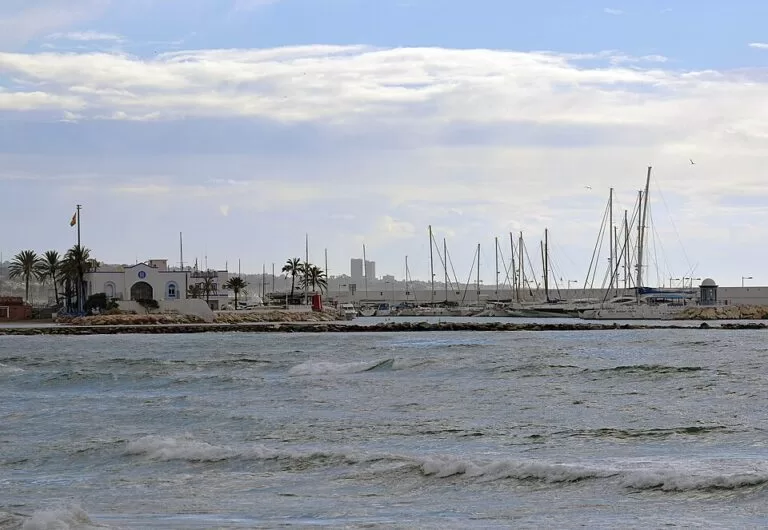
MarinaThe Puerto Deportivo de Marbella, the marina in the centre of Marbella, sits on the seafront at the foot of the old town, 0.8 km from the town centre and 6 km east of Puerto Banús. You walk to it along the Paseo Marítimo, the seafront promenade, or park in one of the paid underground car parks a few streets inland. It is a small, working yacht harbour with a sailing club, bars and restaurants, and town beaches right next to it on both sides. It suits sailors, walkers on the promenade and anyone staying in central Marbella. Skip it if you want the showy superyacht scene: that is Puerto Banús.
Quick facts
- Names: Puerto Deportivo de Marbella, also called Marbella Marina or the Port of Marbella. OpenStreetMap gives the full name as Puerto Deportivo Virgen del Carmen. Do not confuse it with Puerto Banús, La Bajadilla or Cabopino, Marbella’s other ports.
- Where: on the seafront of central Marbella (Málaga), by the Muelle Hermanos León, between Playa del Faro to the west and Playa de Venus to the east.
- Coordinates: 36.5057, -4.8894.
- Run by: Wikipedia says the port is one of four in Marbella and is managed indirectly by the Junta de Andalucía’s public ports agency, with a private operating company.
- Berths: we could not reach the operator’s or the ports agency’s own pages, so we do not give a berth number here. Wikipedia lists berths of 6 to 20 m, a 20 m wide entrance and about 3.5 m of water at the mouth.
- Radio: VHF channels 9 and 16, according to Wikipedia; confirm with the marina before arriving.
Access and parking
On foot: the marina is part of the seafront promenade. The old town begins about 0.5 km inland, and the town’s tourist information point on the seafront is 0.3 km to the west (OpenStreetMap).
Parking: there is very little parking at the port itself; OpenStreetMap shows one small car park at its landward end and another marked private. The nearest public car parks are underground and paid: Avenida del Mar (entrance on Calle Carlos Mackintosh), 0.4 km away; Arias Maldonado, 0.4 km to the north-west and marked open 24 hours; and Plaza de la Victoria, 0.6 km to the north-east.
By bus: the Marbella Centro stops on the main road are about 0.5 km away. OpenStreetMap shows them served by town lines 1 (to Puerto Banús), 2, 3, 6, 12 and 13, by the night lines 8 and 9, and by interurban buses including the M-220 to Fuengirola and lines 70, 77 and 79 to Estepona. Check the operators’ current timetables.
By boat: OpenStreetMap marks a passenger boat stop for Puerto Banús at the western edge of the port. We could not confirm the operator or a timetable.
What to expect
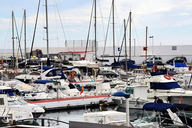
A compact harbour of sailing yachts and motor boats, much smaller in scale than Puerto Banús. The Real Club Marítimo de Marbella, a sailing club, has its building on the quay, and the Marbella lighthouse (Faro de Marbella) stands just behind the port, 0.2 km from the basin. Bars, restaurants and beach clubs line the land side of the port and the beaches on either side. These change often, so check before you go.
Spain’s tourist board describes Playa de la Venus, the beach on the east side of the port, as 400 m long and 40 m wide, of sand and gravel with calm water, and lists sunshade and lounger rental, toilets and showers (Spain.info). It names the Puerto Deportivo de Marbella as the beach’s marina. Playa del Faro lies on the west side, next to the lighthouse.
Services for visiting boats
We could not reach the marina’s own pages or the Andalusian ports agency for this guide. Wikipedia gives these figures for the port, which we could not check with the operator:
- Berths for boats from 6 to 20 m long; about a quarter offered for rent.
- Entrance 20 m wide, about 3.5 m deep at the mouth and 2 m inside the basin, with a sandy bottom.
- VHF channels 9 and 16.
The shallow basin matters: deeper boats should check depths with the marina before entering. Ask the marina directly for berth rates, fuel, water, electricity and showers.
Prices and opening
The quay and promenade are open to walkers, and we found no entry charge. The car parks nearby are paid; we could not check their rates. Bars and restaurants set their own hours.
Accessibility and safety
The Paseo Marítimo is flat and paved, and OpenStreetMap marks free public toilets on the promenade to the east as wheelchair accessible. The breakwater is made of large rocks: do not climb on it. Keep children away from the quay edges. We could not confirm step-free access onto the pontoons, which are for berth holders.
Best time to visit
Any time of year for a walk: the port is part of the town’s everyday promenade. Come in the morning in summer, when the nearby beaches fill up and parking in the centre is harder. For sailors, the shallow basin and small size make it a place to book ahead in high season.
Nearby alternatives
- Marbella Lighthouse, 0.2 km away: the lighthouse right behind the port.
- Marbella town guide, 0.8 km away: the old town, beaches and food.
- Puerto Banús, 6 km away: Marbella’s famous luxury marina, to the west.
- Sierra Blanca, 6.8 km away: the mountains behind the town.
- Basílica de Vega del Mar, 9.8 km away: a historic site further west.
Distances are in a straight line from the marina.
FAQ
Is the Puerto Deportivo de Marbella the same as Puerto Banús?
No. Puerto Banús is a separate marina 6 km to the west. The Puerto Deportivo de Marbella is the smaller marina in the town centre.
Is there parking at the Marbella marina?
Very little at the port. Use the paid underground car parks on the Avenida del Mar or at Arias Maldonado, both about 0.4 km away.
How do I get to the Marbella marina by bus?
Get off at the Marbella Centro stops, about 0.5 km away, and walk down to the seafront. Town line 1 links the centre with Puerto Banús.
Can you swim near the Marbella marina?
Not in the harbour, but Playa de la Venus is right next to it on the east side and Playa del Faro on the west side.
How many berths does the Puerto Deportivo de Marbella have?
We could not check the operator’s current figure, so we do not give one. Ask the marina directly.
Sources and freshness
Checked 6 November 2026 · 4 sources Show
Checked 6 November 2026. Official tourism: Spain.info, La Venus beach (size, surface, services, marina). Management, berth sizes, depths and radio channels: Wikipedia, Puerto Deportivo de Marbella. Location, car parks, bus stops and lines, the boat stop, the sailing club, toilets, beaches and distances: OpenStreetMap (OpenStreetMap contributors, ODbL). The marina’s own website, the Andalusian public ports agency and the Andalusian tourist board’s page on the marina could not be reached for this update. Photos: Wikimedia Commons, licences as credited.
This place is part of our Costa del Sol travel guide: where it is, towns and beaches — see every town, beach and cove we have mapped on that coast.
How this page is made. CostaMap is written with an AI editorial system run by Ebizapple. This page is based on the sources listed above. Last updated 6 November 2026. Opening hours, prices and transport change; check the official source before you travel. How we work · Partner links and ads