
Puerto Deportivo de Estepona (Estepona)
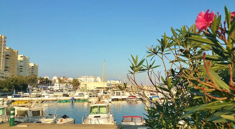
MarinaThe Puerto Deportivo de Estepona, Estepona’s marina, lies on the seafront about 1.8 km west of the town centre, between the Playa del Cristo and La Rada beach. You can walk there along the seafront, take a town bus to the Avenida del Carmen stops 0.3 km away, or drive and use the open car parks behind the port. It is a working mixed harbour: yachts, a fishing port and a boatyard on one side, a quay of bars and restaurants on the other, and a street market every Sunday. It suits families, walkers and sailors heading for the Strait of Gibraltar. Skip it if you want a polished superyacht marina; for that, look east to Puerto Banús.
Quick facts
- Names: Puerto Deportivo de Estepona, also Puerto de Estepona, Estepona Marina or Port of Estepona. The fishing harbour on its east side is the Puerto Pesquero.
- Where: Avenida Luis Braille, Estepona (Málaga), on the western Costa del Sol, below the Punta Doncella lighthouse.
- Coordinates: 36.4145, -5.1575.
- Berths: we could not reach the operator or the Andalusian ports agency, so we give no berth number here.
- Boat sizes and depth: the Andalusian tourist board lists berths for boats of 8 to 35 m, an 80 m wide entrance, 5 m of water at the mouth and 1.5 to 4 m inside the basin.
- Contact: the tourist board gives the marina’s phone as +34 952 801 800.
- Market: a street market of local produce and crafts on the marina every Sunday (Spain’s tourist board).
Access and parking
On foot: the marina is part of Estepona’s seafront. The town’s municipal tourist office stands 0.3 km from the basin on the landward side, and the old bullring with its museums is 0.4 km away (OpenStreetMap).
Parking: OpenStreetMap shows several open car parks within 0.2–0.3 km of the quay, and two larger surface car parks marked free 0.45–0.5 km away, one by the Playa del Cristo road and one inland.
By bus: the Av. del Carmen – Urb. Kai Alde stops are about 0.3 km from the marina. OpenStreetMap shows them on Estepona town lines E-1 and E-2, the interurban line 77 (Casares – Estepona – Hospital Costa del Sol) and the M-240 between Estepona and La Línea. Check current timetables with the operators.
By taxi: there is a taxi rank, the Parada del Puerto, 0.3 km from the basin.
What to expect
A practical, everyday marina rather than a showpiece. The Andalusian tourist board notes that boat trips leave from here for the Strait of Gibraltar, and singles out the Playa del Cristo, the beach just west of the port (Andalucía tourist board). On the quay you find boat charter and sales offices, a slipway, restaurants of many kinds, cafés, bars and a small supermarket. OpenStreetMap also maps pubs and a nightclub on the streets behind the port.
The east side of the harbour belongs to the fishing fleet and the Varadero Estepona boatyard. Above it stands the Faro de Punta Doncella, the town lighthouse, 0.35 km from the basin. Spain’s tourist board names the seafront promenade and the marina, with its Sunday market of traditional products and crafts, among the town’s highlights (Spain.info, Estepona).
Services for visiting boats
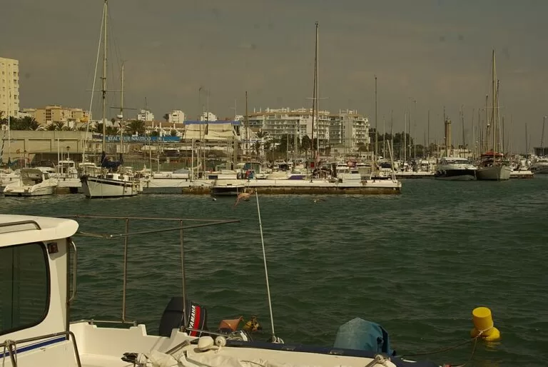
The Andalusian tourist board lists these services at the port: berth rental (it says about half the berths are offered for rent), boat rental, a harbour office, a sailing club, electricity, a crane, slipways, toilets and showers, Wi-Fi and parking. It also notes diving and fishing. It gives the outer breakwater head at 36° 24′ 42″ N, 5° 9′ 30″ W, with a green light, on nautical chart D-454.
We could not check these figures with the marina itself. Ask the marina about transit berths, rates, fuel and office hours before you arrive.
Prices and opening
The quays, the market and the promenade are open to everyone, and we found no entry charge. We could not confirm the car park rates or the market’s hours. Restaurants and bars set their own hours, and berth rates were not available from an official source when we checked in November 2026.
Accessibility and safety
The promenade around the marina is flat and paved. OpenStreetMap marks public toilets on the quay as wheelchair accessible, and the tourist board lists the port as accessible for disabled visitors. We could not confirm step-free access onto the pontoons, which are for boat crews. The working fishing quay and the boatyard have moving vehicles and cranes: keep children close there, and stay off the breakwater rocks.
Best time to visit
Sunday morning for the market; a weekday morning for a quieter walk. In summer, go early if you also want a spot on the Playa del Cristo nearby.
Nearby alternatives
- Estepona town guide, 1.8 km away: the old town, its flower-pot squares and murals route.
- Selwo Aventura, 8.4 km away: the safari park east of town.
- Casares, 10.8 km away: the white hill village behind the coast.
- Basílica de Vega del Mar, 16.2 km away: an early Christian site in San Pedro Alcántara.
- Puerto Banús, 20 km away: Marbella’s luxury marina.
Distances are in a straight line from the marina.
FAQ
When is the Estepona marina market?
Every Sunday, according to Spain’s tourist board, with traditional products and crafts. We could not confirm the hours.
Is there parking at Estepona marina?
Yes. OpenStreetMap shows several open car parks within 0.3 km and two free surface car parks about 0.5 km away.
How do I get to Estepona marina by bus?
Get off at the Av. del Carmen – Urb. Kai Alde stops, about 0.3 km away. Town lines E-1 and E-2 and the interurban lines 77 and M-240 stop there, according to OpenStreetMap.
Is there a beach next to Estepona marina?
Yes. The Playa del Cristo, a sandy beach, lies about 0.8 km west of the basin, and La Rada beach starts 1.6 km to the east.
How many berths does Estepona marina have?
We could not check the operator’s current figure, so we do not give one. Ask the marina directly.
Sources and freshness
Checked 6 November 2026 · 4 sources Show
Checked 6 November 2026. Official tourism: Andalucía tourist board, Puerto Deportivo de Estepona (boat sizes, depths, entrance, services, contact, chart) and Spain.info, Estepona (Sunday market). Location, car parks, bus stops and lines, taxi rank, toilets, lighthouse, beaches and distances: OpenStreetMap (OpenStreetMap contributors, ODbL). The marina operator’s website and the Andalusian public ports agency could not be reached for this update. Photos: Wikimedia Commons, licences as credited.
This place is part of our Costa del Sol travel guide: where it is, towns and beaches — see every town, beach and cove we have mapped on that coast.
How this page is made. CostaMap is written with an AI editorial system run by Ebizapple. This page is based on the sources listed above. Last updated 6 November 2026. Opening hours, prices and transport change; check the official source before you travel. How we work · Partner links and ads