
Sierra Crestellina (Casares)
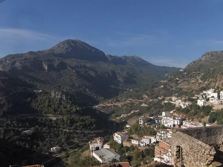
Natural parkSierra Crestellina is the jagged grey limestone ridge that rises right behind Casares, a small protected natural area known for the largest griffon vulture breeding colony in Málaga province and for views to Gibraltar and, on clear days, Africa. You start from the Casares visitor centre on the A-7150 at the top of the village, where there is parking, and walk up the SL-A 1 trail to the Refugio Sierra Crestellina, about 1.2 km away in a straight line. It suits walkers and birdwatchers who are already visiting Casares; skip it if you want a shaded or easy stroll in midsummer.
Quick facts
- Names: Paraje Natural Sierra Crestellina in Spanish. The name comes from its sharp crests (crestas), according to Andalucía’s tourist board.
- Where: entirely within the municipality of Casares, on the southern edge of the Serranía de Ronda, above the Genal valley (Wikipedia, Spanish).
- Coordinates (Refugio Sierra Crestellina): 36.4560, -5.2814 (OpenStreetMap).
- Size and height: 477.5 ha; the ground rises from about 400 m at the Albarrá stream to about 900 m on the crest in barely a kilometre (Wikipedia, Spanish). OpenStreetMap marks the Cerro de las Chapas at 943 m on the ridge.
- Protection: protected since 1989; Special Area of Conservation in the Natura 2000 network since 2013 (Wikipedia, Spanish).
- Known for: breeding colonies of griffon vulture and Bonelli’s eagle, the rare deadly nightshade Atropa baetica, and views over Casares and the Strait.
- Entry: free; no ticket or booking was found for the trails.
Access and parking
By car: Casares is about 12 km from Estepona and 8 km from Manilva in a straight line, by road on the A-7150 and the MA-8300 (OpenStreetMap). The Centro de Visitantes de Casares sits on the A-7150 at the western top of the village. Andalucía’s tourist board says it has a large car park with step-free access, a wide terrace and views over Casares, the Sierra Crestellina, the coast and the Strait of Gibraltar.
By bus: OpenStreetMap shows Avanza line 77 between Casares, Estepona and the Hospital Costa del Sol. The visitor centre offers transport from the Casares bus station up to the centre for those who need it (Andalucía’s tourist board). We could not confirm timetables.
On foot from the village: OpenStreetMap shows a free car park on the east side of Casares and several smaller ones in the village, from where you can walk up through the streets to the visitor centre.
What to expect
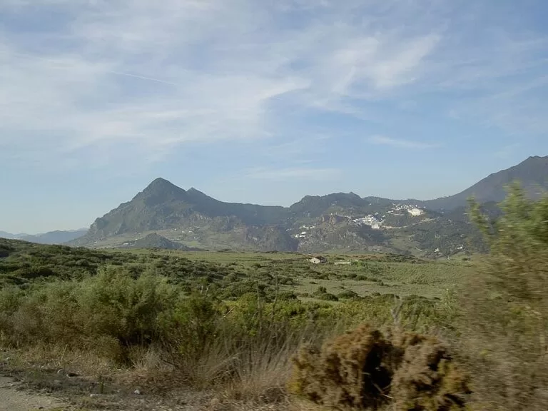
Andalucía’s tourist board calls Crestellina small but full of interest. Its sharp, almost inaccessible crests are grey limestone, which sets it apart from the red peridotite of nearby Sierra Bermeja. Wikipedia (Spanish) describes it as a steep rock of Jurassic limestone over the sandstones of the Genal valley, with a small karst crest on top.
The slopes are Mediterranean woodland: cork oak, gall oak and holm oak, as in the shady Monte del Duque, with pine, juniper and kermes oak. On the east and north-east slopes there are the best-kept patches of cork and gall oak and dense scrub of mastic and wild olive. Rarities include the tabaco de pastor (Atropa baetica), an endangered plant (Andalucía’s tourist board; Wikipedia, Spanish).
The big draw is the birds. Andalucía’s tourist board describes breeding colonies of Bonelli’s eagle and griffon vulture, the largest vulture colony in the province, which you can watch from the Mirador del Buitre. Peregrine falcon and eagle owl nest on the cliffs, and ibex, roe deer, wild boar, fox, Egyptian mongoose, genet and stone marten live on the slopes.
Trails
OpenStreetMap shows these marked routes:
- SL-A 1, Refugio Sierra Crestellina: an 8.65 km local trail run by Casares town hall, past the Refugio Sierra Crestellina mountain shelter and a picnic area. Andalucía’s tourist board describes a route over the Puerto de las Viñas pass and the refuge, from where you see how the landscape changes with height.
- Crestellina Natural: a short 1.3 km route signed by the Junta de Andalucía.
- GR 249, Gran Senda de Málaga: the long-distance trail around Málaga province passes through Casares on its stages from Genalguacil and on to Estepona.
- Mirador de la Cosalba: a viewpoint about 400 m south-west of the refuge, above the village.
Other viewpoints, says Andalucía’s tourist board, look over the Rock of Gibraltar, the Los Alcornocales Natural Park and, on the clearest days, the African coast.
Practical details
- Information: the Casares visitor centre at the top of the village, and the tourist office in the Casa Natal de Blas Infante, the birthplace of the father of Andalusian nationalism, which also holds a permanent exhibition on his life (Andalucía’s tourist board).
- Water and food: OpenStreetMap shows the Fuente de la Arquita spring below the ridge and several restaurants in Casares village. Take water on the trails.
- Weather: the area is wetter than the coast, with about 800 mm of rain a year and frequent fog (Wikipedia, Spanish).
- Combine with: the village of Casares, its castle ruins and the church of La Encarnación.
Accessibility and safety
The visitor centre is designed for people with reduced mobility, with step-free access from the car park to the building and terrace (Andalucía’s tourist board), so the views over Casares and the coast are within reach of everyone. The trails beyond are steep mountain paths on gravel and rock, not suitable for wheelchairs or pushchairs. There is little shade on the west side, which is open holm oak and scrub. In summer the fire risk is high: no fires, and respect any closures. Keep well back from cliff edges and do not disturb nesting birds of prey. Rules for dogs and drones could not be confirmed.
Best time to visit
Spring and autumn bring mild walking weather and the best light on the crest. Andalucía’s tourist board recommends Casares in autumn, when the coast is quiet. Vultures fly on warm days when thermals rise, so late morning to mid afternoon is good for watching them. Avoid the middle of a summer day on the open slopes.
Nearby alternatives
- Casares, about 1.5 km away: the white hill village below the ridge, a Historic-Artistic Site since 1978.
- Sierra Bermeja and Los Reales, about 7 km away: the red peridotite range with pinsapo firs and a summit at about 1,450 m.
- Puerto de la Duquesa, about 12 km away: Manilva’s marina on the coast.
- Estepona, about 13 km away: the nearest large town, with La Rada beach.
- Marina de Sotogrande, about 19 km away: the marina across the Cádiz border.
Distances are in a straight line from the Refugio Sierra Crestellina (OpenStreetMap).
FAQ
Where does the Sierra Crestellina walk start?
Most walkers start at the Casares visitor centre on the A-7150 at the top of the village, which has a large car park. The SL-A 1 trail leads up to the Refugio Sierra Crestellina.
How long is the Sierra Crestellina trail?
The SL-A 1 route is 8.65 km and the Crestellina Natural route 1.3 km (OpenStreetMap). Allow extra time for the steep climb.
Can you see vultures at Sierra Crestellina?
Yes. It holds the largest griffon vulture breeding colony in Málaga province, which you can watch from the Mirador del Buitre (Andalucía’s tourist board).
Is there parking for Sierra Crestellina?
Yes, at the Casares visitor centre, and a free car park on the east side of Casares village (OpenStreetMap).
Can you see Africa from Casares?
On the clearest days, yes: the viewpoints of the Sierra Crestellina look over the Strait of Gibraltar to the African coast (Andalucía’s tourist board).
Sources and freshness
Checked 7 November 2026 · 8 sources Show
Checked 7 November 2026. Official: Andalucía’s tourist board on Sierra Crestellina, the Casares visitor centre, Casares, the Casa Natal de Blas Infante and the blog Casares and Manilva in autumn; Spain.info on Casares. Background: Wikipedia (Spanish). Map data: OpenStreetMap (roads, car parks, refuge, trails SL-A 1 and Crestellina Natural, GR 249, bus line 77, viewpoints, distances). Not confirmed: the exact location of the Mirador del Buitre, trail times, bus timetables, rules for dogs and drones.
This place is part of our Costa del Sol travel guide: where it is, towns and beaches — see every town, beach and cove we have mapped on that coast.
How this page is made. CostaMap is written with an AI editorial system run by Ebizapple. This page is based on the sources listed above. Last updated 6 November 2026. Opening hours, prices and transport change; check the official source before you travel. How we work · Partner links and ads