
The Marina de Sotogrande, also called Puerto Sotogrande, is the yacht harbour of the Sotogrande estate in San Roque (Cádiz), at the western end of the Costa del Sol, 8 km south-west of Puerto de la Duquesa. You reach it by car from the A-7 coast road, with free car parks 0.3–0.4 km from the basin, or by the M-240 bus to the Las Camelias – Puerto de Sotogrande stop, 0.8 km away. Around the basin are quayside restaurants, shops and a five-star hotel, with a 700 m sandy beach right next to the port. It suits sailors with larger boats, people staying in Sotogrande, and walkers who want a quiet seafront. Skip it if you want an old town: Sotogrande is a modern estate of housing and golf.
Quick facts
- Names: Marina de Sotogrande, Puerto de Sotogrande, Puerto Sotogrande or Sotogrande Marina. It lies in the San Roque municipality, next to Torreguadiaro.
- Where: Torre de Control s/n, Puerto de Sotogrande, San Roque (Cádiz), just south of the mouth of the Guadiaro river.
- Coordinates: 36.2900, -5.2720.
- Berths: the operator’s website could not be reached, so we give no berth number here.
- Boat sizes and depth: the Andalusian tourist board lists berths for boats of 6 to 50 m and up to 70 m at most, an 80 m wide entrance, 5 m of water at the mouth and 3 to 5 m inside the basin.
- Contact: the tourist board gives the marina’s phone as +34 956 790 000.
- Golf: the area’s courses include Valderrama, a former Ryder Cup venue, and the Real Club de Golf de Sotogrande, the tourist board notes.
Access and parking
By car: the port lies on the seaward side of the A-7, which Spain’s tourist board names as the nearest main road (Spain.info, Sotogrande beach).
Parking: OpenStreetMap marks two free surface car parks 0.3 and 0.4 km from the basin, one behind the beach on the south side of the port and one by the Laguna de Torreguadiaro on the north side. A paid underground car park lies 0.3 km away, and the San Roque council runs street parking along the shopping streets. Many other underground garages belong to the apartment blocks and are private.
By bus: the Las Camelias – Puerto de Sotogrande stops are about 0.8 km from the basin. OpenStreetMap shows them on the M-240 between Estepona and La Línea de la Concepción, the San Roque town Bus Rojo to San Roque centre, and the M-470 beach bus from San Pablo de Buceite. The Av. Mar del Sur stops in Torreguadiaro, about 1 km north, are on the same routes. Check timetables before you travel.
What to expect
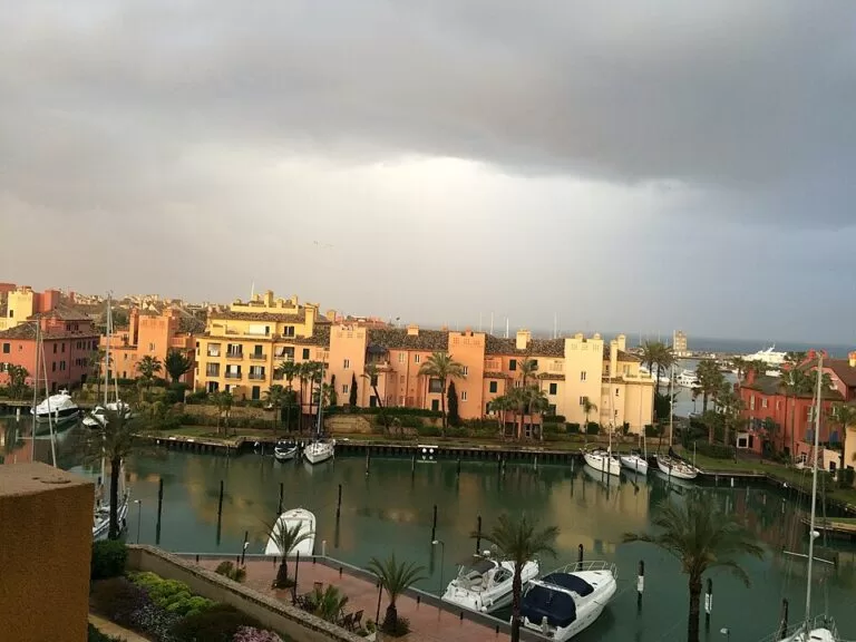
A planned, upmarket marina. The Andalusian tourist board calls it a select place surrounded by luxury housing estates and golf courses (Andalucía tourist board). Apartment blocks with names like Ribera del Marlin stand on small islands and quays linked by bridges, and OpenStreetMap shows a lock gate into an inner canal. Small squares such as the Plaza del Agua and the Plaza de las Palmeras, kept by San Roque council, hold restaurants, cafés, clothes shops and a gym. The five-star Hotel MIM Sotogrande sits on the quay.
The beach on the south side of the port, the Playa Puerto Sotogrande, is 700 m long and 70 m wide according to the tourist board, with a lifeguard service, toilets, showers, and sunbeds and umbrellas for rent. Beach clubs line it. Spain’s tourist board describes the wider Sotogrande beach as 2,250 m of dark sand with moderate waves and high occupancy, and says the area is known for its annual polo championships, as well as padel tennis and golf. On the north side, a bird hide looks over the Laguna de Torreguadiaro, a small protected lagoon.
Services for visiting boats
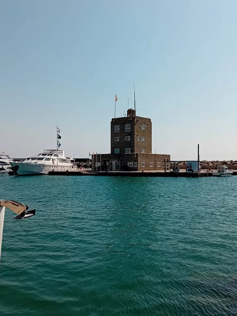
The Andalusian tourist board lists a fuel station, a dry marina, a crane, slipways, a harbour office, a sailing club and sailing academy, a gym, electricity, toilets, showers, Wi-Fi and parking, and says about a quarter of the berths are offered for rent. OpenStreetMap marks the control tower with the harbour office at the south end of the basin, a visitors’ berth and the fuel berth beside it, and a boatyard with a boat hoist on the north quay. The tourist board gives the breakwater head at 36° 17′ 9″ N, 5° 16′ 11″ W, with a green light, on nautical chart D-453.
We could not check these figures, transit rates or office hours with the marina itself. Contact the marina before arriving.
Prices and opening
The quays, squares and beach are open to everyone, and we found no entry charge. Two car parks near the port are marked free on OpenStreetMap; the underground one is paid, at rates we could not check. Restaurants, shops and beach clubs set their own hours, and berth rates were not available from an official source when we checked in November 2026.
Accessibility and safety
The quays and squares are mostly flat and paved, and the tourist board lists the port as accessible for disabled visitors. OpenStreetMap marks the public toilets by the south car park as not wheelchair accessible, and we could not confirm step-free access onto the pontoons, which are for boat crews. The tourist board lists a lifeguard service on the beach; waves can be moderate. Do not climb on the breakwaters.
Best time to visit
Spring and autumn for a quiet walk round the port and the lagoon. In July and August the beach and its beach clubs are at their busiest. For sailors, the tourist board’s figure of a quarter of berths for rent means booking ahead in summer.
Nearby alternatives
- Puerto de la Duquesa, 8.2 km away: Manilva’s smaller marina, with a castle and a beach.
- San Roque, 13.5 km away: the hill town that Sotogrande belongs to.
- La Línea de la Concepción, 15.2 km away: the border town next to Gibraltar.
- Puerto Deportivo de Estepona, 17.2 km away: Estepona’s marina with its Sunday market.
- Casares, 17.2 km away: a white village in the hills.
Distances are in a straight line from the marina.
FAQ
How do I get to Sotogrande Marina?
By car from the A-7, or by the M-240 bus between Estepona and La Línea to the Las Camelias – Puerto de Sotogrande stop, about 0.8 km from the basin.
Is there parking at Sotogrande Marina?
Yes. OpenStreetMap marks two free surface car parks 0.3 and 0.4 km from the basin, and a paid underground car park.
Is there a beach at Sotogrande Marina?
Yes. The Playa Puerto Sotogrande, 700 m long, lies right beside the port, with a lifeguard service and sunbed rental.
Is Puerto Sotogrande the same as Marina de Sotogrande?
Yes. Both names, and Sotogrande Marina, are used for the same port in San Roque.
How big are the boats Sotogrande can take?
The Andalusian tourist board lists berths for boats of 6 to 50 m, and up to 70 m at most.
Sources and freshness
Checked 6 November 2026 · 5 sources Show
Checked 6 November 2026. Official tourism: Andalucía tourist board, Puerto Deportivo de Sotogrande (boat sizes, depths, entrance, services, contact, golf, chart), Andalucía tourist board, Playa Puerto Sotogrande (beach size and services) and Spain.info, Sotogrande beach (beach, polo, A-7). Location, car parks, bus stops and lines, toilets, harbour office, fuel berth, boatyard, lagoon and distances: OpenStreetMap (OpenStreetMap contributors, ODbL). The marina’s own website could not be reached for this update. Photos: Wikimedia Commons, licences as credited.
This place is part of our Costa del Sol travel guide: where it is, towns and beaches — see every town, beach and cove we have mapped on that coast.
How this page is made. CostaMap is written with an AI editorial system run by Ebizapple. This page is based on the sources listed above. Last updated 6 November 2026. Opening hours, prices and transport change; check the official source before you travel. How we work · Partner links and ads