
Punta Entinas-Sabinar (Roquetas de Mar and El Ejido)
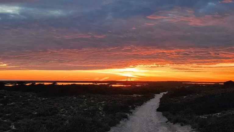
Natural parkPunta Entinas-Sabinar is the protected strip of dunes, salt pans and wild beach between Roquetas de Mar and Almerimar (El Ejido) on the western Costa de Almería. It is a band about one kilometre wide between the sea and the low hills of Los Alcores, running from Punta de Entinas to the Cerrillos and Viejas salt pans, and you reach it on foot from the edge of Almerimar or of the Roquetas resort strip at Playa Serena. It suits birdwatchers, walkers and anyone who wants a long beach with no buildings; skip it if you need sunbeds, bars or shade.
Quick facts
- Names: Punta Entinas-Sabinar; officially both a Paraje Natural and a Reserva Natural (natural site and nature reserve), “Paraje y Reserva Natural de Punta Entinas-Sabinar” on OpenStreetMap. The beach inside it is listed as Playa de Punta Entinas-Sabinar, and the eastern part as Playa de Cerrillos.
- Where: the south-west of Almería province, shared by the municipalities of Roquetas de Mar and El Ejido (Andalucía.org).
- Coordinates: 36.7058, -2.6628 (centre of the protected area, OpenStreetMap).
- Protection: a Special Protection Area for Birds (ZEPA) and, since 2006, a Ramsar wetland of international importance (Andalucía.org).
- Beach: 6,500 m long and about 80 m wide, dark sand, moderate waves and often windy, low occupancy and no buildings (spain.info).
- Visitor centre: the Centro de Interpretación de Punta Entinas-Sabinar, at the Almerimar end (Andalucía.org).
- Entry: we found no entry charge on the official pages.
Access and parking
From Almerimar (west): spain.info describes the beach as starting at the northern end of the Almerimar resort, and the Centro de Interpretación sits at 36.6921, -2.7799 on the edge of the resort (Andalucía.org). OpenStreetMap shows several small free car parks beside the centre and Playa de Levante, about 150 m from the visitor centre.
From Roquetas de Mar (east): the Roquetas resort strip ends at Playa Serena, beside the golf course (spain.info). OpenStreetMap shows a series of car parks marked free behind Playa Serena, and one more car park at 36.7050, -2.6450, about 100 m from Playa de Cerrillos, where the protected beach begins. The salt pans of Cerrillos lie about 3 km further west.
By car inside the reserve: spain.info says the beach can be reached by car on the dirt tracks that cross the Paraje Natural, and names the AL-9006 as the nearest road, but also rates access as “easy on foot”. We could not find the current rules on driving in the reserve, so plan to park at either end and walk.
Without a car: the nearest regular buses run to Roquetas de Mar and El Ejido; we could not confirm a bus stop at either entrance.
What to expect
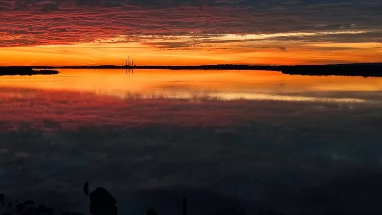
Andalucía.org calls the reserve the least altered wetland of Almería province, with one of the best-preserved dune systems in the Iberian Peninsula. Four landscapes sit side by side: the sandy beach, dunes held in place by Mediterranean scrub, the salt pans of Cerrillos and Salinas Viejas, and small ponds. The Charcones de Punta Entinas are two half-silted lagoons cut off from the sea by a bar of sand and dunes, with marsh and saltmarsh around them (Andalucía.org).
The plants are adapted to sand, heat, little water and salt. Marram grass (barrón) holds the front dunes, and behind it grow lentisk, the black Phoenician juniper (sabina negra) that gives the place its name, buckthorn and agaves. The sea daffodil flowers white on the sand. Reed and tamarisk ring the salt pans. Offshore there are meadows of Posidonia seagrass, which the tourist board describes as the westernmost colony in the Mediterranean (Andalucía.org).
For birds, the main draw is the flamingo, together with many waders that rest here on migration: sandpipers, redshanks and godwits. Audouin’s gull and the little gull also use the beach. In the dunes live reptiles such as the Montpellier snake, the horseshoe whip snake and the ocellated lizard. On the Salinas de Cerrillos path you can see grey herons and shovelers, and the tourist board says flamingos build their mud nests among the reeds of the Charcón del Flamenco (Andalucía.org).
The beach itself is wild: spain.info lists only a tourist office and beach cleaning as services, and says that the quiet has made nudist areas increasingly popular. OpenStreetMap tags Playa de Cerrillos as nudism permitted. Andalucía.org describes both Cerrillos and the main Punta Entinas beach as very quiet, with no buildings of any kind (Andalucía.org).
The ruin of the Torre de Cerrillos stands near the eastern salt pans (OpenStreetMap). It is one of the coastal watchtowers that, with the towers of Entinas, Balerma and Guardias Viejas, defended this shore between the 16th and 18th centuries (Andalucía.org).
Practical details
- Visitor centre: the Centro de Interpretación is an “intelligent classroom” for environmental education, with panels, screens and interactive activities about the reserve. The listing gives no opening hours; check before you go.
- Bring: water, sun protection and binoculars. There is no shade on the beach and no kiosk inside the reserve.
- Walking distances: the beach is 6.5 km long, so a walk from one end to the other and back is about 13 km on sand. The visitor centre and the Cerrillos car park are about 12 km apart in a straight line.
- Nearest services: cafés, toilets and shops in Almerimar and along Playa Serena in Roquetas de Mar.
Accessibility and safety
The beach is isolated and we found no mention of lifeguards in the official listings, unlike the town beaches on either side. Walking is on soft sand and dune paths; we could not confirm a step-free route to the shore. Stay off the dunes and away from nesting areas, and keep dogs on a lead near the lagoons. The coast is often windy: spain.info lists it as “ventosa”, with moderate waves.
Best time to visit
For birds, come in spring and autumn, when the waders stop on migration, and early in the morning, when the light is low and the wind is usually lighter. Summer is hot with no shade, but the beach stays uncrowded compared with the resort beaches next to it. Avoid the hottest hours in July and August.
Nearby alternatives
- Puerto Deportivo de Almerimar, 11.5 km from the centre of the reserve: the marina at the western entrance, with restaurants and beaches.
- Aguadulce, 14 km north-east: the resort of Roquetas closest to Almería, with a Blue Flag beach and marina.
- Albufera de Adra, 26 km west: two lagoons and the rare white-headed duck.
- Alcazaba de Almería, 23 km away: the Moorish fortress above Almería city.
- Cabo de Gata, 42 km away: the salt pans and volcanic cape on the other side of the Bay of Almería, with more flamingos.
Distances are in a straight line from the centre of the reserve.
FAQ
Where is Punta Entinas-Sabinar?
On the coast between Roquetas de Mar and Almerimar (El Ejido), in the west of Almería province. The beach starts at the northern end of Almerimar and runs east to Playa de Cerrillos near Playa Serena.
Is there parking at Punta Entinas?
Yes, at both ends. OpenStreetMap shows free car parks beside the visitor centre in Almerimar and behind Playa Serena in Roquetas, plus a car park near Playa de Cerrillos.
Can you swim at Punta Entinas-Sabinar?
Yes, it is a beach of dark sand 6.5 km long, but it is often windy with moderate waves, and we found no lifeguard service listed. It has no services beyond cleaning.
Is Punta Entinas a nudist beach?
Spain.info says nudist areas are increasingly popular because of the quiet, and OpenStreetMap marks Playa de Cerrillos as nudism permitted. It is not an exclusively nudist beach.
Can you see flamingos at Punta Entinas?
Yes. The tourist board names the flamingo first among its birds, at the salt pans and in the Charcón del Flamenco. Spring and autumn bring the most waders.
Sources and freshness
Checked 9 November 2026 · 9 sources Show
Checked 9 November 2026. Official: Andalucía.org (Junta de Andalucía tourism) on the Reserva Natural and the Paraje Natural (habitats, plants, birds, ZEPA and Ramsar), the interpretation centre, the beaches of Punta Entinas-Sabinar and Cerrillos, and El Ejido (coastal towers). Spain.info (Turespaña) beach sheets for Punta Entinas-Sabinar (length, width, access, services, nudism) and Playa Serena. Location, car parks, the Torre de Cerrillos and distances: OpenStreetMap (ODbL). Not confirmed: the reserve’s size in hectares, visitor centre opening hours, rules for driving on the tracks, bus stops near the entrances. The Junta de Andalucía environment pages and the Roquetas de Mar and El Ejido town hall sites could not be reached when we checked.
This place is part of our Costa de Almería travel guide: where it is, Cabo de Gata, Mojácar and Almería city — see every town, beach and cove we have mapped on that coast.
How this page is made. CostaMap is written with an AI editorial system run by Ebizapple. This page is based on the sources listed above. Last updated 9 November 2026. Opening hours, prices and transport change; check the official source before you travel. How we work · Partner links and ads