
Aguadulce (Roquetas de Mar)
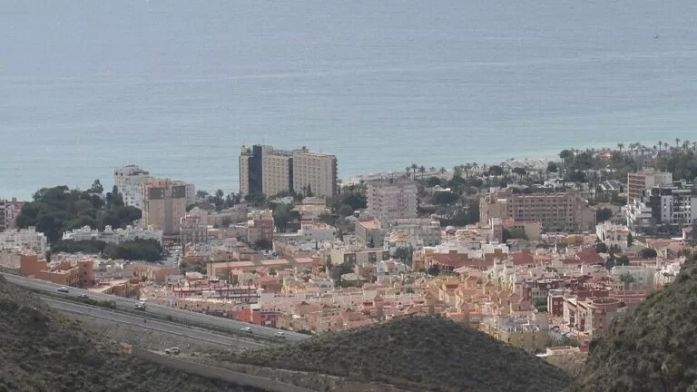
TownAguadulce is the beach resort of Roquetas de Mar closest to Almería city: about 10 km west of the city centre along the coast, reached on the A-7 motorway or the old N-340A cliff road, El Cañarete. It has a Blue Flag town beach of almost 2 km, a marina and a seafront of hotels and apartments, with the cliffs of the Sierra de Enix running east towards Almería. It suits families, short city-and-beach trips and anyone who wants a promenade with restaurants; skip it if you are after a quiet village or a natural beach.
Quick facts
- Names: Aguadulce (“sweet water”), after the spring that once supplied the village; a plaque marks where it was (Spanish Wikipedia). Not to be confused with Aguadulce in Seville province.
- Where: a locality of the municipality of Roquetas de Mar, Almería, in the east of the Poniente Almeriense, with El Parador de las Hortichuelas to the west.
- Coordinates: 36.8124, -2.5710 (OpenStreetMap).
- Population: 18,029 in January 2025, or 32,593 counting Campillo del Moro, usually treated as part of Aguadulce (Spanish Wikipedia). Andalucía.org says the population can triple in summer.
- Beach: Playa de Aguadulce, almost 2 km long, Blue Flag, lifeguards, shade areas, adapted toilets and an adapted bathing area.
- Marina: Puerto Deportivo de Aguadulce, at the north-east end of the beach.
Getting there and parking
By car: the A-7 Autovía del Mediterráneo links Aguadulce with Almería and the rest of the coast. The old N-340A, known locally as El Cañarete, runs along the cliffs to Almería city and on to El Parador, La Gangosa and Roquetas de Mar (Spanish Wikipedia). Since a boulevard was built on Avenida de Carlos III in 2007, the shopping street has an underground car park.
By bus: lines of the Almería transport consortium (Consorcio de Transportes de Almería) run through the town, including the M-301, M-330, M-333, M-351 and M-370 (Spanish Wikipedia). Check current timetables before you travel.
From the airport and station: Spanish Wikipedia gives about 12 km to the Almería intermodal station, 11 km to the port of Almería and 20 km to Almería Airport; in a straight line the airport is about 18 km away (OpenStreetMap).
What to expect
A resort town rather than an old village. Aguadulce grew in the early 20th century as a cluster of houses with few services, and quickly became a summer resort for people from Almería; from the 1950s it changed completely into one of the province’s main tourist destinations (Andalucía.org). The Urbanización de Aguadulce was laid out from 1964 as the first Centro de Interés Turístico Nacional in Andalusia, planned for 12,000 tourist beds, but most of it became second homes for people from nearby Almería (Spanish Wikipedia).
The town belonged to Enix until 1927, when it passed to Roquetas de Mar (Spanish Wikipedia). Modern buildings from the resort years include the El Palmeral apartments of 1968 and the parish church of the Virgen del Carmen.
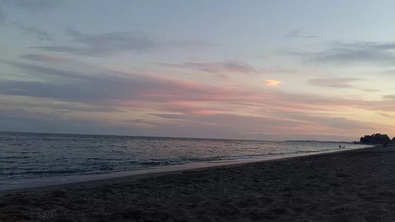
The beach. Andalucía.org lists Playa de Aguadulce as one of the busiest beaches in southern Almería, with calm water, good access to the sand, lifeguards, shade, adapted toilets, amphibious chairs and crutches, support staff and an adapted bathing area (Andalucía.org). Spanish Wikipedia gives its length as almost two kilometres, with a Blue Flag.
The marina. The tourist board describes the Puerto Deportivo de Aguadulce as set in a well-known tourist area beside Playa Serena and Las Marinas, surrounded by hotels (Andalucía.org). A diving school based in the port, Buceo Aguadulce, offers courses and dives along the Almería coast, including wreck dives and trips to Cabo de Gata (Andalucía.org).
Walks. The cliffs of the Sierra de Enix between Almería and Aguadulce are protected in the Poniente land-use plan, and the GR-92 coastal path runs from Aguadulce to Adra (Spanish Wikipedia). South-west of the town, Playa de los Bajos, also called Las Palmerillas, is a windy beach without buildings, reached by a dirt track between Aguadulce and Roquetas (Andalucía.org); spain.info gives it 1,800 m of mixed pebbles, gravel and sand (spain.info).
History nearby. The archaeological site of La Ribera de la Algaida, also called Ribera de Turaniana, is a protected Bien de Interés Cultural, discovered in 1859, with finds from the late Bronze Age to the Islamic period (Spanish Wikipedia). Andalucía.org places Roman Turaniana at Torre Quebrada de los Bajos (Andalucía.org).
Where to stay and eat
Most beds are in hotels and apartments along the seafront and in the 1960s resort. Andalucía.org lists the Inturjoven Aguadulce youth hostel, run by the Junta de Andalucía, right on the beach, with bungalows, sports courts and a pool (Andalucía.org). For food, Aguadulce follows the Almería tapa culture, with fish from the market and vegetables from the Poniente greenhouses (Spanish Wikipedia). In summer the open-air cinemas of the Terrazas de Aguadulce show current films.
Accessibility and safety
Playa de Aguadulce is one of the better-equipped beaches on this coast for visitors with reduced mobility: the tourist board lists adapted toilets, amphibious chairs, crutches, support staff and an adapted bathing area. Lifeguards cover the town beach in the season; Playa de los Bajos, to the south-west, has no services beyond cleaning.
Best time to visit
May, June and September for beach weather without the summer peak, when the population can triple. Outside summer Aguadulce works as a quiet base for Almería city, 10 km away, and for walks along the coast.
Nearby alternatives
- Alcazaba de Almería, 9.5 km east: the Moorish fortress above Almería city.
- Punta Entinas-Sabinar, 14 km south-west: dunes, salt pans with flamingos and a 6.5 km wild beach.
- Puerto Deportivo de Almerimar, 23.5 km south-west: the big marina of El Ejido.
- Museum of Almería, about 11 km east: the Los Millares and El Argar finds.
Distances are in a straight line from the centre of Aguadulce. See also our Roquetas de Mar town guide.
FAQ
Is Aguadulce part of Roquetas de Mar?
Yes. Aguadulce is a locality of the municipality of Roquetas de Mar. It belonged to Enix until 1927.
How far is Aguadulce from Almería?
About 10 km from the city centre in a straight line, by the A-7 or the N-340A cliff road, El Cañarete. Consortium buses link the two.
Does Aguadulce beach have a Blue Flag?
Yes. Playa de Aguadulce, almost 2 km long, has a Blue Flag, lifeguards, shade areas and an adapted bathing area.
Is there a marina in Aguadulce?
Yes, the Puerto Deportivo de Aguadulce at the north-east end of the beach, with a diving school among its businesses.
Aguadulce or Roquetas de Mar: where should I stay?
Aguadulce for the shortest trip to Almería city and a compact beach and marina; Roquetas for more beaches, the Castillo de Santa Ana and the natural beach of Punta Entinas to the south.
Sources and freshness
Checked 9 November 2026 · 10 sources Show
Checked 9 November 2026. Official: Andalucía.org (Junta de Andalucía tourism) on Aguadulce (history, summer population), Playa de Aguadulce (services, accessibility), the marina, Buceo Aguadulce, the Inturjoven hostel, Playa de los Bajos and Roquetas de Mar. Spain.info (Turespaña) beach sheet for Los Bajos. Background (population, history, roads, buses, beach length, heritage): Spanish Wikipedia. Location and distances: OpenStreetMap (ODbL). Not confirmed: number of marina berths, bus timetables, current Blue Flag year. The Roquetas de Mar tourism and town hall sites could not be reached when we checked.
This place is part of our Costa de Almería travel guide: where it is, Cabo de Gata, Mojácar and Almería city — see every town, beach and cove we have mapped on that coast.
How this page is made. CostaMap is written with an AI editorial system run by Ebizapple. This page is based on the sources listed above. Last updated 9 November 2026. Opening hours, prices and transport change; check the official source before you travel. How we work · Partner links and ads