
Sant Jaume d’Enveja (Ebro Delta)
TownSant Jaume d’Enveja is the rice-growing municipality on the south (right) bank of the Ebro in the heart of the Ebro Delta, in the Montsià district of Catalonia. You reach it by road from Amposta or from Deltebre across the Lo Passador bridge, which in 2010 replaced the barge ferries that had carried people and cars over the river since the 19th century. Its land reaches the river mouth, the Illa de Buda and the long, quiet Migjorn beach. It suits birdwatchers, cyclists and people who want flat rice-field landscapes and empty beaches; skip it if you need a lively resort, shops or nightlife.
Quick facts
- Names: Sant Jaume d’Enveja in Catalan (official); San Jaime de Enveja in Spanish. Locals also call it l’Enveja, from an old place name the Spanish Wikipedia traces to the Arabic personal name Ibn Baja.
- Where: Montsià district, Tarragona province, on the right bank of the last stretch of the Ebro. The river is the northern boundary, the sea the eastern one.
- Coordinates: 40.7063, 0.7183 (village, OpenStreetMap).
- Population: 3,745 (municipal register, 2025, as quoted by Wikipedia), in Sant Jaume, Els Muntells and part of Balada.
- Area: 60.78 km² (Spanish Wikipedia).
- Municipality since: 1978, when it split from Tortosa; it moved to the Montsià district in 1990.
- From La Ràpita: about 15 km in a straight line.
Getting there and around
By car: a local road links Sant Jaume with Amposta (English Wikipedia), about 11 km west in a straight line. From the north bank, cross the Lo Passador bridge from Deltebre; the two village centres are only about 2 km apart. Migjorn beach is reached on the T-340 road (catalunya.com).
By bus: the Catalan tourism portal says buses run to Amposta and Deltebre. The nearest train stations for the delta, listed by the natural park, are Amposta, Camarles and L’Ampolla.
On the spot: the delta is flat, so a bike is the easiest way to get around.
The river crossings: from barges to Lo Passador
For centuries the Ebro, more than 200 m wide here, separated Sant Jaume from Deltebre. According to the Catalan Wikipedia, barge ferries (barcasses or passos de barca) ran without a break from 1849, up to eight crossings an hour from 6 a.m. to 10 p.m., carrying cars, buses, tractors and bikes. When the ferries stopped at night or in a strong north-west wind, the road detour via Amposta was more than 30 km.
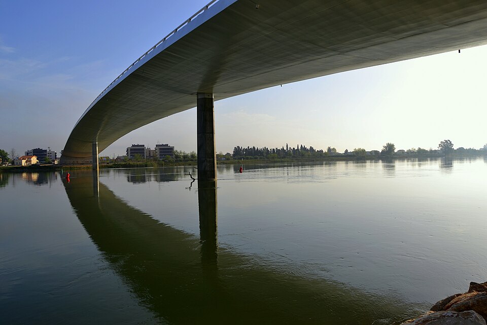
The Lo Passador bridge opened to traffic on 30 September 2010. It is 250 m long and 19.3 m wide, with 8 m for cars and 7.8 m for people on foot and on bikes, and benches and viewpoints on the walkway. It is the last bridge over the Ebro before the sea, and panels along the railing tell the story of the ferries and their boatmen. Catalunya.com recommends it for sunsets over the river.
Three old ferry landings are listed in Catalonia’s architectural heritage inventory: Garriga, at the end of Carrer Verge del Carme, Olmos, 1.5 km downstream, and La Cava, 500 m further on. The Catalan Wikipedia, citing La Vanguardia, says the last working crossing, the Garriga ferry, closed when the bridge opened. We could not find any current ferry service, so plan to cross by the bridge.
What to see
- Centre d’Interpretació de les Barraques del Delta de l’Ebre: Carrer Carles I, 22. A small museum on the reed-and-mud huts (barraques) of the first delta settlers, with models, photos and a rebuilt hut, plus a room of stuffed birds from the natural park. Hours on catalunya.com, checked November 2026: Tuesday 16:00–19:00; Wednesday to Saturday 10:00–14:00 and 16:00–19:00; Sunday 10:00–14:00; closed Mondays.
- Parish church of Sant Jaume: a small neo-Romanesque church with a bell gable.
- Farmhouses: such as Vil·la Tomàs (1920) and Mas d’Algueró in Els Muntells (catalunya.com).
- Rice fields: rice was brought here in the 1860s, when the canal on the right bank of the Ebro made it possible, and it still shapes the landscape.
The Buda side: Migjorn, the river mouth and the island
Migjorn beach: more than 2.5 km of fine, golden sand, about 50–60 m wide, with calm water, far from any village. Catalunya.com lists parking, a bar-restaurant, showers and portable toilets, and notes it is popular with naturists. It runs on into the Serrallo beach, and the regional portal also names La Platjola as a near-untouched beach.
Riu Migjorn and its viewpoint: the Migjorn is an old mouth of the Ebro, 3.5 km long, that wraps round the south of the Illa de Buda. The natural park calls its viewpoint the highest in the delta, with views over Buda’s rice fields, salt marsh and lagoons and the Alfacada marshes.
Illa de Buda: the island at the mouth of the river, about 1,100 ha, of which some 250 ha are rice fields and the rest reed beds, salt marsh and coastal lagoons (Catalan Wikipedia). It belongs to Sant Jaume d’Enveja. The park map says access is restricted, and catalunya.com says it can only be visited twice a year, at rice-harvest time. Watch it from the Migjorn viewpoint instead.
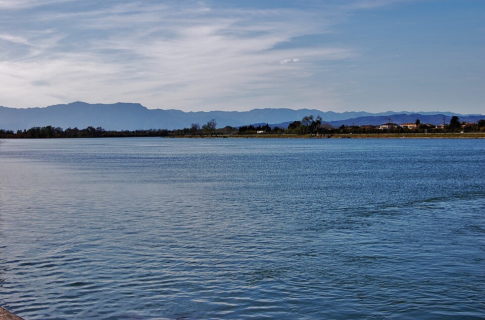
Eucaliptus side: further south, the Platja dels Eucaliptus belongs to Amposta, not Sant Jaume; it is about 8 km from the village in a straight line. Our guide to Punta de la Banya and the Trabucador covers the southern tip of the delta beyond it.
Festivals and food
Rice dishes are the local speciality. The planting festival (Plantada) in spring and the harvest festival (Sega) in September show the traditional farm work. The Festa Major falls on 25 July, Sant Jaume’s day, when the custom is to eat churros with sugar (Spanish Wikipedia).
Accessibility and safety
The village and the delta roads are flat, and the Lo Passador walkway is wide. Migjorn and Serrallo are isolated natural beaches: we could not confirm lifeguards, so swim with care and tell someone where you are going. There is almost no shade in the rice fields; carry water. Respect closed tracks and the restricted access to the Illa de Buda: the island is a protected breeding area.
Best time to visit
The regional portal names April, when the fields are flooded and the delta turns into a mirror, and May onwards, when the rice grows green. September brings the harvest. Winters are mild; only January averages slightly below 10 °C.
Nearby alternatives
- Ebro Delta, about 2 km: our main guide to the natural park.
- Deltebre, about 2 km across the bridge: the park’s ecomuseum and boat trips to the river mouth.
- Amposta, about 11 km: the Montsià capital, with the delta’s largest lagoon, the Encanyissada.
- L’Ampolla, about 12 km: the fishing village on the delta’s northern edge, with the Olles lagoon.
- La Ràpita, about 15 km: the seaside town on the Alfacs bay, a good base with more services.
- Punta de la Banya and the Trabucador: the sand bar and spit at the southern tip of the delta.
Distances are in a straight line from the village. For the whole coast, see our Ebro Delta and southern Costa Dorada guide.
FAQ
Is there still a ferry between Sant Jaume d’Enveja and Deltebre?
We could not find one. The Catalan Wikipedia, citing La Vanguardia, says the last working crossing, the Garriga ferry, closed when the Lo Passador bridge opened in 2010. Cross by the bridge, which has a separate lane for walkers and cyclists.
How do I get to Sant Jaume d’Enveja?
By car from Amposta on the local road, or from Deltebre across the Lo Passador bridge. Buses run to Amposta and Deltebre; the natural park lists Amposta, Camarles and L’Ampolla as the train stations for the delta.
Can you visit the Illa de Buda?
Not freely. The natural park restricts access, and the regional portal says the island opens to visitors only twice a year, at rice-harvest time. The Migjorn viewpoint gives the best view of it.
Is Migjorn beach a naturist beach?
Catalunya.com says it is popular with naturists, like the neighbouring Serrallo beach. It is long and isolated, with parking, a bar-restaurant, showers and portable toilets.
Sources and freshness
Checked 10 November 2026 · 13 sources Show
Checked 10 November 2026. Official: Catalan tourism portal on Sant Jaume d’Enveja (sights, bridge, transport, climate, seasons), Migjorn beach (size, services, Illa de Buda visits), the Barraques interpretation centre (address, hours) and the Ebro Delta Natural Park. Ebro Delta Natural Park (Generalitat de Catalunya): suggested itineraries (Migjorn viewpoint) and park map and guide (Buda access, bridges). Background: Wikipedia in English, Catalan and Spanish, and the Catalan articles on Lo Passador, the ferry landings and the Illa de Buda. The town hall’s website could not be reached when we checked. Location and distances: OpenStreetMap contributors (ODbL). Photos: Wikimedia Commons, licences as credited.
This place is part of our Costa Dorada map and travel guide: Roman Tarragona, Salou and the Ebro Delta — see every town, beach and cove we have mapped on that coast.
How this page is made. CostaMap is written with an AI editorial system run by Ebizapple. This page is based on the sources listed above. Last updated 10 November 2026. Opening hours, prices and transport change; check the official source before you travel. How we work · Partner links and ads