
Costa Dorada · Far south
The Ebro Delta and the southern Costa Dorada travel guide: L’Hospitalet de l’Infant to Alcanar
Small coves and tuna boats at L’Ametlla de Mar, then the rice fields, lagoons and sand spits of the Ebro Delta, the bay towns of L’Ampolla and La Ràpita, and the fishing village of Les Cases d’Alcanar at the edge of Catalonia.
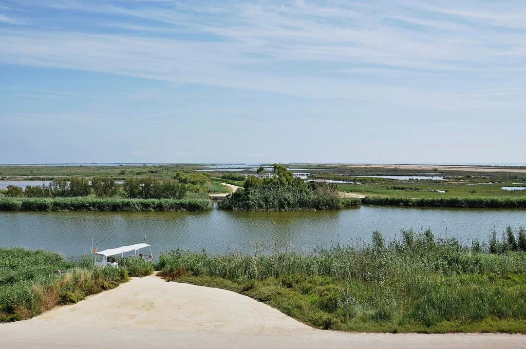
Lagoons of the Ebro Delta · Photo: Alberto-g-rovi, CC BY-SA 3.0
Part of the Costa Dorada guide · Far south: the Ebro Delta
The southern Costa Dorada is the last stretch of the Catalan coast, from L’Hospitalet de l’Infant and the coves of L’Ametlla de Mar south through the Ebro Delta to Alcanar at the border with the Valencian Region, about 60 km in a straight line. Most of it lies in the Baix Ebre and Montsià districts and is promoted as the Terres de l’Ebre; its centre is the Ebro Delta Natural Park, which spain.info calls one of the most important wetlands in Spain and the Mediterranean.
At a glance
- Where the south of Tarragona province, from L’Hospitalet de l’Infant (Vandellòs i l’Hospitalet de l’Infant) to Alcanar, the southernmost town in Catalonia, with the Ebro Delta in the middle.
- Towns L’Hospitalet de l’Infant, L’Ametlla de Mar, L’Ampolla, L’Aldea, Camarles, Deltebre and Riumar, Sant Jaume d’Enveja, Amposta, La Ràpita and Alcanar; inland El Perelló and Tortosa.
- Best for birdwatching and flat cycling in the delta, long empty sand spits, small coves for snorkelling, rice, mussels and prawns.
- Getting there the AP-7 motorway and the N-340 run the length of the coast; regional trains stop at L’Hospitalet, L’Ametlla de Mar, L’Ampolla and L’Aldea. Reus is the nearest airport, about 42 km from L’Ametlla de Mar and 75 km from La Ràpita in a straight line.
- On CostaMap the Ebro Delta, L’Ametlla de Mar, Deltebre, Amposta, La Ràpita, Alcanar and Tortosa, plus campsites along the coast.
Map of the Ebro Delta and the southern Costa Dorada
The map shows the places on this stretch that have a CostaMap page. Tick a place type to filter, and click a marker to see the place in the panel.
Place type
Area · next level
 Area map
The Ebro Delta and the southern Costa Dorada
Click a marker to see the place here. From L’Hospitalet de l’Infant and L’Ametlla de Mar to the Ebro Delta, La Ràpita and Alcanar.
Towns and villagesTowns and villages
From north to south. Beach lengths are from the beach sheets of spain.info, Spain’s official tourism site; park facts from the Ebro Delta Natural Park (Parcs Naturals de Catalunya).
L’Hospitalet de l’Infant
L’Hospitalet de l’Infant is the coastal town of the municipality of Vandellòs i l’Hospitalet de l’Infant, in the Baix Camp; the village of Vandellòs lies some 15 km inland, and the whole municipality has about 7,100 inhabitants (English Wikipedia). The town has a station on the Tarragona–València railway and a marina. Its main beach, L’Arenal, is 2,200 m of dark sand with a promenade and a Blue Flag, and Punta del Riu, on the other side of the marina, is 220 m; L’Almadrava, 1,200 m, lies further south (spain.info). The Vandellòs nuclear power stations stand on the coast near the town.
L’Ametlla de Mar
A working fishing town that locals call la Cala, with one of Catalonia’s main tuna fleets and an afternoon fish auction (English Wikipedia). Spain.info counts 24 sandy or rocky coves backed by pine woods, and recommends it for diving and water sports. Holiday estates such as Calafat, Sant Jordi d’Alfama and Les Tres Cales line the coast north of the town; at Sant Jordi stands the castle of Sant Jordi d’Alfama, which spain.info dates to the 12th century, and the Popular Ceramics Museum. Trains on the Barcelona–Tortosa line stop in the town. See our new L’Ametlla de Mar guide.
El Perelló
El Perelló is an inland village below the Boix and Cabrafeixet ranges, on the N-340, which links it with the AP-7 at L’Ampolla (English Wikipedia). Until 1990 its municipality included L’Ampolla.
L’Ampolla
L’Ampolla, created as a municipality in 1990 from El Perelló, has about 3,800 inhabitants, a small fishing port and a station (English Wikipedia). Spain.info explains that its name comes from the old shape of the river mouth, and describes beaches of sand and stones with small coves, much of the shore protected, and a kitchen of large oysters, mussels, clams and prawns. It is the northern gateway to the delta: the Bassa de les Olles lagoon is in the municipality, and part of it lies in the natural park. El Arenal, 1,800 m of sand sheltered by the delta, is a good windsurfing beach (spain.info).
L’Aldea and Camarles
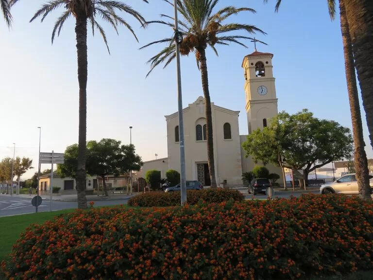
Two farming towns at the head of the delta, on the left bank of the Ebro. L’Aldea was created in 1983 from parts of Tortosa, has about 4,700 inhabitants and a station on the Tarragona–València line (English Wikipedia). The park counts both as delta towns with no land inside the park. Both keep defence towers of the 15th–16th centuries, built against pirates (Parcs Naturals de Catalunya).
Deltebre and Riumar
Deltebre lies right at the river mouth and is, for spain.info, the ideal starting point for the delta: several companies run river cruises down to the mouth. The park’s Ecomuseu, opened in 1988, introduces the delta with an aquarium, traditional huts and a short trail, and the route is adapted for blind visitors and wheelchair users (Parcs Naturals de Catalunya). The beaches are at Riumar and to the north: La Marquesa, 1,150 m with parking and a restaurant, and the 6.5 km Punta del Fangar, with dunes and a lighthouse (spain.info). See our Deltebre guide.
Sant Jaume d’Enveja
Sant Jaume d’Enveja is on the right bank of the river, opposite Deltebre, and is linked to it by a ferry service across the river; it became a municipality in 1978 and has about 3,700 inhabitants (English Wikipedia). Its economy is rice growing and tourism. The Illa de Buda, the largest island at the river mouth, belongs to it, with a lighthouse and a 4,000 m beach that is rarely busy (spain.info).
Amposta
The capital of the Montsià, on the Ebro upstream of the delta. Spain.info highlights the remains of the castle, Modernista houses such as Casa Fàbregues, the 14th-century Torre de la Carrova that guarded the river, and the suspension bridge over the Ebro, which it dates to 1919. Boat trips into the delta leave from the river port. The town also reaches the sea: Eucaliptus beach, 4,600 m long and very wide, faces the urbanisation of the same name (spain.info). See our Amposta guide.
La Ràpita
La Ràpita, formerly Sant Carles de la Ràpita, was founded by Charles III as a port for trade with the colonies and built in neoclassical style, though much was left unfinished after his death (English Wikipedia). It is a fishing port known for prawns, with about 16,100 inhabitants and two large marinas. Its municipality includes the Trabucador sandbar and the Banya peninsula, which close the Alfacs bay. In town, El Garbí is a 500 m Blue Flag beach by the port and Les Delícies a 200 m beach with very shallow water (spain.info). See our La Ràpita guide.
Alcanar and Les Cases d’Alcanar
The southernmost town in Catalonia, below the Serra del Montsià and next to Vinaròs, with about 10,100 inhabitants (English Wikipedia). Spain.info counts 12 km of calm beaches and coves and points to the fishing village of Les Cases d’Alcanar for prawns, rice and fish soups. Its history goes back to the Iberian settlement of La Moleta del Remei, and square watchtowers from 1530–1630 still stand along the shore. See our new Alcanar guide.
Tortosa (inland)
The historic capital of the lower Ebro, about 25 km inland from L’Ametlla de Mar. Spain.info describes medieval, Renaissance, baroque and Modernista buildings, the Arab castle of La Suda above the town, now a Parador hotel, the 14th-century Gothic cathedral. See our Tortosa guide.
Beaches and coves
Two kinds of coast: rocky coves with clear water between L’Hospitalet and L’Ampolla, then long, flat, sandy beaches with shallow water around the delta.
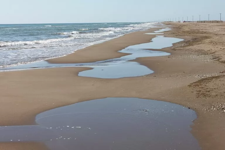
El Trabucador
A 6,165 m arm of sand, 150 m wide, between the open sea and the Alfacs bay, with calm water and few people (spain.info). Car access is limited to set parking areas from 06:00 to 23:00; on foot or by bike entry is free (Parcs Naturals de Catalunya).
See the Ebro Delta guide →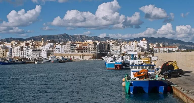
The coves of L’Ametlla
Small sandy or pebbly coves from 20 to 150 m: L’Alguer in town, Cala del Forn and Cala Vidre at Les Tres Cales, and the Blue Flag beach of Sant Jordi below the castle (spain.info).
See the L’Ametlla de Mar guide →- L’Arenal, L’Hospitalet de l’Infant – 2,200 m of dark sand with a promenade, Blue Flag and full services, next to the marina (spain.info).
- El Arenal and Cap Roig, L’Ampolla – 1,800 m of sand sheltered from big waves, and a 185 m beach between rocky points with a beach bar (spain.info).
- La Marquesa and Punta del Fangar, Deltebre – 1,150 m and 6,500 m of sand with protected dunes. The two car parks at La Marquesa and the Bassa d’Arena are paid in July and August, and the Fangar point and lighthouse are reached only on foot (Parcs Naturals de Catalunya).
- Illa de Buda and Eucaliptus – 4,000 m and 4,600 m of open sand in Sant Jaume d’Enveja and Amposta, both with few buildings (spain.info).
- El Garbí and Les Delícies, La Ràpita – town beaches on the calm Alfacs bay (spain.info).
- Les Cases d’Alcanar and El Marjal – a 300 m gravel beach with a promenade and access ramps, and 3 km of sand south of the village (spain.info).
Things to do
Nature: the Ebro Delta Natural Park
The delta covers 320 km², the largest aquatic habitat in Catalonia, and the Generalitat created the natural park in 1983 after local people in Deltebre protested against the draining of the Canal Vell lagoon; it was extended to the right bank in 1986 (Parcs Naturals de Catalunya). The park lists flamingos, present all year, and Audouin’s gull among its emblems, along with the lagoons and bays, the dunes of the Fangar, the beaches and the rice fields. Viewing towers stand around the lagoons, and La Casa de Fusta, a wooden lodge brought from Canada in 1926 for a hunting society, now holds an exhibition on the lagoons by the Encanyissada (Parcs Naturals de Catalunya). See our Ebro Delta guide for routes and access rules.
History: towers, castles and a planned port
Defence towers of the 15th and 16th centuries survive at L’Aldea, Amposta, Camarles and La Ràpita (Parcs Naturals de Catalunya), and more along the shore at Alcanar. The castle of Sant Jordi d’Alfama, the bridge and Torre de la Carrova at Amposta, the neoclassical grid of La Ràpita and the Iberian site above Alcanar complete the picture. Inland, Tortosa has the castle of La Suda and a Gothic cathedral.
Food: rice, mussels and prawns
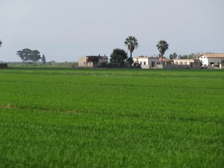
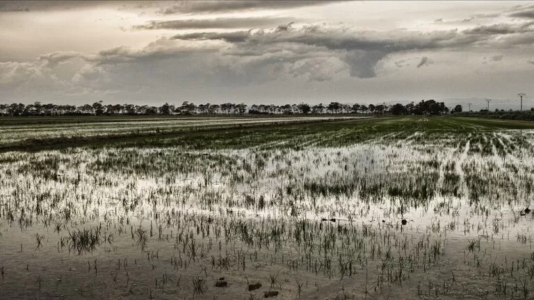
Rice from about 14,000 hectares of paddies carries the Protected Designation of Origin Arròs del Delta de l’Ebre, and goes into arròs rossejat, duck rice and blue crab rice (spain.info). The park singles out the delta’s mussels for their flavour, and L’Ampolla is known for large oysters. Prawns come from La Ràpita and Les Cases d’Alcanar, and L’Ametlla de Mar has its tuna, fideuada and suquet (spain.info).
Where to stay by town
The towns we would base a trip in, north to south. A car makes the delta much easier.
L’Ametlla de Mar
A real port town with a station, restaurants and coves in walking or short driving distance. Good for snorkelling, walking the coast and day trips to the delta.
Coves and seafoodDeltebre and Riumar
In the middle of the delta, next to the Ecomuseu and the river mouth. Best for birdwatchers and cyclists; Riumar has the nearest beach.
Birds and cyclingLa Ràpita
The largest town on the coast here, with town beaches on a calm bay, two marinas and the Trabucador nearby. Good for families.
Bay beaches and town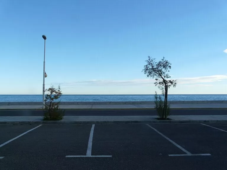
Les Cases d’Alcanar
A quiet fishing village for seafood and a seafront walk, between the delta and Peñíscola.
Quiet and seafoodCampsites on CostaMap in this area: Alannia Costa Dorada at L’Hospitalet de l’Infant, Finca Ermita at L’Ampolla, and Càmping Terra Alta inland at Bot in the Terra Alta hills.
Getting there and around
By air
Reus airport is the nearest, about 42 km from L’Ametlla de Mar, 60 km from Deltebre and 88 km from Alcanar in a straight line (OpenStreetMap); road distances are longer. Barcelona, Castelló and València airports are further away.
By car
The AP-7 motorway and the N-340 run behind the whole coast; L’Ametlla de Mar has exit 39 (English Wikipedia). Inside the delta, local roads such as the TV-3451 lead to the beaches (spain.info). Some sand tracks, as at the Trabucador, have controlled parking in summer.
By train
Regional trains on the Barcelona–València line stop at L’Hospitalet de l’Infant, L’Ametlla de Mar, L’Ampolla and L’Aldea (English Wikipedia). Deltebre and La Ràpita have no station; check bus connections before you travel.
A two-day route
By car, north to south, with a night in Deltebre or La Ràpita.
Day 1
L’Ametlla de Mar, L’Ampolla and the northern delta
Start with a swim or snorkel in the coves of L’Ametlla de Mar and see the castle of Sant Jordi d’Alfama. Have lunch by the port, then drive to L’Ampolla and the Bassa de les Olles. In the afternoon visit the Ecomuseu in Deltebre, take a boat trip to the river mouth and end at La Marquesa beach.
Day 2
Amposta, the Encanyissada, La Ràpita and Alcanar
Cross to Amposta for the suspension bridge, then drive into the southern delta to the Casa de Fusta and the lagoons, looking for flamingos. Walk out on the Trabucador, have lunch in La Ràpita, and finish at Les Cases d’Alcanar for prawns by the sea.
FAQ
Is the Ebro Delta part of the Costa Dorada?
Geographically it is the southern end of the coast of Tarragona province. Spain.info places Amposta at the southern end of the Costa Daurada, but the delta is usually promoted as the Terres de l’Ebre.
What is the best base for the Ebro Delta?
Deltebre for the Ecomuseu, river cruises and cycling in the north; La Ràpita or Amposta for the southern lagoons and the Trabucador. L’Ametlla de Mar suits those who want coves as well as day trips to the delta.
Can you drive onto the Trabucador beach?
Yes, but motor access is regulated: parking only in set areas between 06:00 and 23:00, and no driving or parking at night. Walking or cycling in is free (Parcs Naturals de Catalunya).
When can you see flamingos in the Ebro Delta?
The park says flamingos are present all year. The lagoons, such as the Encanyissada, and the viewing towers around them are the best places to look.
How do I get to the Ebro Delta without a car?
Take a regional train to L’Aldea or L’Ampolla, at the edge of the delta, and continue by bus or taxi. Check current bus timetables before you travel; inside the delta a bike is the easiest way to get around.
Are the beaches in the Ebro Delta good for children?
Most are long, of fine sand and with shallow water (Parcs Naturals de Catalunya), but few have services. For lifeguards and facilities choose town beaches such as Les Delícies in La Ràpita or El Arenal in L’Ampolla.
Other areas of the Costa Dorada
Costa Dorada
The whole coast of Tarragona province from Cunit to Alcanar, with the map, the four areas and the inland day trips.
Costa Dorada guide →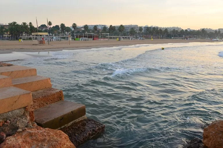
Salou, Cambrils and PortAventura
The busiest stretch, with PortAventura World, the long beaches of Salou and La Pineda and the fishing harbour of Cambrils.
Salou, Cambrils and PortAventura guide →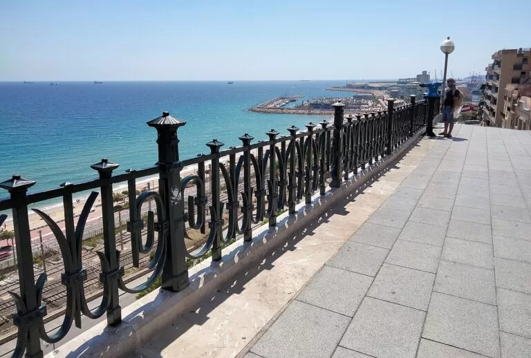
Tarragona, Altafulla and Torredembarra
Roman Tarragona, the walled village of Altafulla and the dunes of Torredembarra.
Tarragona, Altafulla and Torredembarra guide →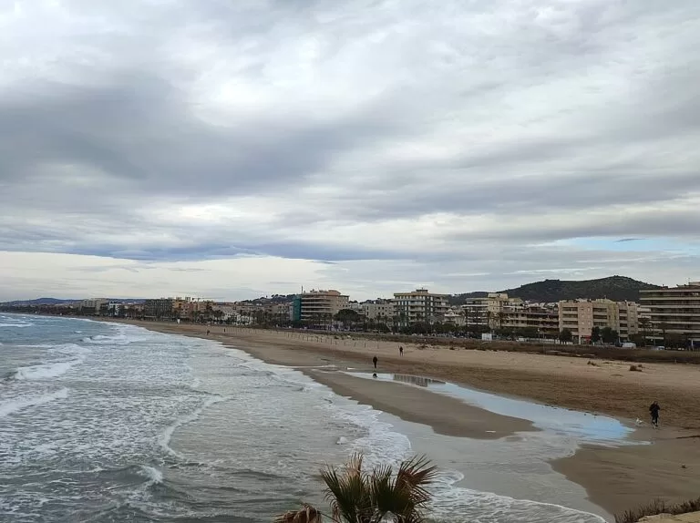
The Baix Penedès
The northern end towards Barcelona: the long beaches of Cunit, Calafell and Coma-ruga in El Vendrell.
Baix Penedès coast guide →South of Alcanar the coast continues in the Valencian Region as the Costa del Azahar: Vinaròs is about 8 km from Alcanar and Peñíscola about 22 km.
Sources and freshness
Checked 7 November 2026. Ebro Delta Natural Park (Parcs Naturals de Catalunya, Generalitat de Catalunya): the park, key data, history of protection, top 10, access and parking and visitor facilities. Spain.info (Turespaña) on L’Ametlla de Mar, L’Ampolla, Deltebre, Amposta, Alcanar and Tortosa, and its beach sheets for L’Arenal, Punta del Riu, L’Almadrava, Sant Jordi, El Arenal, Cap Roig, La Marquesa, Punta del Fangar, Illa de Buda, Eucaliptus, El Trabucador, El Garbí, Les Delícies, Les Cases d’Alcanar and El Marjal. Background from English Wikipedia on Vandellòs i l’Hospitalet de l’Infant, L’Ametlla de Mar, El Perelló, L’Ampolla, L’Aldea, Sant Jaume d’Enveja, La Ràpita, Alcanar and the Ebro Delta (populations from the 2025 register, railway, history). Map data and straight-line distances: OpenStreetMap (ODbL). Not confirmed: bus routes and timetables, river cruise operators and prices, Ecomuseu opening hours, 2026 Blue Flags. The town hall sites of the area and the Terres de l’Ebre tourist board could not be reached when we checked. Photos from Wikimedia Commons: Ebro Delta lagoons by Alberto-g-rovi (CC BY-SA 3.0); rice fields by Jordiferrer (CC BY-SA 3.0); rice paddies by Gabriel Villena (CC BY 2.0); Trabucador by carlos corzo (CC BY-SA 3.0); Jesús i Maria, Deltebre by Juan Emilio Prades Bel (CC BY-SA 4.0); port of L’Ametlla de Mar by Albotea (CC0); Les Cases d’Alcanar by Pere López (CC BY-SA 3.0); Salou by Андрей Бобровский (CC BY 3.0); Balcó del Mediterrani, Tarragona by Enric (CC BY-SA 4.0); Segur de Calafell by Joandrés (CC BY-SA 4.0).