
Balearic Islands · Ibiza
Ibiza travel guide: Ibiza town, Sant Antoni, Santa Eulària and the north
A walled World Heritage old town, sunset coves in the west, a quiet river town in the east and a rural, cliff-lined north.
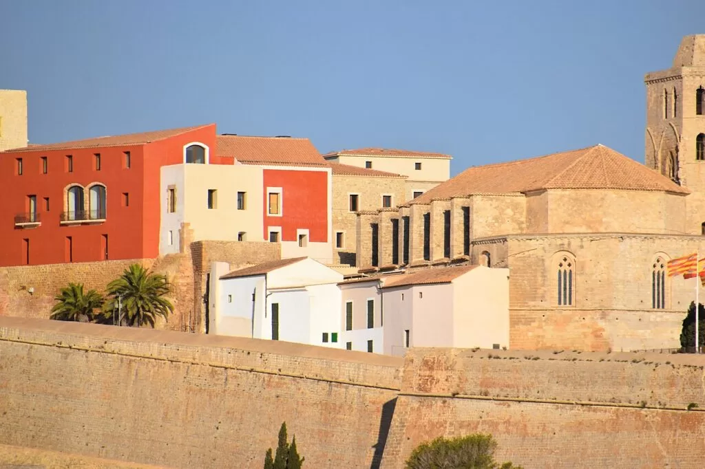
Dalt Vila from the port, Ibiza town · Photo: Charles from Port Chester, New York, CC BY 2.0
Part of the Balearic Islands guide · Ibiza
Ibiza (Eivissa in Catalan) is the third-largest of the Balearic Islands and, with Formentera, one of the two Pitiusas, about 32 km from Portinatx in the north to Ses Salines in the south in a straight line (Wikipedia, OpenStreetMap). Its capital, Ibiza town, has the walled upper town of Dalt Vila; the main ports are Ibiza, Sant Antoni and Santa Eulària, and the island’s World Heritage site, “Ibiza, Biodiversity and Culture”, covers Dalt Vila, the Puig des Molins necropolis, the Phoenician village of Sa Caleta and the Posidonia meadows offshore (Spain.info). This guide goes round the island’s parts: Ibiza town and its districts, Sant Josep and the south-west, Sant Antoni, Santa Eulària and the north.
At a glance
- %%Where the whole island of Ibiza, from Portinatx and Cala de Sant Vicent in the north to Ses Salines and Es Vedrà in the south.
- %%Towns Ibiza town (Eivissa), Sant Josep de sa Talaia, Sant Antoni de Portmany, Santa Eulària des Riu and Sant Joan de Labritja, the island’s five municipalities (Wikipedia).
- %%Best for Dalt Vila and its museums, sandy coves, sunsets in the west, hippie markets, nightlife in Ibiza town and Sant Antoni, and quiet villages inland.
- %%Getting there Ibiza Airport is 7.5 km from the capital, with the 10E bus into town; ferries run from Barcelona, Valencia, Dénia, Mallorca and Formentera (Spain.info).
- %%On CostaMap guides to Dalt Vila, Marina Ibiza, Cala Comte, Cala d’Hort, Es Vedrà, Sa Conillera, Cala Saladeta, Ses Salines Natural Park and Portinatx, a campsite at Es Canar, and town guides to Ibiza town, Sant Antoni, Santa Eulària and Sant Joan.
Map of Ibiza
The map shows the places on Ibiza that have a CostaMap page. Tick a place type to filter, and click a marker to see the place in the panel.
Place type
Area · next level
 Island map
Ibiza
Click a marker to see the place here. From Dalt Vila and Ses Salines to the coves of Sant Antoni and the quiet north around Portinatx.
Towns and villagesTowns and villages
Ibiza town first, district by district, then clockwise round the island: the south-west, Sant Antoni, the north and Santa Eulària.
Dalt Vila (Ibiza town)
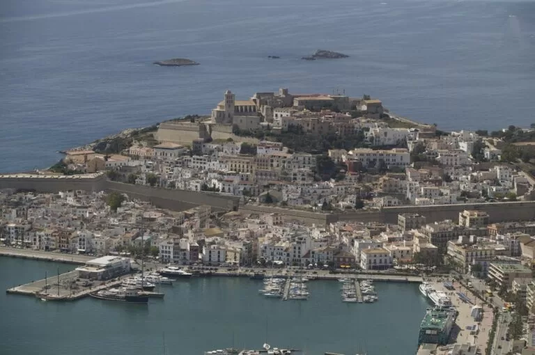
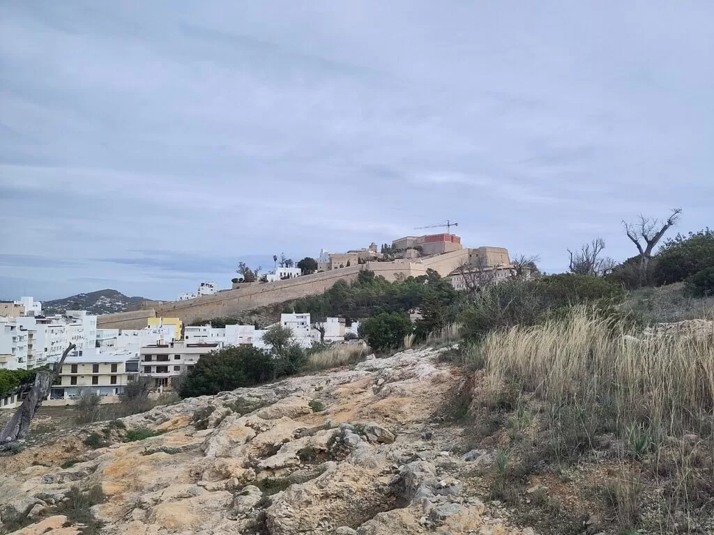
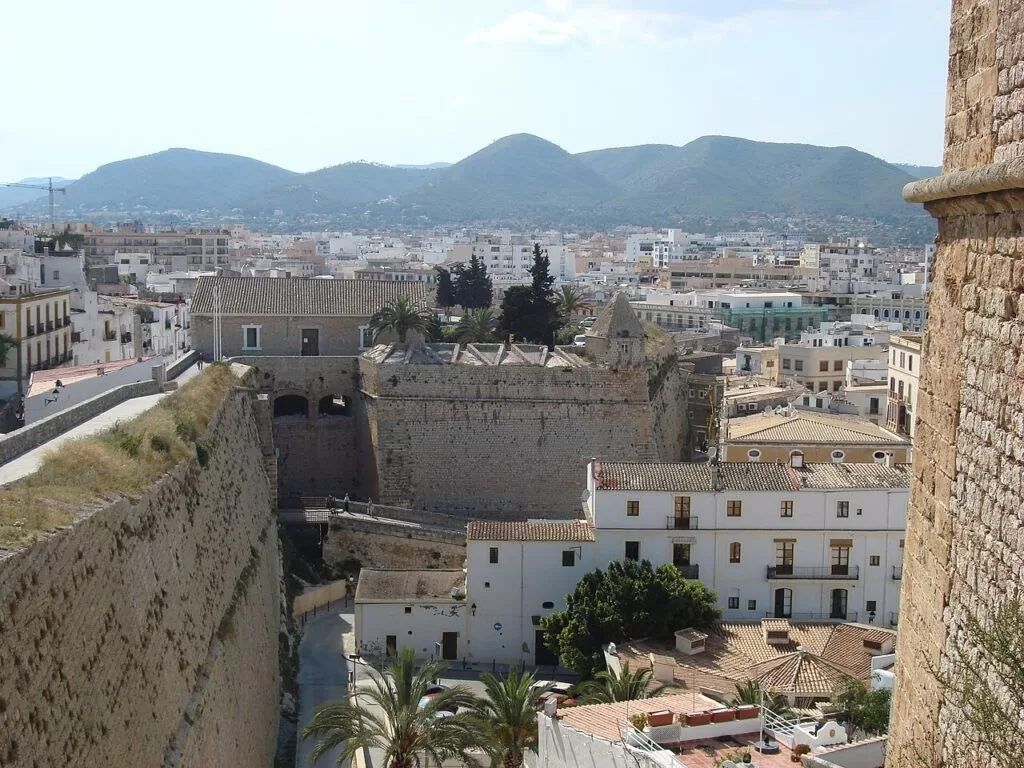
Dalt Vila, the “upper town”, is the walled hilltop above the port and the reason Ibiza town is on the World Heritage list, declared in 1999. The fortress was built in the 16th century to protect the population from constant attacks; inside the walls are the cathedral, the Archaeological Museum and the Museum of Contemporary Art (Illes Balears tourism). Spain.info suggests the Portal de ses Taules as the way in, climbing gentle slopes to the cathedral and the Almudaina beside the castle (Spain.info). See our Dalt Vila guide and the Ibiza town guide.
La Marina and the port
La Marina is the old harbour quarter at the foot of Dalt Vila. Spain.info describes whitewashed streets of shops selling the island’s white Adlib fashion, cafés and restaurants, and the Mercat Vell, the old market, with its fresh produce; nearby are the Plaça del Parc and the Passeig de Vara de Rey (Spain.info). The port, 1.5 km from the centre, has the ferries and cruise ships (Spain.info). Across the harbour, Marina Ibiza faces Dalt Vila with its berths for superyachts, restaurants and fashion shops on the quay.
Sa Penya
Sa Penya is the neighbourhood at the eastern tip of the old town, between La Marina and the sea, below the walls of Dalt Vila (OpenStreetMap). We could not open an official page describing the quarter, so we give only its location; walk it on a loop from La Marina to the Portal de ses Taules.
Talamanca, Figueretes and Puig des Molins
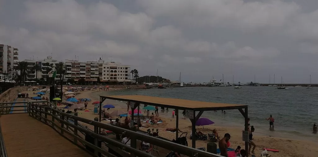
Talamanca is the bay just north-east of the port, about 2 km from Dalt Vila in a straight line. Its beach is almost 1 km of white sand with pines, boats anchored offshore and easy access from the city (Spain.info). Spain.info also lists Ses Figueretes and Platja d’en Bossa as fine sandy beaches near the city. About 700 m west of the cathedral (OpenStreetMap), the Punic necropolis of Puig des Molins was a cemetery throughout antiquity, with more than 3,000 underground tombs counted (Illes Balears tourism).
Sant Josep de sa Talaia and the south-west
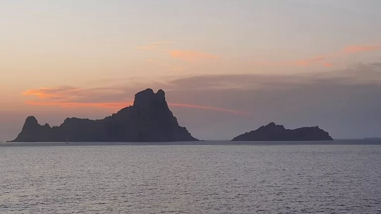
Sant Josep covers the south and west of the island, with 80 km of coastline and more beaches and coves than any other municipality in Ibiza. The village is inland, about 15 km from the capital, and takes its name from the mountain of Sa Talaia, at 475 m the island’s highest point and a viewpoint. Ses Salines, Cala d’Hort, the Phoenician village of Sa Caleta and the Cova Santa cave are all here (Spain.info). The best-known coves are Cala Comte, Cala Bassa and Cala Vedella in the west, and Cala d’Hort, which faces the 382 m rock of Es Vedrà. Off Cala Comte lies Sa Conillera, the largest of the islets off Ibiza. In the south, Platja d’en Bossa lies between Ibiza town and the airport, and beyond them is the Ses Salines Natural Park.
Sant Antoni de Portmany
Sant Antoni, on the bay of the same name on the west coast, is the second-largest town in Ibiza. The Romans called it Portus Magnus; its 14th-century church was fortified in the 16th century against pirates (Spain.info). The town is known for its nightlife and its sunsets: the rocky shore of Ses Variades is full of bars and clubs (Spain.info), and the Café del Mar on the seafront is famous for its sunsets. To the north are the Ca’n Bernadet viewpoint, the cliffs of Cap Nunó and Cala Salada with Cala Saladeta. See our Sant Antoni guide.
Sant Miquel and Benirràs
Sant Miquel de Balansat is the largest village in the municipality of Sant Joan, with a hilltop parish church dedicated to Saint Michael, on the EI-400 about 17.5 km north of Ibiza town; Port de Sant Miquel, its bay and resort, is about 5 km north of the village (Wikipedia). The church was built after the conquest of 1235 and later fortified (Spain.info). Just east of the bay, Cala Benirràs is the cove Spain.info calls the epicentre of the hippie lifestyle, with drum gatherings every Sunday (Spain.info).
Portinatx and Cala Xarraca
Portinatx is the former fishing village in the far north, in Sant Joan de Labritja, about 24 km from Ibiza town in a straight line. It has three beaches: the largest on the bay, the smaller and more private S’Arenal Petit, and Porto, framed by pine-covered mounds (Spain.info). About 2 km west, Cala Xarraca is an unspoiled cove surrounded by small fishermen’s houses, with car parking and pedalo and sunbed hire (Spain.info).
Sant Joan de Labritja
The village of Sant Joan is a quiet street dominated by its church and the town hall of the municipality, the least-populated in Ibiza and almost entirely rural (Wikipedia). It still lives more from farming and livestock than the rest of the island (Spain.info). Its craft market runs on Sundays from 10:00 to 16:00 (Spain.info, checked November 2026). On the north-east coast, Cala de Sant Vicent is the municipality’s other resort. See our Sant Joan de Labritja guide.
Sant Carles and Es Canar
Sant Carles de Peralta, in the municipality of Santa Eulària, has a church with an arcaded entrance, and next to it Bar Anita, a gathering place for hippies in the 1960s; south of the village are the chimneys and ruins of old lead mines (Wikipedia). The Las Dalias market here is one of the island’s classics, with more than 200 stalls on Saturdays. On the coast below, Es Canar has the Punta Arabí market, created in 1973 and the island’s largest, with over 500 stalls on Wednesdays from April to October (Spain.info). Camping La Playa Ibiza is in Es Canar.
Santa Eulària des Riu
Santa Eulària, on the east coast, is what Spain.info calls a beautiful and quiet municipality, with beaches, green fields dotted with almond trees and a marina. Its heritage includes a bridge and the remains of a Roman necropolis, the 16th-century fortified church on the Puig de Missa hill, the Ethnological Museum of the Pitiusas and the Barrau Museum, with works by the impressionist painter Laureà Barrau (Spain.info). About 4 km south, Cala Llonga is a sheltered family beach. See our Santa Eulària guide.
Beaches and coves
Sizes and services are as the official tourist pages give them, checked in November 2026. Most coves have no lifeguard outside summer.
Cala Comte
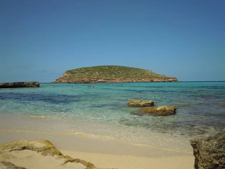
Also called Cala Conta or Racó d’en Xic: small bays of very fine sand and shallow water facing the islets of S’Illa des Bosc and Sa Conillera, with restaurants and parking. Reached by car from Sant Agustí (11.1 km) or by summer boat from Sant Antoni (Illes Balears tourism).
See the Cala Comte guide →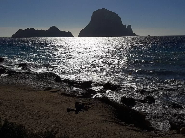
Cala d’Hort
A 150 m beach of sand and stones facing Es Vedrà (382 m) and Es Vedranell (128 m), in their nature reserve, with three seafood restaurants and a car park; 10 km from Sant Josep (Illes Balears tourism).
See the Cala d’Hort guide →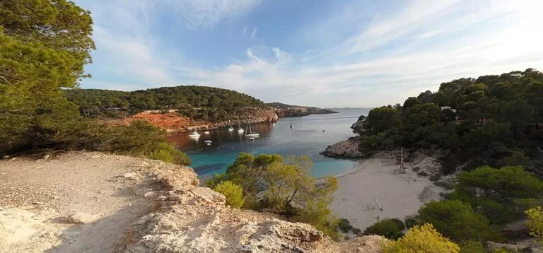
Cala Salada and Cala Saladeta
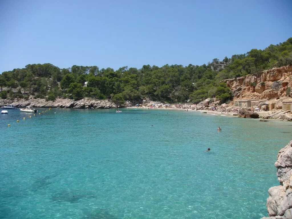
Two sandy coves in one inlet 4 km from Sant Antoni, ringed by pines, with old fishermen’s boat shelters under the cliffs. Cala Salada is 55 m long, with lifeguards and sunbed and pedalo hire; a coastal path leads to Saladeta (Illes Balears tourism).
See the Cala Saladeta guide →- Ses Salines and Es Cavallet – the beaches inside the Ses Salines Natural Park in the far south; Es Cavallet has a nudist area and water sports (Spain.info). See our Ses Salines Natural Park guide.
- Platja d’en Bossa – the beach between Ibiza town and the airport, with a variety of beach clubs (Spain.info).
- Talamanca – almost 1 km of white sand on the bay next to Ibiza town, with water sports (Spain.info).
- Cala Llonga – a 200 m by 90 m cove between pine-covered cliffs south of Santa Eulària, shallow far out, with lifeguards, parking, a boardwalk and amphibious chairs for wheelchair users (Spain.info).
- Benirràs, Cala Xarraca and Portinatx – the quieter coves of the north, described under the towns above.
Things to do
Nature: salt pans, islets and seagrass
The Ses Salines Natural Park stretches from the south of Ibiza to the north of Formentera, including the strait between them; about 85% of it is sea, with Posidonia meadows listed by UNESCO in 1999, and about 210 bird species have been recorded, flamingos among them, best seen at the end of summer and in autumn (Balearic Government). Inland, the Benimussa valley and the Pla de Corona fill with almond blossom in winter (Spain.info).
History: Phoenicians, walls and fortified churches
After Dalt Vila and Puig des Molins, drive to Sa Caleta, the Phoenician settlement on the south coast that is part of the World Heritage site (Spain.info). Almost all of Ibiza’s churches were fortified in the 16th century against pirates and privateers; see Sant Antoni, the Puig de Missa, Sant Miquel and the cave chapel at Santa Agnès (Spain.info).
Food and markets
Try the pagesa salad of potatoes, peppers and aubergine, baked grouper and flaó, a cheese and mint cake (Spain.info). For markets, Las Dalias in Sant Carles is open on Saturdays, Punta Arabí in Es Canar on Wednesdays from April to October, and the second-hand market in Sant Jordi on Saturday mornings all year (Spain.info, checked November 2026).
Where to stay by town
The bases we would choose, depending on what you want from the island.
Ibiza town
Close to the airport and the Formentera ferries, with Dalt Vila, the port, Talamanca beach and the main bus station. The hub for buses round the island.
History and nightlife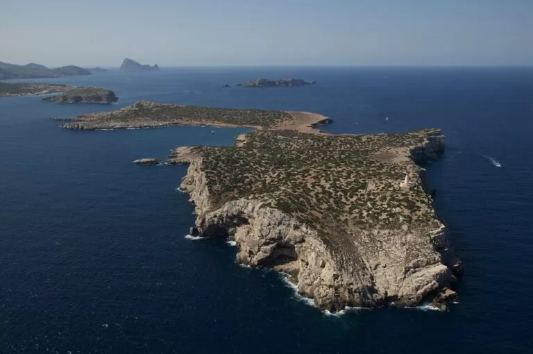
Sant Antoni
The west coast: sunsets, bars and clubs, and summer boats to Cala Comte and Cala Salada. Lively in high season; pick a hotel away from the bay front if you want sleep.
Sunsets and covesSanta Eulària and the north-east
A calmer town with a marina, near Cala Llonga, Es Canar and the markets. Portinatx and Sant Joan are quieter still.
Families and quietCampsite with a CostaMap page: Camping La Playa Ibiza in Es Canar. Camping is not allowed inside the Ses Salines Natural Park, in tents, caravans or motorhomes (Balearic Government).
Getting there and around
By air
Ibiza Airport is in the south of the island, in Sant Josep, 7.5 km from Ibiza town, with direct flights from the other islands, mainland Spain and the rest of Europe. Bus 10E, the Aeroport Express, runs to the port and the town centre from March to October; line 9 links the airport with Sant Josep and Sant Antoni in summer, and line 24 with Santa Eulària and Es Canar from 19 May to 31 October. Spain.info puts a taxi to town at around €20 (Spain.info, checked November 2026).
By sea
The island’s three main ports are Ibiza, Sant Antoni and the Santa Eulària marina. Ibiza and Sant Antoni have regular ferries to Barcelona, Valencia and Dénia, and to Mallorca and Formentera; you can bring your own car (Spain.info). For Formentera, boats leave from Ibiza port.
On the island
Intercity buses link Ibiza town with Sant Antoni, Santa Eulària and the main beaches; Ibiza town has cycle lanes along its main streets and the port (Spain.info). In summer, boats from Sant Antoni serve the western coves; a car is easiest for the north.
A two-day route
By car. Day 1 stays in Ibiza town, the south and the west; day 2 crosses to the north and east.
Day 1
Dalt Vila, Ses Salines and the sunset at Cala d’Hort
Walk up through the Portal de ses Taules to the cathedral before the heat, and come down through La Marina. Drive south to Ses Salines: the interpretation centre in Sant Francesc de s’Estany, then a swim. In the afternoon, head west via Sant Josep to Cala d’Hort for a late lunch and the sunset behind Es Vedrà.
Day 2
Cala Salada, the north and Santa Eulària
Swim early at Cala Salada north of Sant Antoni. Cross to Sant Miquel and its hilltop church, then go north to Portinatx and Cala Xarraca. Return through Sant Joan and Sant Carles (on Saturdays, the Las Dalias market) and finish in Santa Eulària with the climb to the Puig de Missa.
FAQ
What is the best part of Ibiza to stay in?
Ibiza town for history, the port and an easy airport transfer; Sant Antoni for sunsets and nightlife; Santa Eulària for a quieter, family stay; and the north, around Portinatx and Sant Joan, for calm and countryside.
Is Dalt Vila free to visit?
Yes. Walking into the walled town is free; the cathedral and the museums inside have their own hours. The usual way in is the Portal de ses Taules from the old market.
What are the best beaches in Ibiza?
Cala Comte and Cala d’Hort in the south-west for views and sunsets, Ses Salines and Es Cavallet in the natural park in the south, Cala Salada near Sant Antoni, Cala Llonga for families in the east, and Benirràs, Cala Xarraca and Portinatx in the north.
How do I get from Ibiza Airport to Ibiza town?
The airport is 7.5 km from town. Bus 10E runs to the port and centre from March to October; Spain.info gives a taxi fare of around €20 (checked November 2026).
Where is the Benirràs drum party?
At Cala Benirràs on the north coast, near Port de Sant Miquel in Sant Joan de Labritja. Spain.info describes drum gatherings there every Sunday.
Other areas of the Balearic Islands
Balearic Islands
Mallorca, Menorca, Ibiza and Formentera, with the map, the ferries between the islands and itineraries.
Balearic Islands guide →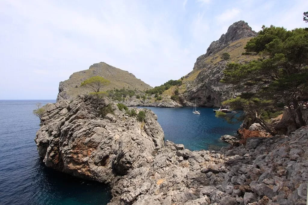
Mallorca
Palma and its cathedral, the Serra de Tramuntana and the coves of the east coast.
Mallorca guide →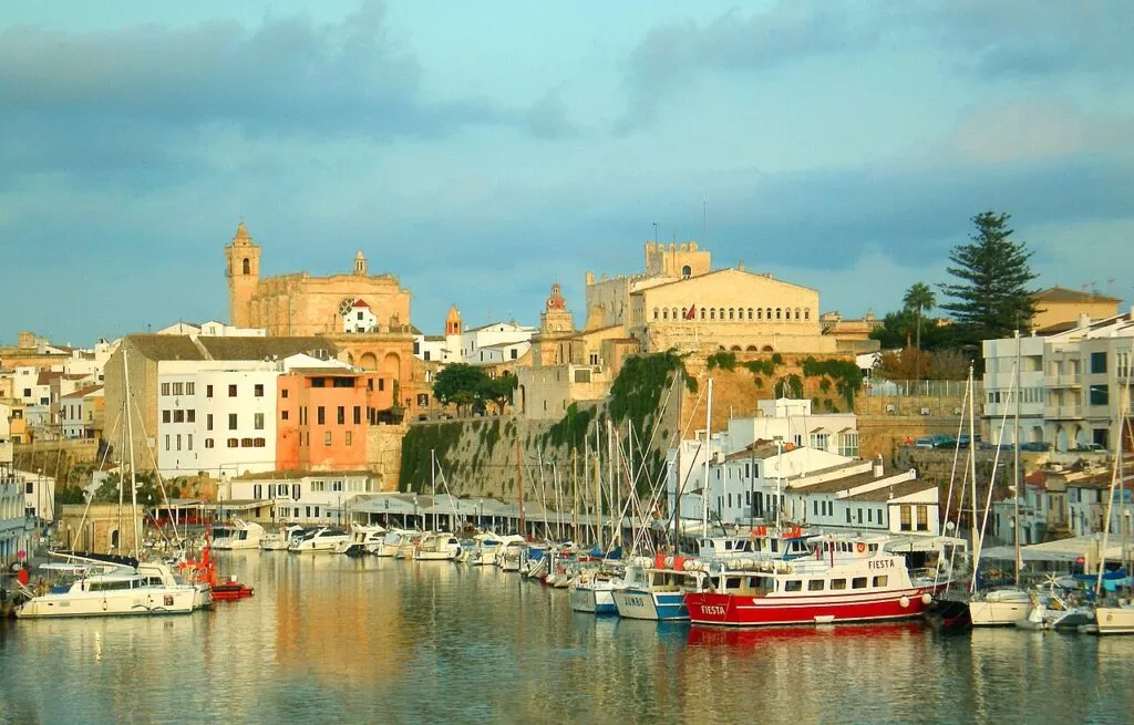
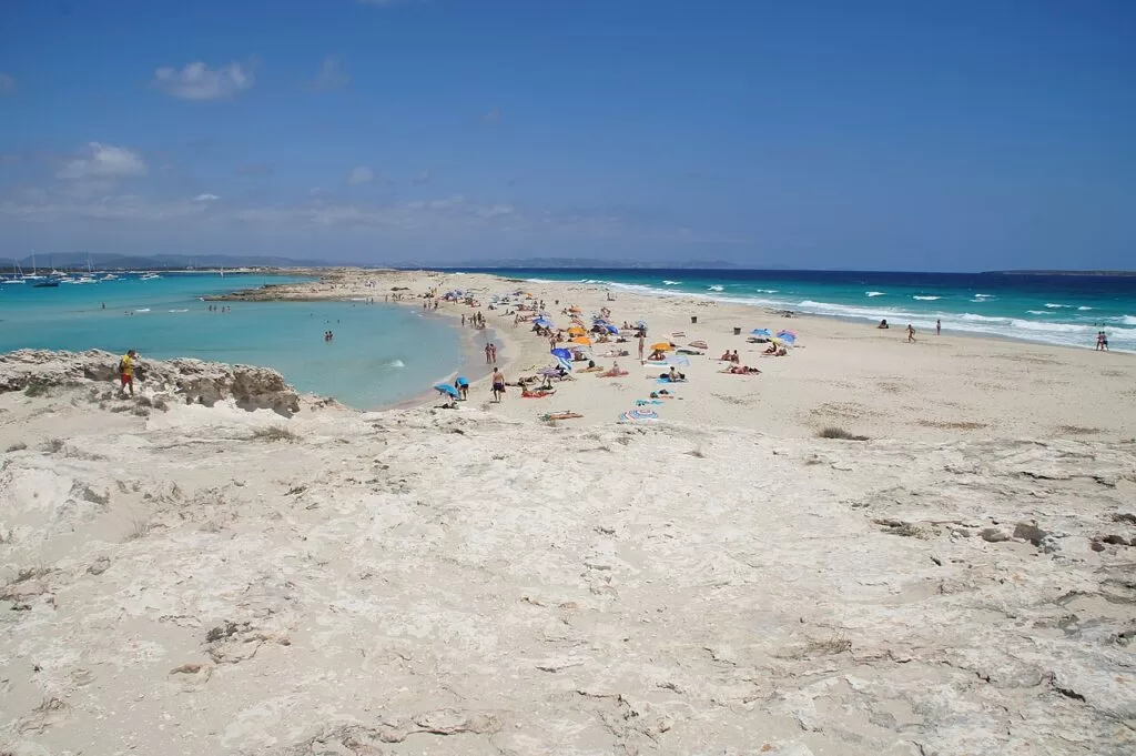
Formentera
The smallest island, by ferry from Ibiza port: Ses Illetes, the lighthouses and the other half of the Ses Salines park.
Formentera guide →Sources and freshness
Checked 7 November 2026. Spain.info on Ibiza island, Eivissa, Sant Josep de sa Talaia, Sant Antoni de Portmany, Santa Eulària des Riu, Portinatx, the beaches of Talamanca, Cala Llonga, Cala Xarraca, Es Cavallet and Cala Salada, the Ibiza markets, Ibiza Airport and the port of Ibiza. Illes Balears tourism on Eivissa, Platges de Comte, Cala d’Hort and Cala Salada (copies opened earlier in November 2026; the site returned errors on our last check). The Balearic Government on the Ses Salines Natural Park. Background from Wikipedia on Sant Joan de Labritja, Sant Miquel de Balansat and Sant Carles de Peralta; locations and distances from OpenStreetMap. The island council and town hall websites could not be opened from our research setup.
Every place we have mapped on the Ibiza
10 towns, beaches, coves and landmarks, kept up to date automatically.
- Cala Comte (Sant Josep, Ibiza)
- Cala d'Hort (Sant Josep, Ibiza)
- Cala Saladeta (Sant Antoni, Ibiza)
- Camping La Playa Ibiza
- Dalt Vila (Ibiza Town)
- Es Vedrà (Sant Josep, Ibiza)
- Marina Ibiza (Ibiza town)
- Portinatx (Sant Joan de Labritja, Ibiza)
- Sa Conillera (Sant Josep, Ibiza)
- Ses Salines Natural Park (Sant Josep, Ibiza)