
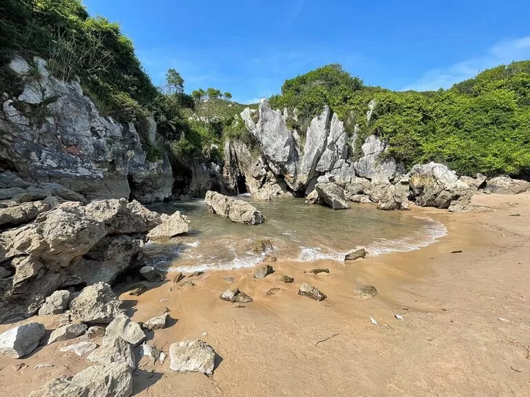
Playa de Gulpiyuri is an inland beach near Naves in Llanes, Asturias: a small ring of sand and salt water in a collapsed limestone sinkhole about 100 m from the open sea, which reaches it through underground passages. There is no road to the sand; you walk in on a farm track from Naves or along the coast from the beach of San Antolín. It is about 40 m long and nearly disappears at high tide, so go at low tide. It suits people who want to see an odd piece of coast and paddle; skip it if you want a full beach day with facilities.
Quick facts
- Names: Playa de Gulpiyuri, also Cala de Gulpiyuri on maps; in English often called Gulpiyuri beach. English Wikipedia gives the meaning of the name as “water circle”.
- Where: north of the village of Naves, municipality of Llanes, eastern Asturias, about 11 km west of Llanes town.
- Coordinates: 43.4476, -4.8861.
- Size: about 40 m long (Turismo Asturias); 15 m wide according to Spain’s official tourism site. The sinkhole is about 50 m across.
- Sand: coarse sand, in a basin of salt water fed by the sea.
- Protection: Natural Monument since 26 December 2001, inside the Protected Landscape of the Eastern Asturias Coast.
- Access: on foot only; vehicles are not allowed to the beach.
- Dogs: not allowed on the beach.
- Entry: free.
Access and parking
On foot: the Asturias tourist board says access is pedestrian only, either from the village of Naves along a farm track or from the beach of San Antolín, about 1.5 km to the east in a straight line (Turismo Asturias). The walk crosses meadows that sit higher than the beach, and the last part drops down to the sand.
Parking: OpenStreetMap shows a pay car park about 600 m south-east of the beach, marked as closed to caravans, with more car parks around 800–900 m away. Spanish Wikipedia notes that local police fine cars left outside the car park on the lanes around it, so do not park on the verges.
By car: the area is reached from the A-8 Autovía del Cantábrico, which runs just inland of the beach. Spain’s tourism site gives the N-634 as the nearest main road.
Without a car: OpenStreetMap shows no bus stop within 600 m. Walkers on the Llanes coast can combine Gulpiyuri with San Antolín beach.
What to expect
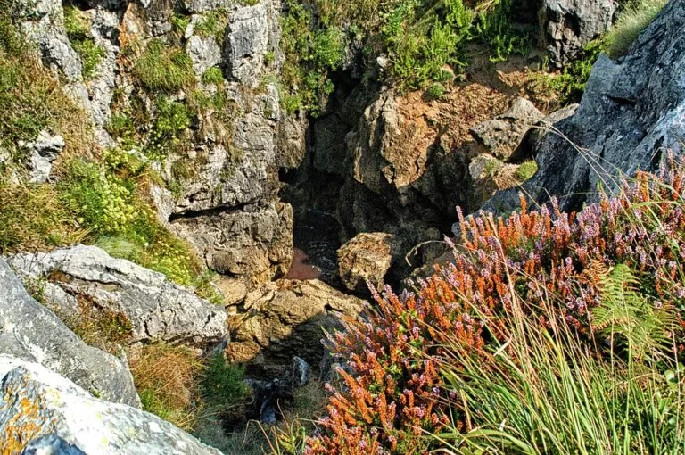
Gulpiyuri is a karst feature, not a seaside beach. The sea dug a cave into the limestone cliffs, the roof of the cave fell in, and what is left is a round hollow among farm fields, still connected to the coast underground. Sea water comes and goes with the tide, and small waves can reach the sand. Spanish Wikipedia links its origin to the same process that formed the Bufones de Arenillas blowholes further east.
The tourist board describes white sand and salt water with the Bay of Biscay a few metres away, flowing under the cliffs, and says the beach holds barely any sand at high tide. The water is shallow: Spanish Wikipedia says it is deep enough only to lie down and get wet, though the hollow is well sheltered from the wind. Spain’s tourism site lists it as calm water with low occupancy, but also says it is often visited by many people who come to take photos.
Practical details
- Facilities: the tourist board states that Gulpiyuri has no services. Its listing also mentions a beach bar nearby in season, and Spanish Wikipedia places a kiosk between the car park and the beach. Do not count on it outside summer.
- Toilets, showers, shade: none at the beach that we could confirm.
- Dogs: the tourist board says pets are banned on the beach; owners who ignore this can be asked to leave and reported.
- Tides: check a tide table for Llanes before you set off. Low tide gives you the most sand.
- Protected site: it is a Natural Monument. Stay on the paths across the fields and take your rubbish with you.
Accessibility and safety
Gulpiyuri is not accessible for wheelchairs or pushchairs: the tourist board says so plainly, and OpenStreetMap also tags it wheelchair “no”. The track and the final drop to the sand are uneven. We found no information on lifeguards, so treat it as unsupervised. The water is shallow and calm, but it is sea water moving through the rock with the tide, so keep children close.
Best time to visit
Low tide is the key. At high water there is little or no sand left. Early morning and weekdays outside July and August will be quieter, since the beach is small and popular with photographers. In winter the hollow is still worth a look, but the walk across the fields can be muddy.
Nearby alternatives
- Llanes Coastal Path, 11 km away: a waymarked walk along the coast around Llanes.
- Llanes, 11 km away: the nearest town and the municipality Gulpiyuri belongs to.
- Ruta del Cares, 22 km away: the gorge walk between Poncebos and Caín in the Picos de Europa.
- Picos de Europa, 21 km away: the national park inland, with the Lakes of Covadonga.
- Mirador del Fitu, 25 km away: a hilltop viewpoint in eastern Asturias.
- Playa de San Antolín, 1.5 km east: a long open beach, and one of the two walking approaches to Gulpiyuri.
Distances are in a straight line from the beach.
FAQ
Where is Gulpiyuri beach?
In the municipality of Llanes in eastern Asturias, north of the village of Naves and about 100 m inland from the coast. Coordinates: 43.4476, -4.8861.
How do you get to Playa de Gulpiyuri?
On foot only. Walk in on the farm track from Naves, or along the coast from San Antolín beach. Vehicles are not allowed down to the beach.
Is there parking at Gulpiyuri?
Yes. OpenStreetMap shows a pay car park about 600 m south-east of the beach. Police fine cars parked outside it on the nearby lanes.
Can you swim at Gulpiyuri?
You can paddle and lie in the water, but it is shallow and small. At high tide there is barely any sand, so go near low tide.
Can I bring my dog?
No. The Asturias tourist board says pets are not allowed on the beach.
Sources and freshness
Checked 6 November 2026 · 5 sources Show
Checked 6 November 2026. Official: Turismo Asturias, Gulpiyuri Beach (length, sand, access on foot, no services, accessibility, dog ban, coordinates); Spain.info, Beach: Gulpiyuri (width, water, occupancy, nearest road). Background: Wikipedia (Spanish) (Natural Monument date, protected landscape, sinkhole size, parking fines) and Wikipedia (English) (distance from the sea, meaning of the name). Location, car parks, bus stops and distances: OpenStreetMap contributors.
How this page is made. CostaMap is written with an AI editorial system run by Ebizapple. This page is based on the sources listed above. Last updated 6 November 2026. Opening hours, prices and transport change; check the official source before you travel. How we work · Partner links and ads