
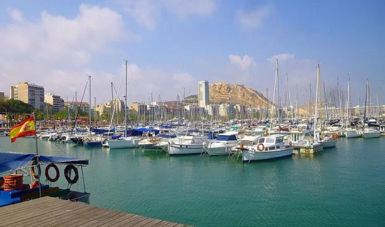
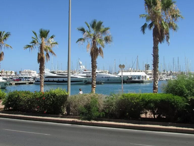
Marina Alicante is the yacht marina in the port of Alicante, on the Muelle 8 in the Zona de Levante, right below the city centre and the Explanada de España promenade. You reach it on foot from the centre in a few minutes; the Santa Bárbara Castle hill rises 1.2 km away. The regional tourist board describes it as a complex for leisure and recreational sailing, with a large shopping and restaurant area close to the town centre. It suits sailors, walkers on the seafront and anyone catching a boat to Tabarca from the nearby quay. Skip it if you want a beach: the Postiguet beach is 1.1 km away.
Quick facts
- Names: Marina Alicante, also called the Alicante marina or Marina Deportiva de Alicante; in Valencian the city is Alacant and the port the Port d’Alacant.
- Where: Muelle 8, Zona de Levante, 03001 Alicante, inside the port of Alicante (Turisme Comunitat Valenciana).
- Coordinates: 38.3391, -0.4828.
- Boats: up to 60 m long, according to the tourist board; OpenStreetMap gives the same maximum length.
- Berths: we could not reach the marina’s or the port authority’s websites, so we do not give a berth number here.
- Contact: +34 965 213 600 or +34 691 242 571, info@marinaalicante.com (tourist board listing).
- Blue Flag: the tourist board lists the Blue Flag among the marina’s services.
- Radio: VHF channel 9, according to OpenStreetMap; confirm with the marina.
Access and parking
On foot: the marina is at the foot of the city centre. The Explanada de España, Alicante’s seafront promenade, is about 0.5 km away.
Parking: OpenStreetMap shows a paid surface car park on the quay about 0.2 km east of the marina, the paid underground Plaza Canalejas car park 0.4 km to the north-west, and the paid underground Plaza del Puerto car park 0.5 km to the north-east.
By bus and tram: the Explanada de España bus stop (Vectalia) is about 0.5 km away. The nearest tram stop we could locate on OpenStreetMap is Luceros, about 1 km away. Check the operators’ current timetables.
By sea: the tourist board says the marina takes boats up to 60 m long and has a large boatyard. OpenStreetMap shows a fuel berth and toilets for boaters on the eastern quay. Contact the marina before arriving.
What to expect
The tourist board puts it plainly: “This marina is not simply just another port.” Its installations have become “an entire complex offering leisure activities and recreational sailing”, and being close to the town centre gives it a large shopping area and a wide choice of restaurants (Turisme Comunitat Valenciana).
Around the marina, OpenStreetMap shows:
- Panoramis: a shopping and leisure centre on the west side of the basin, 0.35 km away.
- The Ocean Race Museum: on the Muelle de Levante, about 0.3 km east. Check its own website for opening hours.
- Casino Mediterráneo Alicante: on the quay to the north-east, 0.45 km away.
- The Lonja del Pescado museum: the old fish market building, now a museum, 0.46 km to the west.
- The Tabarca boat stop: boats to the island of Tabarca leave from a quay 0.4 km north of the marina.
Wikipedia notes that the port of Alicante dates its status as a public port to a privilege granted by Alfonso X in 1271, and that the city later expanded the marina while moving industrial installations such as fuel tanks away from the waterfront (Wikipedia).
Prices and opening
The waterfront around the marina is open to walkers, and we found no entry charge. The car parks nearby are paid; we could not check their rates. For berth rates, ask the marina on the numbers above. Shops, bars and the museums set their own hours. We have not printed prices or hours that we could not check with the operator.
Accessibility and safety
The quays and the promenade are flat. OpenStreetMap marks the Tabarca boat stop as having limited wheelchair access and shows public toilets marked for wheelchair users near the Plaza del Puerto, 0.5 km away. We could not confirm step-free access onto the pontoons, which are for berth holders. Keep children away from the quay edges and watch for cars and service vehicles on the quays.
Best time to visit
Alicante’s waterfront is busy all year. Come in the evening for dinner by the boats, or in the morning if you are combining a walk round the marina with a boat trip to Tabarca.
Nearby alternatives
- Alicante town guide, 0.7 km away: the city, its old quarter and food.
- Playa del Postiguet, 1.1 km away: the city beach to the north-east.
- Santa Bárbara Castle, 1.2 km away: the fortress on the hill above the port.
- MARQ, the Archaeological Museum of Alicante, 1.7 km away.
- Tabarca Island, 19.4 km away: the small island reached by boat from the port.
- Santa Pola, 17.7 km away: the next port town to the south.
Distances are in a straight line from the marina.
FAQ
Where is Marina Alicante?
Inside the port of Alicante, on the Muelle 8 in the Zona de Levante, below the city centre and the Explanada de España. Coordinates: 38.3391, -0.4828.
Is there parking at Marina Alicante?
Yes, all paid: a surface car park on the quay about 0.2 km away, and underground car parks at Plaza Canalejas (0.4 km) and Plaza del Puerto (0.5 km).
Can I get a boat to Tabarca from Alicante marina?
Boats to Tabarca leave from a stop about 0.4 km north of the marina, on the same waterfront. Check the operators for times and prices.
How big are the boats Marina Alicante can take?
Up to 60 m long, according to the regional tourist board. We could not confirm the operator’s current berth count.
Can you swim at Marina Alicante?
Not in the harbour. The nearest city beach, Playa del Postiguet, is 1.1 km away.
Sources and freshness
Checked 6 November 2026 · 5 sources Show
Checked 6 November 2026. Official: Turisme Comunitat Valenciana, Marina Alicante (description, address, contact, maximum length, boatyard, Blue Flag) and its Spanish version. Port history: Wikipedia, Puerto de Alicante. Location, VHF channel, fuel berth, car parks, bus and tram stops, the Tabarca boat stop, nearby museums and distances: OpenStreetMap (OpenStreetMap contributors, ODbL). The marina’s own website and the Alicante port authority’s site could not be reached for this update. Photos: Wikimedia Commons, licences as credited.
This place is part of our Costa Blanca, Spain: towns, beaches and where to stay — see every town, beach and cove we have mapped on that coast.
How this page is made. CostaMap is written with an AI editorial system run by Ebizapple. This page is based on the sources listed above. Last updated 6 November 2026. Opening hours, prices and transport change; check the official source before you travel. How we work · Partner links and ads