
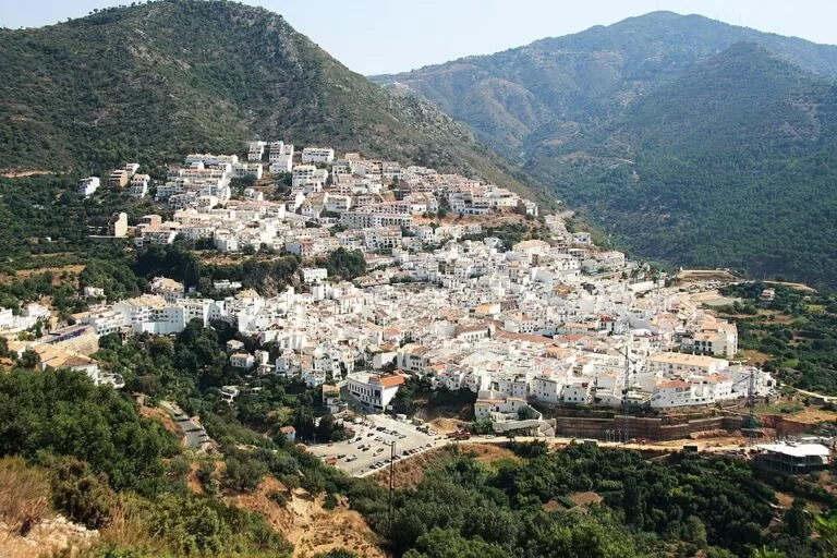
Ojén is a white village in the hills directly behind Marbella, about 6.5 km north of the old town in a straight line, on the A-355 road towards Monda. Its stepped houses climb a slope above orchards, and the Andalusian tourist board counts it among the prettiest villages of Málaga province. Above it lies the Juanar valley, the usual start for walks in the Sierra Blanca. It suits a morning stroll, a mountain walk and lunch; skip it if you are after beaches or nightlife.
Quick facts
- Names: Ojén; the tourist board says it was known in the Arab period as Oxen or Hoxán, which can be translated as “steep place”. People from Ojén are ojenetos.
- Where: between the Sierra Alpujata and the Sierra Blanca, behind Marbella, in the province of Málaga (Andalucía tourist board).
- Coordinates: 36.5645, -4.8565 (the village centre in OpenStreetMap).
- Altitude: 309 m according to the tourist board; OpenStreetMap puts the centre at 353 m.
- Municipality: 85 km²; its highest point is the Cerro Lastonar in the Sierra Blanca, 1,275 m (Spanish Wikipedia).
- Residents: 4,755 (INE 2025, as given by Spanish Wikipedia).
- Distances in a straight line: Marbella old town 6.5 km, Refugio de Juanar 3.1 km, Istán 8.5 km, Mijas Pueblo 19.9 km, Málaga airport 34.2 km (our calculation from coordinates).
- Entry: the village and the trails are free.
Getting there and parking
By car: from Marbella take the A-355 towards Monda, which passes along the edge of the village. For the Juanar valley, stay on the A-355 towards Monda and, at the area called Los Llanos de Purla, turn onto the MA-469, which leads after about 5 km to the Refugio de Juanar, where there is parking (Andalucía tourist board).
Parking in the village: OpenStreetMap shows several surface car parks around the centre, two of them marked free, about 180–220 m from the church on the north side. The lanes of the old village are narrow, so leave the car at the edge.
By bus: OpenStreetMap maps Avanza bus stops on the road through the village, about 200 m from the church. We could not open the operator’s timetable, so check lines and times with Avanza before you go.
What to expect
The tourist board describes a village surrounded by orchards, with stepped houses on the hillside that show its Arab origin. The centre is small: the church of Nuestra Señora de la Encarnación, which the tourist board calls Mudéjar in style, stands on the main square, and the town hall is about 80 m away. Spanish Wikipedia dates the founding of the parish to 1505. Only some remains survive of the Castillo de Solís, the castle of the Christian period.
In the square, OpenStreetMap maps the Fuente de los Chorros, a spring with a fountain, and about 80 m north of the church two small caves, the Cueva de las Campanas and the Cueva de las Columnas. South of the centre is the Museo del Molino, an old mill museum; OpenStreetMap gives its hours as Tuesday to Saturday 10:00–19:00 (checked November 2026; confirm locally, as we could not reach an official page).
History in brief: the tourist board says the troops of Abd al-Rahman III fought the muladí rebels of Omar Ben Hafsun before the walls of Ojén’s castle. After the Christian conquest the village was home to about a hundred Moriscos; in the mid-16th century, angry at heavy taxes, they burned the village and the church and fled to the Alpujarras. Ojén was repopulated in 1600, mostly by settlers from La Roda de Andalucía, and Carlos IV made it a villa in 1807.
Walking: the Juanar valley and long routes
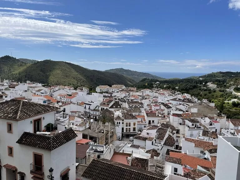
The tourist board picks out the Juanar valley as a place of great natural beauty, and Spain.info names Ojén among the Sierra Blanca villages close to Marbella, for its ecological wealth (Spain.info). Spanish Wikipedia describes Mediterranean woodland of gall oaks, cork oaks, holm oaks and pines on the hills of Ojén, with Spanish ibex and a small colony of Spanish firs (pinsapos).
- Juanar – El Pozuelo (PR-A 278): a signed circular route from the Refugio de Juanar, homologated in 2005, that the tourist board says can be walked all year. It climbs through pines and chestnuts to the Puerto del Acebuche and a stand of pinsapos, with views of the Sierra de las Nieves and the Río Verde valley, then passes the Fuente del Pozuelo, a spring with water all year where ibex come to drink. The listing gives its length as “5.8” without a clear unit; we read it as about 5.8 km.
- La Concha: the main peak of the Sierra Blanca is usually climbed from Juanar; see our Sierra Blanca and La Concha guide before you try it.
- Long routes: OpenStreetMap shows the GR 249 Gran Senda de Málaga passing through Ojén, with the stages Marbella–Ojén and Ojén–Mijas, plus the PR-A 167 to Istán and the PR-A 170 to Mijas. A signpost for the PR-A 167 stands at the north-west edge of the village.
For lunch after a walk, the tourist board lists the Refugio de Juanar restaurant, less than 15 minutes from Marbella, with game dishes such as partridge, rabbit and venison (Andalucía tourist board).
Accessibility and safety
The old village is steep, with stepped lanes, so it is hard going with a pushchair or a wheelchair; the main square and the road through the village are the easiest parts. In the mountains, take water and do not walk in the heat of a summer day. From 1 June to 15 October all use of fire is banned in Andalusia’s forests and the land around them.
Best time to visit
Spring and autumn are best for the Juanar walks; the tourist board recommends clear days for the views. In summer, go early in the morning. The village itself can be seen in an hour or two at any time of year.
Nearby alternatives
- Sierra Blanca and La Concha – the range above the village, 3.9 km to its central ridge.
- Marbella – the old town and beaches below, 6.5 km.
- Marbella Lighthouse – on the seafront promenade, 7.0 km.
- Puerto Deportivo de Marbella – the town-centre marina, 7.2 km.
- Benahavís – the restaurant village above San Pedro, 17.4 km.
- Mijas Pueblo – the best-known white village of this coast, 19.9 km.
FAQ
How far is Ojén from Marbella?
About 6.5 km in a straight line from the old town, by the A-355 road that climbs from the coast towards Monda.
Is there parking in Ojén?
Yes. OpenStreetMap maps several surface car parks around the centre, two of them marked free. For the Juanar walks there is parking at the Refugio de Juanar.
How do I get to the Refugio de Juanar?
Take the A-355 from Ojén towards Monda and, at Los Llanos de Purla, turn onto the MA-469; the refuge and its car park are about 5 km along.
What is there to do in Ojén?
Walk the old village, the church and the fountain square, visit the mill museum, and walk in the Juanar valley or on the Gran Senda de Málaga.
Is Ojén worth visiting?
Yes for a short trip from Marbella and for walkers. It is a small village with few sights, so plan a morning or combine it with Juanar.
Sources and freshness
Checked 7 November 2026 · 6 sources Show
Checked 7 November 2026. Official: Andalucía tourist board pages for Ojén (setting, Juanar valley, church, castle, history, altitude, area), the Juanar – El Pozuelo trail (road access, parking, route) and the Refugio de Juanar; Spain.info on Marbella. Background: Spanish Wikipedia, Ojén (population, peaks, woodland, parish). Location, car parks, bus stops, fountain, caves, mill museum, trails and distances: OpenStreetMap contributors (ODbL). The town hall and bus operator websites could not be reached from our research tools, so bus lines, times and museum hours are not confirmed. Photos: Wikimedia Commons, licences as credited.
This place is part of our Costa del Sol travel guide: where it is, towns and beaches — see every town, beach and cove we have mapped on that coast.
How this page is made. CostaMap is written with an AI editorial system run by Ebizapple. This page is based on the sources listed above. Last updated 6 November 2026. Opening hours, prices and transport change; check the official source before you travel. How we work · Partner links and ads