
Costa del Azahar · South
Castelló and the Plana travel guide: El Grau to Almenara
A provincial capital with a Gothic bell tower and a fishing port, then the long gravel and sand beaches, wetlands and walled villages of the Plana down to the Valencia border.
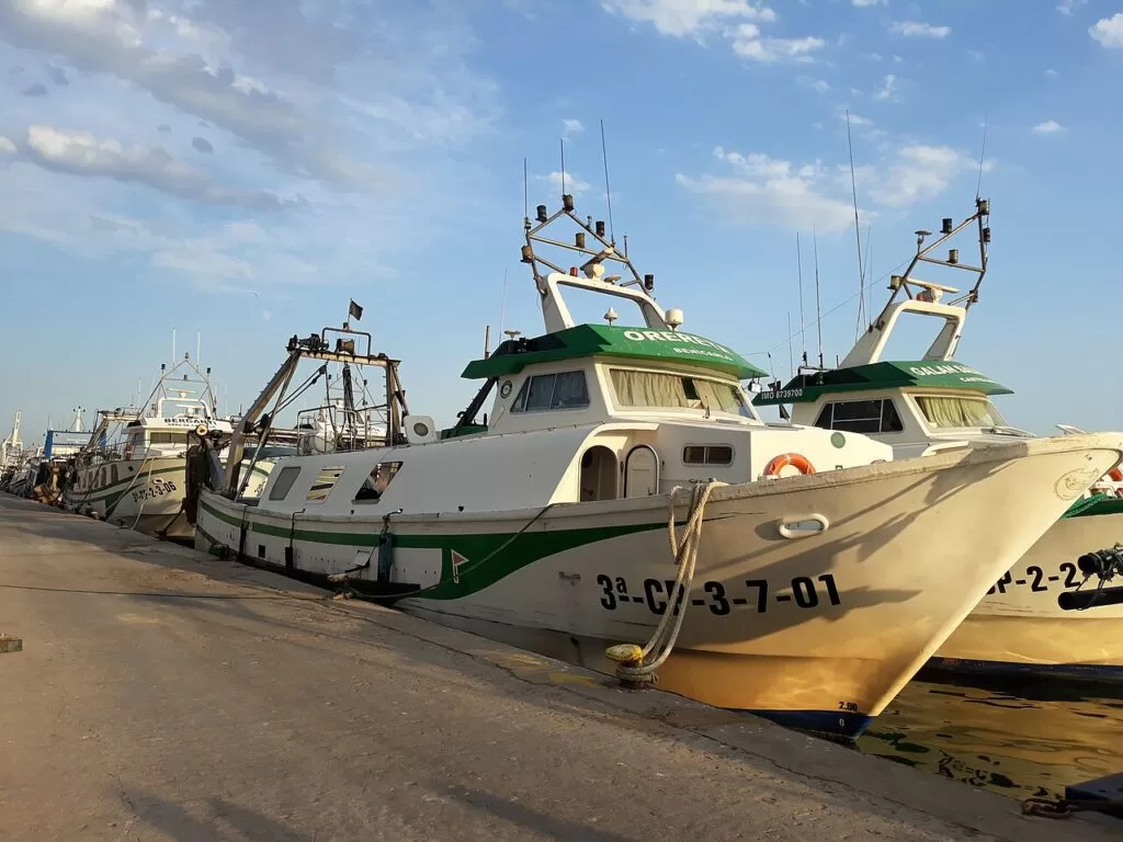
The fishing port of El Grau de Castelló · Photo: Pacopac, CC BY-SA 4.0
Part of the Costa del Azahar guide · South: Castelló and the Plana
Castelló and the Plana is the southern end of the Costa del Azahar: the coast of Castellón province from the city of Castelló de la Plana and its seaside district, El Grau, south to Almenara at the border with Valencia province, about 30 km in a straight line. Behind it lies the Plana, a flat plain of orange groves crossed by the Millars (Mijares) river, with the towns of Almassora, Vila-real, Borriana, Nules, Moncofa, Xilxes, La Llosa and Almenara, and the Columbretes Islands far out at sea.
At a glance
- Where the coast of la Plana Alta and la Plana Baixa in Castellón province, from the Serradal beach at the Benicàssim boundary to Casablanca beach at Almenara.
- Towns Castelló de la Plana and El Grau, Almassora, Borriana, Nules, Moncofa, Xilxes, La Llosa and Almenara on the coast; Vila-real and La Vall d’Uixó a short way inland.
- Best for a city break with beaches, quiet family beach towns, wetland birds, the Coves de Sant Josep and the Columbretes.
- Getting there Castelló station and Cercanías line C-6, which stops in almost every town of the Plana on its way to València; València airport is about 67 km from Castelló and Castellón airport about 27 km, both in a straight line.
- On CostaMap the Castelló Co-Cathedral, the Columbretes Islands, the Coves de Sant Josep, Moncofa, two campsites and seven town guides.
Map of Castelló and the Plana
The map shows the places on this stretch that have a CostaMap page. Tick a place type to filter, and click a marker to see the place in the panel.
Place type
Area · next level
 Area map
Castelló and the Plana
Click a marker to see the place here. From Castelló de la Plana and El Grau south through Borriana, Nules and Moncofa to Almenara.
Towns and villagesTowns and villages
From north to south; seven of them are on the regional tourist board’s Costa Azahar route.
Castelló de la Plana
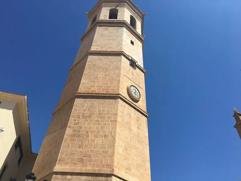
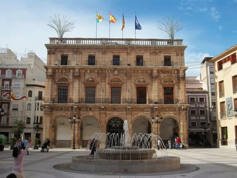
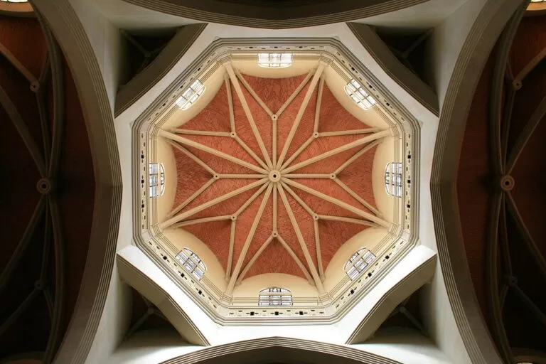
The provincial capital has its old centre around Plaza Mayor: the Gothic co-cathedral of Santa María and El Fadrí, the free-standing Gothic bell tower almost 60 m high, with about 200 steps to the top. Nearby are the Baroque town hall, the 17th-century Lonja del Cáñamo, the Mercado Central of 1949 and Ribalta Park, a 19th-century romantic park. The nine-day Magdalena festival celebrates the city’s foundation with the Romeria de les Canyes and a parade of gaiates (Comunitat Valenciana). See our Castelló de la Plana guide and the Castelló Co-Cathedral.
El Grau de Castelló
El Grau, the seafaring district about 4 km east of the centre, has the port, a wide choice of restaurants and the old lighthouse, which was taken down piece by piece and rebuilt where it stands now. The Planetari, by El Pinar beach, has science exhibitions under a large dome and the information centre of the Columbretes Islands (Comunitat Valenciana). The boats to the islands leave from the Real Club Náutico in the port; see our Columbretes Islands guide.
Almassora
Almassora, in la Plana Alta, sits at the mouth of the Millars (Mijares). It was founded by the Christians in the 13th century, and remains of its 17th- to 18th-century walls survive around the old centre with Plaza Mayor and its arches, the Baroque church of La Natividad and a museum with amphoras from shipwrecks. The Gothic bridge of Santa Quiteria crosses the river towards Vila-real. On the coast, Benafelí and Pla de la Torre are its two beaches, and the river mouth is a wetland for birds (Comunitat Valenciana). See our Almassora guide.
Vila-real
Vila-real lies about 8 km inland from Castelló. The tourist board highlights the 18th-century Neoclassical church of San Jaime, the 13th-century walls with the Torre Motxa, the porticoed Plaça de la Vila and the monastery of San Pascual Bailón, with the saint’s sarcophagus and old cell and what it calls the largest rolling bell in the world. The El Termet area is part of the protected landscape of the Millars river mouth. The San Pascual festival is in May (Comunitat Valenciana). See our Vila-real guide.
Borriana
Borriana (Burriana) keeps part of its medieval street plan, with 19th- and 20th-century manor houses and the 13th-century church of El Salvador and its bell tower, the Templat. Two watchtowers, the Torre del Mar and the Torre de Carabona, survive nearby. Its beaches, L’Arenal and Malvarrosa-Grao, run either side of the port, and the Millars river mouth and the Clot de la Mare de Déu are its natural areas. It is also a water-sports town (Comunitat Valenciana). See our Borriana guide.
Nules and Mascarell
Nules has streets decorated with ceramic altars, some from the 19th century, and several small churches; the chapel of San Joaquín and San Miguel, known as El Fort, holds the Enrique Giner Medal Museum. Its highlight is Mascarell, a hamlet enclosed by walls since the 13th century, about 1.5 km from the centre. Civil War trenches and bunkers survive outside the town. On the coast, the L’Estany wetland lies right behind the beach, with picnic tables, and four beaches run from Les Marines to L’Alcudia (Comunitat Valenciana). See our Nules guide.
Moncofa
Moncofa, with 8,339 inhabitants (INE 2025, Spanish Wikipedia), has an old village about 1.5 km inland and six beaches, from pebbly Pedraroja in the north to L’Estanyol near Xilxes. Every 23 July the town re-enacts the landing of its patron saint, Mary Magdalene, on the beach (Comunitat Valenciana). Belcaire beach is the one for dogs. See our new Moncofa guide and Camping Monmar, on the coastal plain of Moncofa.
La Vall d’Uixó
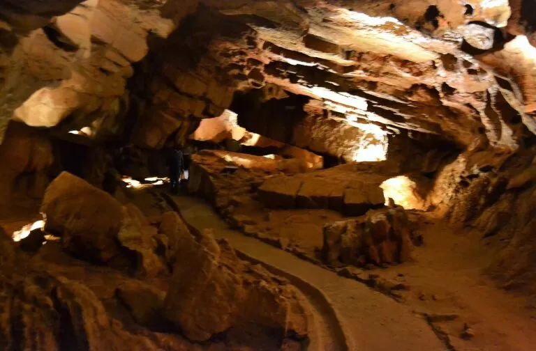
La Vall d’Uixó, about 9 km inland from Moncofa, is known for the Coves de Sant Josep, an underground river visited by boat. Next to the caves, the Iberian and Roman settlement of Sant Josep is open on guided tours and the town keeps a stretch of the Línea XYZ, a Civil War defence line of 1938 (Comunitat Valenciana). See our new Coves de Sant Josep guide and the La Vall d’Uixó town guide.
Xilxes (Chilches)
Xilxes sits halfway between Castelló and València. The tourist board points to beach sports and paddle surfing, the church of La Asunción and houses built in the 1940s by the Dirección General de Regiones Devastadas. Its marjal, a protected marsh, draws migratory birds in winter, and the Ruta dels Sentits Blue Trail and a birdwatching route cross it. Local dishes include arroz a banda, rice with beans and turnips and all i pebre (Comunitat Valenciana). HolaCamp Chilches is the campsite here.
La Llosa
La Llosa is a small village with the 17th-century church of El Salvador. Its only beach, 1 km long and 30 m wide, is 3.5 km from the village beside the Marjal wetland: sand and pebbles with no buildings, reached by a wooden walkway and a lit bridge over the La Gola canal; nudism is not allowed (Comunitat Valenciana). Els Pouets, between La Llosa and Xilxes, is a wetland fed by springs called ullals (Comunitat Valenciana).
Almenara
Almenara closes the Costa del Azahar at the border with Valencia province. Its castle has two lookout towers, L’Agüelet and L’Agüeleta, and a viewpoint over the plain. Els Estanys, three lakes in a former wetland, is one of the most valuable ecosystems in the Valencian Region and trails such as La Rodana start from the town (Comunitat Valenciana). Casablanca beach is 2,610 m of sand and pebbles with a signposted dune reserve. See our Almenara guide.
Beaches
Sand in Castelló and Borriana, then mostly gravel and pebbles further south. Lengths are from the regional tourist board; spain.info figures where they differ. The tourist board lists a Blue Flag among the certificates of the beaches marked below, without a year (checked November 2026).
El Pinar
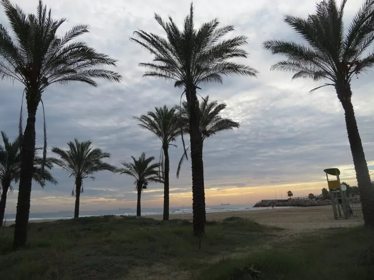
1,750 m from the northern edge of the port, the largest of the three beaches of El Grau, with restored dunes, El Pinar park behind, lifeguards, play areas and the Planetari a few metres from the sand; Blue Flag (Comunitat Valenciana).
See the Castelló guide →L’Arenal
1 km long and 120 m wide, with lifeguards, parasol hire, walkways and beach bars, and the Club Náutico and Escuela del Mar next to it for kayaking, sailing, paddling and windsurfing; Blue Flag (Comunitat Valenciana).
See the Borriana guide →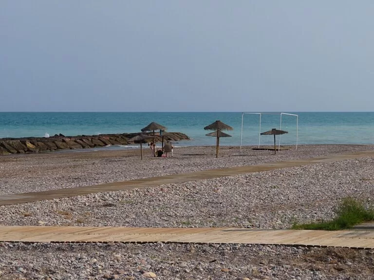
Beniesma
About 1.2 km of pebbles, rocks and small coves with a path along it, a naturist area and the remains of a 16th-century defence tower; not an officially controlled bathing area (Comunitat Valenciana).
See the Moncofa guide →- El Serradal (Castelló) – about 1,700 m of golden sand on the Benicàssim boundary, semi-urban, with protected dunes where the Kentish plover nests; reachable by intercity bus; Blue Flag (Comunitat Valenciana).
- Gurugú (Castelló) – 1 km long and 140 m wide on average, between the Camino de la Plana and the mouth of the Río Seco, with beach bars and play areas; Blue Flag (Comunitat Valenciana; spain.info gives 120 m wide, spain.info).
- Benafelí and Pla de la Torre (Almassora) – Benafelí is 450 m of sand and pebbles south of Castelló port, and Pla de la Torre is 2,200 m of sand and pebbles at the mouth of the Millars; both Blue Flag (Benafelí, Pla de la Torre).
- Malvarrosa-Grao (Borriana) – just over 1 km long, about 70 m wide, split by a breakwater into a sandy south and a pebbly north; Blue Flag (Comunitat Valenciana).
- Nules – L’Alcudia, 1,355 m of sand and pebbles; El Bovalar, almost 1.2 km, with the lighthouse built in 1992 by the architect Blanca Lleó; and quiet Rajadell, 1 km of gravel, not an officially controlled bathing area (L’Alcudia, El Bovalar, Rajadell).
- Moncofa – El Grau, 1,200 m of gravel by the town; Masbó, 800 m with palms, a promenade and a car park for more than 100 cars, Blue Flag; and Pedraroja, Belcaire and L’Estanyol; see the Moncofa guide.
- Casablanca (Almenara) – 2,610 m of sand and pebbles with a dune reserve; Blue Flag (Comunitat Valenciana).
Things to do
Nature: islands and wetlands
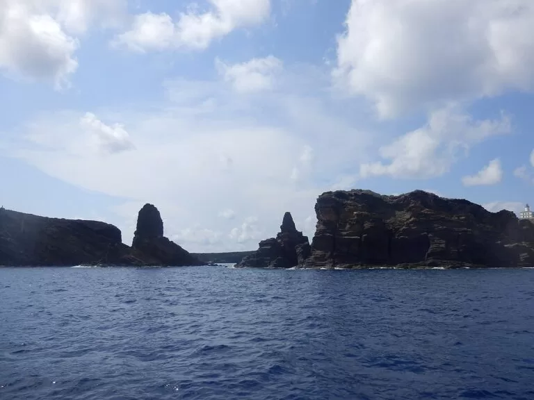
The Columbretes, a volcanic archipelago 48 km off the coast and part of the municipality of Castelló, are a nature reserve where only Illa Grossa can be visited, on boat trips from El Grau (Comunitat Valenciana); see our Columbretes guide. On the mainland, the coast is a chain of wetlands: El Serradal, the Millars mouth, L’Estany at Nules, the marjal of Xilxes and the lakes of Els Estanys at Almenara, fed by springs from the Sierra de Espadán (Comunitat Valenciana).
History: towers, walls and caves
Climb El Fadrí in Castelló, then see the co-cathedral next to it. Further south, Mascarell in Nules has been walled since the 13th century (Comunitat Valenciana), Almenara has its castle, and at La Vall d’Uixó the Coves de Sant Josep take you by boat along an underground river for 18 euros, (checked November 2026, Comunitat Valenciana).
Food: coca, rice and melons
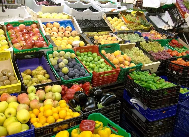
In Castelló, try the coca de Castelló, made with potatoes, at the Mercado Central, and a seafood rice in El Grau (Comunitat Valenciana). Moncofa is known for arrossejat, black rice and its melons, Xilxes for arroz a banda and sweet-potato pastries, and Almassora for cheese, honey and oranges. Borriana’s Citrus Interpretation Centre offers tours with a paella cooked over an orange-wood fire (Comunitat Valenciana).
Where to stay by town
The choice is between the city, with its trains and sights, and the smaller beach towns of the Plana.
Castelló centre
The best base without a car: the main station, the market and the old centre, about 4 km from the beaches of El Grau.
City break and trains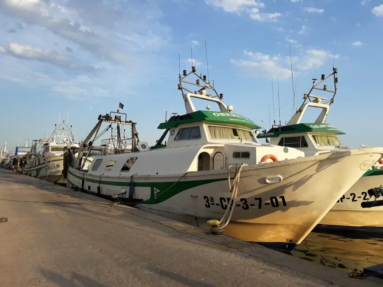
El Grau de Castelló
Beach, port and rice restaurants on the doorstep, the Planetari and the boats to the Columbretes.
Beach and seafoodBorriana
The wide sand of L’Arenal, water sports at the nautical club and a C-6 station, with a historic centre inland.
Families and water sportsMoncofa
A low-rise beach town with a campsite, a dog beach and quiet ends at Beniesma and L’Estanyol. Best with a car.
Quiet beaches and dogsGetting there and around
By train
Castelló station, opened in 2000 with underground tracks, is on Calle Pintor Oliet west of the centre (Spanish Wikipedia). Cercanías line C-6 runs 77 km from València-Nord to Castelló and stops at Almenara, La Llosa, Xilxes, Moncofa, Nules, Borriana, Vila-real and Almassora on the way (Spanish Wikipedia).
By air
València airport is about 37 km from Almenara and 67 km from Castelló in a straight line. Castellón airport, near Vilanova d’Alcolea, is about 27 km north of Castelló station and has a small number of flights (Spanish Wikipedia, OpenStreetMap).
By car
The N-340 runs just inland of the beaches of the Plana, and the AP-7 motorway runs parallel to it (Spanish Wikipedia). The Coves de Sant Josep and Mascarell are easiest by car.
A two-day route
By car, north to south, with a night in Castelló or El Grau.
Day 1
Castelló and El Grau
Start at the Mercado Central, the co-cathedral and El Fadrí. Then go down to El Grau for a rice lunch by the port, the old lighthouse and the Planetari, with its room on the Columbretes. Finish with a swim at El Pinar.
Day 2
Borriana, Mascarell and the Coves de Sant Josep
Drive south to Borriana for its old centre and a morning on L’Arenal. Stop at the walled hamlet of Mascarell in Nules, then book a slot at the Coves de Sant Josep in La Vall d’Uixó for the boat trip on the underground river. End at Casablanca beach and the lakes of Els Estanys in Almenara, or on the beach at Moncofa.
FAQ
What is La Plana?
The flat coastal plain around Castelló de la Plana, divided into two counties: la Plana Alta, with Castelló and Almassora, and la Plana Baixa, with Vila-real, Borriana, Nules, Moncofa, Xilxes, La Llosa, Almenara and La Vall d’Uixó.
What is the best beach in Castelló de la Plana?
El Pinar, the longest beach of El Grau at 1,750 m, with restored dunes, a park behind it and the Planetari next to it. El Serradal is the most natural.
How do I get from València to Castelló by train?
Cercanías line C-6 links València-Nord with Castelló, 77 km, stopping in the towns of the Plana. Check Renfe for times.
Can you visit the Columbretes Islands from Castelló?
Yes, on a private boat trip from the port of El Grau; only Illa Grossa can be visited, and the landing depends on the sea. The regional tourist board lists a day trip at 160 euros (checked November 2026).
Are the beaches of the Plana sandy?
The beaches of Castelló and Borriana’s L’Arenal are sandy. South of the Millars most beaches mix sand with gravel and pebbles, so water shoes help.
Other areas of the Costa del Azahar
Costa del Azahar
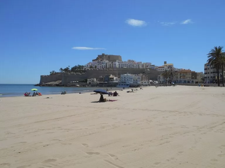
The whole coast from Vinaròs to Almenara, with the map, campsites and inland day trips.
Costa del Azahar guide →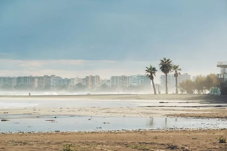
Torreblanca, Oropesa and Benicàssim
Oropesa and its cape, and the beaches and villas of Benicàssim.
Torreblanca, Oropesa and Benicàssim guide →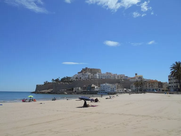
Peñíscola and the Serra d’Irta
Pope Luna’s castle and the wild coves of the Serra d’Irta.
Peñíscola and Serra d’Irta guide →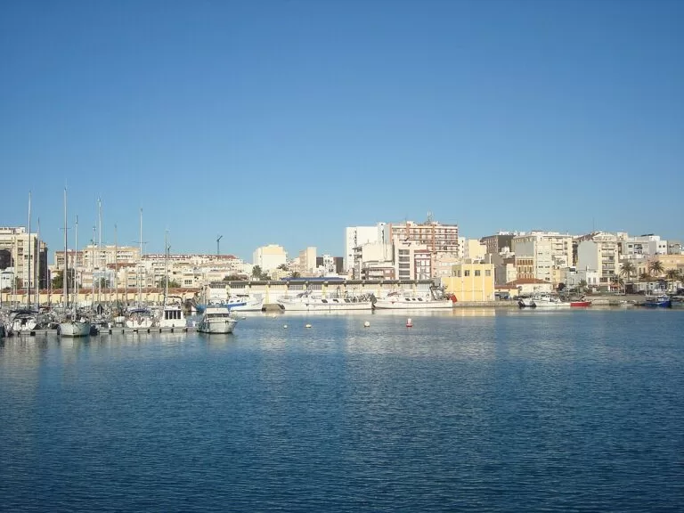
Vinaròs and Benicarló
King prawns, artichokes and the coves of Vinaròs, at the northern end of the coast.
Vinaròs and Benicarló guide →South of Almenara the coast continues as the Costa de Valencia: Sagunto, with its castle and Roman theatre, is about 17 km from the Coves de Sant Josep.
Sources and freshness
Checked 7 November 2026. Comunitat Valenciana (the regional tourist board) on the Costa Azahar route, Castelló de la Plana, the Planetari, the Columbretes reserve, Almassora, Vila-real, Borriana, Nules, Moncofa, La Vall d’Uixó and the Coves de Sant Josep, Xilxes, La Llosa and Almenara, and its beach pages linked above (lengths, services, certificates). Spain.info (Turespaña) beach sheet for Gurugú. Population of Moncofa, roads, Castelló station, line C-6 and Castellón airport: Spanish Wikipedia (Moncofa, Castelló station, C-6, Castellón airport). Map data and straight-line distances: OpenStreetMap (ODbL). Not confirmed: Blue Flag years, bus routes and timetables, and the natural park’s own rules for the Columbretes. Town hall, natural park and cave websites could not be reached when we checked. Photos from Wikimedia Commons: El Grau port by Pacopac (CC BY-SA 4.0); El Pinar beach by Juan Emilio Prades Bel (CC BY-SA 4.0); Columbretes by JavierValencia2005 (CC BY-SA 4.0); El Fadrí by flmv (CC BY-SA 4.0); Mercado Central and Plaça Major by Joanbanjo (CC BY-SA 3.0); Coves de Sant Josep by Joanbanjo (CC BY-SA 4.0); co-cathedral dome by Miguel Ángel García (CC BY 2.0); Beniesma beach in Moncofa by Juan Emilio Prades Bel (CC BY-SA 4.0); Peñíscola by Simon Burchell (CC BY-SA 4.0); Benicàssim by Martin Cox (CC BY 2.0); Vinaròs port by Juan Emilio Prades Bel (CC BY-SA 4.0).
Every place we have mapped on the Castelló and the Plana
6 towns, beaches, coves and landmarks, kept up to date automatically.