
Galician coast · Centre
A Coruña and the Golfo Ártabro travel guide: city districts, rías and naval Ferrol
The middle of the Galician coast: the city of A Coruña and its Roman lighthouse, the calm beaches of the rías of A Coruña, Betanzos and Ares, the forest of the Eume, and the 18th-century naval city of Ferrol.
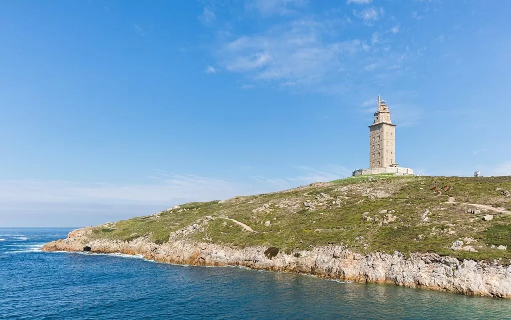
Tower of Hercules · Photo: Diego Delso, CC BY-SA 4.0
Part of the Galician coast guide · Centre: A Coruña and the Golfo Ártabro
The Golfo Ártabro is the bay on the north-west corner of Galicia where three estuaries open to the Atlantic: the Ría da Coruña, the Ría de Ares e Betanzos and the Ría de Ferrol, all visible at once from the lighthouse at Mera (Turismo de Galicia). This stretch runs from Arteixo, west of A Coruña, round the city and the sheltered beaches of Oleiros, Sada and Miño to Betanzos, Pontedeume, Ares, Mugardos and Ferrol, and up the open coast to Valdoviño.
At a glance
- Where the centre of the Galician coast, province of A Coruña: from Barrañán beach in Arteixo to the A Frouxeira lagoon in Valdoviño, between the Costa da Morte and the Rías Altas.
- Towns A Coruña, Oleiros, Sada, Bergondo, Betanzos, Miño, Pontedeume, Cabanas, Ares and Redes, Mugardos, Ferrol and Valdoviño.
- Best for a city break with beaches, Roman and 18th-century heritage, calm ría beaches for families, surf at Pantín and Riazor, and the Atlantic forest of the Eume.
- Getting there A Coruña airport (LCG) is about 8 km south of the city centre; Santiago (SCQ) is about 53 km south. Trains reach A Coruña, Betanzos, Pontedeume and Ferrol.
- On CostaMap guides to A Coruña, the Tower of Hercules, Betanzos, Ferrol and the Fragas do Eume natural park.
Map of A Coruña and the Golfo Ártabro
The map shows the places on this stretch that have a CostaMap page. Tick a place type to filter, and click a marker to see the place in the panel.
Place type
Area · next level
 Area map
A Coruña and the Golfo Ártabro
Click a marker to see the place here. The city of A Coruña and the rías of A Coruña, Betanzos, Ares and Ferrol.
Towns and districtsTowns, villages and city districts
From west to east round the bay, then north to Ferrol and Valdoviño. Descriptions are from Turismo de Galicia and spain.info, with background from Spanish Wikipedia.
Arteixo
West of the city, Arteixo faces the open Atlantic. Turismo de Galicia picks out the beach of Barrañán as a favourite of nudists and surfers (Turismo de Galicia): 1,200 m of fine sand with a Blue Flag (Turismo de Galicia).
A Coruña: Cidade Vella, the old town
The medieval town stood on the peninsula, and its streets and squares still hold a Romanesque ensemble (spain.info). The church of Santiago, from the 12th century, is the oldest in the city, followed by Santa María do Campo and the square of Santa Bárbara (spain.info). The San Carlos garden holds the tomb of Sir John Moore, the British general killed at the Battle of Corunna in 1809. The castle of San Antón is now the Archaeological Museum. See our A Coruña city guide.
A Coruña: Pescadería, María Pita and the Marina
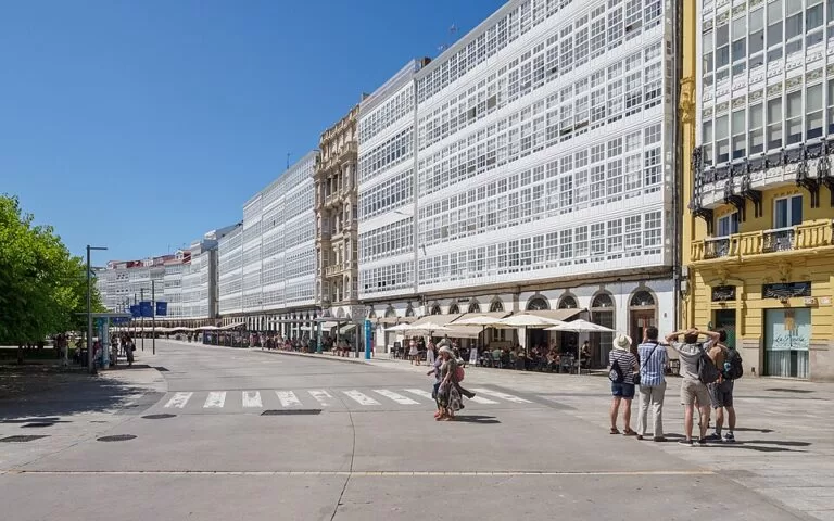
Below the old town, the Praza de María Pita holds the early 20th-century town hall with three domed towers, and Real and Rego de Auga are the oldest shopping streets (Turismo de Galicia). Along the Avenida da Mariña stand the 19th-century houses with white glazed balconies that gave A Coruña its name of the Glass City. The streets off María Pita, such as A Franxa and Galera, are the main eating area. The Méndez Núñez gardens link the port to the Ensanche.
A Coruña: Ensanche, Riazor and Orzán
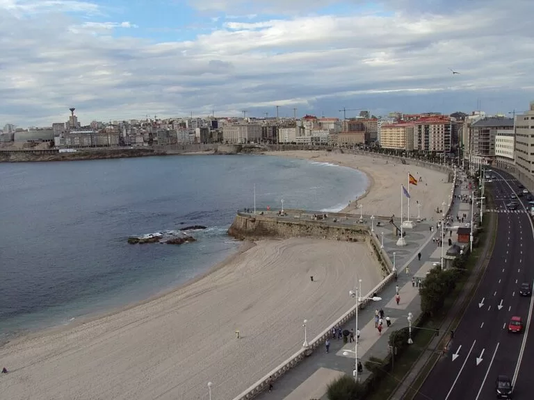
The 19th- and 20th-century extension has modernist buildings and shops on Juan Flórez Street and the Praza de Pontevedra, where the young Picasso went to school (spain.info). To the west the two city beaches, Riazor and Orzán, each about 600 m of coarse sand with a Blue Flag, are separated by a breakwater and have waves for surfing (Turismo de Galicia). The seafront promenade runs from the port round the peninsula to here, past the Aquarium Finisterrae, the Domus and the Tower of Hercules.
A Coruña: the Tower of Hercules headland
The north tip of the peninsula is the park of the Tower of Hercules, a Roman lighthouse built in the early 2nd century AD and refaced in 1791, the oldest working lighthouse in the world (Turismo de Galicia). Turismo de Galicia recommends the sunset here. The Aquarium Finisterrae is on the promenade just west.
A Coruña: Os Castros, Catro Camiños and A Gaiteira
The residential districts east of the centre are where locals eat: Turismo de Galicia points to taverns on almost every street of Catro Camiños, A Gaiteira and Os Castros.
Oleiros
Across the Ría do Burgo, Oleiros has the beaches that Turismo de Galicia calls an extension of the city: Santa Cristina, Santa Cruz, Bastiagueiro and Mera (Turismo de Galicia). Santa Cristina is 1,800 m of fine sand with a Blue Flag. Out on the point, the Costa de Dexo natural monument has cliffs and the Mera lighthouse, whose keeper’s house is now a sea classroom (Turismo de Galicia). The castle of Santa Cruz at Liáns houses an environmental education centre.
Sada and Bergondo
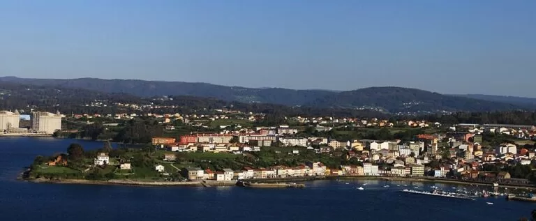
Sada is a fishing town on the west shore of the Ría de Betanzos. Turismo de Galicia recommends a coffee at La Terraza, a modernist building on its tree-lined beach, where thousands come for free grilled sardines on the last day of the San Roque fiestas in mid-August (Turismo de Galicia). Next door, Bergondo has a fine Romanesque church and the Pazo de Mariñán, whose gardens by the marshes of the ría can be visited during opening hours (Turismo de Galicia). Gandarío is its 600 m Blue Flag beach.
Betanzos
At the head of the ría, between the Mendo and Mandeo rivers, the old town of Betanzos climbs a hill: once one of the seven capitals of the Kingdom of Galicia, now a listed historic site with three Gothic churches and the tomb of Fernán Pérez de Andrade (spain.info). It is famous for its potato omelette and the paper balloon launched on 16 August (Turismo de Galicia).
Miño
On the east shore of the ría and on the English Way, Miño has the Praia Grande, 1,400 m of fine sand with a Blue Flag (Turismo de Galicia).
Pontedeume and Cabanas
Pontedeume sits at the mouth of the Eume and takes its name from its bridge over the river. Spanish Wikipedia says Alfonso X founded the town in 1270, and its streets keep arcades, wooden balconies and glazed galleries. The tower keep of the Andrade castle stands in the town (Turismo de Galicia), and the Romanesque church of San Miguel de Breamo is nearby. Cabanas has a beach backed by a pine wood. Pontedeume is the gateway to the Fragas do Eume, about 8 km up the valley.
Ares and Redes
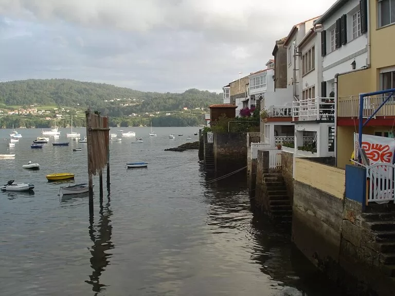
On the peninsula between the rías of Betanzos and Ferrol, Ares has houses with balconies for hanging up fishing nets, and in the small village of Redes the backs of the houses are piers (Turismo de Galicia). O Raso, in Caamouco, is an 850 m sheltered beach (Turismo de Galicia).
Mugardos
Mugardos faces Ferrol across the ría. Octopus has been its main catch since the 18th century, and in July, during the Carme fiestas, volunteers serve about 1,200 kg of octopus in 3,000 portions in the local style, with a sauce of onion and green and red peppers (Turismo de Galicia). The castle of La Palma, opposite San Felipe, guarded the mouth of the ría.
Ferrol: A Magdalena
The 18th-century centre of Ferrol follows plans approved by Carlos III in 1761, a grid of straight streets between the Amboaxe and Armas squares, with glazed galleries and the modernist Jofre theatre (Turismo de Galicia). The Herrera gardens at the end of Rúa Real look over the Arsenal.
Ferrol: the Arsenal and Esteiro
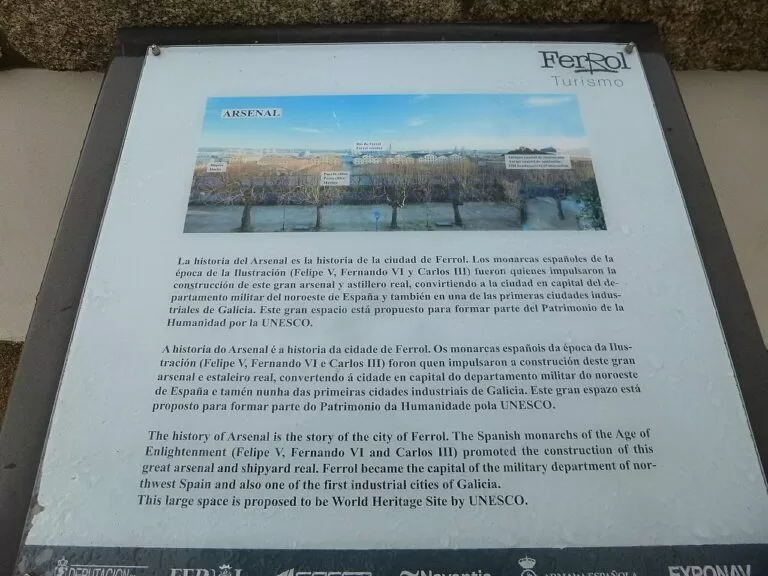
The dockyard, built from 1750, is the only military port of the Enlightenment left intact in Europe; inside, it can only be visited with permission, but the Naval Museum and Exponav are open (Turismo de Galicia). To the east, Esteiro was the 18th-century workers’ district; the Porta de Fontelonga remains.
Ferrol: Ferrol Vello and A Graña
Ferrol Vello, around the Praza Vella and the Curuxeiras quay, is the older fishing town with winding streets. West along the ría, the fishing quarter of A Graña lies below the castle of San Felipe, the 18th-century fortress at the narrow mouth of the ría (Turismo de Galicia).
Valdoviño
North of Ferrol the coast turns to open Atlantic. A Frouxeira beach runs for about 3 km beside a coastal lagoon that is protected for its birds, and Pantín, 950 m of fine sand, is a reference for surfers worldwide and hosts the Pantín Classic (Turismo de Galicia).
Beaches
Sheltered ría beaches with calm water, and open Atlantic beaches with surf. Lengths and Blue Flags are from Turismo de Galicia.
Riazor and Orzán
Two city beaches of about 600 m each, coarse sand, Blue Flag, open to the waves and used for surfing (Turismo de Galicia). The promenade from the Tower of Hercules ends here.
See the A Coruña guide →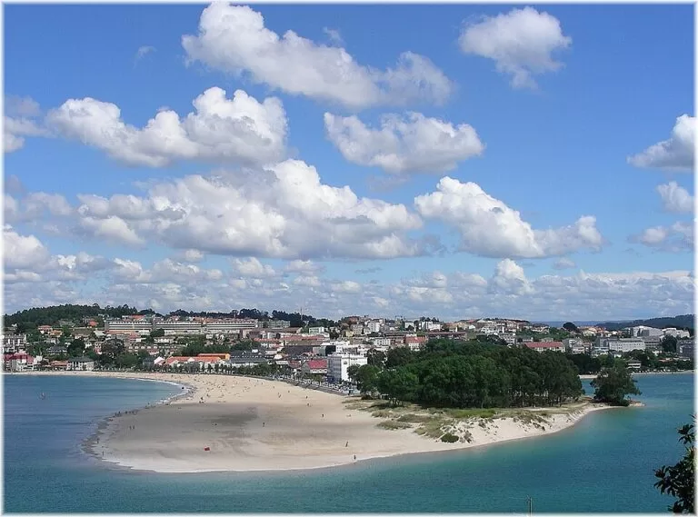
Santa Cristina and Mera
Santa Cristina is 1,800 m of fine sand with a Blue Flag (Turismo de Galicia); Bastiagueiro (580 m) and Mera (1,022 m) follow towards the point, both with Blue Flags.
Gandarío, Miño and O Raso
Sheltered beaches of the inner ría: Gandarío in Bergondo (600 m, Blue Flag), Praia Grande in Miño (1,400 m, Blue Flag) and O Raso in Ares (850 m) (Turismo de Galicia).
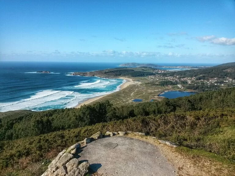
Doniños
A 1,700 m open beach of fine sand in Ferrol, with a Blue Flag and on the English Way (Turismo de Galicia). The Doniños lagoon behind it is a haven for waterfowl.
See the Ferrol guide →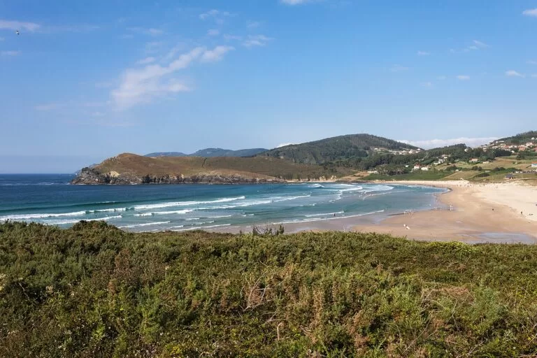
Pantín and A Frouxeira
Pantín, 950 m of fine sand, hosts international surfing competitions; A Frouxeira, about 3 km long, borders a protected lagoon (Turismo de Galicia).
Things to do
History: a Roman lighthouse and an 18th-century naval city
The Tower of Hercules can be visited and has a museum inside (Turismo de Galicia). In Ferrol, walk the Magdalena, see the Arsenal from the Herrera gardens and visit the Naval Museum and Exponav, then drive out to the castle of San Felipe. Betanzos adds Gothic churches and the tomb of Fernán Pérez de Andrade.
Nature: the Eume forest, cliffs and lagoons
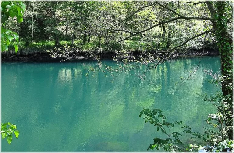
The Fragas do Eume natural park protects one of the best-preserved riverside Atlantic forests in Europe, with the monastery of Caaveiro in the gorge (Turismo de Galicia). On the coast, the Costa de Dexo has cliffs and the Mera lighthouse, and north of Ferrol the Costa Ártabra protected area has dunes and coastal lagoons (Turismo de Galicia).
Food: seafood, octopus, omelette and sardines
A Coruña is known for fish and shellfish: velvet crab, goose barnacles, spider crab and langoustine (spain.info). Around the bay each town has its dish: octopus in Mugardos, potato omelette and the light local wine in Betanzos, free grilled sardines at the Sada fiestas, and rice pudding in Ferrol on 7 January.
Where to stay by town
We do not name hotels; spain.info notes a Parador in Ferrol.
A Coruña
The widest choice, the old town and city beaches on foot, the airport and trains close by. Stay near the Marina or the Ensanche for walking.
City breaks, no carOleiros, Sada and Miño
Calm ría beaches for families, a short drive from the city and from Betanzos.
Families, beach holidays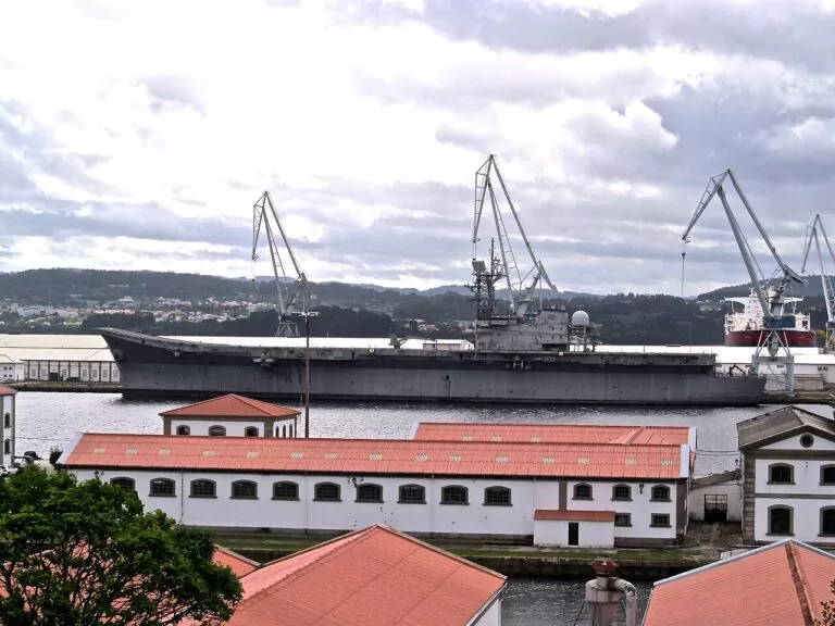
Ferrol
The base for the north of the bay, the beaches of Doniños and Valdoviño and the road to Cedeira and the Capelada cliffs.
History, surf, the Rías Altas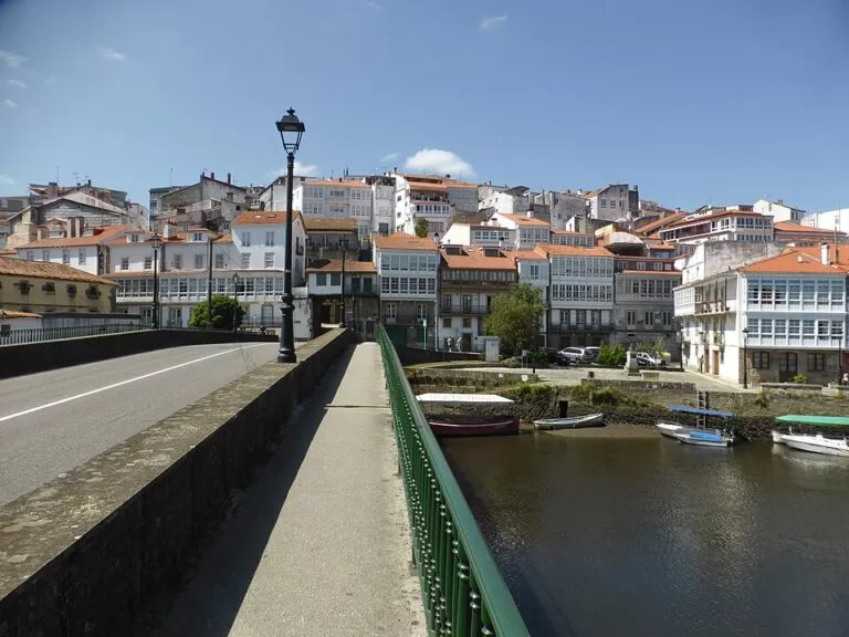
Betanzos and Pontedeume
Small historic towns on the English Way, between the city and the Eume forest.
Walkers, pilgrims, foodGetting there and around
By air
A Coruña airport (LCG, Alvedro, in Culleredo) is about 8 km south of the city centre in a straight line. Santiago de Compostela airport (SCQ) is about 53 km south of A Coruña and 67 km from Ferrol (OpenStreetMap).
By train
Betanzos-Infesta is the junction where the line to Ferrol leaves the A Coruña line, and Pontedeume has a station on it; Ferrol is also the end of the metre-gauge coast line from Asturias (Spanish Wikipedia). We could not confirm timetables.
By car
The AP-9 motorway links A Coruña with Betanzos and the Ferrol area; the A-6 and N-VI reach Betanzos (Turismo de Galicia). Ferrol is 52 km from A Coruña by road (spain.info). We could not confirm bus routes.
A two-day route
By car, with a night in A Coruña or Ferrol.

Day 1
A Coruña on foot
Start at the Praza de María Pita, climb into the Cidade Vella and the San Carlos garden, and walk down to the castle of San Antón. Follow the promenade to the Tower of Hercules, then on past the Aquarium to Orzán and Riazor. Come back to the Tower for the sunset.
Day 2
Betanzos, the Eume and Ferrol
Drive to Betanzos for the old town and an omelette, then on to Pontedeume and up the Ombre road for a walk in the Fragas do Eume (on weekends check the access rules first). Finish in Ferrol: the Magdalena, the Herrera gardens over the Arsenal, and the castle of San Felipe at the mouth of the ría.
FAQ
What is the Golfo Ártabro?
The bay on the north-west coast of Galicia into which three estuaries open: the rías of A Coruña, Ares-Betanzos and Ferrol. Turismo de Galicia says all three mouths can be seen from the Mera lighthouse in Oleiros.
What are the best beaches near A Coruña?
Riazor and Orzán in the city; Santa Cristina, Bastiagueiro and Mera in Oleiros across the ría; Barrañán in Arteixo for surf. All have Blue Flags according to Turismo de Galicia.
Which are the main districts of A Coruña for visitors?
The Cidade Vella on the peninsula, Pescadería with María Pita and the Marina galleries, the Ensanche with Riazor and Orzán, and the Tower headland. For local taverns, Catro Camiños, A Gaiteira and Os Castros.
Where can I surf near A Coruña?
Riazor and Orzán in the city have waves for surfing, Barrañán in Arteixo is popular with surfers, and Pantín in Valdoviño hosts international competitions (Turismo de Galicia).
How do I get to the Fragas do Eume from A Coruña?
Drive to Pontedeume and take the local road up the valley through Ombre to the Caaveiro gate. At weekends vehicles are restricted and public transport runs to the A Figueira bridge (Turismo de Galicia).
Other areas of the Galician coast
Galician coast
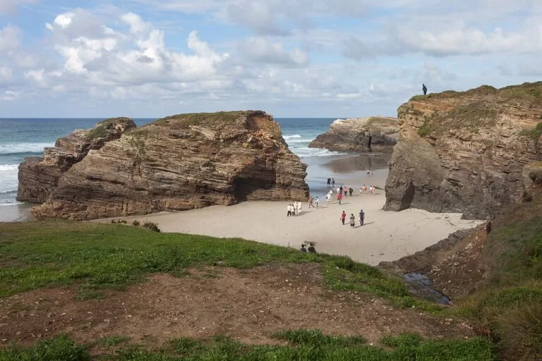
The whole coast north of the Rías Baixas, from Carnota and Fisterra to Ribadeo, with the map, the three areas and the weather.
Galician coast guide →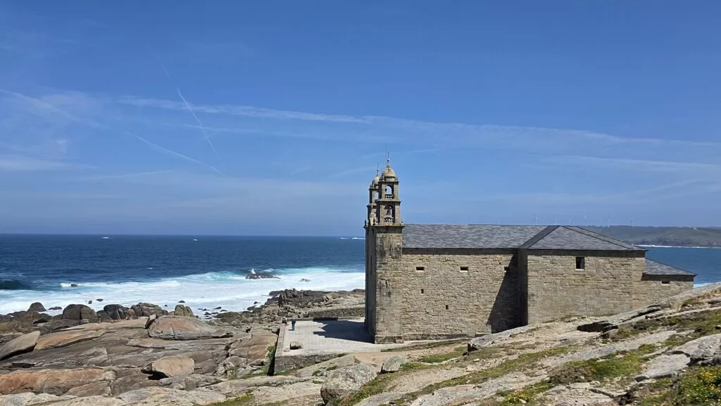
Costa da Morte: Carnota to Malpica
Lighthouses on shipwreck capes, Cape Finisterre, Muxía, Camariñas and the 7 km beach of Carnota.
Costa da Morte guide →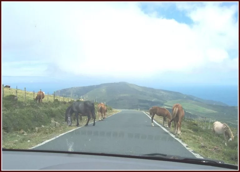
Rías Altas and A Mariña: Cedeira to Ribadeo
Cliffs of the Capelada, San Andrés de Teixido, Estaca de Bares, Viveiro and Cathedrals Beach.
Rías Altas guide →Just north of Valdoviño, the Rías Altas begin with Cedeira, about 24 km from Ferrol, and the cliffs of San Andrés de Teixido, about 32 km away in a straight line.
Sources and freshness
Checked 9 November 2026. Turismo de Galicia on A Coruña, the Ría da Coruña, the Ría de Ares e Betanzos, As Mariñas, Ferrolterra, Ferrol, the Fragas do Eume, the Costa de Dexo and the Costa Ártabra, the old town of A Coruña, the castle of San Felipe, the festivals of Sada and Mugardos, and the beach sheets for Riazor, Orzán, Santa Cristina, Bastiagueiro, Mera, Gandarío, Miño, O Raso, Doniños, Pantín, Valdoviño and Barrañán. Spain.info on A Coruña, Ferrol and Betanzos. Background: Spanish Wikipedia on Pontedeume and Ferrol. Map data and straight-line distances: OpenStreetMap (ODbL). Not confirmed: bus routes, train timetables, opening hours and prices outside Ferrol’s museums, parking. The websites of Turismo de A Coruña and the town halls of Betanzos, Pontedeume and Ferrol could not be reached when we checked. Photos from Wikimedia Commons: Tower of Hercules and María Pita by Diego Delso (CC BY-SA 4.0); Orzán and Riazor by Luis Carrera (CC BY 2.0); Avenida da Mariña by C messier (CC BY-SA 4.0); Santa Cristina and the river Eume by Jose Luis Cernadas Iglesias (CC BY 2.0); Redes by PepedoCouto (CC BY-SA 3.0); Doniños by Carlossoy (CC0); Pantín and Cathedrals Beach by Luis Miguel Bugallo Sánchez (Lmbuga) (CC BY-SA 4.0 and CC BY-SA 3.0); Betanzos by CARLOS TEIXIDOR CADENAS (CC BY-SA 4.0); Mugardos by Ramon Piñeiro (CC BY-SA 2.0); Ferrol Arsenal by Oilisab (CC BY-SA 4.0) and Zarateman (CC0); Muxía by JensKunstfreund (CC BY-SA 4.0); Serra da Capelada by amaianos from Galicia (CC BY 2.0).