
Vilassar de Dalt is a small town in the hills of the Maresme, about 7 km south-west of Mataró and 3 km inland from the R1 coast railway at Premià de Mar, on the northern slopes of the Serra de Sant Mateu. You reach it by road from Premià de Mar or Cabrils, or by bus, and visit the old centre with its castle and theatre before walking up to the hermitage of Sant Salvador and the Roca d’en Toni dolmen. It suits walkers and visitors who want a lived-in Catalan town with history close to Barcelona; skip it if you want a beach base, because the sea is in neighbouring Vilassar de Mar.
Quick facts
- Names: Vilassar de Dalt in Catalan (the same form is used in Spanish), historically Sant Genís de Vilassar. “De Dalt” means “upper”, to tell it apart from Vilassar de Mar on the coast, which separated from it in 1875 (Catalunya.com).
- Where: Maresme comarca, province of Barcelona, between Vilassar de Mar, Premià de Dalt, Cabrils, Òrrius and the Vallès Oriental (Catalan Wikipedia).
- Coordinates: 41.5171, 2.3585 (Plaça de la Vila and town hall, OpenStreetMap).
- Population and size: 8,334 inhabitants, 9 km², 142 m above sea level (Catalunya.com).
- First record: 978 (Catalan Wikipedia); the name comes from the Roman Villa Azari.
- Distances: 3.3 km in a straight line to Premià de Mar station and 7.5 km to Mataró station (OpenStreetMap).
Getting there and parking
By car: the BV-5023 road links Vilassar de Dalt with Premià de Mar, Premià de Dalt and Cabrils, and the C-32 toll motorway runs along the coast below (Catalan Wikipedia). The old centre has narrow, steep streets, so leave the car on the edge of the centre and walk. We could not confirm official car parks or charges.
By train and bus: there is no station in the town. The nearest is Premià de Mar on the R1 Rodalies line, about 3 km away; Catalan Wikipedia mentions a bus between Premià de Mar station and Vilassar de Dalt every 30 minutes on weekdays, and Catalunya.com says there are buses to Mataró and Barcelona. We could not confirm 2026 timetables, so check before you travel.
What to see
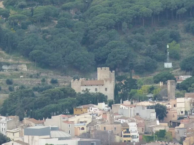
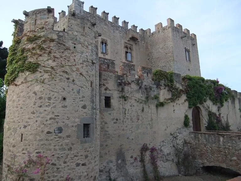
Vilassar Castle. The castle stands at the top of the old town. Catalan Wikipedia dates it to the 12th century, with a round tower and additions up to the 16th century, and lists it as a Cultural Asset of National Interest; Catalunya.com captions it as 10th to 18th century, remodelled in 1950, with the keep in the centre. It houses the heritage archive of the Marquis of Barberà. We could not confirm whether, or when, the interior is open to visitors, so plan to see it from outside.
The old centre. Catalunya.com says the town grew from scattered farmhouses around the castle and the parish, and that the narrow streets of the old centre show these medieval origins. The parish church of Sant Genís was burned in the Civil War and rebuilt in 1943 by Antoni Fisas, keeping some parts of the old building. Nearby is the theatre known as La Massa, a round building with a flat dome from the early 1880s; Catalan Wikipedia credits it to Rafael Guastavino and says it was restored in 2002.
Can Banús and other houses. The Gothic farmhouse of Can Banús holds the Museu-Arxiu Municipal, with prehistoric, Iberian and Roman finds, textile machinery and everyday objects (Catalunya.com). Can Maians is a fortified tower house of the 16th century, and Catalunya.com also points to the wine cellar of Can Bruguera and buildings with Modernista touches such as Torre Mar i Cel and Les Quatre Torres. Catalan Wikipedia lists the Roman kilns of La Fornaca, from the 1st and 2nd centuries AD, and the Cau del Cargol, a private shell museum.
Walks in the hills
The best-known walk climbs into the Serralada Litoral to the Font Freda and the Roca d’en Toni, also called the dolmen of Can Boquet. Catalunya.com describes the route from the town past the church of Sant Genís to the abandoned farmhouse of Can Boquet, with the 11th-century hermitage of Sant Salvador attached to it, then the dolmen and a small medieval cemetery before the spring. The hermitage has a nave and a rectangular apse of pre-Romanesque origin, and its terrace looks over the coastal plain and both Vilassars. The same route can be started from Cabrils. Nearby are the prehistoric burial caves of Cova d’en Pau, Cova d’en Joan and Cova de la Granota. Catalunya.com also mentions mountain-bike routes in the area. We could not confirm distances or waymarking, so take a map.
Festivals
- Sants Màrtirs: the main festival, from the end of April to early May, with the fire-breathing dragon Anarka (Catalunya.com).
- Sant Genís: 25 August, with the traditional “hanging of the donkey”, a dummy hung from the church bell tower (Catalunya.com).
- Fira del bolet i la natura: a mushroom and nature fair in October (Catalan Wikipedia).
Practical details
- Who it suits: walkers, history fans and families combining it with the Illa Fantasia water park, which is in the municipality.
- Time needed: two hours for the old centre; half a day with the walk to Can Boquet and the dolmen.
- Tourist information: the town council is the promotion body named by Catalunya.com. We could not reach its website to confirm museum hours.
Accessibility and safety
The old centre is hilly, with narrow streets and some steep slopes; the newer streets are easier. The paths to Can Boquet and the dolmen are unpaved forest tracks and not suitable for wheelchairs. In summer, check the Catalan forest-fire rules before walking in the hills.
Best time to visit
Spring and autumn for walking. Catalunya.com recommends spring and summer, when the Sants Màrtirs festival in April and the Sant Genís festival in late August take place. In midsummer the hills are hot, so walk early.
Nearby alternatives
- Illa Fantasia, 1.6 km away: the water park in the municipality, with pools and slides.
- Burriac Castle, 3.3 km away: a hilltop ruin above Cabrera de Mar with an Iberian settlement below.
- Mataró Museum, 7.7 km away: the city museum in a 16th-century house.
- Iluro, 7.8 km away: the Roman town under Mataró.
- Caldes d’Estrac, 15.4 km away: a seaside village with thermal baths.
Distances are in a straight line from Plaça de la Vila. For the whole stretch, see our Mataró to El Masnou guide.
FAQ
How do I get to Vilassar de Dalt from Barcelona?
Take the R1 Rodalies train to Premià de Mar, about 3 km away, then the bus or a taxi up to the town. By car, use the C-32 and the BV-5023 from Premià de Mar.
Is Vilassar de Dalt on the coast?
No. It lies inland on the slopes of the Serra de Sant Mateu, at 142 m. Its old seaside district became the separate town of Vilassar de Mar in 1875.
Can you visit Vilassar Castle?
You can see it from the streets of the old town. We could not confirm opening times or guided visits of the interior.
Where is the Roca d’en Toni dolmen?
In the hills above the town, near the farmhouse of Can Boquet and the hermitage of Sant Salvador, on a walking route that also starts from Cabrils.
What is there to do in Vilassar de Dalt?
Walk the old centre with the castle, the church of Sant Genís and the La Massa theatre, visit the Can Banús museum, hike to the dolmen, or spend a summer day at Illa Fantasia.
Sources and freshness
Checked 9 November 2026 · 3 sources Show
Checked 9 November 2026. Official: Catalunya.com (Agència Catalana de Turisme), Vilassar de Dalt (population, area, altitude, castle, church, theatre, Can Banús, Can Boquet route, festivals, buses). Background: Catalan Wikipedia, Vilassar de Dalt (first record, roads, train and bus, castle dating, La Massa theatre, La Fornaca, Cau del Cargol, mushroom fair). Location and distances: OpenStreetMap contributors (ODbL). The town council site could not be reached when we checked. Photos: Wikimedia Commons, licences as credited.
This place is part of our Costa del Maresme map and travel guide: Calella, Canet, Arenys and Mataró — see every town, beach and cove we have mapped on that coast.
How this page is made. CostaMap is written with an AI editorial system run by Ebizapple. This page is based on the sources listed above. Last updated 9 November 2026. Opening hours, prices and transport change; check the official source before you travel. How we work · Partner links and ads