
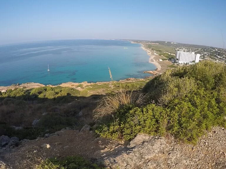
Son Bou is Menorca’s longest beach: a straight 2.3 km stretch of golden sand with dunes on the south coast, in the municipality of Alaior, about 8 km from Alaior town. A resort of the same name sits at its east end with a free car park, a bus stop to Maó and beach bars, while the western half backs onto dunes and a protected wetland, the Prat de Son Bou. It suits families, long beach walks and anyone who wants space; skip it if you want a small sheltered cove.
Quick facts
- Names: Son Bou, Platja de Son Bou or Platges de Son Bou (Catalan); Playa de Son Bou in Spanish.
- Where: south coast of Menorca, Alaior municipality, between Punta Rodona and the Cap de ses Penyes. The resorts of Son Bou, Sant Jaume Mediterrani and Torre Solí Nou lie behind it.
- Coordinates: 39.9000, 4.0708.
- Size: 2,300 m long and 40 m wide (spain.info). The Catalan Wikipedia calls it the longest sandy stretch of coast in Menorca.
- Sand and water: golden sand, calm water in normal conditions (spain.info).
- Services listed by spain.info: sunshade and sun lounger hire, water craft hire, showers, footwash, litter bins, cleaning and a sports area.
- Naturism: the west end of the beach is used for nude bathing (Catalan Wikipedia).
- Entry: free.
Access and parking
By car: Son Bou is reached by a road south from Alaior, which lies on the main Maó–Ciutadella road; the Catalan Wikipedia puts the beach eight kilometres from the town. Spain.info names the C-721 as the nearest main road.
Parking: spain.info says you reach the beach from the car park by crossing the dunes. The main one, mapped on OpenStreetMap as “Parking de Son Bou” and tagged free, lies about 50 m behind the sand at the east end, with more free car parks in the resort streets 300–700 m inland. The Catalan Wikipedia also notes free parking.
By bus: OpenStreetMap shows TMSA line 32 between Maó and Son Bou, with the stop “Son Bou – Platja” at the east end of the beach and more stops in the resort. Timetables are seasonal; check the operator.
On foot: the Camí de Cavalls coastal path runs behind the beach, partly as a boardwalk at the west end, and continues west towards Sant Tomàs (about 3 km).
What to expect
Spain.info calls Son Bou one of the widest stretches of sand in Menorca. The east end is a resort beach: a large hotel block stands on the cliff above it, and lifeguard towers, a lifeguard base, drinking-water points and beach restaurants are mapped on OpenStreetMap along the first few hundred metres. Walk west and the buildings fall away. Dunes back the beach, and some are fenced off with rope as part of a dune restoration programme (English Wikipedia).
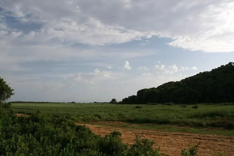
Behind the dunes lies the Prat de Son Bou, a small wetland that the Catalan Wikipedia describes as a refuge for migratory water birds.
At the east end, on the cliff that closes the beach, there are cave openings of a Talaiotic necropolis. Below them are the remains of the early Christian basilica of Son Bou, a 5th-century church found in 1951 (Catalan and English Wikipedia). OpenStreetMap marks it about 800 m from the main car park, with an information panel.
Practical details
- Food and drink: two beach restaurants stand on the sand near the east end, and the resort behind has many more bars and restaurants (OpenStreetMap).
- Water: OpenStreetMap maps two drinking-water points near the main car park.
- Shops and pharmacy: a pharmacy is mapped in the resort centre.
- Anchoring: the Catalan Wikipedia says the seabed suits anchoring when winds are not from the north or north-west.
- Out of season: the English Wikipedia notes that most resort facilities close in winter.
Accessibility and safety
OpenStreetMap shows several lifeguard towers along the beach and a lifeguard base near the main car park, and the Catalan Wikipedia lists a lifeguard service. We could not confirm the season or hours, so treat it as a summer service. The beach is open to the south: on windy days follow the flags. Access from the main car park crosses the dunes, so we could not confirm step-free access to the water. Keep to marked paths in the dunes.
Best time to visit
Spain.info rates occupancy as high, but with 2.3 km of sand you can usually find room by walking west from the resort. June and September are quieter than July and August. Early mornings are the best time to see birds on the Prat de Son Bou.
Nearby alternatives
- Cala Galdana, 10.4 km west: a shell-shaped resort bay with shallow water, good for children.
- Cala Mitjana, 9.2 km west: a cove without buildings, reached on foot.
- Binibeca Vell, 16 km east: the whitewashed holiday village on the Sant Lluís coast.
- Maó Harbour, 16.9 km north-east: the capital and its long natural port, at the other end of bus line 32.
- Fornells, 17.9 km north: the fishing village on the north coast’s big bay.
Distances are in a straight line from the middle of the beach.
FAQ
Is Son Bou the longest beach in Menorca?
Yes. Spain.info gives 2,300 m of sand, and the Catalan Wikipedia calls it the longest sandy stretch of the island’s coast.
Is there parking at Son Bou beach?
Yes. A free car park sits just behind the dunes at the east end, and more free car parks are mapped in the resort streets.
How do I get to Son Bou by bus?
TMSA line 32 runs between Maó and Son Bou (as mapped on OpenStreetMap); the beach stop is “Son Bou – Platja”. Check seasonal timetables before you go.
Is Son Bou a nudist beach?
Partly. The Catalan Wikipedia says nude bathing is practised at the west end; the east end by the resort is a regular family beach.
What is the basilica at Son Bou?
The ruins of an early Christian church from the 5th century, found in 1951, at the east end of the beach below a cliff with Talaiotic burial caves.
Sources and freshness
Checked 9 November 2026 · 5 sources Show
Checked 9 November 2026. Official: spain.info, Son Bou (size, sand, services, car park across the dunes, occupancy) and spain.info, Alaior. The Balearic tourism portal www.illesbalears.travel returned server errors on the day we checked. Background: Catalan Wikipedia (length, location, wetland, necropolis, basilica, naturism, anchoring) and English Wikipedia (resort districts, dune fencing, basilica date, winter closures). Location, car parks, bus line and stops, lifeguard posts and distances: OpenStreetMap. Photos: Wikimedia Commons.
This place is part of our Balearic Islands travel guide: Mallorca, Menorca, Ibiza and Formentera — see every town, beach and cove we have mapped on that coast.
How this page is made. CostaMap is written with an AI editorial system run by Ebizapple. This page is based on the sources listed above. Last updated 9 November 2026. Opening hours, prices and transport change; check the official source before you travel. How we work · Partner links and ads