
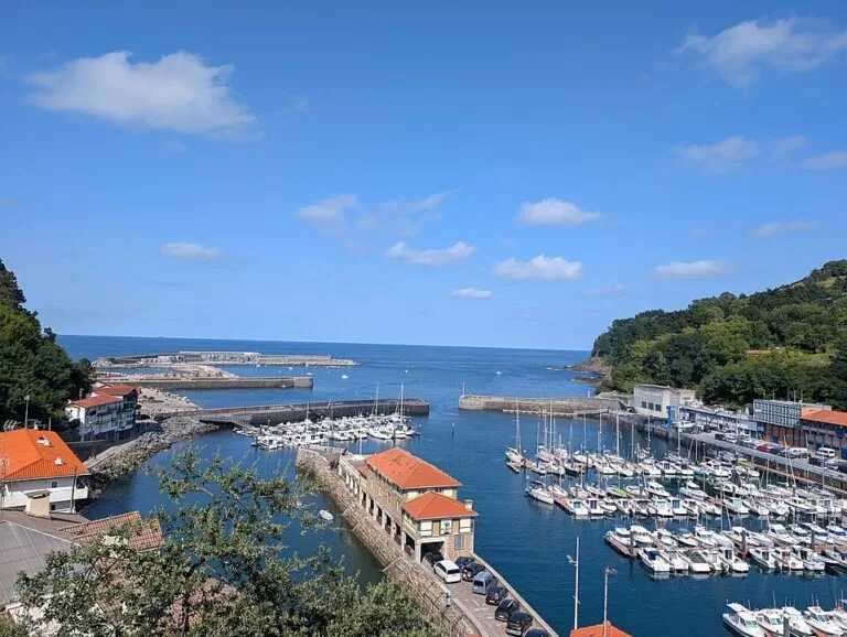
Mutriku is the westernmost town on the coast of Gipuzkoa, a fishing port on the border with Bizkaia, 3 km in a straight line west of Deba. Its medieval old quarter climbs steeply from one of the oldest harbours in Gipuzkoa, with two natural sea pools at the harbour mouth and the beaches of Saturraran and Ondarbeltz either side of town. There is no railway: you arrive by Lurraldebus bus or by car, or on foot along the coastal path from Deba. Come for the old quarter, the harbour pools and the Geopark cliffs; skip it if you want a long town beach.
Quick facts
- Names: Mutriku is the official Basque name; in Spanish it was written Motrico until 1980 (English Wikipedia).
- Where: 20830 Mutriku, Gipuzkoa (Basque Country), in the Debabarrena district, between Ondarroa (Bizkaia) to the west and Deba to the east.
- Coordinates: 43.3075, -2.3871 (Txurruka square, OpenStreetMap).
- Size: 27.70 km², 5,021 inhabitants (Basque tourism board).
- Founded: at the beginning of the 13th century; spain.info gives 1209. The old quarter was declared a historic monument site in 1995.
- Geopark: Mutriku, Deba and Zumaia make up the Basque Coast UNESCO Global Geopark, 89 km².
Getting there and parking
By bus: Mutriku has no railway. OpenStreetMap shows two Lurraldebus lines through the town: DB03 between Donostia/San Sebastián and Lekeitio, and DB04 between Ondarroa and Mallabia. Check the timetable before you travel.
By train and on foot: the nearest station is Deba, on the Euskotren line between Bilbao and San Sebastián, 3 km east in a straight line. A seafront promenade and the coastal path link the two towns.
By car: the old quarter is a tangle of steep, narrow streets, so park outside it. OpenStreetMap maps the municipal Burumendi car park and the Fondaberri car park, both marked as paid, the Portua car park by the harbour and a few smaller free car parks. We found no official parking information or prices.
What to see
The old quarter. The Basque tourism board describes a town on the slope of Mount Arno (628 m) that keeps its medieval layout and traces of its walls. Narrow, steep streets lead to palaces and tower houses from the 15th to 17th centuries. Mutriku was the birthplace of the naval officers Antonio Gaztañeta and Cosme Damián Churruca; Churruca died at the Battle of Trafalgar, and his statue stands in the main square.
Churruca square and the church. Around the square are the town hall, the Galdona palace, whose ashlar façades date from the 17th century (spain.info), and the church of Nuestra Señora de la Asunción. The tourism board calls the church one of the best examples of neoclassical architecture in Gipuzkoa: a Greek-cross plan to a design by the Madrid architect Silvestre Pérez, a portico of six Doric columns and, in the left chapel, a painting of Christ on the cross by Francisco de Zurbarán. It is listed as a monument.
The harbour. The port is one of the oldest in Gipuzkoa. Its people hunted whales for centuries, and fishing goes on. The outer breakwater holds the Mutriku wave power plant, which English Wikipedia describes as the world’s first breakwater wave plant with several turbines: 16 turbines with 296 kW in total, opened on 8 July 2011.
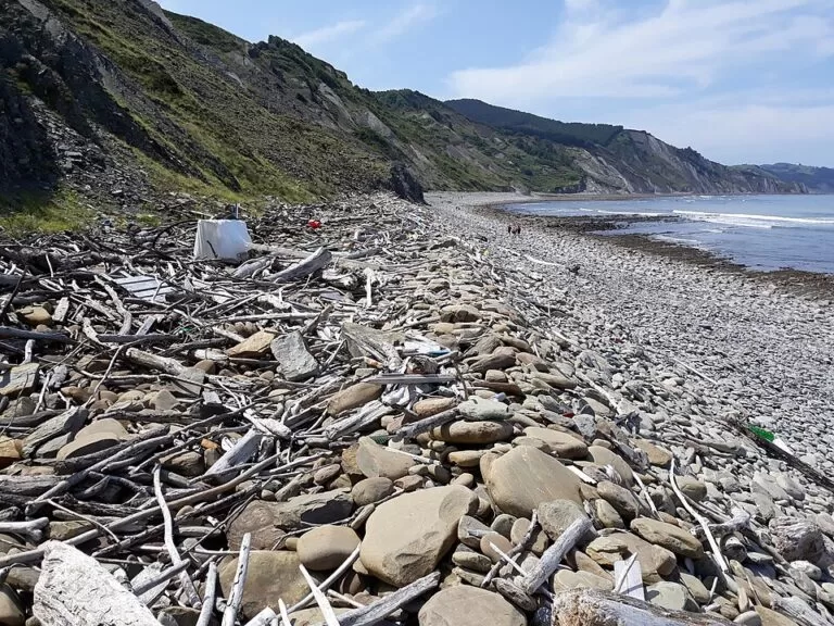
Nautilus. The town’s geological interpretation centre explains, with an audiovisual in Spanish and Basque, the geological history of Mutriku over the last 120 million years. The fossils on show, including ammonites, come from the collection of Jesús M. Narváez Amasorrain, gathered in Mutriku over 30 years (Basque tourism board). It is at Jose Antonio Ezeiza 3, about 200 m from the main square; the board gives no opening hours and refers to the town’s website.
Beyond the town. The tourism board recommends the views from Laranga and Galdona, and the church of San Andrés in Astigarribia, which it calls the oldest in Gipuzkoa (11th century).
Beaches and sea pools
Lengths, services and lifeguard hours are from the Basque tourism board, checked November 2026.
- Harbour beach – a small town beach of 180 m beside the port and the old quarter, with golden sand and strong waves. Next to it are two natural sea pools, one of them Olympic size, plus bars, showers, toilets and changing rooms. Lifeguards 11:00–19:00 in season.
- Saturraran – 300 m of golden sand on the border with Bizkaia, 2.5 km west of the main square. The waves come in hard. Two rock stacks are, by legend, the lovers Satur and Aran. Large car park, beach bar, a campsite nearby and a nudist area; lifeguards 11:00–19:00. A promenade continues to the beach of Ondarroa.
- Ondarbeltz – a 120 m beach of fine dark sand (“black sand” in Basque) with calm water, on the left bank of the Deba estuary. It belongs to Mutriku but is closer to Deba. Showers, toilets, bar, play area, pelota court and parking; lifeguards 11:00–19:00.
At low tide the tourism board suggests walking the “Seven Beaches”, the cliff coast from the harbour to Saturraran; the official path leaflet notes the black flysch at Saturraran point.
Walks
The coastal path (GR 121, part of the European E9) passes Mutriku on its stage from Deba to Ondarroa: 10.5 km, 469 m of climbing, about 3 h 30 min (official leaflet). From Deba it climbs via Laranga and drops to Mutriku harbour at km 5.2. From the sea pools it climbs to the San Nikolas hermitage, once a whale lookout, and passes two campsites to Saturraran (km 9.5), at the mouth of the Muga river on the Bizkaia border. A plaque there remembers the women held in the Francoist prison of Saturraran, a former spa that no longer exists. The leaflet notes a temporary detour after a landslide above Deba in 2025.
Practical details
- Tourist office: Plaza Txurruka s/n, in the town hall, tel. +34 943 603 378, open all year. It runs free guided tours of the old quarter, the Bentalekua sea museum and San Andrés church (Basque tourism board). Its published hours date from 2022.
- Fiestas and food: Berdel Eguna, a mackerel day, on the first Saturday of April; the Madalenas, the town’s patron saint festival, in July; and Kalbaixo in September, which draws people from the neighbouring towns.
Accessibility and safety
The old quarter is steep and cobbled, hard going with a wheelchair or pushchair. The harbour beach and Saturraran have strong waves: swim within lifeguard hours. On the rock platforms, watch the tide and keep away from the cliff foot.
Best time to visit
Summer for the beaches and pools, with lifeguards; early April, July or September for the fiestas. For the Seven Beaches, pick a daylight low tide.
Nearby alternatives
- Flysch Route: Zumaia to Deba, 10.2 km away: the next stage of the coastal path east of Deba, along the best of the flysch cliffs.
- Zumaia Flysch, 10.3 km away: the layered cliffs above Itzurun beach in Zumaia.
- Getaria, 14.9 km away: fishing town of grilled fish, txakoli wine and the Balenciaga museum.
- Zarautz, 18.4 km away: the longest beach on the Basque coast, with surf schools.
Distances are in a straight line from Txurruka square.
FAQ
How do I get to Mutriku without a car?
By Lurraldebus: OpenStreetMap shows line DB03 (San Sebastián – Lekeitio) and line DB04 (Ondarroa – Mallabia) stopping in the town. The nearest train station is Deba, 3 km east, on the Euskotren line from Bilbao and San Sebastián.
Can you swim in Mutriku?
Yes. Beside the harbour there is a small beach and two natural sea pools, one of them Olympic size. Saturraran and Ondarbeltz are nearby. All three beaches have lifeguards from 11:00 to 19:00 in season.
Is there parking in Mutriku?
Yes, outside the old quarter: OpenStreetMap shows the paid Burumendi and Fondaberri car parks, one by the harbour and a few small free ones.
Can you walk from Deba to Mutriku?
Yes. The coastal path from Deba reaches Mutriku harbour after 5.2 km via the Laranga neighbourhood, and a seafront promenade also links the two towns.
Sources and freshness
Checked 9 November 2026 · 13 sources Show
Checked 9 November 2026. Official: Basque tourism board on Mutriku, the church of the Asunción, Nautilus, the tourist office, the beaches (harbour, Saturraran, Ondarbeltz), the Basque Coast Geopark and the Sendero Litoral leaflet, stage 6 (edition 2025). spain.info on Mutriku. The town’s own website could not be reached from our research tools. Background: English Wikipedia on Mutriku and the wave power plant. Bus lines, car parks, coordinates and distances: OpenStreetMap contributors (ODbL). Photos: Wikimedia Commons, licences as credited.
How this page is made. CostaMap is written with an AI editorial system run by Ebizapple. This page is based on the sources listed above. Last updated 9 November 2026. Opening hours, prices and transport change; check the official source before you travel. How we work · Partner links and ads