
Port d’Andratx (Andratx, Mallorca)
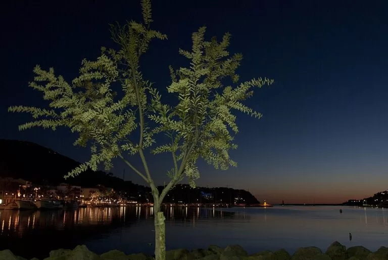
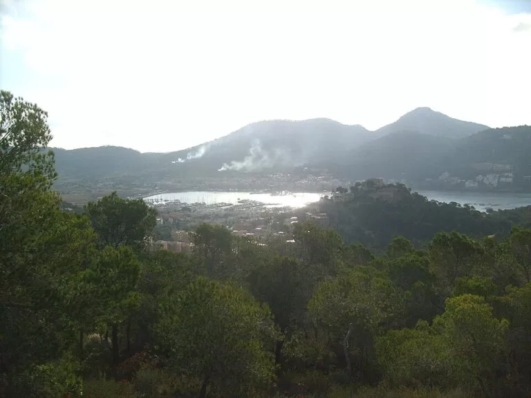
MarinaPort d’Andratx is a natural harbour and resort village in the far south-west of Mallorca, a few miles south of Andratx town and about 16 km west of Puerto Portals. Buses from Palma (line 101) stop on the harbour front, and there is a free 130-space car park at es Saluet, at the head of the bay. The harbour holds a yacht club marina on its north shore and a fishing quay and fish market by the village. It suits people who want a harbour-front meal, a sunset walk to sa Mola or a boat trip, and sailors heading for Sa Dragonera. Skip it if you want a big sandy beach: the beaches here are small.
Quick facts
- Names: Port d’Andratx (Catalan, official); Puerto de Andratx or Puerto de Andrach in Spanish.
- Where: municipality of Andratx, south-west Mallorca, on the Ma-1 road from Palma. The village has around 3,000 inhabitants (Wikipedia).
- Coordinates: 39.5458, 2.3875 (harbour basin).
- Marina: the Club de Vela del Port d’Andratx, a sailing club marina on the north side of the harbour, with numbered pontoons, a waiting quay and a fuel point on the water (OpenStreetMap).
- Berths: we could not reach the sailing club’s or the Balearic ports authority’s websites, so we do not give a berth number here.
- Working harbour: a fishing quay (Moll de pesca) and the fish market building (sa Llotja) on the village front.
- Entry: the promenade and quays by the village are free to walk.
Access and parking
By car: follow the Ma-1 west from Palma; OpenStreetMap shows the road reaching the port at the eastern head of the harbour, by the es Saluet car park. The village front road runs along the south side of the harbour.
Parking: OpenStreetMap shows the free es Saluet car park, with 130 spaces, about 0.26 km from the fish market at the eastern head of the harbour, and a paid surface car park of 50 spaces 0.2 km away beside the S’Aluet bus stop. There are a few paid street spaces on the harbour front and some free street parking further back in the village. Several other car parks are for restaurant or hotel customers only.
By bus: the Llotja stop, right by the fish market, and the S’Aluet stop 0.2 km away are served by line 101 to Palma (via Peguera on some trips), line 121 to Andratx town and Sant Elm, and line 122 to Santa Ponça, according to OpenStreetMap. Check the current TIB timetables before travelling.
Taxi: OpenStreetMap marks a taxi rank next to the Llotja stop.
What to expect
Wikipedia describes a former fishermen’s refuge that has become one of Mallorca’s most visited resorts, with an exclusive residential side. Life centres on the promenade and the quay by the fish market. In the mornings you can still buy fish landed by the local boats at the Llotja, a sign that fishing has not disappeared. Shops, cafés and restaurants with terraces face the water along the promenade, which leads west towards the lighthouse and the sailing club.
Wikipedia calls it a natural port. Small coves lie around it, among them cala Llamp, cala Moragues and cala d’Egos (Wikipedia). By the village, OpenStreetMap shows only the small platja de ses Bassetes, about 0.2 km from the fish market.
For the view, go up to sa Mola, the headland on the south-west side, for sunsets over the open sea and Sa Dragonera island. Sa Mola also has the Torre de Sant Carles, one of the watchtowers built against pirate raids, and the village church is Nuestra Señora del Carmen (Wikipedia).
Services for visiting boats
We could not reach the sailing club’s own pages or the ports authority, so we cannot confirm berth numbers, sizes, rates or services. OpenStreetMap shows these facilities on the water:
- The sailing club marina on the north shore, with pontoons numbered 1 to 7 and a waiting quay (moll d’espera).
- A Repsol fuel point on the water by the club’s pontoons.
- A slipway near the eastern end of the harbour.
- Toilets for harbour users by the fish market, marked as wheelchair accessible.
Contact the sailing club or the Balearic ports authority directly for a berth, especially in July and August.
Prices and opening
There is no charge to walk around the harbour. The es Saluet car park is marked free on OpenStreetMap; the 50-space car park is paid, and we could not check its rates. Restaurants and boat-trip operators set their own hours.
Accessibility and safety
The promenade along the village front is flat, and the toilets by the fish market are marked wheelchair accessible on OpenStreetMap. Keep children away from the quay edges, where fishing boats and dinghies come and go, and swim at the beaches, not in the harbour channels.
Best time to visit
Come in the morning to see the fishing quay and the fish market at work, or in the evening for the sunset from sa Mola. In summer, arrive early if you want one of the free spaces at es Saluet; outside July and August, the harbour front is a pleasant base for walks around sa Mola.
Nearby alternatives
- Puerto Portals, 16 km away: the big upmarket marina of Portals Nous on the Bay of Palma.
- Palma Cathedral (La Seu), 22 km away: the Gothic cathedral on Palma’s seafront.
- Serra de Tramuntana, 40 km away (to the park’s centre point): the mountains that begin right behind Andratx.
- Torrent de Pareis, 50 km away: the gorge walk to Sa Calobra on the north coast.
- Port de Sóller, 38 km away: the harbour village on the north-west coast, reached by the Sóller tram.
- Sa Dragonera, the protected island off Mallorca’s western tip, reached by sea from Port d’Andratx or Sant Elm; its landing stage is 7 km away.
Distances are in a straight line from the harbour.
FAQ
How do I get to Port d’Andratx from Palma?
By car on the Ma-1 west, or by bus line 101, which stops at the Llotja stop on the harbour front.
Is there parking in Port d’Andratx?
Yes. The es Saluet car park at the head of the harbour has 130 free spaces, and a paid car park with 50 spaces is nearby (OpenStreetMap). Harbour-front spaces are few.
Can you swim in Port d’Andratx?
Not in the harbour itself. The small platja de ses Bassetes lies by the village, and coves such as cala Llamp and cala Moragues are around the bay.
Can you get to Sa Dragonera from Port d’Andratx?
Yes. Sa Dragonera can be reached by sea from Port d’Andratx or from Sant Elm (Wikipedia). Check boat operators for the current season.
How many berths does Port d’Andratx have?
We could not check a figure with the sailing club or the ports authority, so we do not give one. Ask them directly.
Sources and freshness
Checked 6 November 2026 · 5 sources Show
Checked 6 November 2026. Official tourism: Spain.info, Andratx (town, Sa Dragonera). Village, harbour life, fish market, coves, towers, church and sa Mola: Wikipedia, Puerto de Andrach; municipality and access to Sa Dragonera: Wikipedia, Andratx. Location, sailing club marina, pontoons, fuel point, car parks, bus stops and lines, taxi rank, toilets, beach and distances: OpenStreetMap (OpenStreetMap contributors, ODbL). The sailing club’s website and the Balearic ports authority (Ports IB) could not be reached for this update. Photos: Wikimedia Commons, licences as credited.
This place is part of our Balearic Islands travel guide: Mallorca, Menorca, Ibiza and Formentera — see every town, beach and cove we have mapped on that coast.
How this page is made. CostaMap is written with an AI editorial system run by Ebizapple. This page is based on the sources listed above. Last updated 6 November 2026. Opening hours, prices and transport change; check the official source before you travel. How we work · Partner links and ads