
Costa de Almería · West
Poniente: Roquetas de Mar to Adra travel guide: Aguadulce, Almerimar and the western beaches
The resort beaches of Aguadulce and Roquetas, the wild dunes and flamingo salt pans of Punta Entinas-Sabinar, the marina town of Almerimar, and Adra with its lagoons at the western end.
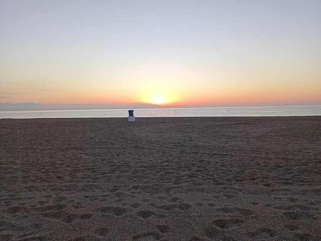
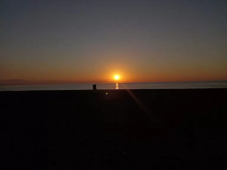
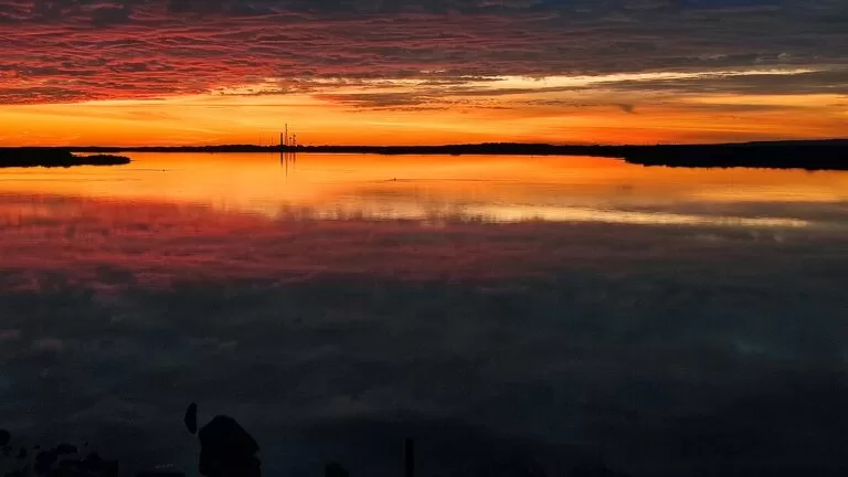
Sunrise from La Romanilla beach, Roquetas de Mar · Photo: Roquex, CC0
Part of the Costa de Almería guide · West: Poniente, Roquetas de Mar to Adra
The Poniente is the western coast of Almería province, from the cliffs just west of Almería city to Adra at the border with Granada province: about 40 km in a straight line from Aguadulce to Adra. It runs through the coastal municipalities of Roquetas de Mar, El Ejido and Adra, with Vícar, La Mojonera, Dalías and Berja on the greenhouse plain and the slopes of the Sierra de Gádor behind (Andalucía.org).
At a glance
- Where the south-west of Almería province, from Aguadulce, 10 km west of Almería city, to Adra and the mouth of the river Adra, with the Sierra de Gádor behind.
- Towns Aguadulce, Roquetas de Mar, Almerimar, Guardias Viejas, Balerma and Adra on the coast; El Ejido, Vícar, La Mojonera, Dalías and Berja inland.
- Best for long beaches with families, a marina and golf at Almerimar, birdwatching at Punta Entinas-Sabinar and the Albufera de Adra, and quiet winter stays.
- Getting there Almería Airport is about 18 km from Aguadulce, 23 km from Roquetas, 41 km from Almerimar and 59 km from Adra in a straight line (OpenStreetMap); the A-7 motorway runs behind the whole coast.
- On CostaMap Roquetas de Mar, Aguadulce, Punta Entinas-Sabinar, the Almerimar marina, El Ejido, the Albufera de Adra, Adra, Vícar and Berja.
Map of the Poniente
The map shows the places on this stretch that have a CostaMap page. Tick a place type to filter, and click a marker to see the place in the panel.
Place type
Area · next level
 Area map
Poniente: Roquetas de Mar to Adra
Click a marker to see the place here. From Aguadulce and Roquetas de Mar past Punta Entinas and Almerimar to the lagoons of Adra.
Towns and villagesTowns and villages
From east to west, starting at the edge of Almería city. Descriptions and history are from Andalucía.org, Andalusia’s official tourism site, unless another source is named.
Aguadulce
Aguadulce is the first resort west of Almería, a locality of Roquetas de Mar. It grew in the early 20th century as a small cluster of houses and from the 1950s became one of the main tourist destinations of the province; its population can triple in summer (Andalucía.org). Its town beach has a Blue Flag, lifeguards and an adapted bathing area, and the marina sits at its north-eastern end. The 1964 Urbanización de Aguadulce was the first Centro de Interés Turístico Nacional in Andalusia (Spanish Wikipedia). See our new Aguadulce guide.
Roquetas de Mar
Roquetas de Mar is the main resort of the province. Andalucía.org says it takes 70 per cent of Almería province’s tourism, with the centres of Aguadulce, the Urbanización and Roquetas itself, and lists its other villages as El Parador, Las Marinas, Las Salinas and El Puerto. The Castillo de Santa Ana gave the town its name; the modern town grew from 1737 and became a municipality in 1782 (Andalucía.org). The castle was rebuilt by the town between 1997 and 2003 and is now a free art museum next to the old lighthouse (Spanish Wikipedia). Part of the Punta Entinas-Sabinar reserve lies in the municipality. See our Roquetas de Mar guide.
Vícar and La Mojonera
Vícar lies on the southern slope of the Sierra de Gádor, split into Vícar Viejo, with its Alpujarra-style village and church, La Puebla de Vícar, La Gangosa, Cabañuelas and Llanos de Vícar. It became a municipality in 1782, and from 1972 sand-bedded crops and greenhouses moved its people down to the coastal plain (Andalucía.org). See our Vícar guide. La Mojonera, on the plain below, is the youngest municipality in the province, separated from Felix in 1984 (Andalucía.org).
Punta Entinas-Sabinar
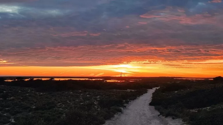
Between Playa Serena in Roquetas and Almerimar, the coast is protected for about 6.5 km as the Paraje and Reserva Natural de Punta Entinas-Sabinar: dunes, the Cerrillos and Viejas salt pans with flamingos, and a beach with no buildings. It is a bird protection area and, since 2006, a Ramsar wetland (Andalucía.org). A visitor centre stands at the Almerimar end. See our new Punta Entinas-Sabinar guide.
Almerimar
Almerimar is the resort of El Ejido, planned with wide open spaces from the start, with a marina, hotels, beaches and a golf course (Andalucía.org). The tourist board calls its port one of the big marinas of the Andalusian coast, the second most important, with 1,100 berths, the same distance from Adra as from Roquetas (Andalucía.org). The golf club, founded in 1976 to a design by Gary Player, has a 12th hole with an island green (Andalucía.org). See our Almerimar marina guide.
El Ejido
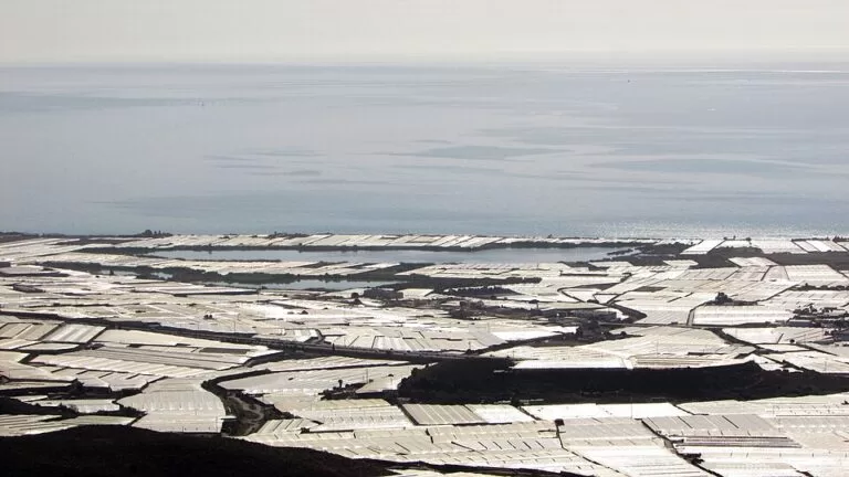
El Ejido sits on the plain between the Sierra de Gádor and the sea, now a “sea of plastic” of greenhouses that made its wealth. It separated from Dalías in 1982; at the end of the 19th century it had 48 inhabitants, in 1960 about ten thousand and in 1994 45,354. The Ciavieja archaeological site, Roman Murgi, has given baths, a circus and rich tombs (Andalucía.org), and the town’s local history museum shows a Roman mosaic found there in 1984 (Andalucía.org). See our El Ejido guide.
Guardias Viejas
West of Almerimar, the Castillo de Guardias Viejas stands on a low rise above the village of the same name. Built in the 18th century, partly destroyed in the War of Independence and rebuilt in 1817, it was restored in 1980 and declared a Bien de Interés Cultural in 1985; it now holds a small museum of Napoleonic-era uniforms and weapons and hosts concerts in summer (Andalucía.org). The beach of Los Baños, Guardias Viejas and Punta Culo de Perro has no buildings behind it and suits surfing (Andalucía.org).
Balerma
Balerma is a fishing village of El Ejido, known for rock fish caught by hand-line fishermen. Its town beach has a Blue Flag and a promenade over 3 km long, with an 18th-century watchtower in the middle (Andalucía.org). The Torre Fortificada was built in the mid-18th century to guard the shore between the Cerrillos tower and the Guardias Viejas fort; by 1849 it was so run-down that its guards lived in huts nearby (Andalucía.org).
Adra
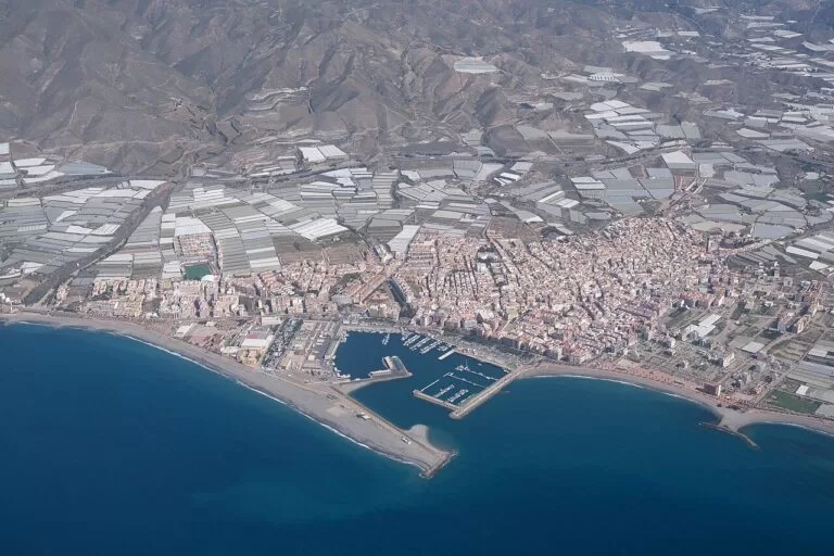
Adra closes the Costa de Almería in the south-west, with about 20 km of coast and the mountains of the Sierra de la Contraviesa behind. It is the ancient Abdera, a Phoenician site from the 8th century BC that minted its own coins under Rome. In the 19th century its lead smelters worked ore from the Sierra de Gádor, and the 1837 San Andrés foundry left the Torre de los Perdigones, a shot tower (Andalucía.org). The Museo de Adra shows Phoenician, Punic and Roman finds and opens onto the Cerro de Montecristo site (Andalucía.org). East of town lie the lagoons of the Albufera de Adra. See our Adra guide.
Berja and the Sierra de Gádor villages
Berja, in the low Almería Alpujarra, is the Roman Vergis, with remains of the Villavieja amphitheatre. Its lead boom in the 19th century brought it the title of city in 1876, and its Semana Santa and the sanctuary of the Virgen de Gádor draw visitors; Andalucía.org puts it 15 minutes from the sea (Andalucía.org). See our Berja guide. Higher up, Enix and Felix are white villages of the Sierra de Gádor; Felix paints messages on house fronts for its Fiesta de los Letreros on Holy Saturday (Andalucía.org).
Beaches and coves
Long beaches of dark sand and gravel, many with Blue Flags and good access; the only stretch without buildings is Punta Entinas-Sabinar. Lengths are from spain.info’s beach sheets.
Aguadulce
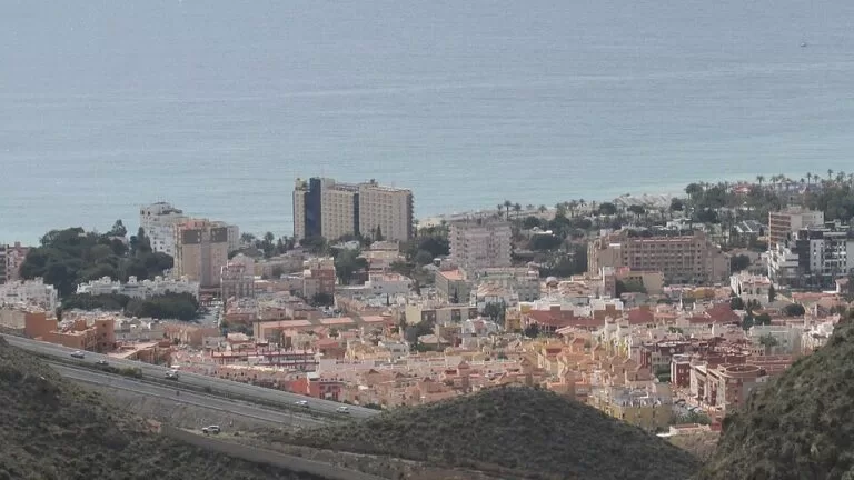
One of the busiest beaches of southern Almería: calm water, lifeguards, shade, adapted toilets and an adapted bathing area with amphibious chairs (Andalucía.org).
See the Aguadulce guide →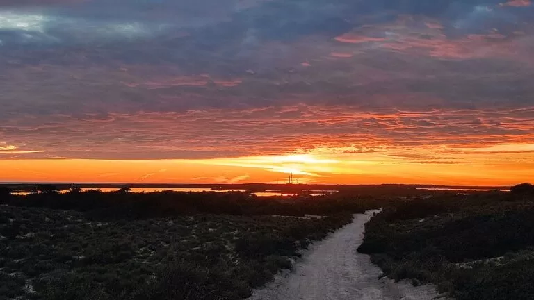
Punta Entinas-Sabinar
6,500 m of dark sand, about 80 m wide, isolated and little used, with no services beyond cleaning; nudism is common in quiet stretches (spain.info).
See the Punta Entinas guide →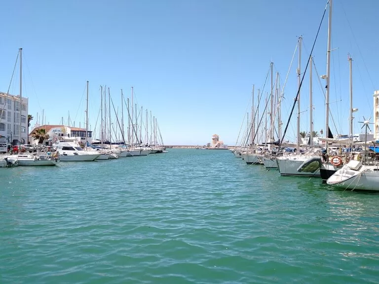
Almerimar: Poniente and Levante
Two dark-sand beaches either side of the marina: Poniente, 1,950 m, with a surf area, and Levante, 1,000 m, quieter (spain.info).
See the Almerimar marina guide →- La Romanilla – 1,000 m of dark sand between the port of Roquetas and Aguadulce, with a small promenade of restaurants and a sailing club (spain.info).
- Los Bajos (Las Palmerillas) – 1,800 m of pebbles, gravel and sand among palms, windy and without buildings, on a dirt track between Aguadulce and Roquetas (spain.info).
- Urbanización de Roquetas and Playa Serena – the resort beaches south of Roquetas, among the best equipped on this coast; Playa Serena, 1,500 m, runs along the golf course to the edge of Punta Entinas (spain.info).
- Balerma – 2,090 m of sand and gravel, an urban beach with a new promenade, often windy (spain.info).
- San Nicolás and El Censo, Adra – San Nicolás, 600 m by the port with volleyball nets and a promenade; El Censo, 500 m, regenerated in 2001, with a promenade and bike lane (spain.info).
Things to do
Nature: dunes, salt pans and lagoons
Two protected wetlands sit inside the greenhouse plain. At Punta Entinas-Sabinar the Salinas de Cerrillos path passes salt pans with grey herons and shovelers, and flamingos nest in the Charcón del Flamenco (Andalucía.org). The Albufera de Adra, two lagoons east of Adra, is called the most important wetland in the province, home of the rare white-headed duck (Andalucía.org); see our Albufera de Adra guide. The GR-92 coastal path runs from Aguadulce to Adra (Spanish Wikipedia).
History: Phoenicians, Romans and coastal forts
Adra was Phoenician Abdera, and its museum shows finds from that period (Andalucía.org). Roman Murgi lies at Ciavieja in El Ejido, and Roquetas places Roman Turaniana at Torre Quebrada de los Bajos (Andalucía.org). From the 16th to the 18th century a chain of towers and forts guarded the shore: Balerma, Guardias Viejas, Entinas and Cerrillos in El Ejido (Andalucía.org) and the Castillo de Santa Ana in Roquetas, now a free museum with a collection of 82 Goya etchings, The Disasters of War (Spanish Wikipedia).
Food, golf and the sea
The Poniente is called the “pantry of Europe” for its greenhouse vegetables (Andalucía.org). Balerma is known for its hand-caught rock fish (Andalucía.org), and in Berja tapas come free with each drink, chosen by the customer (Andalucía.org). Golfers have Almerimar and Playa Serena; divers can go out from Aguadulce marina with Buceo Aguadulce (Andalucía.org).
Where to stay by town
The towns we would base a trip in, east to west. Aguadulce is the closest base to Almería city and the airport.
Aguadulce
A compact beach town 10 km from Almería, with a Blue Flag beach, a marina and a beachfront youth hostel. Good for short stays and trips into the city.
Beach and city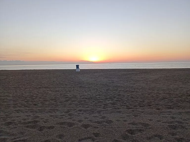
Roquetas de Mar
The biggest choice of hotels on the coast, around the Urbanización and Playa Serena, with Punta Entinas a walk away. Best for families and long beach holidays.
Big beaches and familiesAlmerimar
A planned resort around a large marina, with two beaches, golf and the Punta Entinas visitor centre at its edge. Quieter than Roquetas.
Marina and golfAdra
A working fishing and farming town with beaches by the port, its museum and the Albufera lagoons nearby. Best for a quiet stay at the western end.
Quiet western endGetting there and around
By air
Almería Airport is east of the city: about 18 km from Aguadulce, 23 km from Roquetas, 41 km from Almerimar and 59 km from Adra in a straight line (OpenStreetMap). Road distances are longer.
By car
The A-7 Autovía del Mediterráneo runs behind the whole coast, and the old N-340A links the towns; between Almería and Aguadulce it is the cliff road known as El Cañarete (Spanish Wikipedia). Almerimar is reached on the AL-906 (spain.info).
By bus
Almería transport consortium lines such as the M-301 and M-370 run through Aguadulce (Spanish Wikipedia). El Ejido’s bus station has more than twenty regular local, provincial, regional, national and international lines a day (Andalucía.org). There is no railway on this coast; the nearest station is Almería.
A two-day route
By car, east to west, with a night in Roquetas de Mar or Almerimar.
Day 1
Aguadulce, Roquetas and Punta Entinas
Start on the promenade at Aguadulce, then drive to Roquetas de Mar for the Castillo de Santa Ana and the old lighthouse next to it. In the afternoon park behind Playa Serena and walk west into Punta Entinas-Sabinar to the Cerrillos salt pans; stay for sunset over the lagoons.
Day 2
Almerimar, Guardias Viejas, Balerma and Adra
Begin at the Punta Entinas visitor centre in Almerimar and walk along the marina. Drive west to the Castillo de Guardias Viejas and on to Balerma for fish by the watchtower. In the afternoon look over the Albufera de Adra with binoculars, then end in Adra at the museum and the Torre de los Perdigones.
FAQ
What is the Poniente Almeriense?
The western part of Almería province, between Almería city and the Granada border: the coast of Roquetas de Mar, El Ejido and Adra and the plain of the Campo de Dalías behind it, covered in greenhouses.
Is Roquetas de Mar or Almerimar better for a beach holiday?
Roquetas for the most hotels, long equipped beaches and Punta Entinas nearby; Almerimar for a quieter planned resort with a big marina, golf and two beaches either side of the port.
How far is Roquetas de Mar from Almería Airport?
About 23 km in a straight line, more by road via the A-7. Aguadulce is about 18 km from the airport.
Which beaches in the Poniente have Blue Flags?
Andalucía.org says Balerma’s beach has received the Blue Flag for years, as have those of Almerimar, and Spanish Wikipedia gives Aguadulce a Blue Flag. Flags are awarded each season, so check the current list before you go.
Where can you see flamingos near Roquetas de Mar?
At the Cerrillos and Viejas salt pans and the Charcón del Flamenco in Punta Entinas-Sabinar, between Playa Serena and Almerimar.
Is there a nudist beach near Roquetas?
Spain.info says nudist areas are increasingly popular on the quiet beach of Punta Entinas-Sabinar, and OpenStreetMap marks Playa de Cerrillos as nudism permitted.
Other areas of the Costa de Almería
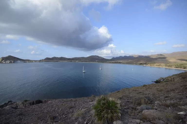
Costa de Almería
The whole coast of Almería province from the Levante to the Poniente, with the map, the four areas and the inland day trips.
Costa de Almería guide →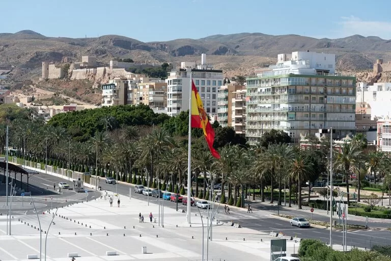
Almería city
The Alcazaba, the fortress cathedral, the port and the city beaches, 10 km east of Aguadulce.
Almería city guide →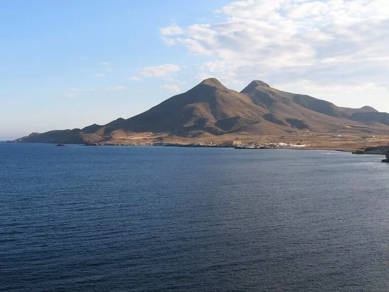
Cabo de Gata-Níjar
Volcanic cliffs, coves and fishing villages from the Cabo de Gata salt pans and lighthouse to Carboneras.
Cabo de Gata-Níjar guide →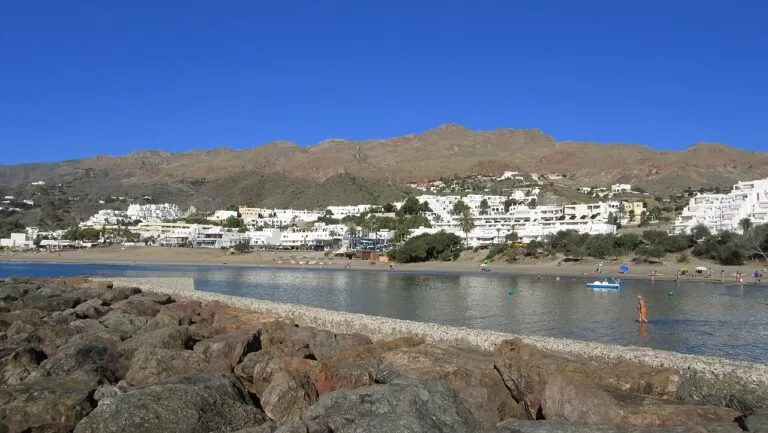
Mojácar, Garrucha and Vera
The resort coast of the north-east: the white hill village of Mojácar, the fishing port of Garrucha and the beaches of Vera.
Mojácar, Garrucha and Vera guide →West of Adra, in Granada province, the coast continues as the Costa Tropical: the Castillo de Salobreña is about 57 km from the Albufera de Adra.
Sources and freshness
Checked 9 November 2026. Andalucía.org (Junta de Andalucía tourism) on Roquetas de Mar, Aguadulce, Vícar, La Mojonera, El Ejido, Almerimar, Balerma, Adra, Berja and Felix; on Punta Entinas-Sabinar, the Albufera de Adra, the Castillo de Guardias Viejas, the Balerma tower, the Museo de Adra, El Ejido’s history museum, Almerimar marina, Almerimar golf, El Ejido bus station and the beaches of Aguadulce and Guardias Viejas. Spain.info (Turespaña) beach sheets for La Romanilla, Los Bajos, Playa Serena, Punta Entinas-Sabinar, Levante and Poniente Almerimar, Balerma, San Nicolás and El Censo. Background on Aguadulce, Almerimar and the Castillo de Santa Ana: Spanish Wikipedia (Aguadulce, Almerimar, Castillo de Santa Ana). Map data and straight-line distances: OpenStreetMap (ODbL). Not confirmed: current Blue Flag list, bus timetables, opening hours of the Castillo de Santa Ana, the Castillo de Guardias Viejas and the Punta Entinas visitor centre. The Turismo de Almería, Roquetas de Mar, El Ejido and Adra tourism sites and the Junta de Andalucía environment pages could not be reached when we checked. Photos from Wikimedia Commons: Roquetas de Mar sunrise (two) by Roquex (CC0); Punta Entinas-Sabinar (two) and the Albufera de Adra by MdeVicente (CC0); Aguadulce by Tajotep (CC BY-SA 4.0); Almerimar marina by Ismael Olea (CC BY 4.0); Adra by kallerna (CC BY-SA 4.0); Los Genoveses by Javier Pérez López (CC BY 3.0); Alcazaba of Almería by Paul Colin Hennig firstdorsal.eu (CC BY-SA 4.0); Los Escullos by isol (CC BY-SA 3.0); Mojácar Playa by INDALOMANIA (CC BY-SA 3.0).