
Costa del Sol · West
Estepona, Manilva and Casares travel guide: the western Costa del Sol
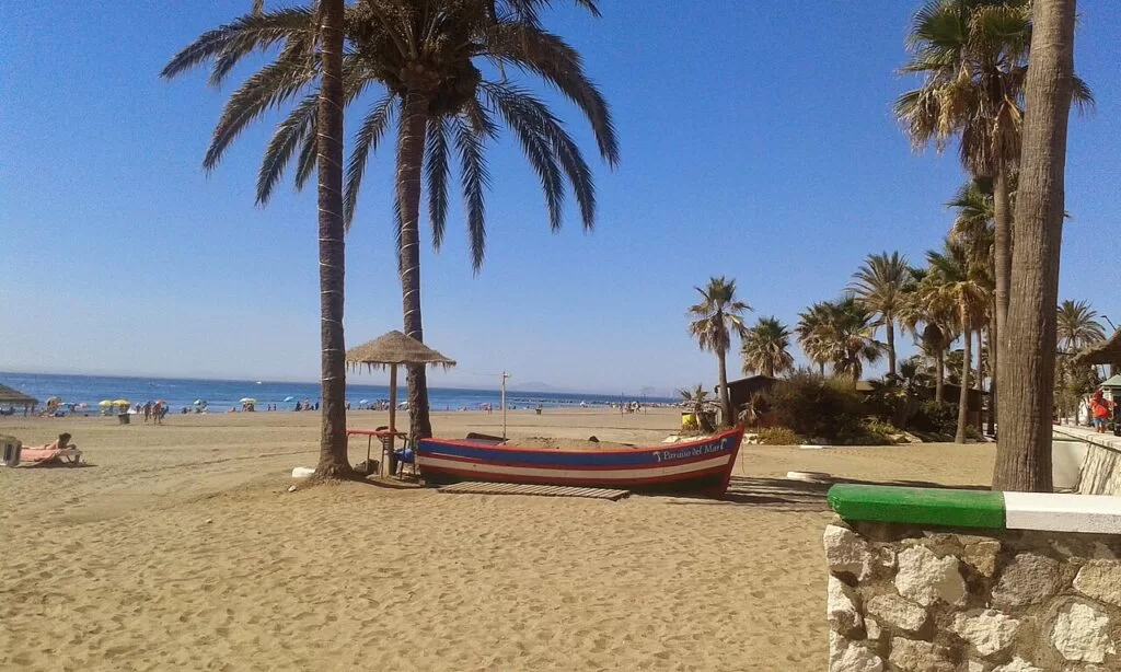
The quieter western end of the Costa del Sol, from the Cádiz border at Punta Chullera to Estepona, with the white village of Casares and the red peaks of Sierra Bermeja behind.
La Rada, Estepona · Photo: Turista Inglesa, CC BY-SA 4.0
Part of the Costa del Sol guide · West: Manilva, Casares and Estepona
The western Costa del Sol is the stretch of Málaga’s coast between Punta Chullera, the natural border with Cádiz, and the end of Estepona’s beaches at the Guadalmina river, covering the municipalities of Manilva, Casares and Estepona. It is a coast of long dark-sand beaches, two marinas and a fishing port, with the hill village of Casares and the mountains of Sierra Bermeja and Sierra Crestellina only a short drive inland (Andalucía’s tourist board). This guide covers each town from west to east, the beaches, what to do, where to base yourself, how to get there and a two-day route.
At a glance
- Where the western end of the Costa del Sol, from Punta Chullera on the Cádiz border to El Saladillo beach at the Guadalmina river, about 25 km apart in a straight line.
- Towns Castillo de la Duquesa, San Luis de Sabinillas, Manilva, Casares and its coast, and Estepona.
- Best for a quieter beach base, Estepona’s flower-filled old town, white villages, mountain walks, vultures and pinsapo firs, Moscatel wine and grilled sardines.
- Getting there Gibraltar airport is about 26 km from Manilva and 35 km from Estepona, Málaga airport about 64 km from Estepona in a straight line; the A-7 coast road links all the towns. There is no train.
- On CostaMap guides to Estepona, Casares, the marinas of La Duquesa and Estepona, Selwo Aventura, Sierra Bermeja and Sierra Crestellina.
Map of Estepona, Manilva and Casares
The map shows the places on the western Costa del Sol that have a CostaMap page. Tick a place type to filter, and click a marker to see the place in the panel.
Place type
Area · next level
 Area map
Estepona, Manilva and Casares
Click a marker to see the place here. From Punta Chullera on the Cádiz border to Estepona, with Casares and Sierra Bermeja behind.
Towns and villagesTowns and villages
From west to east. Andalucía’s tourist board lists Estepona, Manilva and Casares as the westernmost coastal towns of the Costa del Sol.
Punta Chullera and Castillo de la Duquesa
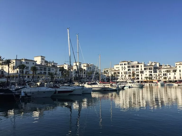
The province ends at Punta Chullera, also called Punta Cala Sardina, a rocky point that forms the natural border with Cádiz. Andalucía’s tourist board describes it as a landscape of special value, with clear water suited to spearfishing and snorkelling among the rocks, and an old watchtower, the Torre de la Chullera, stands above it (Andalucía’s tourist board). A few kilometres north is the Castillo de la Duquesa, a fort built in 1767 to guard the anchorage near Gibraltar. It stands on a Roman villa, with the remains of baths, a fish-salting works and a cemetery around it, and now holds Manilva’s archaeological museum (Andalucía’s tourist board). Next to it is the marina; see our Puerto de la Duquesa guide. It is the planned western end of the Senda Litoral coast path (Andalucía’s tourist board).
San Luis de Sabinillas
Sabinillas is Manilva’s seaside village, 2 km from the old town. It began as a fishing settlement and has become a resort with apartments, hotels, campsites and golf courses, with La Duquesa as its marina (Andalucía’s tourist board). Roman remains found here suggest a villa once stood on the site. The whole seafront is lined by a promenade above a long beach of dark sand that runs from the Maicandil stream to the Manilva river. Come here for espetos, fish grilled on skewers over embers, with sardines the classic choice (Andalucía’s tourist board). OpenStreetMap lists a street market on Friday mornings.
Manilva
Manilva is the westernmost municipality of Málaga province. Its land falls from the lower Genal valley to the sea in gentle hills, mostly vineyards, and the town sits 2 km from the coast around the 18th-century church of Santa Ana. It became a separate municipality in 1796, splitting from Casares, and its coat of arms reads “very noble and loyal town” because Napoleon’s troops never took it (Andalucía’s tourist board; Spain.info). The local wine is made mainly from Moscatel de Alejandría grapes, and the CIVIMA interpretation centre explains vine growing, winemaking and raisin drying, with a winery next door (Andalucía’s tourist board). The Fiesta de la Vendimia at the end of the harvest, with the treading of the grapes, is a Fiesta of Provincial Tourist Interest. Read our Manilva guide.
Casares
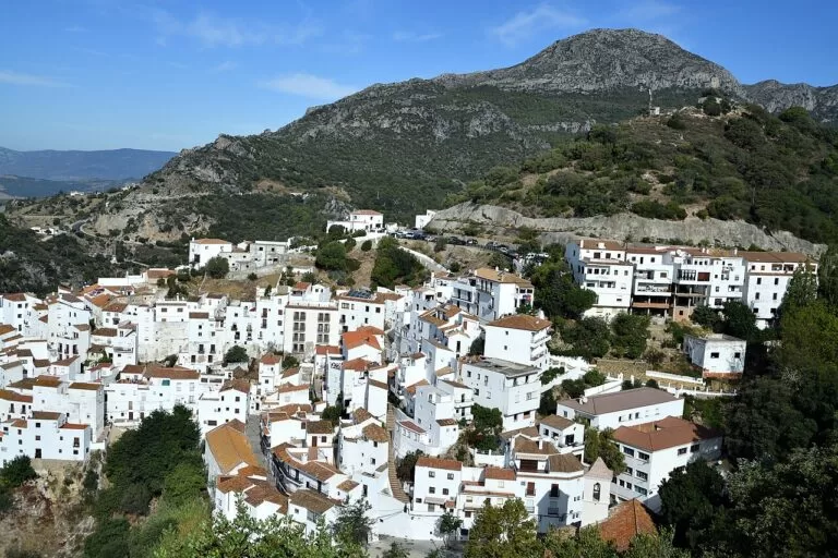
Casares sits on a hilltop between the Ronda mountains, the Costa del Sol and Gibraltar, and has been a Historic-Artistic Site since 1978. Tradition says Julius Caesar founded it in thanks for being cured in the waters of the Baños de la Hedionda, though the village itself dates from Moorish times (Spain.info). See the ruins of the castle, the 17th-century church of La Encarnación, now a cultural centre, and the house where Blas Infante, the father of Andalusian nationalism, was born, now the tourist office (Andalucía’s tourist board). The visitor centre at the top of the village has a large car park and views to the Strait. Behind the village rise the limestone crests of Sierra Crestellina. See our Casares guide and the longer Casares village article.
The Casares coast
Casares has a short strip of coast between Manilva and Estepona, built up with housing estates and marked by the Torre de la Sal watchtower, which Spain.info names among the village’s landmarks. Three beaches are listed by Andalucía’s tourist board: Playa Ancha, 825 m long with calm water, lifeguards and good services; Torre de la Sal, a small clean beach reached from the Paseo de la Perla de la Bahía beside the tower; and Piedra Paloma, a gravel beach with calm water where dogs are allowed on the stretch between the Torre de la Sal and the Estepona boundary (Andalucía’s tourist board).
Estepona
Estepona is the largest town of the stretch and a full resort, with about 21 km of coast (Spain.info). Its old town has whitewashed streets crowded with flowerpots and three art trails: more than 40 murals, more than 30 sculptures and a poetry route. Look for the Clock Tower, the 18th-century church of Los Remedios, the remains of the San Luis castle, the Plaza de las Flores, the Casa del Aljibe archaeological museum and the orchid house in the botanical park. The town was taken by Henry IV of Castile in 1456 and became independent of Marbella in 1729 (Andalucía’s tourist board). The marina and fishing port are covered in our Puerto Deportivo de Estepona guide. See our Estepona guide and the Estepona old town article.
East Estepona: El Padrón to El Saladillo
East of the town centre, the coast is a line of housing estates, hotels and beaches all the way to the Guadalmina river. El Padrón, about 2 km from the town, is one of Estepona’s most visited beaches after La Rada, with a shopping centre opened in 2006 and restaurants nearby (Andalucía’s tourist board). Further on come Río Castor, with sand and boulders, the long narrow Guadalmansa beach, and El Saladillo, which runs for about three kilometres to the mouth of the Guadalmina. The Roman baths near the Guadalmansa river may belong to the Roman town of Salduba. In the hills above is Selwo Aventura, where Spain.info counts more than 2,000 animals living in semi-freedom.
Beaches and coves
From west to east. Services and descriptions are as Andalucía’s tourist board lists them; we could not confirm 2026 Blue Flags or lifeguard dates.
Sabinillas and La Duquesa
Sabinillas is the dark-sand town beach of Manilva, with a promenade, calm water, lifeguards, toilets and access for people with reduced mobility. La Duquesa – El Castillo beach lies by the marina and the castle; it has narrowed since the port was built (Andalucía’s tourist board).
See the marina guide →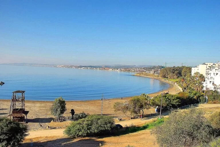
El Cristo
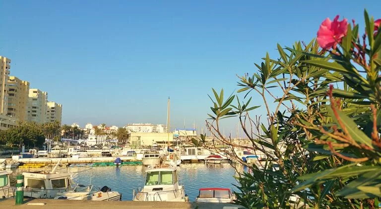
A small cove of dark sand next to the Estepona marina, sheltered from the wind, with calm water, lifeguards, toilets and shade (Andalucía’s tourist board). The best choice for children and for swimming on a windy day.
See the marina guide →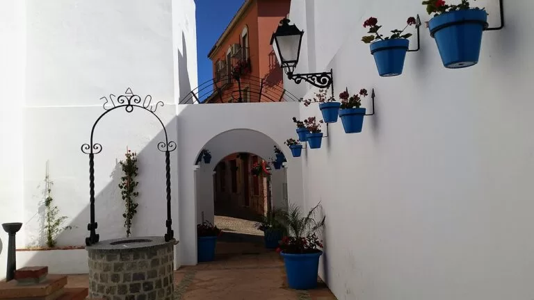
La Rada
Estepona’s main beach, in front of the town centre: long, busy and recently regenerated, with dark sand, a promenade, lifeguards, toilets, shade and good access. It lost its Blue Flag in 2019 (Andalucía’s tourist board). The old town is a short walk inland.
See the Estepona guide →- Punta Chullera (Manilva) – rocks and clear water for snorkelling at the Cádiz border; few services (Andalucía’s tourist board).
- Los Toros (Manilva) – a wide, open gravel beach named after the cattle that crossed it on the old drove road from Los Barrios to Estepona (Andalucía’s tourist board).
- Piedra Paloma (Casares) – gravel, calm water and a stretch where dogs are allowed (Andalucía’s tourist board).
- Costa Natura (Estepona) – a small naturist beach of sand and pebbles a few hundred metres long, with views of Gibraltar and the Atlas mountains; popular with naturists from across Europe (Andalucía’s tourist board).
Things to do
Nature: red mountains, pinsapos and vultures
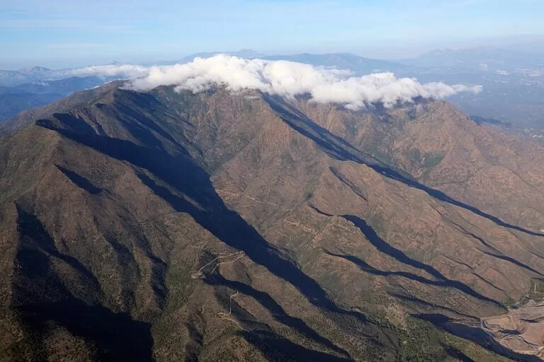
Two protected mountains stand behind the coast. Sierra Bermeja is made of red peridotite, one of the largest outcrops of this rock in the world, and Los Reales, at about 1,450 m, holds the only pinsapo fir forest that grows on it (Andalucía’s tourist board). Sierra Crestellina, the grey limestone ridge above Casares, has the largest griffon vulture colony in the province (Andalucía’s tourist board). From the Baños de la Hedionda a walk through the Canuto de la Utrera gorge crosses what the tourist board calls the southernmost karst landscape in Europe, often with vultures overhead. On the coast, the Reserva Ecológica Playa de Manilva protects more than 150 seashore plants along a route of over 6 km.
History: Romans, forts and museums
Roman sites run along this coast: the villa, baths and fish-salting works around the Castillo de la Duquesa, the baths near the Guadalmansa river and the Cortijo de Alechipe near Casares, a possible site of the Roman town of Lacipo. Manilva’s museum in the castle also shows finds from the Castillejos de Alcorrín, a large Late Bronze Age fortress. In Estepona, the archaeological museum in the 18th-century Casa del Aljibe, the town hall from 1853 to 2011, displays the Venus of Estepona, a female figurine about 5,000 years old (Andalucía’s tourist board). The Orquidario in Estepona has more than 1,300 orchid species under three glass domes, the tallest about 30 m high, and a waterfall of more than 15 m (Andalucía’s tourist board). Opening hours could not be confirmed.
Food: espetos, fish auctions and Moscatel
Spain.info recommends Estepona’s salt-baked fish, fritura malagueña (mixed fried fish) and char-grilled sardines, and in Manilva sea bream, red mullet, grouper, tuna and oven-roasted sardines. In Estepona’s fishing port, a guided “Marinero en Tierra” visit shows the boats coming in, the fish auction in the market hall, the fishermen’s quarter with its Virgen del Carmen chapel, and ends with a seafood tapa (Andalucía’s tourist board). In Manilva, try the sweet and semi-sweet wines made from Moscatel grapes, and the must at the grape harvest fiesta.
Where to stay by town
The towns we would base a trip in, west to east. We name no hotels; compare locations on the map.
Sabinillas and La Duquesa
Promenade, beach and marina restaurants, the closest base to Gibraltar airport and Sotogrande. Quieter than Estepona, with mostly apartments and golf resorts.
Beach and marina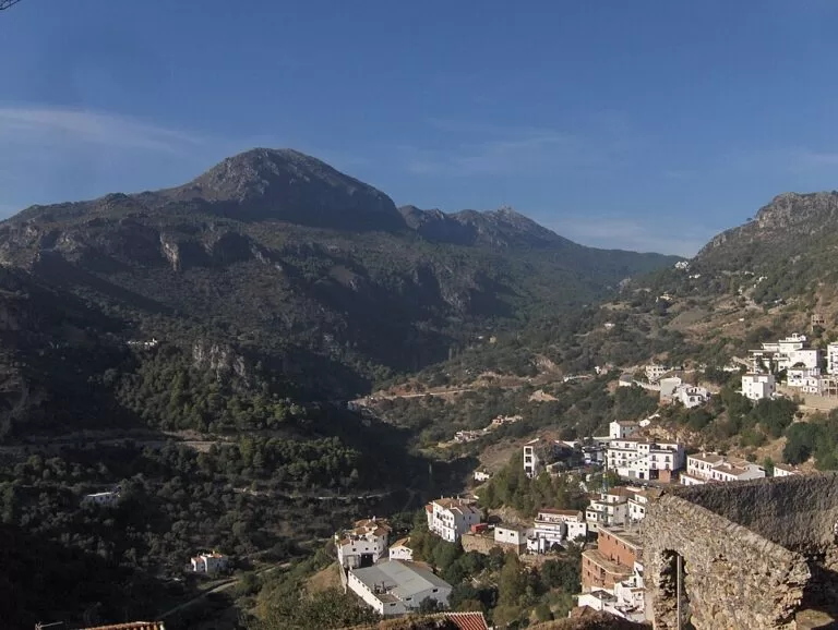
Casares
A white hill village with rural places to stay, about 9 km from the Torre de la Sal beach in a straight line. Best for walkers and for quiet evenings; you need a car for the beach.
Village and hillsEstepona
The most services, an old town to walk in the evening, La Rada beach in the centre and El Cristo by the port. The best base without a car, with the tourist office in the old town.
Town and beachGetting there and around
By air
Gibraltar airport is the closest: about 26 km from Manilva and 35 km from Estepona in a straight line. Málaga airport is about 64 km from Estepona and 75 km from Manilva (OpenStreetMap). For airport buses and the train to Fuengirola, see the Costa del Sol guide.
By car
The A-7 coast road links Estepona, the Casares coast and Manilva and continues to Sotogrande in Cádiz. Casares is reached by the MA-8300 and A-7150, and Los Reales by the MA-8301 from Estepona over the Peñas Blancas pass (OpenStreetMap). A car is the practical way to reach the villages and mountains.
By bus
There is no train west of Fuengirola. OpenStreetMap shows Avanza line 77 between Casares, Estepona and the Hospital Costa del Sol, and stops in Manilva and Sabinillas served by Avanza and CTSA Portillo. Casares visitor centre offers transport up from the village bus station (Andalucía’s tourist board). Check routes and times with the operators.
A two-day route
By car, based in Estepona.
Day 1
Estepona old town, the port and Sierra Bermeja
Walk the old town in the morning, from the murals to the Plaza de las Flores and the Orquidario. Swim at La Rada or El Cristo, then eat fried fish near the port. In the late afternoon drive up the MA-8301 to Peñas Blancas and on to Los Reales for the short walk to the summit and, on a clear evening, the view to Gibraltar and Africa.
Day 2
Casares, Crestellina and the Duquesa coast
Drive to Casares early, park at the visitor centre and walk up the castle hill and past the Blas Infante house. Fit walkers can climb towards the Sierra Crestellina refuge and look for vultures. After lunch go down to the coast, visit the Castillo de la Duquesa and its Roman site, then walk the promenade at Sabinillas and end with espetos at sunset.
FAQ
Which towns are on the western Costa del Sol?
From the Cádiz border eastwards: Manilva with Sabinillas and Castillo de la Duquesa, the coast of Casares, and Estepona. Casares village itself is in the hills. Marbella is the next stretch to the east.
Is Estepona or Manilva better to stay in?
Estepona has more services, an old town and beaches in the centre, and works without a car. Manilva (Sabinillas and La Duquesa) is quieter and closer to Gibraltar and Sotogrande.
Is there a train to Estepona?
No. The train from Málaga airport ends at Fuengirola; continue by bus or car. OpenStreetMap shows Avanza buses serving Estepona, Casares and Manilva.
What is Casares known for?
Its white houses on a hilltop, the castle ruins, the birthplace of Blas Infante, the legend of Julius Caesar and the Baños de la Hedionda, and the vulture colony of Sierra Crestellina.
Is there a dog beach near Estepona?
Yes. Andalucía’s tourist board says dogs are allowed on the Piedra Paloma stretch in Casares, between the Torre de la Sal and the Estepona boundary.
Is there a nudist beach near Estepona?
Yes, Costa Natura, a small sand and pebble beach west of the town that the tourist board says is popular with naturists from across Europe.
Other areas of the Costa del Sol
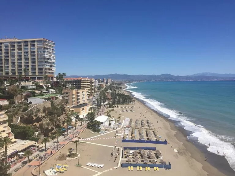
Costa del Sol
The whole Málaga coast from Manilva to Nerja, with the map, weather, inland day trips and itineraries.
Costa del Sol guide →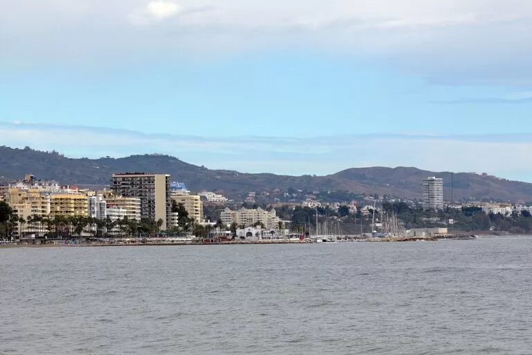
Marbella, Mijas and Fuengirola
Marbella’s marinas and mountain, the white village of Mijas and Fuengirola at the end of the train line.
Marbella, Mijas and Fuengirola guide →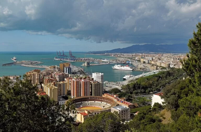
Málaga and the central Costa del Sol
Málaga city and its museums, Torremolinos and Benalmádena, close to the airport and the train.
Málaga and central coast guide →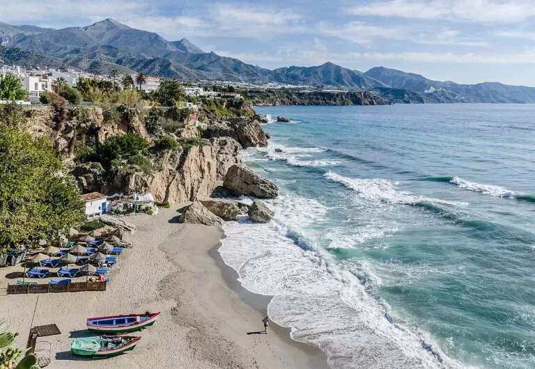
The Axarquía coast and Nerja
Rincón de la Victoria, Torre del Mar, Torrox and Nerja, with the Nerja caves and the cliffs of Maro.
Axarquía and Nerja guide →Across the Cádiz border, Marina de Sotogrande is about 10 km from Manilva.
Sources and freshness
Checked 7 November 2026. Andalucía’s tourist board on Estepona, Manilva, Sabinillas, Casares, the Casares visitor centre, the Castillo de la Duquesa museum, CIVIMA, the Baños de la Hedionda, Los Reales de Sierra Bermeja, Sierra Crestellina, Estepona’s archaeological museum, the Orquidario, the fish auction visit, the beaches linked above plus La Duquesa – El Castillo, Torre de la Sal, Río Castor and Guadalmansa, the Vendimia, and the blogs on Casares and Manilva and the Senda Litoral. Spain.info on Estepona, Casares and Manilva. Map data and straight-line distances: OpenStreetMap. Not confirmed: bus timetables, museum hours, 2026 Blue Flags and lifeguard dates; the Estepona, Manilva and Casares town hall sites and visitcostadelsol.com could not be reached from here.