
Costa del Sol · Málaga and the centre
Málaga and the central Costa del Sol travel guide: Benalmádena to El Palo
Málaga’s old town, museums and city beaches, La Carihuela in Torremolinos, and the marina and hilltop sights of Benalmádena.
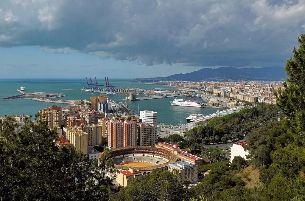
Málaga from Gibralfaro · Photo: Ввласенко, CC BY-SA 3.0
Part of the Costa del Sol guide ←
The central Costa del Sol is the stretch of coast around Málaga airport, from Benalmádena and Torremolinos in the west to Málaga city and its eastern beaches at El Palo. It is the busiest and best-connected part of the coast: the C-1 commuter train links the airport with Málaga, Torremolinos and Benalmádena, and Málaga’s old town, with the Alcazaba, the cathedral and the Picasso and Pompidou museums, is about 9 km from the terminal in a straight line.
At a glance
- Where the centre of the Costa del Sol, from the Benalmádena coast past Torremolinos and the Guadalhorce estuary to Málaga city and El Palo: about 23 km in a straight line from the Benalnatura beach in Benalmádena to El Palo in Málaga.
- Towns Benalmádena, Torremolinos and Málaga on the coast; Alhaurín de la Torre and Alhaurín el Grande inland.
- Best for a city break with a beach, museums, short stays without a car, family days out and fried fish by the sea.
- Getting there Málaga-Costa del Sol airport (AGP) is in the middle of the stretch; the C-1 train runs from the terminal to Málaga Centro Alameda and west through Torremolinos and Benalmádena to Fuengirola.
Map of Málaga and the central Costa del Sol
The map shows the places in this stretch that have a CostaMap page, from Málaga’s monuments to Benalmádena and the hills behind the city. Tick a place type to filter it, and click a marker to see the place in the panel.
Place type
Area · next level
 Area map
Málaga and the central Costa del Sol
Click a marker to see the place here. From Benalmádena and Torremolinos to Málaga’s old town and beaches, with the Montes de Málaga inland.
Towns and villagesTowns and villages
Coastal towns west to east, then the inland towns. Facts from the Andalusian tourist board and spain.info, checked November 2026.
Benalmádena
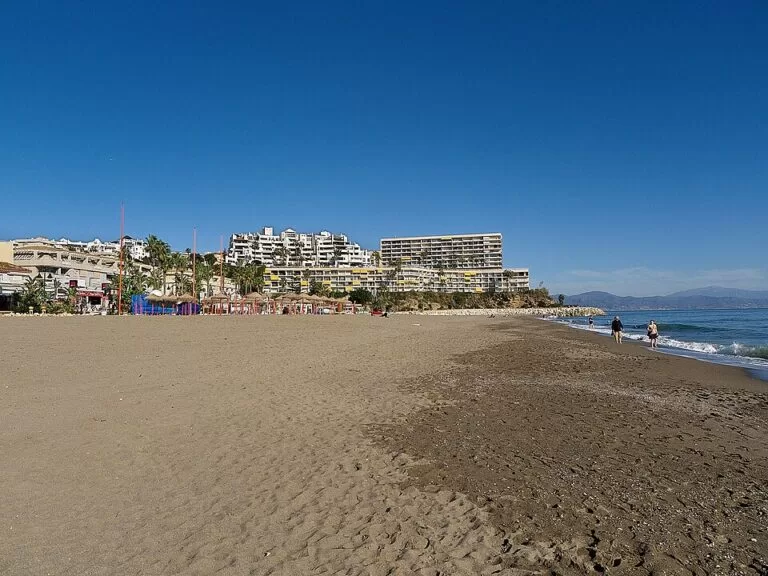
Benalmádena runs from the foothills of the Sierra de Mijas down to a narrow strip of coast, and the tourist board describes it in three parts. The old village sits on a hill; below it, Arroyo de la Miel has most of the population, an amusement park and the C-1 station. Benalmádena Costa, from the Torremolinos border to Fuengirola, holds the hotels, the casino, golf courses and Puerto Marina. On the seafront stands the Castillo de Bil-Bil, a red neo-Arab villa that the town now uses for exhibitions and concerts. Above the town are the Benalmádena Stupa, a Buddhist monument over 33 m tall, and the Castillo de Colomares, a castle-shaped monument to Columbus built between 1987 and 1994.
Torremolinos
Torremolinos stretches from Benalmádena to the mouth of the Guadalhorce. The tourist board calls it the typical product of the 1960s boom, which turned a small fishing village into a large resort. Its name comes from a watchtower and old flour mills; the Torre de Pimentel still stands in the centre. The old character survives in the El Bajondillo and La Carihuela quarters, and spain.info names fried fish, pescaíto frito, as the local dish. The beaches are La Carihuela, El Bajondillo, Playamar and Los Álamos. Below the town, the Bajondillo Cave is an archaeological site whose finds have been used to argue for an earlier arrival of modern humans in western Europe, and on the hill is the seasonal Aqualand water park.
Málaga
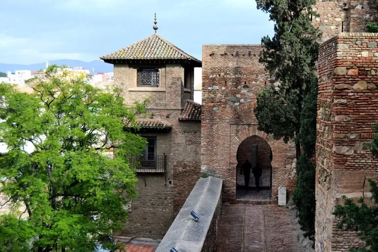
Málaga, the provincial capital, fills the bay between the Guadalhorce river and the start of the Axarquía. Spain.info counts 16 beaches in the city and calls it the birthplace of Picasso. In the centre stand the Alcazaba, one of the largest Arab fortresses in Andalusia, Gibralfaro Castle above it, the Roman theatre at its foot and the cathedral, called La Manquita because its right-hand tower was never finished. The museums include the Museo Picasso Málaga, the Carmen Thyssen Museum, the Museo de Málaga in the Palacio de la Aduana, and the Centre Pompidou in its colourful cube on the port. East of the centre, La Malagueta beach leads east to Pedregalejo and El Palo, with their fishermen’s houses and seafront fish restaurants.
Alhaurín de la Torre
Alhaurín de la Torre lies inland between the eastern slope of the Sierra de Mijas and the Guadalhorce valley, about 4 km from the airport and 7 km from the beach at Guadalmar in a straight line. The tourist board describes pine woods and orchards dotted with housing estates, and a town of Moorish origin that kept few traces of its past as it grew into a commuter town for Málaga and Torremolinos. There is a golf course nearby. It is a quiet base with a car, close to both the airport and the city, but not a beach resort.
Alhaurín el Grande
Alhaurín el Grande sits on the north side of the Sierra de Mijas above the Guadalhorce valley, surrounded by citrus groves, fruit trees and market gardens. It is about 18 km from the airport in a straight line. The tourist board lists the church of the Encarnación, the hermitages of the Santa Vera Cruz and San Sebastián, the Arco del Cobertizo, the well-preserved Molino de los Corchos mill, and museums of bread and agriculture. Choose it for a rural base; the beaches are a drive away.
Beaches and coves
Our pick from west to east: long urban beaches with promenades, not hidden coves. Facts from Málaga city council, the Andalusian tourist board and spain.info, checked November 2026.
Santa Ana, Bil-Bil and Arroyo de la Miel
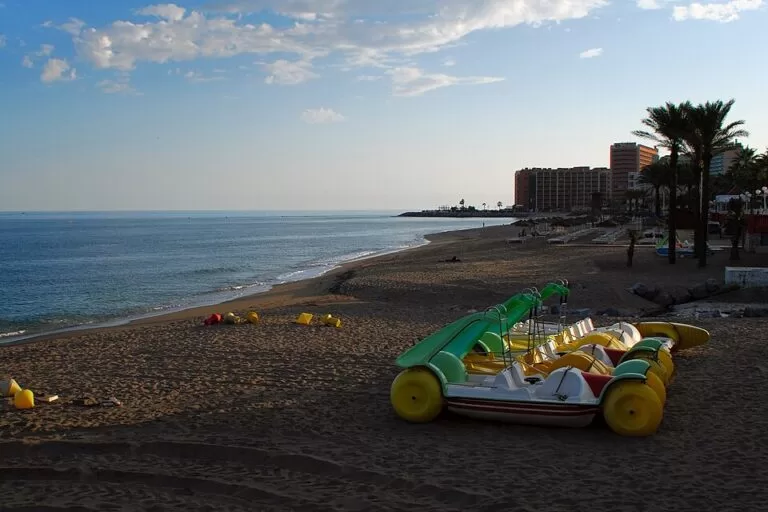
Busy beaches by Puerto Marina. Santa Ana is 435 m of dark sand; Bil-Bil has amphibious chairs. Benalnatura, further west, is one of the few naturist beaches on the Málaga coast.
La Carihuela
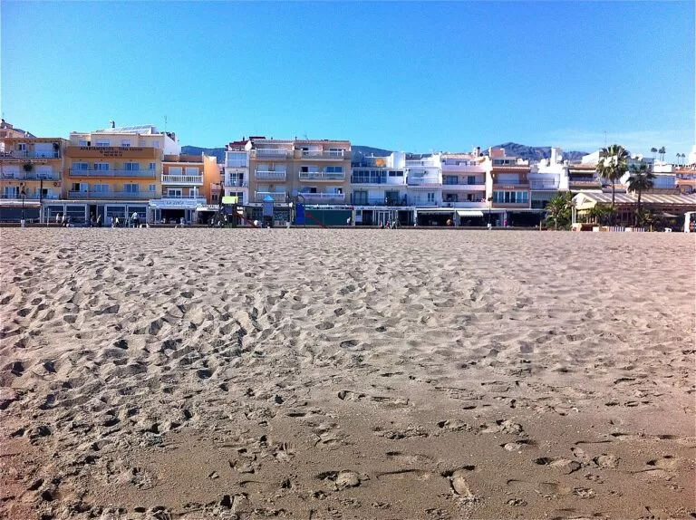
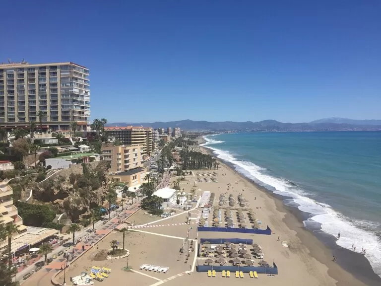
2,100 m of fine dark sand from Torremolinos Point to the Benalmádena marina, with an accessible bathing point and fish restaurants on the promenade. La Carihuela beach guide.
El Bajondillo, Playamar and Los Álamos
El Bajondillo is the most central beach of Torremolinos, reached from the town by a lift in the Plaza del Panorama or the stepped Cuesta del Tajo. Playamar and Los Álamos continue east towards the Guadalhorce.
La Malagueta
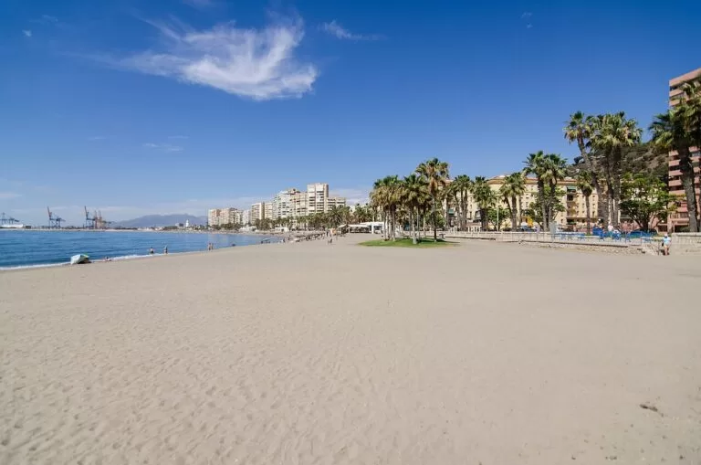
The city beach by the port: 1,200 m long and 45 m wide, medium-grain sand, a Blue Flag and lifeguards from 15 June to 15 September. La Malagueta beach guide.
Málaga’s other beaches, west to east (city council): Guadalmar, by the Guadalhorce mouth, the only urban beach with a naturist area; La Misericordia, about 2,000 m long, with old factory chimneys on its promenade; San Andrés, 650 m; La Caleta, 1,000 m next to La Malagueta; the Baños del Carmen, 550 m, with views over the bay; Pedregalejo, with the city’s oldest promenade and its fish and seafood restaurants; and El Palo, 1,200 m, where fishing boats still lie on the sand. The dog beach is at La Araña. According to CostaMap’s Costa del Sol guide, all four Torremolinos beaches fly the Blue Flag in 2026 (Torremolinos town hall) and Benalmádena has three.
Things to do
History and museums
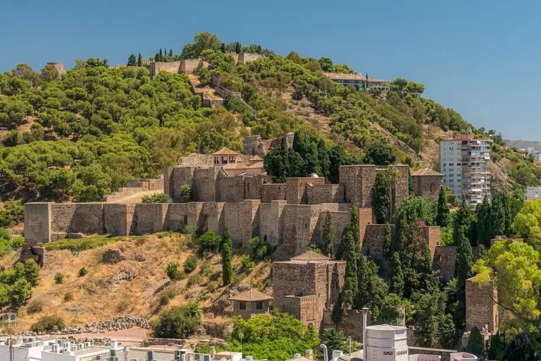
Málaga’s centre is compact. Start at the Alcazaba, the 11th-century Moorish palace-fortress above the Roman theatre, and climb to Gibralfaro, the 14th-century castle built to protect it. The cathedral is a few streets away. For art, choose between the Museo Picasso, the Centre Pompidou (closed on Tuesdays, free on Sundays from 16:00), the Carmen Thyssen Museum of 19th-century Spanish painting, the Museo de Málaga with its fine-art and archaeology sections, and the Jorge Rando Museum of Expressionism. Spain.info adds Picasso’s birthplace on the Plaza de la Merced. In Benalmádena, the Castillo de Colomares and the Stupa make an easy pair, and Torremolinos has the Torre de Pimentel and the Casa de los Navajas.
Nature
The Montes de Málaga Natural Park, 4,995 hectares of Aleppo pine and remnants of Mediterranean forest just north of the city, has free entry through the Lagar de Torrijos visitor centre on the Colmenar road; spain.info notes one of the largest chameleon colonies in Andalusia. West of the airport, the Paraje Natural Desembocadura del Guadalhorce is a set of lagoons between the two arms of the river, the most important stopover for migrating coastal birds in the province according to the tourist board. In the north of the city, the Jardín Botánico-Histórico La Concepción a romantic garden created around 1855 by the Loring family, has more than 1,000 plant species and a palm collection; in 2026 a standard ticket is 5.20 euros and it is closed on Mondays (tourist board).
Food and family
Eat fried fish (pescaíto frito) in Torremolinos and charcoal-grilled sardine skewers (espetos) in Pedregalejo, and try the Atarazanas market and the tapas bars around Calle Marqués de Larios (spain.info). With children, Selwo Marina has dolphins, sea lions and penguins, Aqualand is open from April to September, and Puerto Marina has quays of restaurants and bars, the Sea Life aquarium and a paddle steamer.
Where to stay by town
We do not list hotels. These are the bases we would choose, with what each suits. The C-1 train decides a lot: it reaches Málaga about 12 minutes from the airport and Benalmádena about 18 minutes (Aena, via CostaMap’s Costa del Sol guide).
Málaga centre and La Malagueta
Monuments, museums, tapas bars and the city beach within walking distance, and the train to the airport. The obvious base for a city break; El Palo and Pedregalejo put you by the sea further east.
City break with a beachTorremolinos: La Carihuela and El Bajondillo
Hotels and apartments on long beaches, fish restaurants on the promenade and C-1 stations in town. The coastal town closest to the airport, about 6 km in a straight line.
Beach holiday without a car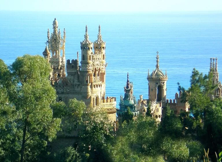
Benalmádena Costa and Arroyo de la Miel
The marina, the casino, golf and the family parks, with the train at Arroyo de la Miel and the old village on the hill above.
Families and marina lifeInland, Alhaurín de la Torre and Alhaurín el Grande suit a quieter stay with a car. For a motorhome, Finca Colores is a stopover campsite open all year in the hills north of Málaga, about 9 km from the Montes de Málaga Natural Park.
Getting there and around
By air: Málaga-Costa del Sol airport is in the middle of the stretch, about 8 km from Málaga’s centre by road according to spain.info, 6 km from Torremolinos and 11 km from Benalmádena in a straight line. Spain.info lists a minimum taxi fare from the airport of 17.37 euros on weekdays by day (checked November 2026).
By train: the C-1 Cercanías line (Málaga Centro Alameda – Fuengirola) stops at the airport and links it with Málaga city centre, Torremolinos and Benalmádena; spain.info gives fares from 1.80 to 2.70 euros. For La Carihuela use Montemar Alto, for Benalmádena Arroyo de la Miel. Long-distance trains arrive at Málaga María Zambrano station, Explanada de la Estación (spain.info).
By bus: an express bus runs from the airport to Málaga city centre for 4 euros, and intercity lines go to Marbella, Estepona and Nerja (spain.info).
By car: the MA-20 ring road and the A-7 connect the airport with Málaga and the towns to the east and west; the AP-7 toll motorway runs further west (spain.info). A car helps for Benalmádena Pueblo, the Stupa, the Montes de Málaga and the inland towns.
A two-day route
Two days
Day 1
Málaga: Alcazaba, museums and the beach
Begin at the Alcazaba and walk up to Gibralfaro for the view over the port and La Malagueta. Then visit the cathedral and the Museo Picasso, with lunch near the Atarazanas market. In the afternoon walk the Muelle Uno quay to the Centre Pompidou (closed on Tuesdays), then cross to La Malagueta for a swim or a walk along the promenade. End the day with espetos in Pedregalejo or El Palo.
Day 2
Torremolinos and Benalmádena
Take the C-1 to Torremolinos. Walk down the Cuesta del Tajo from the Torre de Pimentel to El Bajondillo and the Casa de los Navajas, then follow the promenade west to La Carihuela for fried fish at lunch. Continue on foot to Puerto Marina in Benalmádena. In the afternoon choose Selwo Marina with children, or go up by taxi or car to the Castillo de Colomares and the Stupa above Arroyo de la Miel, and take the train back from Arroyo de la Miel.
FAQ
Is it better to stay in Málaga or Torremolinos?
Stay in Málaga for monuments, museums and restaurants with a city beach; stay in Torremolinos for long beaches and hotels by the sea. The C-1 train links both with the airport, so moving between them is easy.
How do I get from Málaga airport to Torremolinos or Benalmádena?
Take the C-1 train from the airport towards Fuengirola. Get off at Montemar Alto for La Carihuela and at Arroyo de la Miel for Benalmádena; spain.info gives fares from 1.80 to 2.70 euros.
What is the best beach in Málaga city?
For a swim near the sights, La Malagueta: 1,200 m long, Blue Flag and lifeguards in season. For fish restaurants, Pedregalejo and El Palo; for a beach with a naturist area, Guadalmar in the west.
Are there naturist beaches near Málaga?
Yes. Guadalmar in Málaga has a naturist area, and Benalnatura in Benalmádena is one of the few naturist beaches on the Málaga coast.
Is there a dog beach in Málaga?
Yes, at La Araña in the east of the city, by the Totalán stream. Dogs over 20 kg must wear a muzzle and owners must carry the dog’s papers.
Other areas of the Costa del Sol
Estepona, Manilva and Casares
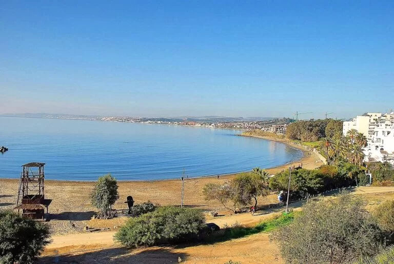
The western end towards the Cádiz border: Estepona and its La Rada beach, the Castillo de la Duquesa in Manilva, and Casares in the hills.
Estepona, Manilva and Casares guide →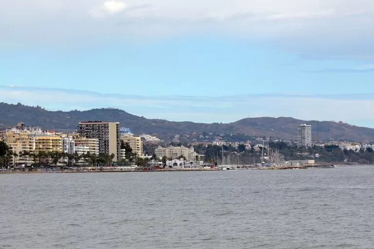
Marbella, Mijas and Fuengirola
Marbella, the white village of Mijas and Fuengirola, the end of the C-1 line.
Marbella, Mijas and Fuengirola guide →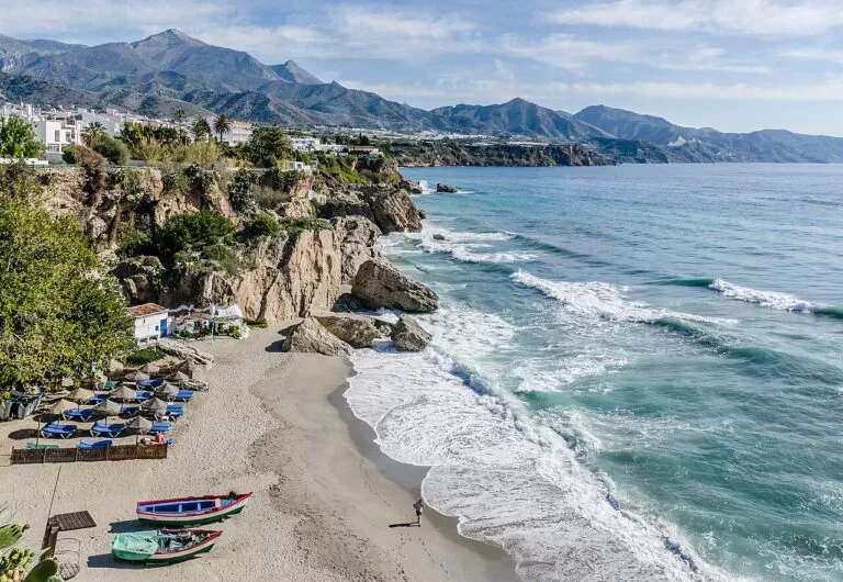
The Axarquía coast and Nerja
Just east of Málaga: Rincón de la Victoria, Torre del Mar, Torrox and Nerja with its caves and the cliffs of Maro.
Axarquía coast and Nerja guide →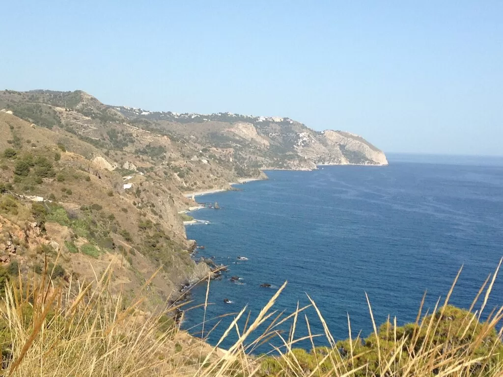
Costa del Sol guide
All four areas from Manilva to Nerja, the map of the whole coast and inland day trips such as Ronda and the Caminito del Rey.
Costa del Sol guide →Sources and freshness
Checked 6 November 2026. Málaga city council: beaches of Málaga (14 km of coast, bathing season), beach services (lifeguard periods and hours), and the beach pages for La Malagueta, La Misericordia, Guadalmar, San Andrés, La Caleta, Baños del Carmen, Pedregalejo, El Palo and the dog beach. Andalusian tourist board listings for Benalmádena, Benalmádena Costa, Torremolinos, Málaga, Alhaurín de la Torre, Alhaurín el Grande, the beaches of Santa Ana, Bil-Bil, Benalnatura, La Carihuela and El Bajondillo, the Castillo de Bil-Bil, the Guadalhorce estuary, La Concepción and the Centre Pompidou. Spain.info on Málaga, Torremolinos, Benalmádena, La Carihuela, La Concepción, the Montes de Málaga Natural Park, Málaga airport (train, bus, taxi, roads) and María Zambrano station. Blue Flags in Torremolinos and Benalmádena and C-1 times: our Costa del Sol guide. The Torremolinos, Benalmádena and Málaga tourist office sites could not be reached from our setup. Locations, stations and straight-line distances: OpenStreetMap contributors (ODbL).
Photo credits · 13 photos from Wikimedia Commons Show
Photos from Wikimedia Commons, not altered except for cropping: Málaga from Gibralfaro by Ввласенко (CC BY-SA 3.0); Arroyo de la Miel beach by Aapo Haapanen (CC BY 2.0); La Carihuela by DODO DODO (CC BY 2.0); Torremolinos by ianpudsey (CC BY 3.0); La Malagueta by Jeff Hitchcock (CC BY 2.0); Alcazaba by Fernando (CC BY-SA 4.0); Castillo de Colomares by LANOEL (CC BY-SA 3.0); Alcazaba gate by Emilio J. Rodríguez Posada (CC BY-SA 2.0); Playa del Cristo, Estepona by Turista Inglesa (CC BY-SA 4.0); Marbella by Harvey Barrison (CC BY-SA 2.0); Nerja by Tuxyso (CC BY-SA 3.0); Maro cliffs by Alexander Wagner García (CC BY-SA 3.0 es); Playa de la Carihuela (map panel) by Jl FilpoC (CC BY-SA 4.0).
Every place we have mapped on the Costa del Sol
77 towns, beaches, coves and landmarks, kept up to date automatically.
- Alcazaba of Málaga
- Aqualand Torremolinos
- Bajondillo Cave
- Balcón de Europa (Nerja)
- Basílica de Vega del Mar (San Pedro Alcántara)
- Benahavís (Costa del Sol)
- Benalmádena Stupa (Estupa de la Iluminación)
- Bioparc Fuengirola
- Calaburras Lighthouse (Mijas)
- Caminito del Rey (Ardales – El Chorro)
- Camping Cabopino
- Camping Marbella Playa
- Carmen Thyssen Museum (Málaga)
- Casares
- Castillo de Colomares (Benalmádena)
- Caves of Nerja
- Centre Pompidou Málaga
- Cómpeta (Axarquía, Málaga)
- Costa del Sol Glamping Village
- Estepona
- Finca Colores
- Frigiliana
- Fuengirola
- Gibralfaro Castle (Málaga)
- Jorge Rando Museum (Málaga)
- Málaga
- Málaga Cathedral
- Marbella
- Marbella Lighthouse
- Marina de Sotogrande (San Roque)
- Mijas Pueblo
- Montes de Málaga Natural Park
- Museo de Málaga (Palacio de la Aduana)
- Museo Picasso Málaga
- Nerja
- Ojén (Costa del Sol)
- Playa de Burriana (Nerja)
- Playa de la Carihuela (Torremolinos)
- Playa de la Malagueta (Málaga)
- Playa del Cañuelo (Nerja)
- Puerto Banús
- Puerto de la Duquesa (Manilva)
- Puerto Deportivo de Estepona (Estepona)
- Puerto Deportivo de Marbella (Marbella)
- Puerto Marina (Benalmádena)
- Ronda
- Selwo Aventura (Estepona)
- Selwo Marina (Benalmádena)
- Sierra Bermeja and Los Reales (Estepona)
- Sierra Blanca and La Concha (Marbella)
- Sierra Crestellina (Casares)
- Sierras of Tejeda, Almijara and Alhama Natural Park
- Sohail Castle
- Torre de Maro
- Torre del Mar (Vélez-Málaga)
- Alhaurin de la Torre: Costa del Sol Guide
- Alhaurín el Grande: White Village in the Costa del Sol Hinterland
- Álora: Guadalhorce Valley White Town near El Chorro
- Antequera: UNESCO Dolmens and El Torcal
- Benalmádena: almost 9 km of beaches, a 1,100-berth marina and a cable car
- Cártama: Castle and the Guadalhorce Valley
- Casares: White Hilltop Village of Costa del Sol
- Coín: Guadalhorce Valley Gardens and Springs
- Costa del Sol travel guide: where it is, towns and beaches
- Estepona: Old Town, Murals and a 2,630 m Town Beach on the Costa del Sol
- Frigiliana: Old Town, Nerja Bus and the Río Higuerón Walk
- Fuengirola: Beaches, Sohail Castle and the 34-Minute Airport Train
- Málaga: Alcazaba, Picasso Museum and La Malagueta Beach
- Manilva: Duquesa Castle, Roman Ruins and Sabinillas Beach
- Marbella: Old Town, 24 Beaches and the Puerto Banús Marina
- Mijas: a hill village, the La Cala coast and 11 km between them
- Nerja: Cave Visit Tips, Balcón de Europa and Maro Cliffs
- Rincón de la Victoria: Málaga's Local Beach Town
- Ronda
- Torremolinos: 5 km from the airport, four beaches and a commuter train line
- Torrox, Spain: Torrox Costa Beaches and Torrox Pueblo
- Vélez-Málaga: Old Town, Moorish Fortress and Torre del Mar Beach