
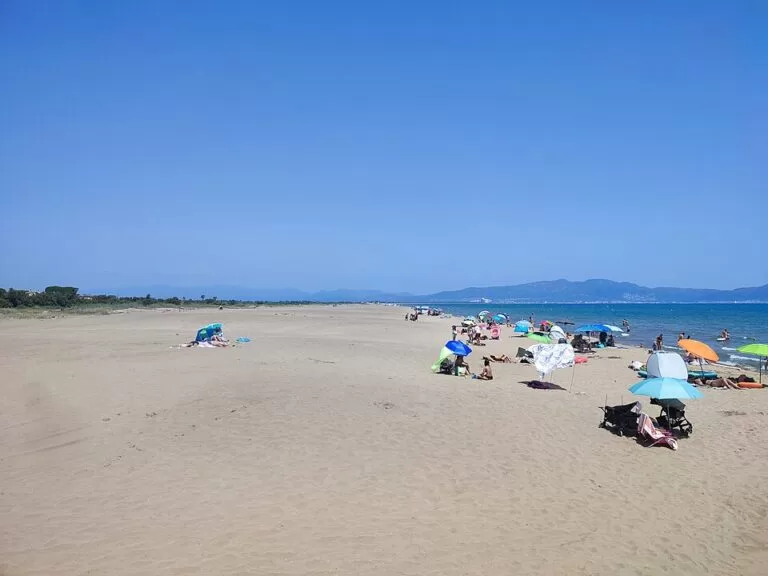
Sant Pere Pescador is a farming village on the river Fluvià in the middle of the Bay of Roses, about 2 km inland from a beach of dunes and fine sand that runs for some six kilometres. The beach is one of the best-known spots in Catalonia for kitesurfing and windsurfing, and its northern end lies inside the Aiguamolls de l’Empordà Natural Park. You drive or cycle from the village to car parks behind the dunes. It suits wind-sport fans, families who want shallow water and space, and campers; skip it if you want rocky coves, a lively old town or shelter from the wind.
Quick facts
- Names: Sant Pere Pescador (Catalan; also used in Spanish and English). The beach is Platja de Sant Pere Pescador, made up of several named sections.
- Where: Alt Empordà, Girona, in the centre of the Bay of Roses, between the current mouth of the Fluvià and its old mouth, the Riuet, on the boundary with L’Escala and L’Armentera.
- Coordinates: 42.1900, 3.0837 (village). The beach centre is at about 42.1904, 3.1105.
- Population: 1,804, at an altitude of 5 m (catalunya.com).
- Beach: dune beach of fine sand with a very gentle slope, given as six kilometres by the tourist board and “almost 7 km” in its family guide.
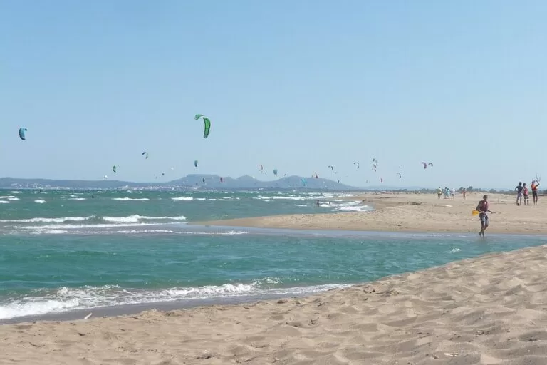
- Known for: kitesurfing and windsurfing; Spain’s tourist board says a world windsurfing championship is held here every year.
- Festa Major: end of June.
Access and parking
By car: the village sits on the Fluvià; the Carretera de la Platja leads east from the bridge towards the coast, a little over 2 km in a straight line (OpenStreetMap). The tourist board recommends a car or bicycle for the beach and the Aiguamolls, and walking in the village centre and along the Fluvià (catalunya.com).
Parking: OpenStreetMap maps several car parks behind the dunes, most marked free. At the southern end, by Platja del Cortal de la Vila, there are two large gravel car parks, one free with about 500 spaces and one paid with about 300. More free car parks are mapped in the middle of the beach, near Can Sopa. At La Gola, the northern section, the tourist board says cars are not allowed. We could not confirm tariffs or summer rules.
By bus: buses run to Figueres and L’Escala with variable frequencies (catalunya.com). OpenStreetMap shows a stop in each direction in the village centre. We could not open the timetables, and we found no mapped stop by the beach.
By bike: the EuroVelo 8 cycle route passes through the village, with a stage on to L’Armentera and Sant Martí d’Empúries (catalunya.com).
What to expect
The beach is wide, long and open, curving round the bay towards Roses. The tourist board describes shallow water and very fine sand, and dunes that make it feel wild; the constant wind is what draws kitesurfers and windsurfers, and it calls the beach one of the best areas in Catalonia for both sports (catalunya.com). It is divided into sections. The northernmost, La Gola, lies on both sides of the mouth of the Fluvià within the Aiguamolls de l’Empordà Natural Park, with lifeguards, showers, toilets and a restaurant but no car access (catalunya.com). Just south, Can Martinet has an area set aside for kitesurfing and a Blue Flag (catalunya.com). OpenStreetMap names Can Sopa, the Cortal de la Vila and La Cagarra further south, towards the Riuet and L’Escala.
The village is small and flat, built on land that was once the lake of Sant Pere, drained in the 17th and 18th centuries. It is first recorded in 974, as a possession of the monastery of Sant Pere de Rodes, and in 1466–1467, during the war between the Generalitat and King Joan II, the Parliament of Catalonia was installed here for a time. The parish church of Sant Pere is a plain Baroque building of the 17th century, badly damaged in the Civil War; the chapel of Sant Sebastià dates from the 16th century. Out in the fields are cortals, isolated farm buildings where livestock was raised (catalunya.com). Fruit orchards and fields surround it.
The Fluvià and the wetlands: near its mouth the river has a marina used for water sports. Kayak trips leave from the Club Nàutic de Sant Pere and paddle to the Caramany island nature reserve, a river island with willows, poplars and tamarisks; the trip takes about two hours (catalunya.com). The Aiguamolls de l’Empordà lagoons and reed beds are reached on foot or by bike from the village; the signposted Camí de Mig of Dos Rius has an information point next to the bridge.
Practical details
- Water sports: windsurfing, kitesurfing, kayaking, water skiing, wakeboarding and sailing on the beach and the Fluvià (catalunya.com). Learn with a school if you are new: the wind is the attraction and the risk.
- Other activities: cycling, horse riding, golf, hot-air balloon and microlight flights and skydiving are listed by the tourist board.
- Campsites: the tourist board counts seven campsites near the sea; OpenStreetMap maps several directly behind the dunes.
- Toilets: OpenStreetMap shows public toilets at several beach access points, one tagged wheelchair-accessible.
- Tourist office: OpenStreetMap places it beside the bridge over the Fluvià; we could not confirm its hours.
- Walking: the GR 92 coastal footpath passes through the municipality.
Accessibility and safety
The village and the approach roads are flat, and the beach slopes very gently into the water. Dune paths to the sand can be soft; we could not confirm boardwalks, ramps or amphibious chairs. The tramuntana, the cold, strong north wind of the Empordà, blows often here: it is what kitesurfers come for, but it can blow sand, make sunbathing unpleasant and push inflatables and paddle boards out to sea. Keep to the marked sport and swimming zones, and stay out of fenced dunes.
Best time to visit
The tourist board names summer as the time for the six kilometres of dune beach. Wind-sport visitors come whenever there is wind, often outside July and August. Spring and autumn are good for birdwatching in the Aiguamolls and for cycling; the Festa Major is at the end of June.
Nearby alternatives
- Aiguamolls de l’Empordà Natural Park, 3.8 km away: lagoons, hides and the white storks of the bay.
- Empúries, 6.8 km away: Greek and Roman ruins by the sea, suggested by the tourist board as an outing from here.
- Port de Roses, 10.5 km away: the marina and fishing port across the bay.
- Cala Montgó, 11.5 km away: a sheltered sandy cove if the wind is too strong on the open bay.
- Ciutadella de Roses, 11.1 km away: Greek Rhode inside a Renaissance fortress.
Distances are in a straight line from the village of Sant Pere Pescador.
FAQ
How long is the beach at Sant Pere Pescador?
About six kilometres by the Catalan tourist board’s count (“almost 7 km” in its family guide), split into named sections from La Gola at the Fluvià mouth south to the Riuet.
Is Sant Pere Pescador good for kitesurfing?
Yes. The tourist board calls it one of the best areas for kitesurfing and windsurfing in Catalonia, and Can Martinet beach has a zone set aside for kitesurfing.
Is there parking at Sant Pere Pescador beach?
Yes. OpenStreetMap shows several car parks behind the dunes, mostly free, including a free one of about 500 spaces at the southern end. Cars are not allowed at La Gola.
Is Sant Pere Pescador beach good for children?
The tourist board recommends it for families: the sand is very fine and the water shallow. Watch out on windy days, when inflatables can be blown offshore.
How far is Sant Pere Pescador from the beach?
The village is a little over 2 km from the sand in a straight line, along the Carretera de la Platja.
Sources and freshness
Checked 6 November 2026 · 8 sources Show
Checked 6 November 2026. Official: Catalan Tourist Board pages on Sant Pere Pescador (history, church, activities, transport, population, campsites), Sant Pere Pescador with the family, the beaches of La Gola and Can Martinet, kayaking on the Fluvià and EuroVelo 8 stage 6; Spain.info on Sant Pere Pescador (beaches and the windsurfing championship). The town hall website could not be opened from our tools. Car parks, bus stops, beach sections, toilets and distances: OpenStreetMap contributors (ODbL). Photos: Wikimedia Commons, licences as credited.
This place is part of our Costa Brava travel guide: Cadaqués, the Palafrugell coves and Tossa de Mar — see every town, beach and cove we have mapped on that coast.
How this page is made. CostaMap is written with an AI editorial system run by Ebizapple. This page is based on the sources listed above. Last updated 6 November 2026. Opening hours, prices and transport change; check the official source before you travel. How we work · Partner links and ads