
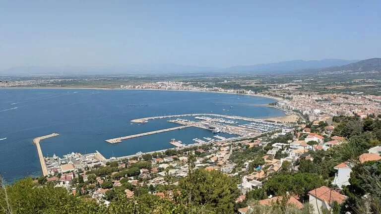
Port de Roses is the harbour of Roses on the northern Costa Brava, at the eastern end of the Bay of Roses where the Cap de Creus begins, a few metres from the town centre. It is both a fishing port, with its own fish market, and a marina in the northern basin, run by the town’s company Port de Roses SA. You come here to berth a boat, take a boat trip along the Cap de Creus, book a water sport, or walk the quays from the town beach. It suits sailors, divers and families staying in Roses. Skip it if you want a quiet village harbour: this is a busy working and leisure port.
Quick facts
- Names: Port de Roses in Catalan, Puerto de Rosas in Spanish; the marina is the Port Esportiu de Roses.
- Where: Avinguda de Rhode, Roses (Alt Empordà, Girona), at the eastern end of the Bay of Roses.
- Coordinates: 42.2534, 3.1782.
- Run by: a public port of Ports de la Generalitat; the marina is managed by the municipal company Port de Roses SA (Viquipèdia).
- Rebuilt: extended and refurbished in 2004 (Catalan tourist board).
- Boats: up to 45 m long; entrance channel 70 m wide (Catalan tourist board).
- Berths: we could not reach the operator’s or the port authority’s website, so we do not give a berth number here.
- Entry: the quays are open to the public and free.
Access and parking
By car: the port is at the eastern edge of Roses town, on the Avinguda de Rhode. On OpenStreetMap, surface car parks lie 0.3–0.5 km from the marina, including one on the Plaça Carles Fages de Climent, and there is more parking near the Castell de la Trinitat, 0.7 km away. The Catalan tourist board lists a car park among the port’s services.
By bus: the Roses bus station is on the Riera Ginjolers (Spain.info), about 1.3 km from the marina in a straight line. OpenStreetMap shows the town bus stops “Moll” and “Port” about 0.4–0.5 km from the marina.
On foot: the marina’s northern breakwater, the Moll de la Perola, separates it from the Platja de la Punta, a town beach right next to the marina (Viquipèdia).
What to expect
A working harbour in three parts. In the north is the marina; the Moll Comercial in the middle separates it from the fishing basin, and the Moll de la Llosa in the south separates the fishing port from the Platja dels Palangrers. The fish market (llotja) on the Moll Comercial is run by the Roses fishermen’s guild, the Confraria de Pescadors (Viquipèdia).
The Catalan tourist board says the harbour gives good shelter from the winds, which can blow very hard here, and that it is a good base for the beaches and coves of the Cap de Creus natural park; Cadaqués is 8 miles away by sea (Catalunya.com). On the quays you find a restaurant, chandleries, boat hire, car and motorbike rental, workshops and diving centres.
Boat trips and water sports: Els Blaus de Roses runs coastal cruises, glass-bottom boat trips and outings to coves reachable only by sea, and hires out boats (Catalunya.com). The Roses–Cap de Creus water sports station (Estació Nàutica) is based at the marina and covers canoeing, sailing, water skiing, windsurfing, diving and snorkelling (Catalunya.com). The Grup d’Esports Nàutics de Roses, founded in 1985, runs the municipal water sports school (Viquipèdia).
For visiting boats
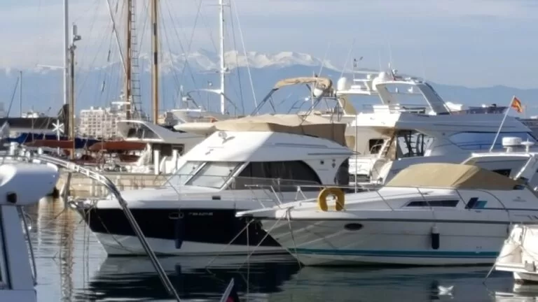
We could reach only the Catalan tourist board’s summary, not the marina’s own website. That summary describes:
- The marina basin in the northern part of the harbour, for boats up to 45 m, with a share of berths for visitors. Berths have water, electricity and Wi-Fi.
- A slipway, waste water collection, 24-hour surveillance and a fuel station with a transit quay beside it.
- A harbour office with a communications service and weather and tourist information.
- Toilets with showers, a laundry, a medical service, a car park, a sailing school and a school for yachting activities.
- An entrance channel 70 m wide; depths inside the harbour of 3 to 6 m.
Contact the marina for berth rates and availability before you sail in.
Accessibility and safety
The promenade and quays are flat. OpenStreetMap marks a free wheelchair-accessible public toilet near the Platja de la Punta, and a paid one (0.60 euro, open 24 hours, wheelchair accessible) closer to the port. The Catalan tourist board warns that the wind can blow very hard here; stay off the breakwaters in a storm, and keep children away from the quay edges. Do not swim in the harbour; the Platja de la Punta is next door.
Best time to visit
Check seasons and times for boat trips and water sports with the operators before you go. In summer, come in the morning, before the town beach and the car parks fill up, and pick a calm day for a trip along the Cap de Creus.
Nearby alternatives
- Ciutadella de Roses, 1.7 km away: the Renaissance citadel with the remains of Greek Rhode.
- Aiguamolls de l’Empordà Natural Park, 6.9 km away: wetlands at the back of the bay, good for birdwatching.
- Cadaqués, 9.0 km away: the white village on the far side of the Cap de Creus.
- Salvador Dalí House Museum, 9.9 km away: Dalí’s house at Portlligat.
- Cap de Creus, 13.5 km away: the natural park and lighthouse at the tip of the peninsula.
- Cala Montgó, 16.2 km away: a cove at L’Escala, across the bay.
Distances are in a straight line from the marina.
FAQ
Is there parking at the port of Roses?
Yes. OpenStreetMap shows surface car parks 0.3–0.5 km from the marina, and the port lists a car park among its services.
How do I get to Roses without a car?
By bus. The Roses bus station is on the Riera Ginjolers, about 1.3 km from the marina, and town buses stop near the port.
Can you take a boat trip from Roses to Cap de Creus?
Yes. Els Blaus de Roses runs cruises and glass-bottom boat trips along the coast and to coves reachable only by sea.
Who runs the marina in Roses?
The municipal company Port de Roses SA manages the marina; the harbour itself belongs to Ports de la Generalitat.
Can you swim near the port of Roses?
Not in the harbour, but the Platja de la Punta starts at the marina’s northern breakwater.
Sources and freshness
Checked 6 November 2026 · 8 sources Show
Checked 6 November 2026. Official tourism: Catalan tourist board on the Port de Roses (shelter, 2004 works, entrance, boat sizes, services), Els Blaus de Roses and the Estació Nàutica Roses-Cap de Creus; Spain.info on Roses and the Roses bus station. Background: Viquipèdia, Port de Roses (management, quays, fish market, water sports school). Location, car parks, bus stops, toilets and distances: OpenStreetMap (OpenStreetMap contributors, ODbL). The marina’s own website, the Roses town site and Ports de la Generalitat could not be reached for this update. Photos: Wikimedia Commons, licences as credited.
How this page is made. CostaMap is written with an AI editorial system run by Ebizapple. This page is based on the sources listed above. Last updated 6 November 2026. Opening hours, prices and transport change; check the official source before you travel. How we work · Partner links and ads