
Cadaqués to Roses walk (GR 92, Cap de Creus)
Hiking trailThe Cadaqués to Roses walk is stage 3 of the GR 92 coastal trail: a waymarked 21.66 km route along the southern edge of the Cap de Creus peninsula, from Cadaqués past the coves of Jòncols and Montjoi to the town of Roses. The Catalan tourist board gives 5 h 5 min, about 1,068 m of climbing and the same down, rated for beginners and walkable all year. From Cap Norfeu onwards the path follows the coastline for the rest of the stage. It suits fit walkers who want a long, wild coastal day with a bus back; skip it if you want a short stroll or shade, as it is a long day in the sun.
Quick facts
- Names: GR 92 stage 3, Cadaqués–Roses (GR 92 etapa 3, de Cadaqués a Roses); much of it is known locally as the camí de ronda.
- Where: the south coast of the Cap de Creus peninsula, Alt Empordà (Girona), inside the Cap de Creus Natural Park for much of the way.
- Start coordinates: 42.2885, 3.2782 (Platja Gran, Cadaqués, from OpenStreetMap). The stage ends in Roses, about 9 km away in a straight line.
- Distance: 21.66 km one way (catalunya.com).
- Height: +1,068 m / −1,070 m.
- Time: 5 h 5 min.
- Difficulty: beginners, on foot, according to the tourist board’s route sheet.
- Waymarking: yes, GR 92.
- Season: all year round.
- Entry: free.
Access and parking
Start in Cadaqués: OpenStreetMap shows a free surface car park (P1) on the north-east side of the town, about 0.5 km from the Platja Gran, and paid car parks near the bus station. Parking in Cadaqués is limited, so leaving the car in Roses and taking the bus to the start is worth considering.
Getting back: this is a one-way walk. OpenStreetMap maps two Moventis Sarfa bus routes that link Cadaqués and Roses: the e6 (Cadaqués–Roses–Figueres) and line 4 (Cadaqués–Roses–Girona). The Cadaqués bus station is about 0.5 km from the Platja Gran, and Roses has a bus station near its tourist office. We did not check timetables.
Tourist offices: the route sheet lists the tourist offices of Cadaqués and Roses as contacts.
What to expect
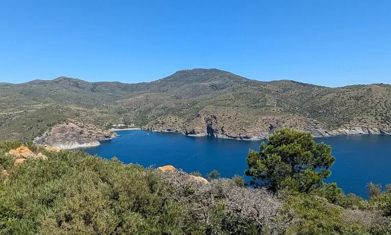
According to the official stage description, the route leaves Cadaqués behind the beach of Llané and follows the old track to Cala Jòncols. Just before the cove, in the Jòncols stream bed, you pass La Barraca, a traditional building by the beach. The path then crosses the isthmus of Cap Norfeu, one of the best-known spots in the Cap de Creus Natural Park, and from there it traces the coastline for the rest of the stage. The sheet notes that outside the summer season the landscape is quiet.
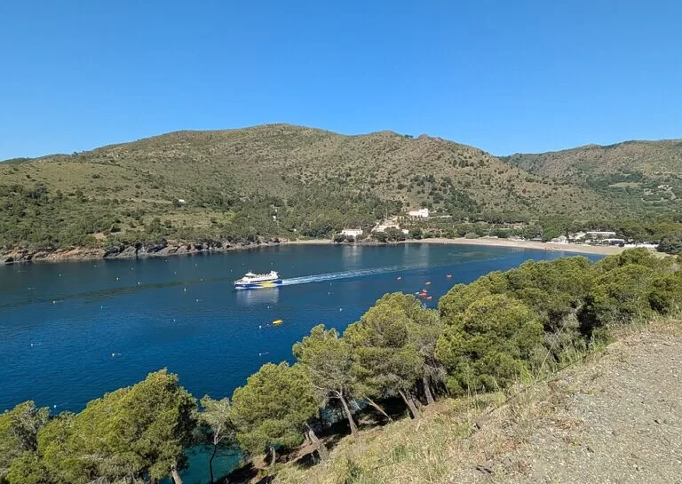
Cala Calitjàs comes before Cala Montjoi, known for its croissant shape. Montjoi is quite enclosed, so its water is calm, with little wind or swell, but it looks dark. Soon after Punta Falconera, which the sheet calls the southernmost tip of the Cap de Creus, the path enters the built-up area of Roses at L’Almadrava. The sheet singles out the views from the points of L’Ullastrell and L’Omella. Then you reach the Roses lighthouse beside the Trinitat castle, and finally the town of Roses, where the Ciutadella is worth a visit.
Practical details
- What to bring: the route sheet advises suitable footwear, water and snacks, sun protection (above all in summer) and a torch in case it gets dark.
- Navigation: follow the GR 92 waymarks and carry a map; the sheet warns that your phone may fail where there is no signal.
- Swimming: the route passes the coves of Jòncols, Calitjàs and Montjoi, so bring swimwear. We found no information on lifeguards at these coves.
- Toilets: OpenStreetMap shows free public toilets in central Cadaqués and public toilets in Roses near the tourist office.
- Shorter options: walking only part of the stage, for example out from Roses to the lighthouse and L’Almadrava, keeps you on the same waymarked path; we found no official figures for partial sections.
- Next stages: the tourist board also describes stage 2, from Llançà harbour to Cadaqués, and stage 4, from Roses to El Cortalet.
Accessibility and safety
The tourist board rates this stage for beginners, but 21.66 km with over 1,000 m of climbing is a long day; turn back early if you are not on schedule. The sheet’s own advice is to carry water and a torch, protect yourself from the sun and carry a map in case your phone has no signal. We could not confirm step-free access to any part of the route, so do not plan on it with a wheelchair or pushchair.
Best time to visit
The route sheet lists the stage as walkable all year round and notes that the landscape is at its quietest outside the summer season. In summer, start early, carry extra water and plan your swim stops at Jòncols or Montjoi.
Nearby alternatives
- Cadaqués, at the start: the whitewashed town on its bay.
- Cadaqués to Cap de Creus coastal walk, from the same start: a shorter walk north-east to the lighthouse at the tip of the cape.
- Salvador Dalí House Museum, 0.8 km away: Dalí’s home at Portlligat.
- Cap de Creus, 4.6 km away: the natural park this walk crosses.
- Ciutadella de Roses, 9.2 km away: the fortified citadel in Roses, at the end of the stage.
- Port de Roses, 9.1 km away: the harbour in Roses.
Distances are in a straight line from the start in Cadaqués.
FAQ
How long is the walk from Cadaqués to Roses?
The GR 92 stage is 21.66 km one way, with about 1,068 m of climbing. The Catalan tourist board gives 5 h 5 min of walking.
Can you get the bus back from Roses to Cadaqués?
Yes. OpenStreetMap maps the Moventis Sarfa e6 and line 4 buses between Roses and Cadaqués. Check the timetable before you set off.
Is there parking in Cadaqués for the walk?
OpenStreetMap shows a free surface car park (P1) about 0.5 km from the Platja Gran and paid car parks near the bus station. Space is limited.
Can you swim on the Cadaqués to Roses walk?
Yes. The route passes Cala Jòncols, Cala Calitjàs and Cala Montjoi, where the tourist board says the water is calm. We found no information on lifeguards.
Is the Cadaqués to Roses walk difficult?
The tourist board grades it for beginners, but it is long: 21.66 km and more than 5 hours, with over 1,000 m of total climbing.
Sources and freshness
Checked 6 November 2026 · 2 sources Show
Checked 6 November 2026. Official: Catalan Tourist Board (catalunya.com) GR 92 stage 3, Cadaqués to Roses (distance, time, height, difficulty, season, waymarking, route description, tips). Location, car parks, bus stations, bus lines, toilets and distances: OpenStreetMap contributors (ODbL). Photos: Wikimedia Commons, licences as credited.
How this page is made. CostaMap is written with an AI editorial system run by Ebizapple. This page is based on the sources listed above. Last updated 6 November 2026. Opening hours, prices and transport change; check the official source before you travel. How we work · Partner links and ads