
Cadaqués to Cap de Creus coastal walk
Hiking trailThe coastal walk from Cadaqués to Cap de Creus is a 9.2 km one-way route from the entrance of Cadaqués to the Cap de Creus lighthouse, at the tip of the Cap de Creus Natural Park. The Cap de Creus Natural Park rates it moderate, with 235 m of ascent, 165 m of descent and about 3 h 15 min of walking. It starts at the tourist office at the entrance to the village, follows the shore past Portlligat and Salvador Dalí’s house, then takes the old camí de ronda to the lighthouse. It suits fit walkers in good shoes. Skip it in strong tramuntana wind, in midsummer heat without plenty of water, or if you need a step-free path.
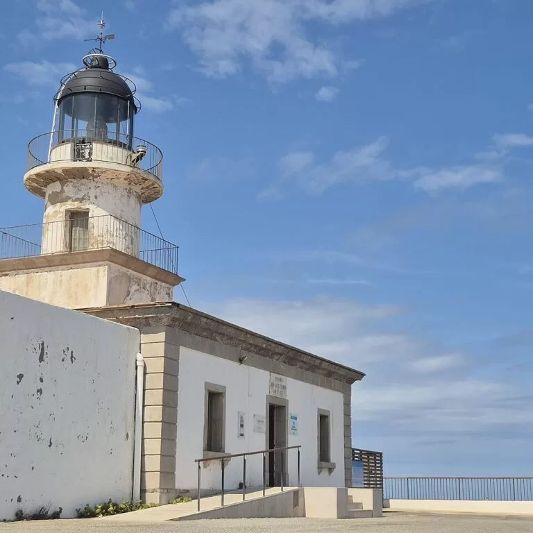
Quick facts
- Names: official park route 19, “De Cadaqués al cap de Creus per la costa” (Catalan) or “De Cadaqués al Cap de Creus por la costa” (Spanish). The last stretch follows the old lighthouse path, the camí de ronda.
- Where: Cadaqués, Alt Empordà (Girona), inside the Cap de Creus Natural Park.
- Start coordinates: 42.2887, 3.2773 (Cadaqués tourist office). Finish: Cap de Creus lighthouse, 42.3189, 3.3159.
- Distance: 9.2 km one way (linear route).
- Ascent / descent: +235 m / −165 m.
- Time: about 3 h 15 min one way (park estimate).
- Difficulty: moderate (SENDIF scale). No equipped or exposed sections.
- Waymarking: marker posts and yellow paint.
- Season: all year, according to the park.
- Entry: free. Walkers can always reach the cape on foot.
Access and parking
Start: the park sheet starts the route at the tourist office at the entrance to Cadaqués, which you reach by the GIV-614 road. The sheet gives about 200 parking spaces, on the street or in paid car parks. On OpenStreetMap the paid car parks and the Cadaqués bus station are all within about 400 m of the tourist office.
Corral d’en Morell: this car park sits on the route, just above Portlligat. On days when the cape road is closed to cars (see below), it is a free 120-space car park for Cap de Creus visitors, with toilets, an information point and the shuttle stop (park FAQ, 2026).
Getting back: the route is one way. On regulated days a shuttle runs from the lighthouse car park back to Corral d’en Morell, and some trips go on to the Cadaqués bus station. A single ticket costs 4 euros and a return 7 euros for ages 14 to 65 (park FAQ, checked November 2026). Outside those days, plan to walk back or arrange a lift.
What to expect
The park’s route sheet describes it stage by stage. You start at the tourist office, go down to Platja Gran in the centre of Cadaqués, with its statue of Salvador Dalí, and follow the seafront promenade. After Ses Oliveres beach the route crosses the Els Caials housing area to Es Calders beach, then follows a stony stretch by the sea to Portlligat.
Portlligat is the coarse sand and pebble beach with small fishing boats, next to the Salvador Dalí House-Museum, where Dalí lived and worked until Gala’s death in 1982. Visits need a booking. Behind the beach a small path climbs the Portlligat stream bed to the Corral d’en Morell. It then crosses the road and follows the signed camí de ronda.
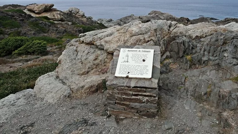
The old path has paved sections and dry-stone walls. It passes Ses Figuretes, where holed and wind-carved rocks suggest sculpted shapes, then Cala Jugadora, a cove at the foot of the lighthouse. The last section climbs to the Cap de Creus lighthouse, a working 19th-century lighthouse built on the foundations of an old watchtower. It holds a park information point and marks the end of the GR 11 trans-Pyrenean trail.
Rules and practical details
The tip of the cape is an Integral Natural Reserve, the strictest protection a Catalan natural park has. Walkers must stay on the signed paths. The park sheet lists these rules:
- Swimming is only allowed at Cala Culip, Cala Gentils and Cala Jugadora.
- Dogs must be on a lead.
- No fires, drones, camping, fishing from the shore or spearfishing.
- Take your rubbish home and do not make noise.
Car restrictions: in 2026 the road from Cadaqués to the lighthouse was closed to cars and motorbikes on set days, monitored by camera, with fines. The closures covered spring weekends and holidays, every day in July and August (9:30–21:30) and weekends in autumn. In November 2026 only the 1st was a closed day (park access page). Walkers and cyclists are not affected.
Fire risk: when the Catalan Pla Alfa fire-risk alert reaches level 4, access to the natural park is closed. Check before summer walks.
Accessibility and safety
This is a rough coastal path with stony stretches and climbs, so it is not suitable for wheelchairs or pushchairs. The shuttle buses are adapted for people with reduced mobility, and blue-badge holders can drive to the cape after registering their plate with the town hall (park FAQ). The park warns that the weather can change quickly and that strong wind brings a risk of falls. Carry water and food, tell someone your plan and call 112 in an emergency.
Best time to visit
The park lists the route as walkable all year. Spring and autumn avoid the summer heat on this open, rocky ground. Avoid days of strong tramuntana, the wind that the park says has shaped this landscape. Check the meteo.cat forecast, as the park recommends.
Nearby alternatives
- Cap de Creus Natural Park, 4.6 km away: our guide to the whole park, its coves and its other routes.
- Cadaqués, at the start: the village where the walk begins.
- Salvador Dalí House-Museum, 0.9 km away: Dalí’s home at Portlligat, on the route (booking needed).
- Ciutadella de Roses, 9.2 km away: the historic site in Roses, on the south side of the cape.
- Aiguamolls de l’Empordà Natural Park, 16 km away: the wetland natural park on the Empordà plain.
Distances are in a straight line from the Cadaqués tourist office.
FAQ
How long is the walk from Cadaqués to Cap de Creus?
9.2 km one way along the coast, with 235 m of ascent. The park estimates about 3 h 15 min. An inland route via the GR 11 is 11.2 km and about 4 hours.
Where does the walk start, and is there parking?
It starts at the tourist office at the entrance to Cadaqués, where the park counts about 200 spaces on the street and in paid car parks. On regulated days you can also park for free at Corral d’en Morell, on the route.
Can you drive to Cap de Creus instead?
Not on regulated days: in 2026 the lighthouse road was closed to cars on set days from spring to autumn, including every day in July and August. A shuttle runs from Corral d’en Morell on those days (7 euros return for adults).
Can you swim on the way?
Only at Cala Culip, Cala Gentils and Cala Jugadora; the park allows swimming at no other spot in the reserve. Cala Jugadora is on the route, just below the lighthouse.
Is it suitable for children and dogs?
The park rates it moderate, so it suits children used to hiking. Dogs are allowed on a lead, and non-dangerous dogs can ride the shuttle on a lead (maximum two per bus).
Sources and freshness
Checked 6 November 2026 · 6 sources Show
Checked 6 November 2026. Official: Parc Natural de Cap de Creus (Generalitat de Catalunya), route 19 sheet, Cadaqués to Cap de Creus by the coast (distance, ascent, time, difficulty, parking, stages, rules), route 24 sheet, inland route, walking routes, how to get there and the 2026 access FAQ (version 28 August 2026: car restrictions, shuttle, prices, Corral d’en Morell). Location, car parks, bus station and distances: OpenStreetMap contributors (ODbL). Photos: Wikimedia Commons, licences as credited.
How this page is made. CostaMap is written with an AI editorial system run by Ebizapple. This page is based on the sources listed above. Last updated 6 November 2026. Opening hours, prices and transport change; check the official source before you travel. How we work · Partner links and ads