
Alcanar and Les Cases d’Alcanar
TownAlcanar is the southernmost town in Catalonia, in Tarragona province at the foot of the Serra del Montsià, just north of the border with Vinaròs in the Valencian Region. Its coast, with the fishing village of Les Cases d’Alcanar and the holiday area of Alcanar-Platja, is reached from the N-340 and lies about 12 km south-west of La Ràpita in a straight line. Spain.info counts 12 km of calm beaches and coves, and Les Cases is known for prawns and rice dishes. It suits travellers who want a quiet seafront, seafood and an easy base for both the Ebro Delta and Peñíscola; skip it if you want long golden-sand beaches or nightlife.
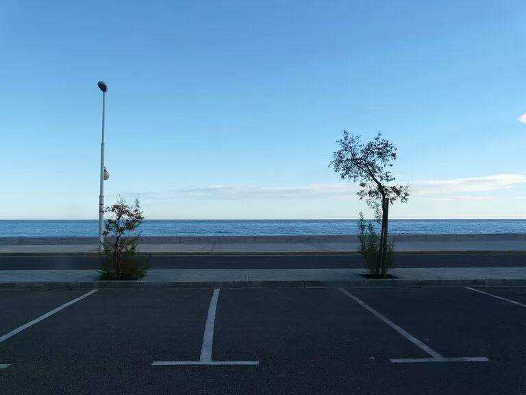
Quick facts
- Names: Alcanar (same in Catalan and Spanish); Les Cases d’Alcanar is also written Las Casas de Alcanar in Spanish.
- Where: Montsià comarca, Tarragona province, Catalonia; the next municipality south is Vinaròs, in Castellón province (English Wikipedia).
- Coordinates: 40.5439, 0.4808 (Alcanar town, OpenStreetMap); Les Cases d’Alcanar 40.5528, 0.5307.
- Population: 10,104 (municipal register, 2025): Alcanar 7,494, Les Cases d’Alcanar 1,391, Alcanar-Platja 988 and La Selleta 96 (English Wikipedia).
- Coast: 12 km of beaches and coves (spain.info).
- Distance to the Ebro Delta Natural Park: about 40 km (spain.info).
- Known for: prawns and seafood at Les Cases, citrus groves, the Iberian site of La Moleta del Remei and coastal watchtowers.
Getting there and around
By car: the N-340 runs between the town and the sea, and spain.info names it as the road to the beach at Les Cases. The town itself lies a few kilometres inland; Les Cases is about 4.3 km from it in a straight line (OpenStreetMap). Vinaròs is about 8 km south and La Ràpita about 12 km north-east, both in a straight line.
By air: Reus airport is about 88 km away in a straight line, and Castelló and València airports lie to the south. Road distances are longer.
Public transport: we could not confirm current train or bus services to Alcanar from an official source; check with the operators before you travel.
The coast: Les Cases d’Alcanar and the beaches
Les Cases d’Alcanar is a small fishing village next to the town, which spain.info picks out for its traditional seafood cooking: prawns, rice dishes and fish soups. English Wikipedia describes it as old and relatively quiet, and with Alcanar-Platja it is where most visitors stay in summer. Fishing, especially for prawns, is still important in these smaller villages. OpenStreetMap maps the harbour of Les Cases in the centre of the village.
- Les Cases d’Alcanar beach – 300 m of gravel in the village, with a promenade, access ramps for wheelchairs, showers, toilets, a children’s area and a tourist office; spain.info lists it as a Blue Flag beach and rates it as busy (spain.info).
- El Marjal – 3,000 m of sand split in two by the point of L’Estanyet, with a campsite and a few low houses; towards the Castellón side small low cliffs begin (spain.info).
The coast faces east and gets moderate waves rather than the flat water of the Ebro Delta bays; spain.info classes the bathing conditions at Les Cases as moderate swell. For long, shallow sandy beaches, drive north to the delta: the Trabucador sandbar is about 22 km away in a straight line.
What to see
La Moleta del Remei: spain.info dates the origins of Alcanar to the Iberian settlement of Moleta del Remei, inhabited from the 7th to the 2nd centuries BC; OpenStreetMap marks the hill about 1.6 km north of the town. Romans and later Muslims followed, and spain.info credits the Islamic period with irrigation techniques still used today.
The Remei shrine: next to the hill stands the Ermita de la Mare de Déu del Remei, built in Gothic style in the late 16th and early 17th centuries and enlarged in the 18th with a belltower and dome. The old guest house keeps a mosaic of the Battle of Lepanto that once formed the floor of the chapel and is now badly worn (English Wikipedia).
The old town: the parish church of Sant Miquel is Renaissance, with a single nave, side chapels and a square belltower (English Wikipedia). Of the medieval walls, spain.info notes that the Torre del Carrer Nou still stands.
Coastal towers: square defence towers were built along the shore between 1530 and 1630 against pirate raids; most have been restored and are now homes or summer houses (English Wikipedia). Spain.info names the tower of Sant Pere.
History in short: Alcanar received a charter in 1239, but English Wikipedia treats the new charter of 1252 as its real foundation; it belonged to Ulldecona until 1449. Its economy today mixes tourism and second homes with oranges and clementines inland and prawn fishing on the coast. In July 1978 a tanker lorry exploded beside the Los Alfaques campsite on this coast, killing 217 people.
Food
The kitchen is seafood first: prawns, rice dishes and fish soups at Les Cases (spain.info). The citrus groves around the town are the other local product (English Wikipedia). For Ebro Delta rice and mussels, the restaurants of La Ràpita and Deltebre are within half an hour’s drive.
Practical details
Where to stay: Les Cases d’Alcanar for a village by the sea with restaurants in walking distance; Alcanar-Platja for holiday flats and campsites along the coast; the town for a quieter base among the orchards. A car is useful for everything beyond the village.
Water sports: spain.info lists water sports, hiking and excursions through the protected natural areas as the main activities. Les Cases has a nautical club.
Walks: the Serra del Montsià rises behind the town and its foothills reach the coast (English Wikipedia). We could not confirm marked routes from an official source.
Accessibility and safety
Les Cases beach has a promenade and access ramps for wheelchair users (spain.info). The other beaches have fewer services, and El Marjal has low cliffs at its southern end. There is moderate swell on some days, so check the flag at staffed beaches. We could not confirm the 2026 lifeguard season.
Best time to visit
June and September for swimming with fewer people. In July and August Les Cases and Alcanar-Platja are at their busiest. Spring and autumn suit walks on the Montsià and day trips to the Ebro Delta.
Nearby alternatives
- Vinaròs, 8.2 km away: the first town of the Costa del Azahar, with a fishing port.
- Peñíscola, 21.5 km away: the walled old town on a rock in the sea.
- Peñíscola Castle, 21.5 km away: the Templar castle and papal seat above the town.
- Serra d’Irta, 26.6 km away: an unbuilt coastal range with coves and a coastal path.
- Ebro Delta, 28.5 km away: lagoons, rice fields and the Trabucador sandbar.
- L’Ametlla de Mar, 46.5 km away: a tuna-fishing port with small coves north of the delta.
Distances are in a straight line from Alcanar town. For the whole southern end of the Costa Dorada, see our Ebro Delta and southern Costa Dorada guide.
FAQ
Where is Alcanar?
At the southern tip of Catalonia, in Tarragona province, between La Ràpita and Vinaròs. It is the last Catalan town before the Valencian Region.
Does Alcanar have beaches?
Yes, about 12 km of beaches and coves (spain.info). Les Cases d’Alcanar has a 300 m gravel town beach with a promenade, and El Marjal is 3 km of sand.
What is Les Cases d’Alcanar known for?
It is a small fishing village known for seafood, especially prawns, rice dishes and fish soups.
How far is Alcanar from the Ebro Delta?
Spain.info gives about 40 km to the natural park. The nearest delta beaches, at the Trabucador, are about 22 km away in a straight line.
Is Alcanar on the Costa Dorada?
It lies at the southern end of the Costa Dorada in Tarragona province, though the area is promoted as the Terres de l’Ebre.
Sources and freshness
Checked 7 November 2026 · 5 sources Show
Checked 7 November 2026. Official: spain.info, Alcanar (Turespaña: history, 12 km of coast, Les Cases, distance to the park) and its beach sheets for Les Cases d’Alcanar and El Marjal. Background: English Wikipedia (population, villages, history, churches, towers, economy). Location, harbour, Moleta del Remei and distances: OpenStreetMap contributors (ODbL). The Alcanar town hall website could not be reached when we checked. Not confirmed: train and bus services, opening of the shrine, 2026 Blue Flags, marked walking routes. Photo: Wikimedia Commons, licence as credited.
This place is part of our Costa Dorada map and travel guide: Roman Tarragona, Salou and the Ebro Delta — see every town, beach and cove we have mapped on that coast.
How this page is made. CostaMap is written with an AI editorial system run by Ebizapple. This page is based on the sources listed above. Last updated 6 November 2026. Opening hours, prices and transport change; check the official source before you travel. How we work · Partner links and ads