
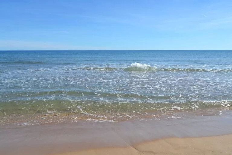
L’Ahuir beach (Platja de l’Ahuir) is the wild northern end of Gandia’s coast, about 2 km of fine sand behind a protected ridge of dunes between the Platja Nord and the beach of Xeraco, about 7 km from Gandia old town. You reach it on foot along the wooden boardwalks through the dunes, from the north end of the Platja Nord or from a free car park beside the beach. It is an authorised nudist beach with lifeguards and a Blue Flag; it suits naturists, walkers and anyone who wants space and no buildings, and is the wrong choice if you want shade, a promenade and bars on the sand.
Quick facts
- Names: Platja de l’Ahuir in Valencian, also written l’Auir; Playa de l’Ahuir or Playa del Ahuir in Spanish.
- Where: Carrer Ribera Baixa, 46730 Gandia (Valencia), at the northern tip of the municipality, next to Xeraco.
- Coordinates: 39.0293, -0.1803.
- Length: about 2 km of fine sand (Comunitat Valenciana tourism; OpenStreetMap maps the beach at about 2.3 km end to end).
- Type: natural beach behind a dune ridge, authorised nudist beach, smoke-free beach.
- Labels: Blue Flag, ISO 9001, ISO 14001, EMAS and the S for sustainability, as listed by the regional tourist board.
- Services: lifeguards, police presence, boardwalks, foot showers and parking.
Access and parking
On foot from the Platja Nord: L’Ahuir begins where the Platja Nord ends in the north (OpenStreetMap). The wooden walkways lead through the dunes to the sand; the boardwalk lets you walk the whole way between Gandia and Xeraco (Comunitat Valenciana tourism).
By car: OpenStreetMap shows a free surface car park beside the beach, about 130 m from the sand at its southern half, with two bicycle stands of ten places each next to it, and more free car parks at the northern end of the Platja Nord (OpenStreetMap).
By bus and train: Gandia station, the end of Cercanías line C1 from València, is about 7 km away in the town. OpenStreetMap shows a stop of the La Marina Gandiense bus company (stop 19) about 1.2 km south of the middle of the beach, at the north end of the Platja Nord. We could not confirm lines or timetables.
What to expect
The regional tourist board calls it one of the few virgin beaches left in the Mediterranean, with the highest level of protection, and describes a dune ridge with native plants, palms and fine sand, with Mondúver mountain rising inland behind it (Comunitat Valenciana tourism). Spain.info calls it the quiet nudist beach of the most northerly part of Gandia’s coast, surrounded by dunes (spain.info).
- Dunes and boardwalks: the dunes are well conserved and protected by wooden walkways, so stay on them; do not cut across the dunes or sit on the vegetation.
- Naturism: L’Ahuir is an authorised nudist beach. OpenStreetMap shows a city sign with the rules for the public nudist beach near the middle of the beach.
- Smoke-free: it is part of the Playa sin Humos scheme, which asks people not to smoke on the beach.
- Safety: lifeguards and police patrol the beach in season.
- The north end: walk north and you reach Xeraco’s beach, 3 km long and over 80 m wide with its own dunes (Comunitat Valenciana tourism). OpenStreetMap marks a small nature reserve at the mouth of the River Xeraco and a viewpoint over the River Vaca there.
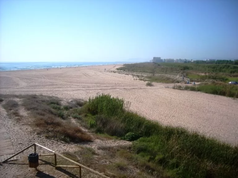
Some sources disagree on the length. The regional tourist board’s beach page gives 2 km, while its feature on Gandia’s beaches speaks of more than 3,000 m flanked by dunes (Comunitat Valenciana tourism); the difference is probably where the boundary with the Platja Nord and Xeraco is drawn.
Practical details
- Services: the regional tourist board lists parking, boardwalks, foot showers, lifeguards and sea-state information, but no bars or toilets. OpenStreetMap shows summer beach bars at the Xeraco end, and bars, restaurants, toilets and a Red Cross first-aid post at the north end of the Platja Nord.
- Bring: shade and water.
- Price: free access.
- Contact: Gandia tourist office, +34 962 877 788.
- Dogs: we could not confirm the dog rules for L’Ahuir. Do not assume dogs are allowed in summer.
Accessibility and safety
Unlike the Platja Nord, which has adapted walkways and water chairs, L’Ahuir is not listed as an accessible beach: reaching the sand means walking along the boardwalks over the dunes. Swim only when the lifeguards are on duty and follow the flags: green for normal bathing, yellow for caution and red for no swimming. Call 112 in an emergency. There is no natural shade.
Best time to visit
For swimming, come in the summer season, when the lifeguards are on duty; we could not confirm the 2026 lifeguard dates. In July and August arrive in the morning, before the sand gets hot. Outside the season the beach is at its best for long walks, with the Mondúver behind the dunes and the boardwalk all the way to Xeraco, but expect no lifeguards. There is no shade at any time of year.
Nearby alternatives
- Camping La Naranja, 2.8 km away: a campsite in Gandia’s beach district.
- Camping & Bungalows San Vicente, 3.5 km away: by the beach of Xeraco, north of L’Ahuir.
- Gandia, 6.9 km away: the town, the Platja Nord and the Grau.
- Ducal Palace of the Borgias, 7.1 km away: the Gothic palace of the Dukes of Gandia.
- Valldigna Monastery, 10.9 km away: the Cistercian monastery in Simat.
- Cullera, 16.0 km away: castle hill and beaches at the mouth of the Júcar.
Distances are in a straight line from the middle of the beach.
FAQ
Is L’Ahuir a nudist beach?
Yes. The regional tourist board lists L’Ahuir as an authorised nudist beach, and the city has put up a sign with the rules.
Is there parking at L’Ahuir beach?
Yes. OpenStreetMap shows a free surface car park beside the beach and more free car parks at the north end of the Platja Nord.
How do I get to L’Ahuir from Gandia?
Go to the north end of the Platja Nord and follow the wooden boardwalks through the dunes. By car it is about 7 km from the old town; trains from València stop at Gandia station.
Are there lifeguards at L’Ahuir?
Yes, in season. The tourist board says the beach has lifeguards and a police presence. Outside summer there may be none.
Are there beach bars at L’Ahuir?
The tourist board lists none on the beach. OpenStreetMap shows summer beach bars at the Xeraco end and plenty of bars at the north end of the Platja Nord.
Sources and freshness
Checked 7 November 2026 · 8 sources Show
Checked 7 November 2026. Official: Comunitat Valenciana tourism on L’Ahuir beach (length, dunes, nudism, labels, services), Gandia’s beaches, the Platja Nord, Xeraco beach and Gandia; spain.info on Gandia. Beach flags and the emergency number: the Generalitat’s 112 service, as summarised in our Costa de Valencia guide. Location, car parks, bus stop, signs and distances: OpenStreetMap contributors (ODbL). Visit Gandia (visitgandia.com) could not be reached from here. Photos: Wikimedia Commons, licences as credited.
This place is part of our Costa Valenciana Map: Valencia, Gandia and the Albufera — see every town, beach and cove we have mapped on that coast.
How this page is made. CostaMap is written with an AI editorial system run by Ebizapple. This page is based on the sources listed above. Last updated 6 November 2026. Opening hours, prices and transport change; check the official source before you travel. How we work · Partner links and ads