
Costa del Azahar · North centre
Peñíscola and the Serra d’Irta travel guide: Peñíscola to Alcossebre
Pope Luna’s castle on its rock above Playa Norte, then the wild, unbuilt coast of the Serra d’Irta natural park, Templar castles in the hills and the low-rise beaches of Alcossebre.
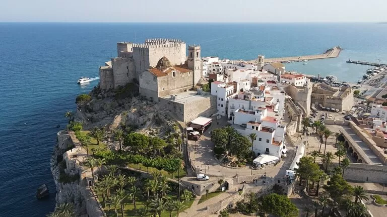
Peñíscola from the air · Photo: Lodevermeiren, CC BY-SA 4.0
Part of the Costa del Azahar guide · North centre: Peñíscola and the Serra d’Irta
Peñíscola and the Serra d’Irta is the stretch of the Costa del Azahar in northern Castellón between Peñíscola and Alcossebre, about 18 km apart in a straight line, covering the municipalities of Peñíscola, Santa Magdalena de Polpís and Alcalà de Xivert-Alcossebre. Between the two resorts lies the Serra d’Irta, a natural park whose coast has never been built on, so the area combines a castle town with a long beach, a wild middle and a quieter resort at the southern end (Turisme Comunitat Valenciana). This guide covers each town from north to south, the beaches and coves, what to do, where to stay, how to get there and a two-day route.
At a glance
- Where the Baix Maestrat coast of Castellón province, from Playa Norte in Peñíscola, at the Benicarló boundary, south through the Serra d’Irta to La Romana beach in Alcossebre.
- Towns Peñíscola on the coast; Santa Magdalena de Polpís and Alcalà de Xivert inland; Alcossebre, Capicorb and Les Fonts on the southern coast.
- Best for a castle town with a long family beach, unspoilt coves and coastal walks, Templar history, and a quiet low-rise resort.
- Getting there Castellón Airport is about 33 km from Peñíscola in a straight line; trains stop at Benicarló-Peñíscola in Benicarló and at Alcalà de Xivert; the N-340 and the AP-7 run behind the coast.
- On CostaMap guides to Peñíscola, Peñíscola Castle, Playa Norte, the Serra d’Irta, Santa Magdalena de Polpís, Alcalà de Xivert, Xivert Castle and Alcossebre, plus two campsites.
Map of Peñíscola and the Serra d’Irta
The map shows the places in this stretch that have a CostaMap page. Tick a place type to filter, and click a marker to see the place in the panel.
Place type
Area · next level
 Area map
Peñíscola and the Serra d’Irta
Click a marker to see the place here. From Peñíscola’s castle and Playa Norte through the Serra d’Irta to Alcalà de Xivert and Alcossebre.
Towns and villagesTowns and villages
From north to south. Peñíscola sits on its rock at the northern end, Santa Magdalena de Polpís and Alcalà de Xivert lie inland behind the Serra d’Irta, and Alcossebre closes the stretch on the coast.
Peñíscola
Peñíscola is a town of about 8,800 people whose old town stands on a rocky peninsula crowned by the Castillo del Papa Luna, a Templar castle completed in 1307 where Pope Benedict XIII lived in exile (Turisme Comunitat Valenciana). Inside the walls, steep lanes of whitewashed houses lead to the Portal Fosc, the Casa de las Conchas with its shell-covered façade and El Bufador, a cave where the sea roars on stormy days. Spain.info notes the Museum of the Sea and the lighthouse, and that the town has hosted films and series, among them Game of Thrones (spain.info). Outside the walls the town is a beach resort of hotels and apartments along Playa Norte. Read our Peñíscola guide and our Peñíscola Castle guide.
Santa Magdalena de Polpís
Santa Magdalena de Polpís (Spanish: Santa Magdalena de Pulpis) is a village of about 770 people on the N-340, about 9 km inland from Peñíscola, at the foot of the Serra d’Irta. Its main sight is the castle of Polpís, an Arab alcazaba with 10th- and 11th-century walls and 13th-century changes by the Order of Calatrava and the Knights Templar, reached by a trail; the keep, gate and cistern still stand (Turisme Comunitat Valenciana). Walking routes pass leaf-shaped petroglyphs near the Barranc del Mas and dry-stone walls. In January the Sant Antoni festival brings bonfires and gorra, a local pastry. There is little accommodation, so most visitors come on a half-day trip. Read our Santa Magdalena de Polpís guide.
Alcalà de Xivert
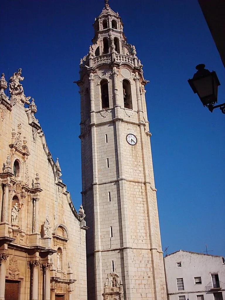
Alcalà de Xivert is the inland old town of the municipality of Alcalà de Xivert-Alcossebre, which has about 7,350 inhabitants (Spanish Wikipedia). It lies in a valley between the Serra d’Irta and the Serra de les Talaies, on the N-340 and the railway. The church of Sant Joan Baptista was built between 1736 and 1766, and its octagonal bell tower, one of the tallest in the Valencian Region, carries a statue of Saint John that the tourist board says was placed by a tightrope walker. The Casa de la Cultura, a Renaissance building, served as chapter house and prison, and a Templar tour links the buildings of the Order (Turisme Comunitat Valenciana). Above the town stands Xivert Castle. Read our new Alcalà de Xivert guide.
Alcossebre, Capicorb and Les Fonts
Alcossebre is the coastal side of the same municipality, with Capicorb and Les Fonts further south. The regional tourist board counts about 10 km of beaches and coves, and spain.info five beaches plus several unspoilt coves, with water sports, the L’Estany wetland at the mouth of the river Coves and dunes between the Carregador and La Romana beaches (spain.info). It is also a starting point for boat trips to the Columbretes Islands. Alcossebre has stayed low-rise and quiet compared with the bigger resorts, and the Serra d’Irta park begins at the edge of town. Read our Alcossebre page.
Beaches and coves
From north to south. Lengths and services are as the regional tourist board lists them, checked November 2026; we could not confirm 2026 Blue Flags or lifeguard dates.
Playa Norte
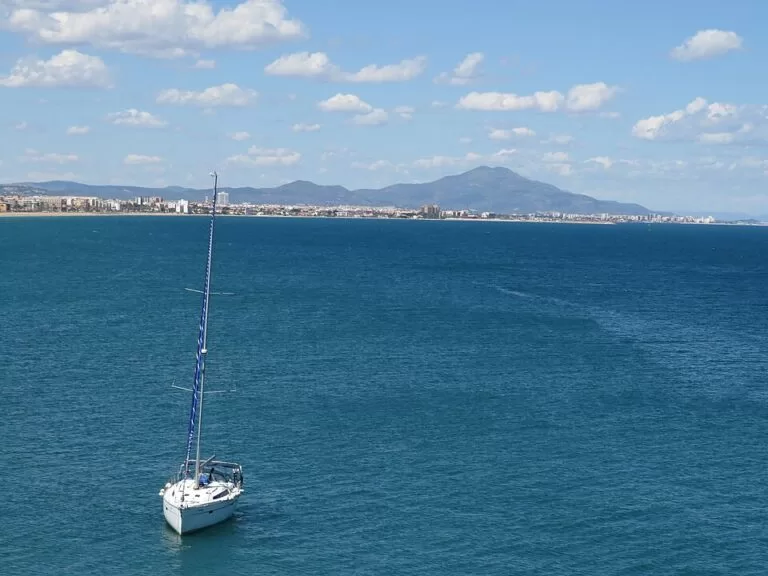
Peñíscola’s main beach runs from the foot of the castle towards Benicarló: 5 km long and 44 m wide on average, mostly sand with rockier ends, with lifeguards, accessible walkways, toilets and a promenade. The tourist board lists the Blue Flag among its certificates (Turisme Comunitat Valenciana).
Playa Norte guide →South Beach
On the other side of the rock, next to the fishing port, South Beach has calm water, fine sand, a water sports school for kayaking, windsurfing and sailing, accessible walkways, toilets and a Red Cross post (Turisme Comunitat Valenciana). Our Peñíscola guide gives its length as 650 m.
Peñíscola guide →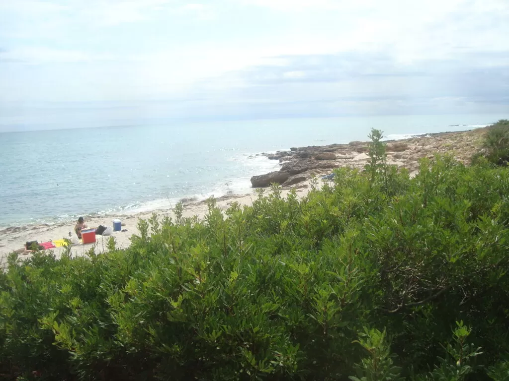
Pebret, Russo and the Irta coves
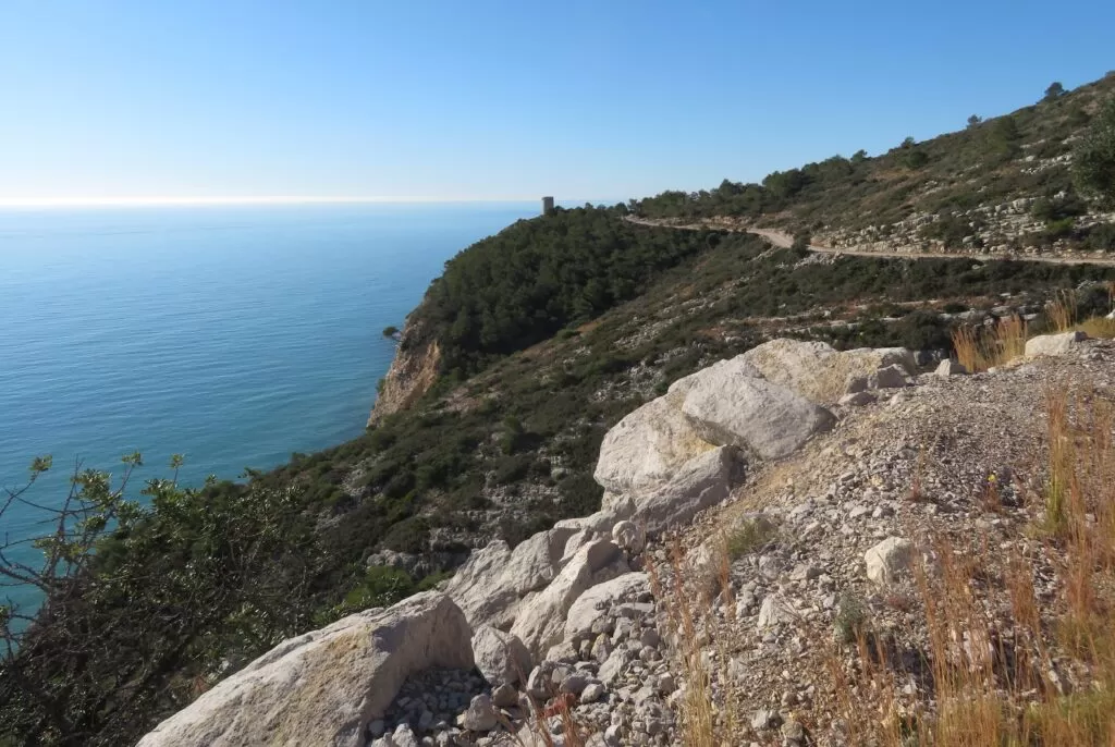
South of Peñíscola the coast track leads past Torre Badum to Platja del Pebret, the only sandy beach of any size in the range, with one of the last dunes on the Castellón coast, and on to Platja del Russo, Cala Argilaga and smaller coves (Parcs Naturals, as summarised in our Serra d’Irta guide). There are no services; bring water and shade.
Serra d’Irta guide →Las Fuentes, Romana and Cala Mundina
In Alcossebre, Las Fuentes beach is known for freshwater springs that rise in the sea, and La Romana is a long stretch of sand (Turisme Comunitat Valenciana). North of town, inside the park, Cala Mundina is a sandy and pebbly cove reached by a dirt track, with clear water and no services; the tourist board advises water shoes (Turisme Comunitat Valenciana).
Alcossebre page →Things to do
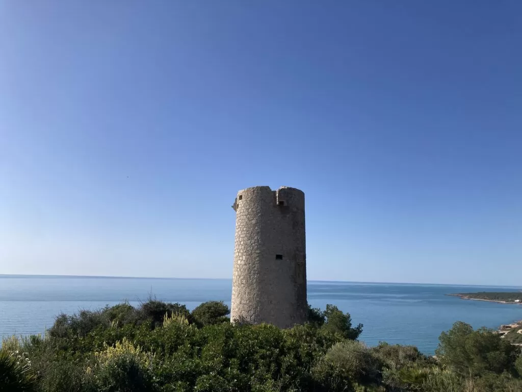
Nature: the Serra d’Irta natural park
The Serra d’Irta was declared a natural park and marine reserve on 16 July 2002 and is one of the last unspoilt mountain ranges on the Valencian coast, with an estimated 70,000 to 80,000 visitors a year (Turisme Comunitat Valenciana). The easiest walk is the park’s 2.7 km blue loop from Torre Badum, a coastal watchtower on a cliff about 97 m high (Spanish Wikipedia), down to the Pebret dunes. From 20 June to 6 September cars reach the coast track only with a parking space booked in advance in the GVA Parcs Naturals app; the details are in our Serra d’Irta guide.
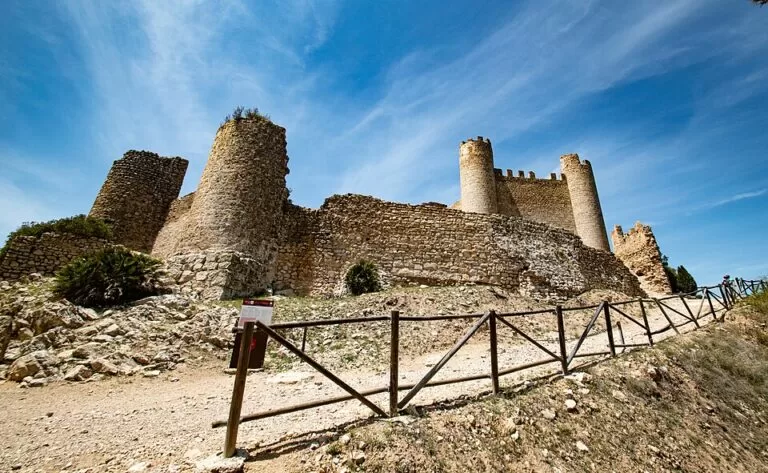
History: Pope Luna and the Templar castles
The Templars held all three castles of this stretch. Peñíscola Castle is an austere Gothic fortress where you can see the stables, dungeons, cistern and the papal rooms of Benedict XIII. Xivert Castle, in the south-west of the Irta, is a Muslim fortress of the 10th and 11th centuries taken by the Templars in 1234, covering about 8,000 m² with a walled Morisco village below it (Turisme Comunitat Valenciana). The castle of Polpís above Santa Magdalena completes the set. In Alcalà de Xivert, the chapel of Santa Llúcia and Sant Benet at 312 m has views to the Columbretes Islands.
Food and festivals
Peñíscola’s fish market sells the catch at daily auctions, and the town’s dishes include suquet de peix, a fish stew, and arrossejat, rice with fish; galeras, a local crustacean, are best in the cold months (Peñíscola tourist office, as quoted in our Peñíscola guide). Alcossebre is known for fresh fish and rice dishes (spain.info), and Alcalà de Xivert for its hanging tomato. Peñíscola’s festivities for the Virgen de la Ermitana fall in early September; Alcalà holds pilgrimages to Sant Benet on 11 June and Santa Llúcia on 13 December.
Where to stay by town
The towns we would base a trip in, north to south. We name no hotels; compare locations on the map.
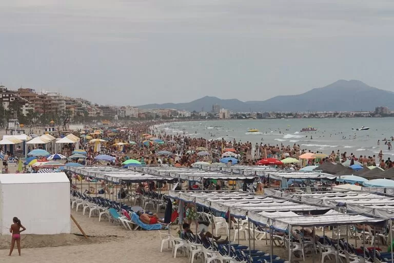
Peñíscola
The most choice: hotels, apartments and campsites along Playa Norte, or rooms in the old town for the castle at your door and a lot of steps. Camping Peñíscola is inland towards the station road.
Families, beach and sightsAlcalà de Xivert
A working inland town with a railway station, for walkers and drivers who want to be near the Xivert and Irta trails. Los Olivos de Xivert Camping Park is just outside the town.
Walkers and rail travellersAlcossebre
Low-rise apartments and holiday homes along five beaches, with the Irta coves and the coast walk to the north. Quieter than Peñíscola, and you will want a car.
Quiet beach holidaysGetting there and around
By air
Castellón Airport is about 33 km from Peñíscola and about 16 km from Alcalà de Xivert in a straight line. Our Costa del Azahar guide covers its flight-timed buses; the Benicarló tourist board also lists Reus, Valencia and Barcelona airports.
By train
The station for Peñíscola is Benicarló-Peñíscola, in Benicarló about 7.7 km from Peñíscola town hall, so continue by bus or taxi. Alcalà de Xivert has its own station on the coastal line, about 250 m from the church (OpenStreetMap). Check Renfe for which trains stop.
By car and bus
The AP-7 has an exit at Peñíscola-Benicarló, and the N-340 runs inland through Santa Magdalena and Alcalà. The park’s coast is reached on the CV-141 to Peñíscola or the CV-142 to Alcossebre. AMSA buses run along Avenida Papa Luna in Peñíscola (OpenStreetMap). Inside the park and to the castles you need a car, a bike or your feet.
A two-day route
By car, based in Peñíscola or Alcossebre. Outside 20 June to 6 September you can drive the coast track without booking.
Day 1
Peñíscola and the northern Irta
Visit Peñíscola Castle early, then walk the old town to the Portal Fosc, the Casa de las Conchas and El Bufador. After lunch near the port, drive south past the visitor centre on the CV-141 to Torre Badum and walk the 2.7 km blue loop to Platja del Pebret for a swim. Back in town, walk Playa Norte at sunset.
Day 2
Templar castles and Alcossebre
Drive the N-340 to Santa Magdalena de Polpís and, if you are walking, climb to the castle of Polpís. Continue to Alcalà de Xivert for the church and bell tower, then take the track up to Xivert Castle. In the afternoon go down to Alcossebre for Las Fuentes beach, or follow the dirt track north to Cala Mundina.
FAQ
Is Peñíscola or Alcossebre better to stay in?
Peñíscola has the castle, the old town, the long Playa Norte and far more services. Alcossebre is quieter and low-rise, with smaller beaches and the Irta coves on the doorstep.
Do you need to book to drive into the Serra d’Irta?
Only from 20 June to 6 September (2026 dates), when cars reach the coast track only with a parking space booked 2 to 7 days ahead in the GVA Parcs Naturals app. The rule is for motor vehicles.
How long is the walk from Peñíscola to Alcossebre?
The two towns are about 18 km apart in a straight line, with the Irta coast track between them. We could not confirm an official end-to-end walking distance; the park’s marked routes are shorter sections.
Was Game of Thrones filmed in Peñíscola?
Yes. The regional tourist board lists Game of Thrones among the series filmed in Peñíscola, and our Peñíscola guide notes that the sixth season used the town as a setting.
What is the nearest train station to Peñíscola?
Benicarló-Peñíscola, in Benicarló, about 7.7 km from Peñíscola town hall. Further south, Alcalà de Xivert has its own station.
Are there beaches in the Serra d’Irta?
Yes, Platja del Pebret, Platja del Russo, Cala Argilaga and Cala Mundina among others. They have no services, and in summer car access needs a booked parking space.
Other areas of the Costa del Azahar
Costa del Azahar
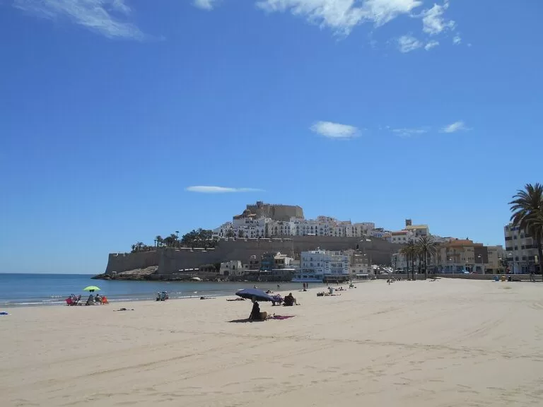
The whole Castellón coast from Vinaròs to Almenara, with the map, campsites, weather, Morella and itineraries.
Costa del Azahar guide →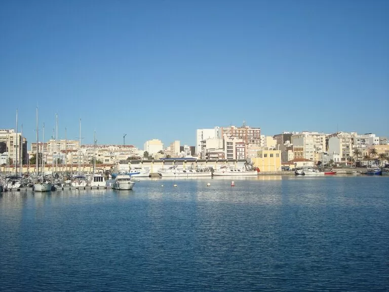
Vinaròs and Benicarló
King prawns and coves in Vinaròs, artichokes and the MUCBE museum in Benicarló, just north of Playa Norte.
Vinaròs and Benicarló guide →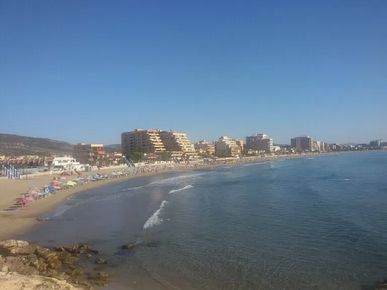
Torreblanca, Oropesa and Benicàssim
The Prat de Cabanes wetland, Oropesa’s cape and coves, and Benicàssim’s beaches and villas south of Alcossebre.
Torreblanca, Oropesa and Benicàssim guide →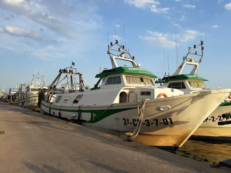
Castelló and the Plana
Castelló’s co-cathedral and El Grao, then the long beaches and wetlands of the Plana down to Almenara.
Castelló and the Plana guide →Along the coast
CostaMap covers the whole Spanish coast as one connected guide. These are the neighbouring areas, following the Mediterranean and Atlantic coast from Portugal to France. Or start from the map of every Spanish costa, or browse the full area directory.
- ← Previous along the coastTorreblanca, Oropesa and BenicàssimCosta del Azahar
- Next along the coast →Vinaròs and BenicarlóCosta del Azahar
Inland from here
Sources and freshness
Checked 7 November 2026 · 16 sources Show
Checked 7 November 2026. Official: Turisme Comunitat Valenciana on Peñíscola, Peñíscola Castle, the historic centre, Nord Beach, Sur Beach, Santa Magdalena de Pulpis, Alcalà de Xivert-Alcossebre, Xivert Castle, Santa Lucía and San Benito, Cala Mundina and the Sierra de Irta natural park; spain.info on Peñíscola and Alcossebre. Park access rules, routes and visitor centre: Parcs Naturals de la Comunitat Valenciana, as checked for our Serra d’Irta guide in October 2026. Peñíscola tourist office figures (population, South Beach, food, trains): via our Peñíscola guide. Background: Spanish Wikipedia on Alcalà de Xivert and Torre Badum. Map data and distances: OpenStreetMap. Photos (Wikimedia Commons): hero Lodevermeiren, CC BY-SA 4.0; Playa Norte Enric, CC BY-SA 4.0, and Pepe Travel, CC BY-SA 2.0; Irta coast Donarreiskoffer, CC BY-SA 4.0; Torre Badum Romang, CC BY 4.0; Pebret Juan Emilio Prades Bel, CC BY-SA 4.0; Xivert Castle Magnificus, CC BY-SA 4.0; Alcalà bell tower Mariano Jesús Mingo Naval, public domain; area cards as credited on the hub. Not confirmed: 2026 Blue Flags and lifeguard dates, train and bus timetables, Xivert Castle opening hours; the park and town hall websites could not be reached when we checked.