
Costa de Almería · Almería city
Almería city travel guide: Alcazaba, old town, port and beaches
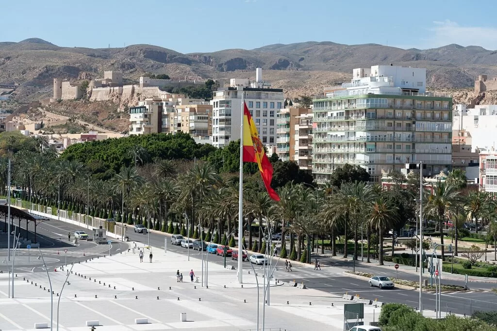
The Alcazaba and the fortress cathedral, the port and the Paseo, the city beaches of El Zapillo and the resort strip of El Toyo and Retamar on the way to Cabo de Gata.
The Alcazaba from the harbour promenade · Photo: Paul Colin Hennig firstdorsal.eu, CC BY-SA 4.0
Part of the Costa de Almería guide ←
Almería city is the capital of Almería province and the middle of the Costa de Almería, on a wide bay between the Sierra de Gádor in the west and the plain that runs east to Cabo de Gata. The stretch in this guide covers the old town under the Alcazaba, the port and the Paseo, the city beaches from San Miguel and El Zapillo east past the airport to El Toyo and Retamar, about 13 km from the centre, plus the inland day trips reached from the city: Los Millares and the Tabernas Desert.
At a glance
- Where the centre of the Costa de Almería, on the Gulf of Almería: from the port and the Alcazaba east along the bay to Retamar and the Torregarcía beach, where the Cabo de Gata-Níjar Natural Park begins; about 14 km in a straight line.
- Districts the old town with the Alcazaba, La Chanca and Pescadería; the port, the Paseo and the centre; El Zapillo and the city beaches; El Toyo and Retamar. Inland: Los Millares and Tabernas.
- Best for a city break with a beach, Moorish and Civil War history, tapas, winter sun, and a base for day trips to Cabo de Gata.
- Getting there Almería airport is 9 km east of the city; the intermodal station has trains to Granada, Seville and Madrid and the province’s buses; ferries sail from the port to Melilla, Morocco and Algeria.
Map of Almería city
The map shows the places in Almería city and the inland day trips that have a CostaMap page. Tick a place type to filter it, and click a marker to see the place in the panel.
Place type
Area · next level
 Area map
Almería city
Click a marker to see the place here. The Alcazaba, the old town and the port, with Los Millares and the Tabernas Desert inland.
Districts and placesDistricts and places
The city is not a chain of towns but a set of districts along the bay. We go from the old town by the port east to the newer beach districts, then inland. Facts from the Andalusian tourist board, spain.info and Spanish Wikipedia, checked November 2026; the city tourist office site could not be reached from our setup.
Old town and the Alcazaba
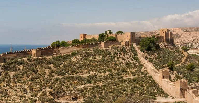
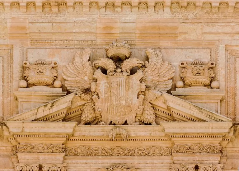
The Alcazaba dominates the city from its hill. Spain.info says Abd al-Rahman III built it in 955, and the Andalusian tourist board calls it the largest citadel the Arabs built in Spain, finished in the 11th century by Hayrán, king of the taifa of Almería, and altered after the Christian conquest. It has three walled enclosures: gardens where the living quarters stood, the palace area with the caliphs’ cisterns and a Mudéjar shrine, and the castle the Catholic Monarchs built after taking the city in 1489. From its walls you see the city and the port; the walls of Hayrán run on along the Cerro de San Cristóbal. Below, the cathedral looks more like a fortress than a church, with battlements and arrow slits against pirate raids, and a cloister on the old parade ground (spain.info). Nearby, the 11th-century Arab cisterns (Aljibes Árabes) on Calle Tenor Iribarne hold temporary exhibitions.
La Chanca and Pescadería
West of the Alcazaba, between the castle hill and the port, lie the quarters of La Chanca and Pescadería. The Andalusian tourist board describes La Chanca as the most typical quarter, with brightly painted houses at the foot of the Alcazaba, and calls both districts the most Gitano and flamenco in Almería. Here are the old flamenco clubs (peñas) such as El Taranto, and the Museo de la Guitarra, dedicated to the guitar maker Antonio de Torres. Spain.info notes cave dwellings dug into the side of the San Cristóbal hill. It is a working-class area; visit with respect and in daylight if you do not know it.
Port, Paseo and centre
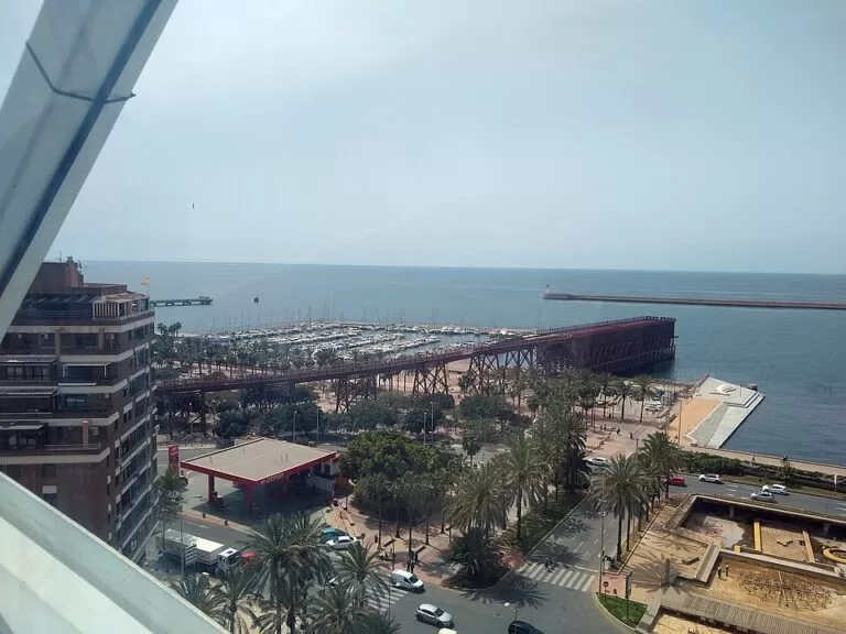
The Paseo de Almería, the main street of the 19th-century city, runs from the Puerta de Purchena towards the sea. Its full pedestrianisation, begun in January 2025, was completed on 12 October 2026 (Spanish Wikipedia). Under it lie the Civil War Shelters, about 1 km of 1937–38 air-raid tunnels shown on guided visits; they closed after a fire in March 2025 for restoration, so check that they have reopened. Along the shore, spain.info recommends a stroll in the Parque de Nicolás Salmerón, under palms, with views of the marina and the port. East of it, the Cable Inglés, an iron-ore pier of 1904, has been a walkway over the sea since 2023, next to the old railway station of 1893. The Museum of Almería, near the intermodal station, holds finds from Los Millares and El Argar. Our Almería town guide has more on the city as a whole.
El Zapillo and the city beaches
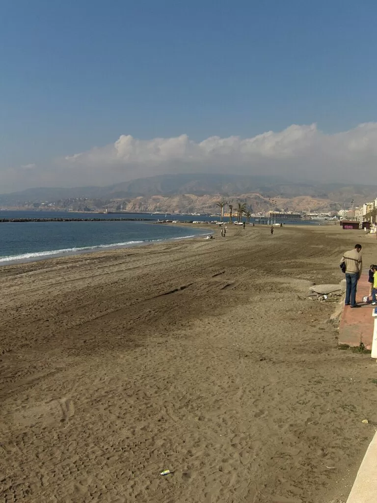
El Zapillo, south-east of the centre, began as a small fishermen’s quarter and grew into a residential district over the last 50 years (Spanish Wikipedia). It faces the busiest city beach along the Paseo Marítimo Carmen de Burgos, with the Maestro Padilla auditorium of 1992 at its eastern end, next to Nueva Almería. In July the district celebrates the Virgen del Carmen, whose image is carried through the streets to the beach, and on the night of San Juan in June the city’s beaches fill with bonfires, El Zapillo among the busiest. This is the place to stay if you want a city beach on your doorstep and the old town 2 to 3 km away.
El Toyo and Retamar
Retamar and El Toyo are a resort and residential district of the municipality, about 13 km east of the centre by the AL-12 road and close to the airport (Spanish Wikipedia). Retamar grew from the 1960s as a long, narrow strip of villas and low apartment blocks running down to the sea. El Toyo, beside it, was begun in 2005 as the athletes’ village of the XV Mediterranean Games, with a golf course, hotels near the shore, cycle lanes, a seafront park and the Plaza del Mar. Four city bus lines reach it, and an ALSA bus continues to Cabo de Gata. East of Retamar, across the Rambla del Agua, the Cabo de Gata-Níjar Natural Park begins.
Inland: Los Millares and the Tabernas Desert
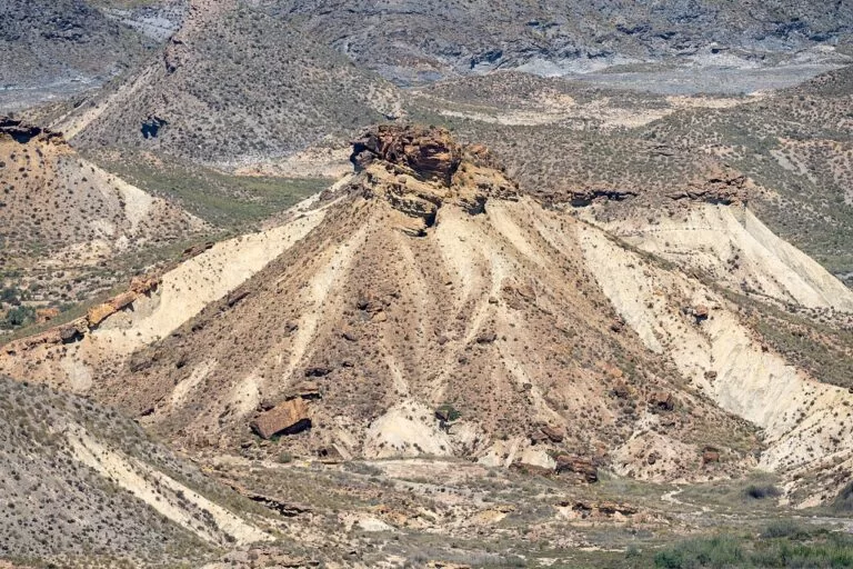
Two day trips are reached from the city. Los Millares, about 15 km north-west in the Andarax valley at Santa Fe de Mondújar, is the Copper Age settlement that gives its name to the culture shown in the Museum of Almería. About 20 km north, in the Tabernas Desert, Oasys MiniHollywood is a theme park in one of the western film sets the desert is known for. The Andalusian tourist board says actors such as Clint Eastwood and Brigitte Bardot filmed in Tabernas and Cabo de Gata, and that John Lennon stayed at the Cortijo Romero in the city in 1966, while shooting How I Won the War; the farmhouse is now the Casa del Cine film museum, with guided visits by booking.
Beaches
Our pick from west to east. The city’s beaches are urban and gently sloping; the further east you go, the wilder, windier and emptier they get. Descriptions from the Andalusian tourist board listings, checked November 2026.
San Miguel, El Zapillo and Nueva Almería
Continuous city beaches along the promenade. El Zapillo is sandy and busy, with calm water, lifeguards, toilets, shade and sunbed hire; Nueva Almería joins San Miguel and shares its services. San Miguel itself is small.
Costacabana and El Perdigal
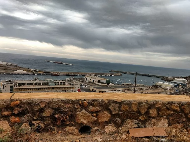
Natural beaches east of the city. The tourist board is blunt about Costacabana: gravel and constant wind make it unpleasant for visitors, though it has adapted toilets and an amphibious chair. El Perdigal, by El Alquián, is quiet but windy, with strong waves.
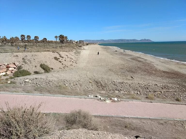
El Toyo and Retamar
Retamar has a promenade, lifeguards, showers, adapted toilets, amphibious chairs and support staff, on gravelly sand with moderate waves; spain.info calls it very quiet. El Toyo, next to it, is a natural beach with strong waves and wind.
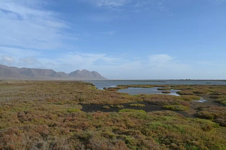
Torregarcía and Las Amoladeras
Torregarcía, named after the Torre García shrine on the beach, marks the southern edge of the natural park: isolated, gravelly and dark. Las Amoladeras, further on, lies inside the park and is protected.
For the beaches of the natural park itself, such as Los Genoveses and Mónsul, see the Cabo de Gata-Níjar guide.
Things to do
History
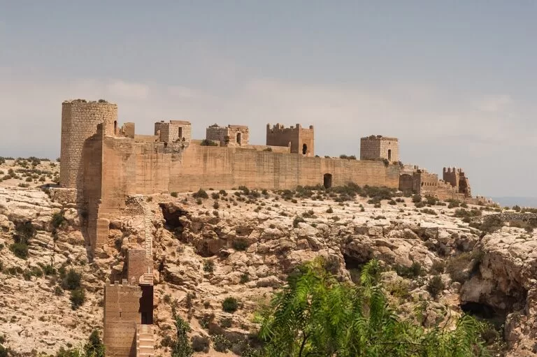
Plan a morning at the Alcazaba, where spain.info singles out the caliphs’ cisterns, the Mudéjar shrine, the military baths and a rebuilt Muslim house, and the castle keep in the third enclosure. Walk down to the cathedral, then to the Paseo for the Civil War Shelters once they reopen. Finish at the Museum of Almería, whose collections run from the Middle Palaeolithic to the present, with finds from Los Millares, El Argar, Villaricos and Fuente Álamo (spain.info), and at the Cable Inglés for the view of the port at sunset.
Nature
The city is the nearest large base for the Cabo de Gata-Níjar Natural Park, which spain.info calls Andalusia’s first land and sea reserve. From Retamar the coast road leads to the salt pans and the village of Cabo de Gata, with a camper area near the wetlands. Inland, the Andalusian tourist board notes that part of the municipality lies in the Sierra Alhamilla protected area, with a well-kept holm oak forest and birdlife.
Food and markets
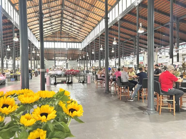
The city was promoted as Spanish Capital of Gastronomy in 2019 (Spanish Wikipedia). Spain.info lists local dishes such as ajo colorao, a stew of potatoes, peppers, fish and garlic, breca a la uva (pandora fish with grapes) and rape a la barraca (monkfish), and singles out the prawns of Garrucha. The Mercado Central, near the Paseo, is the city’s market hall, and the Paseo’s terraces and the old town’s bars are the usual places for tapas.
Where to stay by district
We do not list hotels. These are the bases we would choose, with what each suits.
Old town and the Paseo
For sightseeing on foot: the Alcazaba, the cathedral, the shelters, the market and the tapas bars are all within a short walk, and the bus and train station is close. You are in a city centre, not on a beach.
El Zapillo and Nueva Almería
For a city beach on the doorstep, with lifeguards in season and the promenade to walk into town. Suits families and beach-and-city trips without a car.
El Toyo and Retamar
Resort hotels, golf and a quiet beach close to the airport and to Cabo de Gata. Best with a car; the old town is about 13 km away by bus or taxi.
Getting there and around
By air: Almería airport lies 9 km from the city on the bay, according to the Andalusian tourist board, which says a city bus links it with the centre every day in about 35 minutes. Check the current line number at the stop. From the airport to El Toyo and Retamar is a short taxi ride.
By train and bus: the intermodal station by the old railway station serves trains and intercity buses. Spanish Wikipedia lists direct trains to Granada and Seville and a Talgo to Madrid; regional buses reach all the towns of the province, including Roquetas de Mar, Níjar and Mojácar.
By sea: the port has passenger ferries to Melilla, Nador in Morocco and Oran and Ghazaouet in Algeria (Spanish Wikipedia); check operators and timetables before you plan.
Around the city: the old town, the Paseo, the port and El Zapillo are walkable. Retamar and El Toyo have four city bus lines and an ALSA line to Cabo de Gata village.
A two-day route
Two days
Day 1
The old town, the Paseo and the port
Start early at the Alcazaba before the heat, then walk down through the old town to the cathedral and the Arab cisterns. Lunch near the Mercado Central. In the afternoon take the Civil War Shelters tour if it runs, visit the Museum of Almería, and end on the Cable Inglés and the seafront park at sunset, with tapas in the centre.
Day 2
Inland or along the bay
With a car, drive up the Andarax valley to Los Millares in the morning and on to the Tabernas Desert and Oasys MiniHollywood. Without one, take the bus east to Retamar for a quiet beach morning and continue to the salt pans of Cabo de Gata, then back for an evening walk along El Zapillo.
FAQ
Is Almería city worth visiting?
Yes, for history and a working Spanish city by the sea: the Alcazaba is one of the largest Moorish fortresses in Spain, and the old town, the port and the beaches are close together. It is not a resort town; for that, stay in El Toyo or Roquetas de Mar.
Does Almería city have a beach?
Yes. San Miguel, El Zapillo and Nueva Almería run along the promenade south-east of the centre, with lifeguards, toilets and calm water. Quieter beaches lie further east at Retamar and El Toyo.
How far is Almería airport from the city?
About 9 km. A city bus runs to the centre every day in about 35 minutes; El Toyo and Retamar are closer to the airport than the old town.
How far is Cabo de Gata from Almería city?
The natural park begins just east of Retamar, about 14 km from the old town. Cabo de Gata village is about 28 km from the Alcazaba in a straight line, and San José, the main base for Mónsul and Los Genoveses, is further by road.
Can you visit the Civil War shelters in Almería?
The shelters closed after a fire in March 2025 and were being restored, with reopening planned for early summer 2026; on 9 November 2026 we could not confirm on an official page that they have reopened (the city council site could not be reached). Visits are guided only and must be booked in advance; see our Civil War Shelters guide.
Where should I stay in Almería, the old town or El Toyo?
Stay in the old town or El Zapillo without a car and for sightseeing; choose El Toyo or Retamar for a beach hotel, golf and quick access to the airport and Cabo de Gata.
Other areas of the Costa de Almería
Mojácar, Garrucha and Vera
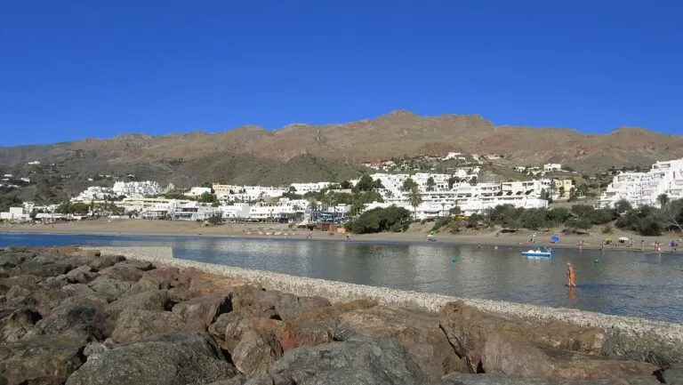
The resort coast of the north-east: the white hill village of Mojácar, the fishing port of Garrucha and the beaches of Vera.
Mojácar, Garrucha and Vera guide →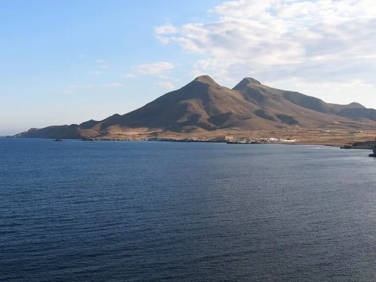
Cabo de Gata-Níjar
Volcanic cliffs, coves and fishing villages from Carboneras to the Cabo de Gata lighthouse, starting just east of Retamar.
Cabo de Gata-Níjar guide →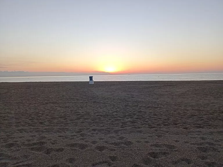
Roquetas de Mar to Adra
West of the city: the big beaches of Aguadulce and Roquetas de Mar, Almerimar and Adra.
Poniente guide →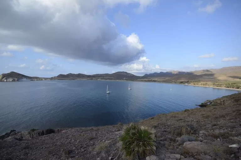
Costa de Almería guide
All four areas from Pulpí to Adra, the map of the whole coast, weather, buses and campsites.
Costa de Almería guide →Sources and freshness
Checked 9 November 2026. Andalusian tourist board listings for Almería city (districts, port, history, Sierra Alhamilla), the Alcazaba, the cathedral, the Arab cisterns, Pescadería and La Chanca, the Civil War Shelters, the Cable Inglés, the Casa del Cine, the airport and the beaches of San Miguel, El Zapillo, Nueva Almería, Costacabana, El Perdigal, El Toyo, Retamar, Torregarcía and Las Amoladeras. Spain.info on Almería (walls of Hayrán, La Chanca, Nicolás Salmerón park, food), the Alcazaba, the cathedral, the Museum of Almería, Retamar beach and the Cabo de Gata-Níjar Natural Park. Background from Spanish Wikipedia: Almería (beaches, San Juan, intermodal station, Capital of Gastronomy 2019), El Zapillo, Retamar and El Toyo, Paseo de Almería and Port of Almería (ferry routes). The city tourist office (turismodealmeria.org), the city council and the port authority sites could not be reached from our setup, so opening times, prices and bus line numbers are not given. Locations and straight-line distances: OpenStreetMap contributors (ODbL).
Photo credits · 13 photos from Wikimedia Commons Show
Photos from Wikimedia Commons, not altered except for cropping: Alcazaba from the harbour by Paul Colin Hennig firstdorsal.eu (CC BY-SA 4.0); Cable Inglés (map panel) by CarlosVdeHabsburgo (CC BY-SA 4.0); Playa El Zapillo by Schumi4ever (CC BY-SA 4.0); Port of Almería by Ismael Olea (CC BY 4.0); Retamar and El Toyo beach by Olea (CC BY 4.0); Salinas del Cabo de Gata by Krzysztof Ziarnek, Kenraiz (CC BY-SA 4.0); city walls, Alcazaba and cathedral pediment by Jebulon (CC0); Mercado Central by Sharon Hahn Darlin (CC BY 2.0); desert near Fort Bravo by Paul Colin Hennig firstdorsal.eu (CC BY-SA 4.0); Mojácar by INDALOMANIA (CC BY-SA 3.0); Los Escullos by isol (CC BY-SA 3.0); Roquetas de Mar by Roquex (CC0); Los Genoveses by Javier Pérez López (CC BY 3.0).
Every place we have mapped on the Almería city
7 towns, beaches, coves and landmarks, kept up to date automatically.