
Els Ports Natural Park (Parc Natural dels Ports)
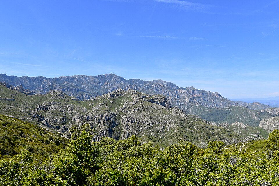
Natural parkEls Ports Natural Park (Parc Natural dels Ports) is the limestone massif behind Tortosa, the nearest real mountains to La Ràpita and the Ebro Delta. Drive inland to Roquetes, then climb by mountain road to the 1,441 m summit of Caro, or follow a dirt track from Mas de Barberans into the gorge of La Vall. The park covers 35,050 hectares, with 35 waymarked walks and more than 200 km of trails. It suits walkers and anyone wanting a big view and a cool, green day away from the beach; skip it if you want a short, flat outing without a car.
Quick facts
- Names: Els Ports, Parc Natural dels Ports in Catalan.
- Where: southern Catalonia, where it meets the Valencia region and Aragon. Parts of nine municipalities: Alfara de Carles, Paüls, Roquetes and Tortosa (Baix Ebre), La Sénia and Mas de Barberans (Montsià), Arnes, Horta de Sant Joan and Prat de Comte (Terra Alta).
- Coordinates: 40.8307, 0.3401 (park centre); Caro summit 40.8031, 0.3431.
- Size: 35,050 hectares, including 861 hectares of nature reserves.
- Protected since: 2001. Also Natura 2000 and the core of the Terres de l’Ebre Biosphere Reserve.
- Highest point: Caro, 1,441 m, the top of the province of Tarragona.
- Entry: free, as are the visitor-centre exhibitions.
- From La Ràpita: Roquetes is 24 km, Mas de Barberans 22 km and Caro 29 km away in a straight line.
Access and parking
The park says it plainly: inside the park you need your own vehicle. The nine villages lie outside the boundary, at the foot of the mountains, and each is a way in. Roads and forest tracks inside are mostly unpaved; a normal car reaches the recreation areas, though a few may need a 4×4 (park access page).
From La Ràpita (town guide), head inland to Tortosa and Roquetes, where the park office and main visitor centre stand. Three good day-trip areas start there:
- Caro: take the T-342 towards Els Reguers, turn left on the signed road to Caro and climb the Carretera del Caragol (vehicles up to 8 m recommended). You can drive to a car park a few metres from the summit viewpoint. The Esquirol car park, start of the walk, is 1.5 km along the branch towards Fredes.
- La Vall: take the TV-3421 towards La Sénia. 2.5 km past Mas de Barberans, a sign points right to the “Àrea de lleure de la Vall”. Follow the dirt track 5 km to a wooden footbridge where two walks start; the recreation area is 1.5 km further.
- El Toscar: take the TV-3422 towards Alfara de Carles. After 12.6 km a paved lane on the left leads 4.1 km to the El Toscar car park.
Without a car: buses run to the park villages and trains reach Tortosa, but from there you walk, on the GR-7, GR-171 and GR-8 paths. Cyclists can use the Via Verda greenway to Roquetes, Prat de Comte, Horta de Sant Joan and Arnes.
What to expect
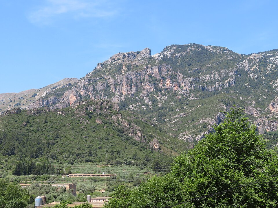
A wild limestone massif of deep ravines, cliffs and scree, with big forests and mountain pasture, worked by people since prehistoric times: old farmhouses, dry-stone walls, lime kilns and charcoal pits. The park lists more than 1,300 kinds of plants, and its beech woods are the southernmost in the Iberian Peninsula. Maples give the woods their strongest colour in autumn. The wild goat (Iberian ibex) is easy to spot; look up for vultures, bearded vultures and golden and Bonelli’s eagles.
Caro viewpoint
The quickest big view in the area. The Mirador de Caro has information panels and is adapted for reduced mobility. On a clear day you see the Ebro Delta and, the park says, even Mallorca. The pines grow bent by the strong north-west wind. The waymarked Caro loop from the Esquirol car park is 7.5 km with 560 m of climb, about 2 h 45 min.
La Vall
A gorge between Roquetes and Mas de Barberans with high rock walls and pine, oak and some beech. From the footbridge, the Racó de la Cova d’en Marc loop is a short family walk (1.1 km, about 20 minutes); the Mas de Barró loop is 9.1 km. The access track also leads to the Cocó de la Gralla rock paintings.
El Toscar
A valley where strong springs once drove mills and paper, glass and electricity works. The easy “stone and water” loop is 5.8 km, about 1 h 45 min; the Cova Pintada loop 3.7 km, about 1 h 10 min.
Practical details
- Visitor centre, Roquetes: Av. Val de Zafán; tel. 977 500 845; free geology exhibition (about 40 minutes). From 1 November to 20 December 2026: Saturdays and holidays 9:00–14:00 and 15:00–17:00, Sundays 9:00–14:00; closed from 21 December until further notice (checked November 2026).
- Mas de Barberans: the Museu de la Pauma information point (tel. 977 053 778) opens Tuesday to Sunday 9:30–14:00 and arranges guided visits to the Cocó de la Gralla paintings (checked November 2026).
- Park office: tel. 977 504 012, weekdays 9:00–14:00.
- No camping in the park; walkers on a route may bivouac one night, except in Arnes and Horta de Sant Joan.
- Driving: 30 km/h on forest tracks, no driving off them. Groups over 40 people or four cars need permission.
- Paid parking applies at Easter and in summer at swimming spots in Arnes and Horta de Sant Joan.
Accessibility and safety
Check the park’s notices first. In October 2026, after heavy rain, the park closed the Camí de la Font Nova and the Font Nova recreation area. Under the Pla Alfa fire plan access roads can be closed on high-risk days; check the map each day. At El Toscar cattle graze freely, and the Cova dels Adells path is temporarily not recommended because of bulls. Mountain roads are narrow and services few: bring water and fuel up from the villages. The Caro viewpoint is adapted for reduced mobility; the Roquetes centre has ramps and an adapted toilet.
Best time to visit
Autumn, when the maples and beeches colour the woods, and spring for walking. In summer the heights are cooler than the coast, but fire risk can close roads. Pick a clear day for Caro if you want to see the delta.
Nearby alternatives
- Tortosa Cathedral and the Castell de la Suda, 15 km from Caro, and the Tortosa town guide.
- Via Verda greenway: the old railway line along the park’s edge, for cycling.
- Miravet Castle, 33 km: the Templar castle above the Ebro.
- Càmping Terra Alta, 20 km, for a stay on the Terra Alta side.
- Ebro Delta, 34 km, and the Ebro Delta coast guide.
Distances are in a straight line from the park centre.
FAQ
How do I get to Els Ports Natural Park from La Ràpita?
Drive inland to Tortosa and Roquetes, 24 km away in a straight line, then take the signed road to Caro or the TV-3421 to Mas de Barberans. Inside the park you need a car.
Can you drive to the top of Caro?
Yes. A road climbs to a car park a few metres from the 1,441 m viewpoint.
Is Els Ports Natural Park free?
Yes. Only some Easter and summer car parks at swimming spots in Arnes and Horta de Sant Joan charge.
Can you camp in Els Ports?
No. Camping is banned; walkers on a route may sleep out one night, except in Arnes and Horta de Sant Joan.
What is the best easy walk in Els Ports?
The Racó de la Cova d’en Marc loop in La Vall (about 20 minutes) or the Cova Pintada loop at El Toscar (about 1 h 10 min), both rated easy by the park.
Sources and freshness
Checked 10 November 2026 · 9 sources Show
Checked 10 November 2026. Official: Parc Natural dels Ports (Generalitat de Catalunya): notices, key facts, top 10, visitor centres, rules, Caro, La Vall, El Toscar. Municipal and regional tourism websites could not be checked when we checked. Location and distances: OpenStreetMap contributors. Photos: Wikimedia Commons, as credited.
This place is part of our Costa Dorada map and travel guide: Roman Tarragona, Salou and the Ebro Delta — see every town, beach and cove we have mapped on that coast.
How this page is made. CostaMap is written with an AI editorial system run by Ebizapple. This page is based on the sources listed above. Last updated 10 November 2026. Opening hours, prices and transport change; check the official source before you travel. How we work · Partner links and ads