
La Foradada (Serra del Montsià) hike
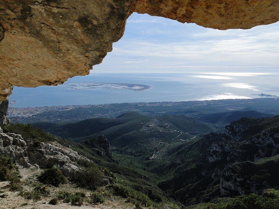
ViewpointLa Foradada is the rock arch and summit in the Serra del Montsià directly above La Ràpita, about 4.3 km west-northwest of the town’s Plaça de Carles III in a straight line. You reach it on foot: the Catalan tourism portal gives the Camí de Mata-redona, which starts beside the football ground in La Ràpita, as the way in, and the last section to the arch is a steep, rocky path. From the top you look down on the town, the Alfacs bay and the flat plain of the Ebro Delta. It suits fit walkers who are used to rough mountain paths; skip it in summer heat, with small children or if you want a stroll, and climb La Guardiola hill in town instead.
Quick facts
- Names: La Foradada (Catalan, “the holed one”), also Roca Foradada or La Foradada del Montsià. Do not confuse it with the Cala de la Foradada cove near Vinaròs.
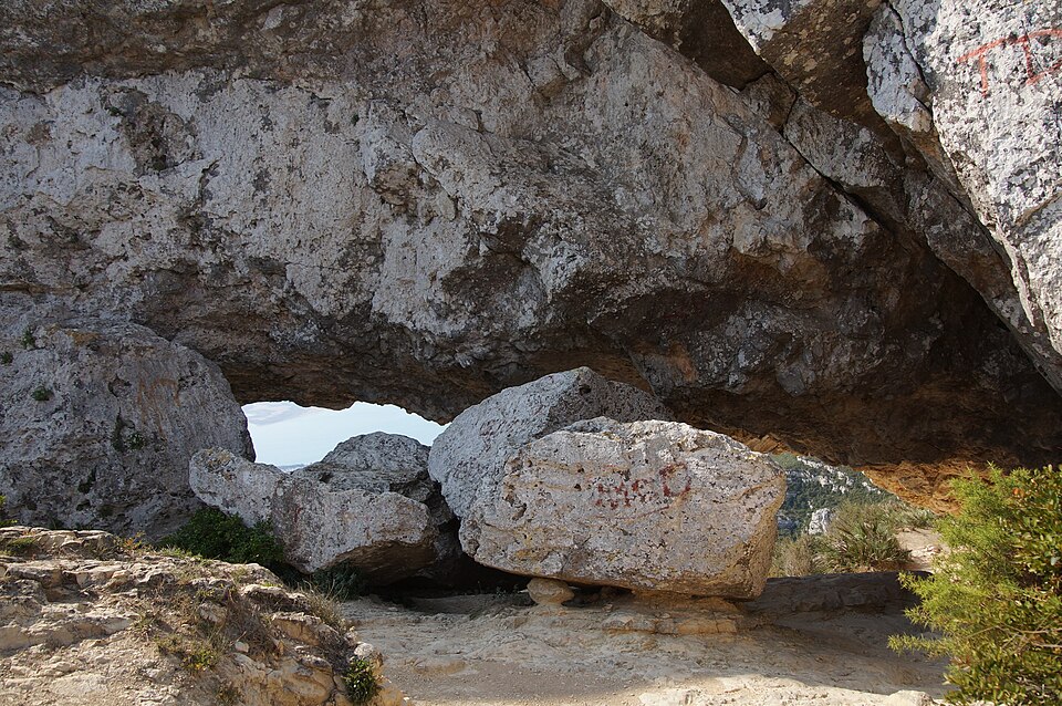
- What it is: the second-highest summit of the Serra del Montsià, named after a natural rock bridge just below the top (Catalan Wikipedia).
- Height: sources differ. The summit is 682.8 m in the Catalan mapping agency data used by OpenStreetMap; the Catalan Wikipedia gives 695 m and the Catalan tourism portal 687 m for the summit and about 650 m for the rock window itself.
- Where: on the ridge where the municipalities of La Ràpita, Alcanar and Freginals meet, 126 m from the corner of Ulldecona (Catalan Wikipedia). Montsià district, Tarragona province.
- Coordinates: 40.6322, 0.5441 (viewpoint at the arch, OpenStreetMap).
- From La Ràpita: about 4.3 km in a straight line from Plaça de Carles III, and roughly 5 km each way on the shortest mapped paths from the football ground (our measurement on OpenStreetMap).
- Protection: Serra del Montsià protected natural area, 5,296 ha (catalunya.com).
How to get there
Start in town: the Catalan tourism portal names the Camí de Mata-redona as the access, starting next to the football ground. On OpenStreetMap the football pitches lie on the north-west edge of town, about 0.9 km on foot from Plaça de Carles III. From there streets lead up to the Camí de Mata-redona, an asphalt lane that climbs towards the range.
On the hill: OpenStreetMap shows the asphalt of the Camí de Mata-redona ending about 2 km beyond the football ground, where a mapped circular hiking route called “La Furadada del Montsià” (operator: Terres de l’Ebre) begins. On the map that loop is about 10.6 km long. It passes the Font de Burgar spring and the Cova del Llop. The shortest mapped line from the football ground to the arch, using lanes, a track and then paths, is about 5 km one way, with a climb from almost sea level to around 680 m.
The GR-92: the long-distance coastal path GR-92 also crosses the Foradada on its last Catalan stage. The Catalan Wikipedia describes it running along the ridge to the Font del Burgar, climbing to the Mas de Mata-redona and then taking its steepest section up to the Foradada.
Times and grades: we found no official walking time, distance or difficulty grade for these routes; the regional tourism board’s and town hall’s websites could not be reached when we checked. The distances above are our own measurements on OpenStreetMap, not signposted figures. Use a current hiking map.
Parking: we found no official car park for the walk. If you drive to the start, park legally in town near the football ground rather than on the narrow lane.
What you see
The Catalan tourism portal describes the Roca Foradada as rising “like a window” over La Ràpita and the bay of Els Alfacs; the Catalan Wikipedia calls it a fine viewpoint over the Ebro Delta plain. From the arch you see:
- Below you: La Ràpita, its port and the Alfacs bay.
- Beyond the bay: the flat plain of the Ebro Delta.
- Along the ridge: the limestone crest of the Montsià, which runs about 12 km parallel to the coast and peaks at the Torreta del Montsià, 764 m, to the south.
On OpenStreetMap the path named “la Foradada” passes through the rock arch itself, and there are trail signposts at the arch. The range is good country for birds of prey: the tourism portal lists Bonelli’s and golden eagles as breeding species, with the spectacled warbler and black wheatear. A large cement quarry scars the south-east slope (Catalan Wikipedia).
Terrain and safety
The Serra del Montsià is a steep limestone range with cliffs, gullies and big height differences (Catalan Wikipedia). OpenStreetMap tags the upper paths as rocky mountain hiking trails about 0.75 m wide, and the Catalan Wikipedia calls the last section of the GR-92 to the Foradada its most abrupt. There is little shade. Springs exist on the mountain, but an OpenStreetMap mapper noted the Font de Burgar dry in April 2024, so carry all the water you need. Wear proper boots, stay back from the edges at the arch, avoid strong wind, rain and summer afternoons, and check fire-risk restrictions in summer. This is not a walk for pushchairs or wheelchairs.
The protected area is open all year (catalunya.com). The Catalan Wikipedia lists hiking, climbing, mountain biking and hunting as the only activities allowed in it, so keep to the paths.
Best time to go
October to May is the natural season. Clear winter days give the sharpest views over the delta. In summer the climb is hot and exposed; if you go then, start at first light.
Nearby alternatives
- Església Nova and the Carles III old town, about 4.3 km: the short walk through La Ràpita’s 18th-century plan, ending on La Guardiola hill, a much easier viewpoint.
- Ulldecona rock art and the Serra del Montsià, about 6 km: prehistoric painted shelters on the other side of the valley.
- Badia dels Alfacs: the bay you look down on from the arch.
- La Ràpita beaches, about 4.6 km: the calm town beaches to cool off after the walk.
- Punta de la Banya and the Trabucador, about 15 km: the sand bar that closes the bay.
- Alcanar and Les Cases d’Alcanar, about 11 km: the town on the southern side of the range.
Distances are in a straight line from the arch. For the delta itself, see our Ebro Delta guide, and for the whole coast our Ebro Delta and southern Costa Dorada guide.
FAQ
How do I get to La Foradada from La Ràpita?
On foot from town: the Catalan tourism portal gives the Camí de Mata-redona, which starts beside the football ground. On OpenStreetMap the shortest mapped paths from there to the arch are about 5 km each way, with a climb of roughly 680 m.
How long does the La Foradada hike take?
We found no official time. The climb is about 5 km each way on mapped paths, steep and rocky near the top, so start early and set your own pace.
How high is La Foradada?
The summit is 682.8 m in Catalan mapping data, while other sources give 687 m or 695 m. The rock window itself sits at about 650 m.
Can you drive to La Foradada?
No. The asphalt lane ends well below the ridge, and the last stretch is only on foot.
Sources and freshness
Checked 10 November 2026 · 3 sources Show
Checked 10 November 2026. Official:
- Catalan tourism portal on the Serra del Montsià protected natural area (Roca Foradada, access, area, wildlife
- also in Catalan) and on La Ràpita (summit heights). Background: Catalan Wikipedia on La Foradada (height, municipalities, GR-92) and the Serra del Montsià (size, terrain, quarry, permitted activities). The websites of La Ràpita town hall and the Terres de l’Ebre tourist board could not be reached when we checked, so local route signage and times are not confirmed. Paths, route lengths, springs and coordinates: OpenStreetMap contributors (ODbL)
- distances are our own measurements. Photos: Wikimedia Commons, licences as credited
This place is part of our Costa Dorada map and travel guide: Roman Tarragona, Salou and the Ebro Delta — see every town, beach and cove we have mapped on that coast.
How this page is made. CostaMap is written with an AI editorial system run by Ebizapple. This page is based on the sources listed above. Last updated 10 November 2026. Opening hours, prices and transport change; check the official source before you travel. How we work · Partner links and ads