
Església Nova and the Carles III old town (La Ràpita)
Historic siteThe Església Nova (“New Church”) is the unfinished 18th-century neoclassical building at the south-west edge of La Ràpita’s old town, about 0.8 km on foot from Plaça de Carles III. It is the most striking piece of the royal town that Charles III began here in 1780 and never completed. A self-guided loop of about 3.5 km links it with the arcaded square, the castle remains, the Guardiola watchtower and La Glorieta. It suits people who like architecture and town history; skip it if you want museums with guides, because these are façades, ruins and viewpoints. For the town as a whole, start with our La Ràpita guide.
Quick facts
- Names: Església Nova (Catalan for “New Church”). The town was officially Sant Carles de la Ràpita until 2021 and is now La Ràpita.
- What it is: an unfinished neoclassical building of the Carles III town plan, built to roof level only; a listed Cultural Asset of National Interest (BCIN).
- Where: Carrer de Sant Isidre / Carrer de l’Església Nova, La Ràpita, Montsià district, Tarragona province.
- Coordinates: 40.6158, 0.5877 (OpenStreetMap).
- Town founded: 6 November 1780.
- The walk: about 3.5 km, flat except the climb to the tower (our measurement on OpenStreetMap). Everything is seen from outside.
Why the town looks like this
Charles III planned a great port on the Alfacs bay, with a navigation canal from Amposta and a new town named Sant Carles in his honour (Catalan Wikipedia). The king’s death, the fall of his minister Floridablanca and economic and administrative disorder left only a few sectors half built. That is why grand, roofless public buildings stand next to ordinary 20th-century houses.
Two axes cross at Plaça de Carles III: the coast road (now the N-340) and a sea-to-mountain axis from La Glorieta down Carrer de Sant Francesc to the sea.
The walking route
- 1. Plaça de Carles III. Start in the arcaded half of the square.
- 2. Castle remains, about 270 m. Walk south to the municipal market.
- 3. Església Nova, about 0.7 km. Head south-west along Carrer de Sant Isidre.
- 4. Torre de la Guardiola, about 1.2 km. Inland via Carrer Doctor Cartaña, then up the Camí de la Torreta and a track.
- 5. La Glorieta, about 0.8 km. Come down to the school grounds at the top of the main axis.
- 6. Back to the square, about 0.6 km, downhill along Carrer Constancia.
Distances are approximate, measured on OpenStreetMap. The walking takes roughly an hour at an easy pace, plus stops; the only climb is La Torreta hill, a little over 100 m high.
What you see
Plaça de Carles III
The square is about 150 by 40 m, closed in a semicircle at one end (Catalan Wikipedia). That half is lined with an 18th-century portico of rectangular pilasters and basket arches; most floors above it date from the 20th century. Where it ends, the parish church and the old Laureano bakery face each other, each fronted by four round pillars. The Catalan tourism portal calls this the “zona dels Porxos” and singles out the Casa de Laureà for its columns. The church of the Santíssima Trinitat looks old but was rebuilt after the Civil War: the first stone was laid on 25 July 1941.
The castle and the old monastery
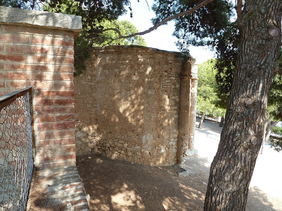
La Ràpita takes its name from a ribat, a fortified Muslim monastery. In 1097 Count Ramon Berenguer III gave it to the monastery of Sant Cugat; later the Hospitallers kept nuns here until pirate raids drove them to Tortosa in 1579 (Catalan Wikipedia). From about 1780 a coastal battery, the “castle”, was built on the site. In the 1970s the walls were dynamited for the municipal market. A raised semicircular wall of dressed stone survives in Carrer del Fossat, with two courses of stone across the street in the old moat. Of the monastery, only a stone belfry is visible from the street.
Església Nova
The building has a Greek-cross plan inside a square of 23.75 m a side, with a central space probably meant for a dome (Catalan Wikipedia). Rooms with galleries and balconies open onto it. The façade has two storeys divided by a cornice, and a central door flanked on each side by two giant Ionic columns; some details recall Sabatini’s Puerta de Alcalá in Madrid.
Despite the name, no document shows it was built as a church. Its layout is closer to the administrative buildings of its time, and nobody knows who designed it. The only known drawing is a sketch of about 1780 signed by Manuel Antonio Santiesteban. The structure was consolidated in 1991.
Torre de la Guardiola
The tower on La Torreta hill is first documented in 1483 and was probably strengthened in the 16th century against pirates (Catalan Wikipedia). In 1848 it became tower number 45 of the civil optical telegraph from Madrid to La Jonquera. In the 1960s a storey was cut off to carry a statue of the Sacred Heart; a large cross added then was removed in February 2017. From the top you see the town, the Alfacs bay and much of the delta.
La Glorieta
La Glorieta was built as a pavilion and viewpoint at the inland end of the main axis (Catalan Wikipedia): a small rotunda with three round arches facing the town, each flanked by Doric pilasters. It was never roofed, floored or rendered. Public schools later grew up around it, so it now stands inside their grounds. We could not confirm public access to the grounds; you can see it from outside.
Accessibility and practical details
The old-town part is flat on pavements and paved squares. The climb to the tower uses a lane, then an unpaved track and a short footpath, so it is not step-free; with a wheelchair or pushchair, see the square, the market and the Església Nova and skip the hill. The hilltop has little shade, so carry water in summer.
OpenStreetMap marks a free informal car park on the west side of La Torreta hill and a tourist office about 450 m south of the square. We could not check the office’s hours or any interior visits, because the town’s website could not be reached.
Best time to visit
Any time of year. In summer walk early or in the evening; clear winter days give the best views from the hill.
Nearby alternatives
- La Ràpita beaches, about 0.6 km: the town beaches south of the square.
- Badia dels Alfacs: the bay Charles III wanted to turn into a great port.
- La Foradada hike, about 4.3 km: the rock arch on the Montsià above town.
- Ulldecona rock art, about 10.5 km: prehistoric painted shelters.
- Punta de la Banya and the Trabucador, about 11 km.
- Alcanar and Les Cases d’Alcanar, about 12.6 km.
Straight-line distances from Plaça de Carles III. See also our Ebro Delta guide and the Ebro Delta and southern Costa Dorada guide.
FAQ
What is the Església Nova in La Ràpita?
An unfinished neoclassical building of about 1780, part of Charles III’s royal town on the Alfacs bay. No document shows it was meant to be a church, and its designer is unknown.
Can you go inside the Església Nova?
We could not confirm visiting hours or interior access. The outside can be seen from the street at any time.
How far is the Església Nova from Plaça de Carles III?
About 0.8 km on foot, mostly along Carrer de Sant Isidre, roughly 10 minutes at an easy pace.
Where is the best viewpoint in La Ràpita town?
La Torreta hill with the Torre de la Guardiola, about 1.2 km on foot from the square.
Sources and freshness
Checked 10 November 2026 · 10 sources Show
Checked 10 November 2026. Official: Catalan tourism portal on La Ràpita (Glorieta, Porxos, Casa de Laureà, Església Nova). Background: Catalan Wikipedia on the Església Nova, Plaça Carles III, the Santíssima Trinitat church, the castle, the Reial Monestir, La Glorieta, the Torre de la Guardiola and La Ràpita. La Ràpita town hall’s website could not be reached when we checked, so visiting arrangements are not confirmed. Streets, distances and coordinates: OpenStreetMap contributors (ODbL); distances are our own measurements. Photos: Wikimedia Commons, licences as credited.
This place is part of our Costa Dorada map and travel guide: Roman Tarragona, Salou and the Ebro Delta — see every town, beach and cove we have mapped on that coast.
How this page is made. CostaMap is written with an AI editorial system run by Ebizapple. This page is based on the sources listed above. Last updated 10 November 2026. Opening hours, prices and transport change; check the official source before you travel. How we work · Partner links and ads