
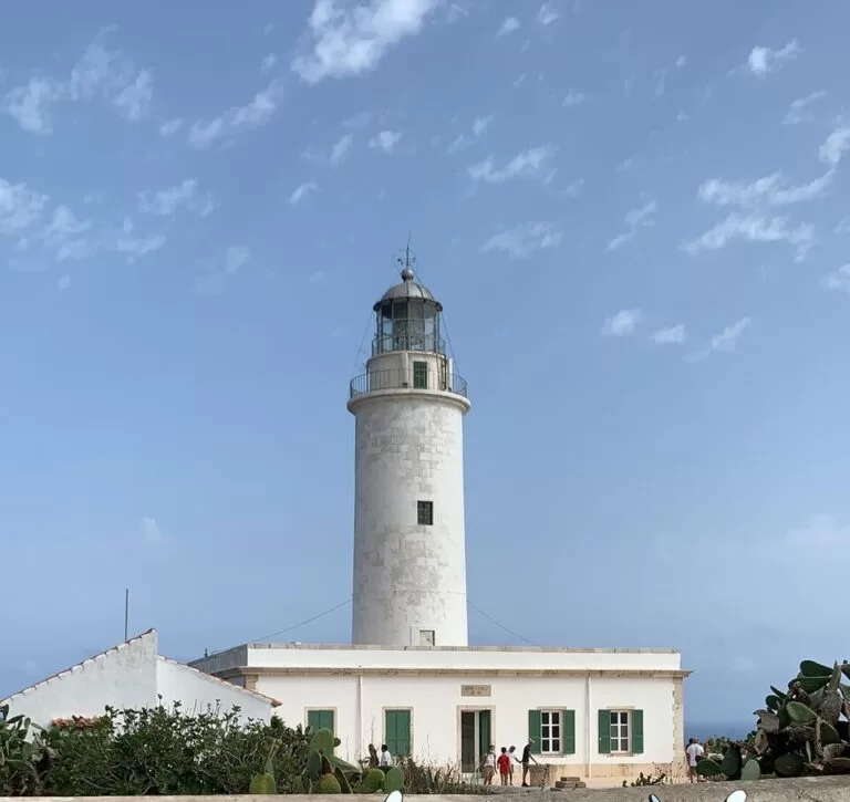
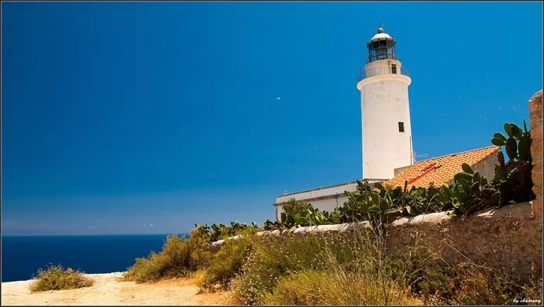
The Far de la Mola (La Mola lighthouse) stands on the cliff edge at the eastern tip of Formentera, at the end of the PM-820 road from La Savina, 2.6 km beyond the village of El Pilar de la Mola. The island council puts the lighthouse on a cliff 120 m above the sea; around it is an open clifftop with free parking, a bus stop, a memorial to Jules Verne and views over the Mediterranean. It suits sunrise and sunset watchers and anyone touring the island; skip it if you want a beach, as this is a high, exposed clifftop.
Quick facts
- Names: Far de la Mola (Catalan), Faro de la Mola (Spanish), La Mola lighthouse; OpenStreetMap also records Far de Formentera.
- Where: end of the Carretera de la Savina a Far de la Mola (PM-820), La Mola plateau, Formentera (Balearic Islands).
- Coordinates: 38.6634, 1.5837.
- Height: the island council gives 120 m above sea level for the lighthouse site (Consell de Formentera); we use that figure. The Balearic tourist board’s page gave a 158-metre cliff and a 21 m tower when we first checked it (Illes Balears tourism), but it did not load on 9 November 2026, so the two figures could not be reconciled; treat 120 m as the council’s number. The plateau’s highest point, Sa Talaïassa, is 192 m.
- Built: designed in 1861 by Emili Pou; it now runs on electricity.
- Inside: an exhibition space; general ticket 4.50 euros (checked November 2026).
- Outside: a monolith to Jules Verne, a café and gift shop, free parking.
Access and parking
By car or scooter: follow the PM-820 east across the island from La Savina, the ferry port, through Es Caló de Sant Agustí and up onto La Mola, then on past El Pilar de la Mola to the end of the road. The lighthouse is 16.3 km from La Savina in a straight line, and OpenStreetMap shows the PM-820 km 19 marker about 350 m before the lighthouse. On the climb, just before the top, the island council points out a restaurant with views to the west where you can park easily for a first viewpoint over both coasts of the island (Consell de Formentera, viewpoints).
Parking: OpenStreetMap shows a free surface car park with two electric-vehicle charging spaces about 65 m from the lighthouse, a larger compacted car park about 110 m away that also serves the bus, a customers’ car park and a motorcycle park for seven bikes.
By bus: the island council recommends the bus for longer trips such as the climb to La Mola (Consell de Formentera, transport). OpenStreetMap places a stop called Far de Mola about 100 m from the lighthouse, on line L2 between the port and El Pilar. We could not confirm the 2026 timetable or the winter service.
What to expect
An open clifftop at the end of the road, with the lighthouse tower on the edge. The island council calls it one of the most spectacular places on Formentera, and recommends it above all at sunrise or sunset (Consell de Formentera). OpenStreetMap marks two viewpoints on the cliff edge either side of the lighthouse, facing east and south-east, and a history board about the lighthouse.
The lighthouse was designed in 1861 by Emili Pou. It moved from oil to paraffin and petroleum and now runs on electricity; its light is continuous, with a brief blink that repeats every 4.67 seconds (Illes Balears tourism).
Next to it stands a monolith to Jules Verne. The tourist board explains that although Verne is often said to have taken this lighthouse as the model for “The Lighthouse at the End of the World”, Formentera is in fact the setting of another of his novels, “Hector Servadac”: the astronomer Palmyrin Rosette is in the lighthouse taking measurements when a comet carries him off into space. The character is based on the French astronomer François Arago, who was on Formentera in 1808 measuring the Paris meridian.
Exhibition, prices and opening
Since 2019 the lighthouse has housed a cultural space on Formentera’s maritime heritage. From 2026 it is dedicated to the island’s art: it shows, permanently, 56 works by artists closely linked to Formentera, donated to the island by Cati Verdera (Consell de Formentera). The council’s page, checked November 2026, gives:
- 15 October to 30 November: Tuesday to Sunday, 9:00–14:00. Closed Mondays.
- 1 December to 11 February: closed.
- Rest of the year: Tuesday to Sunday, 10:00–14:00, plus Wednesday and Sunday afternoons 17:00–21:00; closed Mondays. The same page also lists summer hours of Tuesday to Sunday 10:00–14:00, so check the afternoon opening before you plan a sunset visit inside.
- Tickets: 4.50 euros; 2.50 euros for pensioners and students; free for residents, under-18s and unemployed people.
The prices and hours apply to the exhibition. The council’s page gives no charge for the clifftop around the lighthouse. OpenStreetMap lists a café-bar and gift shop, Códice Luna, by the car park, open daily 11:00–20:00 according to its map entry; we have not checked this with the business.
Accessibility and safety
The lighthouse is a short walk from the car parks, and OpenStreetMap tags the café and shop as wheelchair accessible. We could not confirm step-free access into the exhibition or how much of the cliff edge is fenced. The cliff drops more than 100 m to the sea: keep children close and stay back from the edge, especially in wind. An emergency point (112) is mapped by the car park.
Best time to visit
The council recommends sunrise and sunset. The lighthouse is at the island’s eastern tip, so it suits sunrise well; for sunset, the viewpoint on the climb up to La Mola faces west. If you want to see the exhibition, avoid Mondays and the winter closure from 1 December to 11 February.
Nearby alternatives
- Formentera island guide, 13.9 km from the island’s centre point: ferries, getting around, beaches and villages, including El Pilar de la Mola 2.6 km back along the road.
- Ses Illetes, 16.7 km away: a beach in the north of the island.
- S’Espalmador, 19.5 km away: the small island off Formentera’s northern tip.
- Es Vedrà, 40.4 km away: the rock islet off Sant Josep, Ibiza.
Distances are in a straight line from the lighthouse. The island council lists the Molí Vell de La Mola windmill (2.1 km) and the church of La Mola (2.4 km) as other sights close by.
FAQ
How do I get to the Far de la Mola?
Drive or ride the PM-820 from La Savina to its eastern end, past El Pilar de la Mola. By bus, OpenStreetMap shows a Far de Mola stop on line L2, about 100 m from the lighthouse.
Is there parking at the Far de la Mola?
Yes. OpenStreetMap shows a free car park about 65 m from the lighthouse, a larger car park about 110 m away and a motorcycle park.
Can you go inside the La Mola lighthouse?
Yes, into the exhibition space. Tickets are 4.50 euros; it is closed on Mondays and from 1 December to 11 February (checked November 2026).
Is the Far de la Mola good for sunrise or sunset?
The island council recommends both. The lighthouse faces east from the tip of the island, which suits sunrise.
What is the Jules Verne connection?
Verne set part of his novel “Hector Servadac” at this lighthouse, and a monolith beside it honours him.
Sources and freshness
Checked 6 November 2026 · 4 sources Show
Checked 6 November 2026. Official:
- Consell de Formentera on the Far de la Mola (height, exhibition, hours, prices, Jules Verne monolith), viewpoints and transport
- Illes Balears tourism on Lighthouse La Mola (history, light, Hector Servadac
- its 158 m cliff figure conflicts with the council’s 120 m). Corrected 9 November 2026: height line now follows the island council’s 120 m
- the Balearic tourism page returned an error, so its 158 m could not be re-checked. Location, parking, bus stop and route, café, viewpoints and distances: OpenStreetMap contributors (ODbL). Photos: Wikimedia Commons, licences as credited
How this page is made. CostaMap is written with an AI editorial system run by Ebizapple. This page is based on the sources listed above. Last updated 9 November 2026. Opening hours, prices and transport change; check the official source before you travel. How we work · Partner links and ads