
Los Cahorros de Monachil (Granada)
Hiking trailLos Cahorros de Monachil is a limestone gorge on the River Monachil, about 2 km from the village of Monachil and 8 km south-east of Granada’s Alhambra in a straight line. You walk it from the village: the town hall’s circular route is 8.2 km, with 386 m of climbing and about 2 h 15 min of walking, and crosses a 63 m suspension bridge into the narrowest part of the canyon. The path is not waymarked and has exposed steps with drops, so it suits sure-footed walkers with a map or GPS track. Skip it with small children, with a fear of heights, or if you want a signposted, easy stroll.
Quick facts
- Names: Los Cahorros de Monachil, or simply Los Cahorros; the town calls it the desfiladero (gorge) of Los Cahorros. The town hall’s route sheet is “Ruta 2: Cahorros por Era del Portachuelo”.
- Where: the River Monachil above the village of Monachil (Granada), on the edge of Sierra Nevada.
- Coordinates: 37.1276, -3.5182 (the main suspension bridge, from OpenStreetMap).
- Distance: 8.2 km, circular (town hall route sheet).
- Height gain: 386 m up and 386 m down.
- Walking time: 2 h 16 min, without stops.
- Start: Monachil village, up Calle Madre Trinidad Carreras.
- Difficulty: the town hall warns of very difficult passages with a risk of falling, and the route is not waymarked.
- Season: recommended in all seasons (town hall).
- Entry: free.
Access and parking
By car: drive from Granada to Monachil village. On OpenStreetMap there is a small car park in the village centre near the river, a mapped surface car park about 250 m east along Calle Madre Trinidad Carreras, and the Era del Portachuelo car park about 0.9 km east of the village, on the route itself. We could not confirm prices, capacity or weekend restrictions.
By bus: OpenStreetMap maps bus line 0183 between Granada and Monachil, with stops on the Paseo del Río in the village, close to the start. Check the current timetable with the Granada area bus consortium before you go.
Where the walk starts: the route sheet starts in the village, climbs Calle Trinidad Carreras beside the river and turns right at the first bend to the Fuente del Piojo.
What to expect
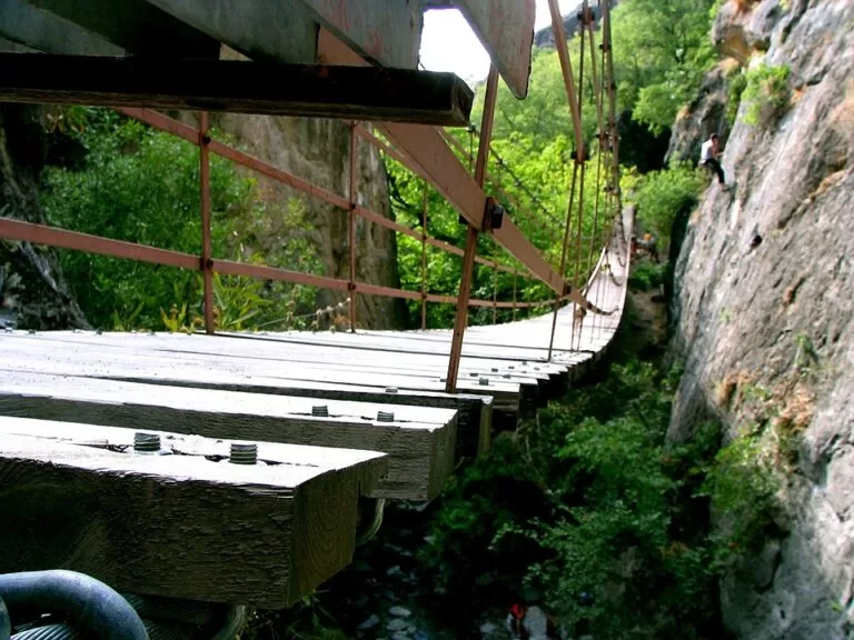
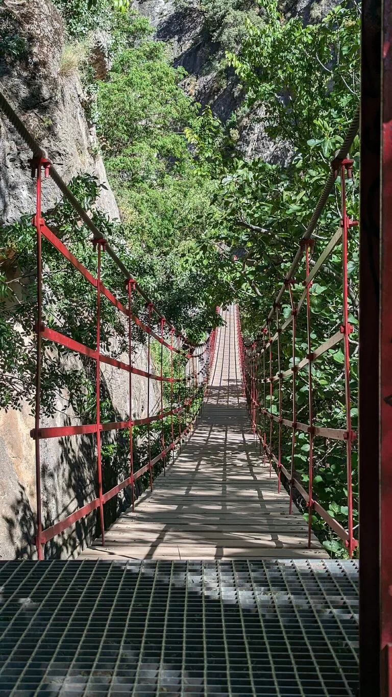
The town hall’s route (Monachil hiking page) first climbs away from the river past old threshing floors: the Era Portachuelos, then a steep climb to the Eras de los Renegrales, with views over the canyon’s limestone walls. From there the path drops into the gorge, past the ruins of the guard’s house of an old power station, to the foot of the 63 m suspension bridge. Across it starts the narrowest part of the canyon. Look up to see the walls overhang like cornices; the town says the two sides were once joined in a tunnel cut by the water, which you still see at the Túnel de las Palomas.
At the top of the gorge the valley opens out at Las Azuelas, with a smaller suspension bridge and a drinking fountain by a water-supply hut. A few minutes further, beside the channel, is the Fuente Las Chorreras, also drinking water, in the shade by the river. You return on the Camino de la Solana: cross the Puente de las Chorreras, climb the right bank to the best view of the gorge, follow the Acequia de los Habices irrigation channel, and come down past the Era Portachuelos to the village.
The cliffs are a popular climbing school, so expect climbers on the walls (Monachil town hall). Another town page gives the main bridge as more than 55 m long; the route sheet gives 63 m.
Practical details
- Navigation: the town hall says its Cahorros routes are suggestions on traditional paths that it does not maintain or waymark, walked at your own risk. Take a map or the GPS track linked from its hiking page.
- Route sheet: download the town’s PDF, Ruta 2: Cahorros por Era del Portachuelo.
- Waymarked option: OpenStreetMap also maps a “Circular de los Cahorros” with the reference PR-A 283. We could not find official details of it, so we give the town hall’s figures above.
- Water: drinking fountains at Las Azuelas and Fuente Las Chorreras, and several in the village (town hall and OpenStreetMap).
- Crowds: the town notes that Las Azuelas is busy at weekends. In 2024 it started a study on how to manage visitor numbers in Los Cahorros, and in 2025 it opened a new 26 m suspension footbridge on the Camino de la Acequia Gorda to take pressure off busier spots (town hall, 2025).
Accessibility and safety
This is not an accessible walk. The town hall warns of very difficult passages with drops, and the path climbs and descends 386 m. Wear proper walking shoes, keep children close in the narrow sections, and turn back if you are not comfortable with heights. The route is not waymarked, so carry a map or GPS track.
Best time to visit
The town recommends the route in every season. Go on a weekday or early in the morning to avoid the weekend crowds at Las Azuelas. For a rest, the route sheet points to the shaded Fuente Las Chorreras by the river.
Nearby alternatives
- Alhambra, 8.4 km away: Granada’s Nasrid palace and gardens.
- Granada Cathedral, 9 km away: in the centre of the city.
- Royal Chapel of Granada, 9 km away: the burial place of the Catholic Monarchs, next to the cathedral.
- Granada town guide: Alhambra tickets, the Albaicín and tapas in the city below Monachil.
- La Zubia town guide: the neighbouring Sierra Nevada foothill town.
- Caminito del Rey: another gorge walk in Andalucía, on boardwalks above El Chorro in Málaga province.
Distances are in a straight line from the main suspension bridge.
FAQ
How long is the Los Cahorros walk?
The town hall’s circular route from Monachil village is 8.2 km with 386 m of climbing and takes about 2 h 16 min of walking, without stops.
Where does the Los Cahorros route start, and is there parking?
It starts in Monachil village, up Calle Madre Trinidad Carreras. OpenStreetMap shows a small car park in the village and the Era del Portachuelo car park on the route, about 0.9 km east.
How long is the suspension bridge in Los Cahorros?
The town hall’s route sheet gives 63 m for the main bridge; another town page says more than 55 m.
Is Los Cahorros dangerous?
The town hall warns of very difficult passages with drops and the path is not waymarked. It is not suitable for people who are uneasy with heights.
Can you get to Los Cahorros by bus from Granada?
Yes. OpenStreetMap maps line 0183 between Granada and Monachil, with stops in the village near the start. Check the timetable before you go.
Sources and freshness
Checked 6 November 2026 · 7 sources Show
Checked 6 November 2026. Official: Monachil town hall hiking page and Ruta 2 route sheet (route, distance, time, height gain, warnings), natural setting (2 km from the village, bridge over 55 m), sport and nature (climbing), sustainable planning project, 2024 and new footbridge, 2025. Location, car parks, bus line, PR-A 283 and distances: OpenStreetMap contributors (ODbL). Photos: Wikimedia Commons, licences as credited.
This place is part of our Costa Tropical, Spain: map, towns, beaches and where to stay — see every town, beach and cove we have mapped on that coast.
How this page is made. CostaMap is written with an AI editorial system run by Ebizapple. This page is based on the sources listed above. Last updated 6 November 2026. Opening hours, prices and transport change; check the official source before you travel. How we work · Partner links and ads