
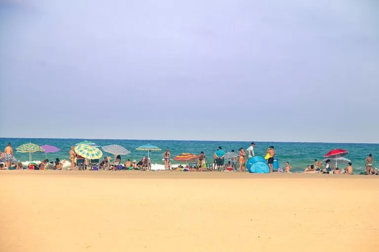
La Malvarrosa (Platja de la Malva-rosa) is València’s best-known city beach: about 1 km of fine golden sand, on average 135 m wide, on the northern seafront of the city between La Patacona beach in Alboraya and El Cabanyal beach. It lies about 4.5 km in a straight line from the cathedral square, and you reach it by tram, by city bus or on foot along the seafront promenade. It has lifeguards, an accessible bathing point and a promenade of rice and seafood restaurants. It suits anyone who wants a full-service city beach without a car; skip it if you want dunes or a quiet natural shore.
Quick facts
- Names: La Malvarrosa, Malvarrosa beach (English); Playa de la Malvarrosa (Spanish); Platja de la Malva-rosa (Valencian).
- Where: the north of València’s seafront. It runs from La Patacona beach in Alboraya in the north to Calle Acequia de la Cadena in the south, where El Cabanyal beach begins (Comunitat Valenciana).
- Coordinates: 39.4794, -0.3237 (OpenStreetMap).
- Size: about 1 km long and 135 m wide on average.
- Sand and water: fine golden sand; an open beach facing the Mediterranean.
- Awards listed by the regional tourist board: Blue Flag, Q for tourist quality, ISO 14001, EMAS and an accessibility certificate (UNE 170001).
- Entry: free; loungers and parasols are for hire.
Access and parking
By tram: the tram runs along Carrer d’Eugènia Viñes, one street behind the promenade, with stops at Platja Malva-rosa, Platja les Arenes and Neptú (OpenStreetMap). Metro and tram run from 4 am to 11:30 pm on weekdays and from 5 am to 12:30 am at weekends, according to Spain’s tourist board (Spain.info, checked November 2026).
By bus: Spain.info says EMT line 95 takes about half an hour from the City of Arts and Sciences area to the Marina and El Cabanyal–Las Arenas beach, and that lines 1, 2, 19, 31 and 32, plus special summer lines, also run to the city beaches (Spain.info). Check the EMT timetable before you go.
On foot or by bike: the regional tourist board says you can reach the beaches from the historic centre on public transport or on foot, passing through the old seafaring district of El Cabanyal. From the cathedral square it is about 4.5 km in a straight line. The promenade has bike lanes and bike parking, and the city’s municipal bike scheme is Valenbisi.
By car: the official beach page lists parking nearby, but we could not confirm a specific car park or price. Large parts of central València are Low Emission Zones where driving and parking are restricted, also for foreign-registered cars (Spain.info), so check before you drive in.
From the airport: Valencia Airport is about 13 km away in a straight line. Metro lines 3 and 5 run from the airport into the city in about 20 minutes; change to the tram for the beach.
What to expect
This is an urban beach in every sense. The regional tourist board calls it the city’s unmissable urban beach and describes a seafront promenade where you can walk, enjoy the views and stop for a meal; the beach bars and restaurants serve rice dishes and freshly caught seafood. Spain’s tourist board names it one of the best-known beaches in València and says the fine golden sand and blue water recall the paintings in which Joaquín Sorolla depicted the city (Spain.info).
At 135 m on average, the beach is wide. The services listed by the tourist board include lifeguard stations, health stations, sports areas, floating platforms, toilets, showers and foot fountains, walkways and a taxi rank.
The writer Vicente Blasco Ibáñez had his beach house here. On its site, at Carrer d’Isabel de Villena 159, the Casa-Museo Blasco Ibáñez opened in 1997 in a building whose façade copies the original house. The ground floor covers his life and work, the first floor recreates the rooms he lived in with original objects, and the second floor holds a library and research centre (Comunitat Valenciana). It is about 400 m north of the middle of the beach.
Walk south and La Malvarrosa runs straight into El Cabanyal beach, a large beach of fine sand with lifeguards, loungers, parasols and beach bars in the high season. Beyond it lies La Marina de València, where, the tourist board says, many water-sports companies are based (Comunitat Valenciana). Walk north and you cross into La Patacona, in Alboraya: more than 1 km long and 110 m wide, with a busy promenade and, early in the morning or at sunset, horse riders along the shore (Comunitat Valenciana).
Accessibility and safety
La Malvarrosa is well equipped for visitors with reduced mobility. The tourist board lists accessible points, walkways onto the sand, adapted toilets and showers, and a swimming programme for disabled people (Comunitat Valenciana). La Patacona next door also offers free bathing assistance with amphibious chairs and floats.
Swim near the lifeguard posts and follow the flags and the lifeguards’ instructions. In an emergency call 112.
Dogs: the official page for Pinedo beach, south of the port, marks it as dog-friendly (Comunitat Valenciana). We could not confirm the rules for dogs on La Malvarrosa, so do not assume they are allowed in season.
Best time to visit
For swimming, come in summer, when the beach services and lifeguards are in place. The regional tourist board says the promenade of neighbouring La Patacona is busy all year round, especially at weekends, so come early on a summer weekend. Outside summer the seafront is still worth a walk: the tourist board points out that El Cabanyal beach has a good atmosphere even in winter.
Nearby alternatives
- Marina Real Juan Carlos I (La Marina de València), 2.1 km away: the city’s marina, with restaurants, boat trips and the Veles e Vents building.
- Oceanogràfic, 3.6 km away: Europe’s largest aquarium, a good plan for a day too windy for the beach.
- City of Arts and Sciences, 3.6 km away: Calatrava’s complex in the old Turia riverbed.
- Valencia Cathedral, 4.5 km away: the Holy Chalice and the Miguelete tower in the old town.
- Silk Exchange (La Lonja), 4.7 km away: the UNESCO-listed Gothic hall opposite the Central Market.
Distances are in a straight line from the middle of the beach. For the whole city, see our Valencia guide.
FAQ
How do I get to Malvarrosa beach from the city centre?
Take the tram to the Platja Malva-rosa or Platja les Arenes stops, one street behind the beach, or a city bus such as line 19, 31 or 32. You can also walk or cycle; the beach is about 4.5 km from the cathedral in a straight line.
How long is Malvarrosa beach?
About 1 km, with an average width of 135 m. It joins El Cabanyal beach to the south and La Patacona to the north, so you can walk well over 3 km of continuous sand.
Is Malvarrosa beach good for swimming?
Yes. It is an open, sandy beach with lifeguard stations and a Blue Flag listed by the regional tourist board. Swim near the lifeguards and follow the flags.
Is there parking at Malvarrosa beach?
The official page lists parking nearby, but we could not confirm a car park or price, and parts of the city are Low Emission Zones. The tram stops one street behind the beach.
Is Malvarrosa beach accessible for wheelchairs?
Yes. It has accessible points, walkways, adapted toilets and showers and a swimming programme for disabled people, and holds the UNE 170001 accessibility certificate.
Sources and freshness
Checked 7 November 2026 · 8 sources Show
Checked 7 November 2026. Official: Turisme Comunitat Valenciana on La Malvarrosa beach (size, services, certificates), El Cabanyal beach, La Patacona beach, Pinedo beach and the Casa-Museo Blasco Ibáñez; Spain.info on València (transport, Low Emission Zones) and Valencia in two days (bus lines). Location, tram stops and distances: OpenStreetMap contributors (ODbL). Photo: Wikimedia Commons, licence as credited. Not confirmed: car park names and prices, beach rules for dogs, the exact months of lifeguard cover.
This place is part of our Costa Valenciana Map: Valencia, Gandia and the Albufera — see every town, beach and cove we have mapped on that coast.
How this page is made. CostaMap is written with an AI editorial system run by Ebizapple. This page is based on the sources listed above. Last updated 6 November 2026. Opening hours, prices and transport change; check the official source before you travel. How we work · Partner links and ads