
Marina Real Juan Carlos I (La Marina de València)
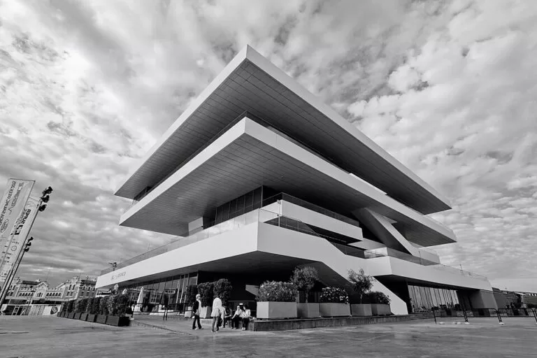
MarinaMarina Real Juan Carlos I is the yacht marina in the old inner harbour of Valencia, now run as part of La Marina de València, by the Veles e Vents building in the Grau district. You reach it by tram: the Neptú stop is about 0.3 km away and the Grau–La Marina stop 0.45 km, and the city beach of Las Arenas starts about 0.9 km to the north. The regional tourist board describes a marina integrated into the city, with berths for boats from 8 to 150 m, built around the bases of the America’s Cup teams. It suits sailors, walkers and cyclists on the waterfront, and anyone booking a boat trip. Skip it if you want old-town sights: the cathedral is 4.5 km inland.
Quick facts
- Names: Marina Real Juan Carlos I, the name the regional tourist board still uses; on OpenStreetMap it is now La Marina de València (in Spanish La Marina de Valencia), with Marina Real Juan Carlos I as the old name. The English page of the tourist board calls it the America’s Cup Marina.
- Where: Moll de la Duana and the surrounding quays, el Grau, Poblats Marítims, 46024 València (OpenStreetMap).
- Coordinates: 39.4605, -0.3260.
- Operator: Consorcio València 2007, according to OpenStreetMap.
- Berth sizes: 8 to 150 m, in the North Marina (Marina Norte) and the South Marina (Marina Sur), according to the tourist board.
- Berths: we could not reach the operator’s or the port authority’s websites, so we do not give a berth number here.
- Contact: +34 963 462 007, info@marinavalencia.com (tourist board listing).
- Services listed: diesel, toilets, showers, security, parking, food shop, chandlers, bar and waste collection.
Access and parking
By tram and metro: OpenStreetMap shows the Metrovalencia stops Neptú (0.3 km) and Grau–La Marina (0.45 km) closest to the marina, with Canyamelar 0.7 km away. Check Metrovalencia for lines and times.
By bike: Valenbisi, the city’s bike share, has docking stations by the Veles e Vents building (0.24 km) and on the Passeig de Neptú (0.48 km).
Parking: OpenStreetMap marks several free surface car parks at the north end of the marina, near the Passeig de Neptú, 0.4–0.55 km away, and free surface parking on the east side of the dock about 0.55–0.6 km away. Paid underground car parks lie 0.46 km and 0.61 km to the north. On busy summer days and event days the free spaces fill early.
By sea: the tourist board invites boat owners to moor in the North or South Marina, beside the canal facing the Veles e Vents building. OpenStreetMap shows a fuel berth on the east side of the harbour. Contact the marina before arriving.
What to expect
The tourist board calls it “a different marina, integrated into the city”, “for all audiences”, where you moor surrounded by the bases of the teams of the 32nd and 33rd America’s Cup and can follow the route of the Valencia Formula 1 Grand Prix. It also mentions the marina’s own weather station.
Around the basin, OpenStreetMap shows:
- Veles e Vents: the landmark building on the Moll de la Duana, 0.17 km from our map point.
- Boat trips: the Mundo Marino catamaran stop by the Veles e Vents, including a route to Port Saplaya, and sailing charters on the North Marina pontoons.
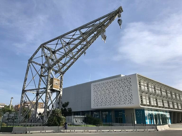
- Old harbour buildings: the Docks Comerciales and the Tinglados (old port sheds), numbers 2, 4 and 5, on the west side of the dock.
- Sailing: the base of the Marina Valencia Sailing Club and a windsurf station on the east side.
- Food: restaurants and beach clubs at the north end, towards the Passeig de Neptú and the beach, including Balandret.
- The beach: the Platja del Cabanyal, also called Las Arenas, starts about 0.9 km to the north.
Prices and opening
The quays are public space and we found no entry charge. OpenStreetMap marks some public toilets at the marina as paid. For berth rates, fuel and the marina office’s hours, contact the marina on the number above; we could not check them with the operator, so we do not print them. Boat trips, restaurants and events set their own prices and hours.
Accessibility and safety
The quays are wide and flat. OpenStreetMap marks wheelchair-accessible public toilets at several points around the marina. We could not confirm step-free access onto the pontoons, which are for berth holders. Watch for cyclists and service vehicles on the quays, keep children away from the edges, and swim at the beach, never in the harbour.
Best time to visit
The waterfront is open all year. Come in the late afternoon for a walk from the marina to the beach and dinner on the Passeig de Neptú, or in the morning if you are taking a boat trip. In high summer, arrive early for the free car parks, or come by tram.
Nearby alternatives
- Oceanogràfic, 2 km away: the aquarium in the City of Arts and Sciences.
- City of Arts and Sciences, 2.2 km away.
- Valencia city guide, 4.4 km away: the old town, food and markets.
- Valencia Cathedral, 4.5 km away.
- Albufera, 13.6 km away: the lagoon and natural park south of the city.
- Sagunto, 24 km away: the historic town to the north.
Distances are in a straight line from the marina.
FAQ
Where is Marina Real Juan Carlos I?
In Valencia’s old inner harbour, in the Grau district, by the Veles e Vents building. It is now part of La Marina de València. Coordinates: 39.4605, -0.3260.
Is Marina Real Juan Carlos I the same as La Marina de València?
Yes. OpenStreetMap lists Marina Real Juan Carlos I as the old name of La Marina de València, the waterfront and marina around the old America’s Cup team bases. The regional tourist board still uses the old name.
How do I get to the marina by public transport?
Take Metrovalencia to Neptú (0.3 km) or Grau–La Marina (0.45 km). Valenbisi bikes also dock by the Veles e Vents building.
Is there parking at the Valencia marina?
Yes. OpenStreetMap shows free surface car parks near the Passeig de Neptú and on the east side of the dock, and paid underground car parks to the north.
How big are the boats it takes?
Berths range from 8 to 150 m, according to the regional tourist board.
Sources and freshness
Checked 6 November 2026 · 4 sources Show
Checked 6 November 2026. Official: Turisme Comunitat Valenciana, Marina Real Juan Carlos I (description, berth sizes, North and South marinas, America’s Cup and Formula 1, services, contact) and its English page (America’s Cup Marina name). Location, names, operator, tram stops, bike stations, car parks, buildings, boat trips and distances: OpenStreetMap (OpenStreetMap contributors, ODbL). The marina’s and the Valencia port authority’s websites could not be reached for this update. Photos: Wikimedia Commons, licences as credited.
This place is part of our Costa Valenciana Map: Valencia, Gandia and the Albufera — see every town, beach and cove we have mapped on that coast.
How this page is made. CostaMap is written with an AI editorial system run by Ebizapple. This page is based on the sources listed above. Last updated 6 November 2026. Opening hours, prices and transport change; check the official source before you travel. How we work · Partner links and ads