
Mirador Es Colomer (Formentor, Pollença)
ViewpointMirador Es Colomer (Mirador d’es Colomer, also called Mirador del Mal Pas) is the cliff-top viewpoint on the Formentor road in the north of Mallorca, about 3.6 km in a straight line from Port de Pollença. You park at the Coll de la Creueta on the Ma-2210 and walk a short paved path and a few steps out to terraces above the cliffs, with the rock islet of Es Colomer below. Entry and the two car parks are free. It suits anyone driving, cycling or taking the bus to Cap de Formentor; skip it if you cannot manage steps or have no head for heights.
Quick facts
- Names: Mirador Es Colomer, Mirador d’es Colomer or Mirador des Colomer in Catalan; also Mirador del Mal Pas. The Balearic tourism portal calls the stop Mirador de Sa Creueta, after the Coll de la Creueta pass where the car park is.
- Where: Ma-2210, the road from Port de Pollença to Cap de Formentor, Pollença municipality, northern Mallorca.
- Coordinates: 39.9310, 3.1124 (the viewpoint terrace on OpenStreetMap).
- Height: the Coll de la Creueta, where you park, is mapped at 207 m above sea level.
- Who built it: engineer Antoni Parietti, who designed the Port de Pollença–Formentor road (1925) and also the viewpoint. A stone memorial to him has stood here since 1968.
- Entry: free, open-air, no ticket.
- Parking: two free car parks, plus a small coach bay and a bicycle rack for 45 bikes.
- Bus: line 334 (Alcúdia–Formentor) stops at “Mirador d’es Colomer (Formentor)”.
Access and parking
By car: from Port de Pollença follow the signs for Formentor onto the Ma-2210. The Formentor road is 13.5 km long from Port de Pollença to the cape (Wikipedia); the viewpoint is on the climb out of the port, before the Formentor beach turn-off. The Balearic tourism portal describes the road as winding and steep and recommends the stop for its view of the vertical cliffs.
Parking: on OpenStreetMap the main car park sits on the Coll de la Creueta, right by the bus stops, about 290 m from the far end of the viewpoint. A second car park lies about 190 m from the terrace. Both are tagged free (checked by mappers in April 2025). There is also a coach bay for three buses.
Summer road rules: OpenStreetMap tags the Ma-2210 around the viewpoint as closed to private motor vehicles from June to October, 10:00–22:00, with a note that access is restricted when the Formentor beach car park is full. We could not open the Consell de Mallorca website to confirm the 2026 dates and hours, so check the current rules before you drive up in summer.
By bus: bus 334 runs between Alcúdia and Formentor and has a stop on each side of the road at the viewpoint (OpenStreetMap route). We could not confirm the 2026 timetable; check the Consorci de Transports de Mallorca (TIB) before you go.
By bike: there is a 45-place bike rack next to the car park (OpenStreetMap).
What to expect
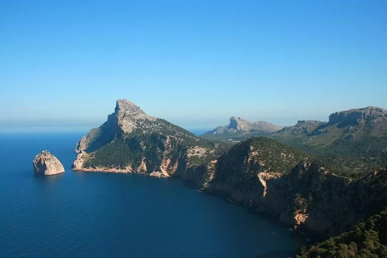
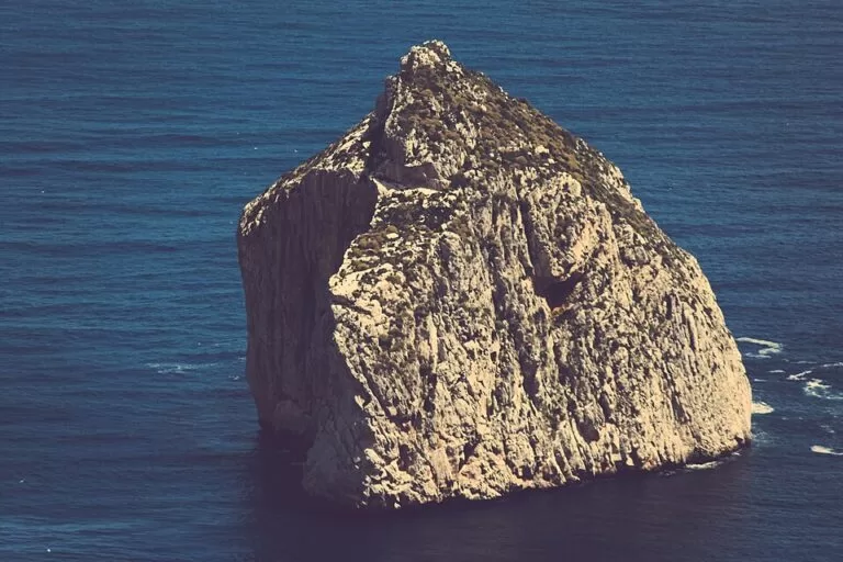
The viewpoint is a set of terraces and walkways on a rocky ridge above the north side of the peninsula. Below you the cliffs drop straight into the sea, and offshore stands the islet of Es Colomer, the rock on the left of the photo above. The tourism portal describes the peninsula’s cliffs as “guarded by the Colomer islet” (illesbalears.travel).
On the coll itself you find the memorial stone to Antoni Parietti, an information board (“Bienvenidos a Formentor”), a small picnic area and, in summer, a kiosk. OpenStreetMap shows two kiosks, one of them marked as open June to August. Do not count on food or toilets; none are mapped here.
The engineer behind the place matters to the story. Parietti built the Formentor road in 1925, which allowed the Hotel Formentor to be built a few years later, and he also designed the snake road down to Sa Calobra (Viquipèdia, Wikipedia ES).
Practical details
- Bring water and a hat. The terraces are exposed, and the only mapped shop is a seasonal kiosk.
- Opening hours: none are published. The viewpoint is open-air, and OpenStreetMap shows no gate or barrier.
- Extra walk: an asphalt lane, the camí de la talaia d’Albercutx, climbs from near the coll to the Talaia d’Albercutx, a stone watchtower from the late 16th or early 17th century, listed by the Consell de Mallorca. It sits about 480 m from the viewpoint at 370 m above sea level, with its own small free car park (OpenStreetMap).
Accessibility and safety
OpenStreetMap marks the viewpoint as not wheelchair accessible: the last part is a flight of 10 concrete steps with a handrail and no ramp, and the walkways run along the cliff edge. Keep children close and stay behind the walls. Walking along the road between the car parks means sharing a two-lane road with no pavement and no shoulder, so take care. Wind on the cape can be strong.
Best time to visit
If you want to drive up yourself in summer, the OpenStreetMap tags suggest going before 10:00 or after 22:00, or taking bus 334; check the official rules first. The restriction tagged on OpenStreetMap only covers June to October, and the tourism portal lists the Formentor area as a destination for all four seasons.
Nearby alternatives
- Pollença town guide: the Calvari steps, the old town and Port de Pollença, 3.6 km from the viewpoint to the port.
- Torrent de Pareis, 25.5 km away: the gorge hike that ends at Sa Calobra, at the bottom of Parietti’s other famous road.
- Serra de Tramuntana, 35.7 km away (to the centre of the range): the mountain range that ends at Formentor.
- Port de Sóller, 38.6 km away: the harbour on the west coast and boat trips along the cliffs.
- The Talaia d’Albercutx watchtower, 0.5 km away, and the Platja de Formentor further along the same road.
Distances are in a straight line from the viewpoint.
FAQ
Is there parking at Mirador Es Colomer?
Yes. There are two free car parks on the Coll de la Creueta, 190–290 m from the viewpoint, plus a coach bay and a bike rack. In summer, check the traffic rules on the Formentor road first.
How do I get to Mirador Es Colomer?
Drive or cycle from Port de Pollença along the Ma-2210 towards Cap de Formentor; the viewpoint is on the climb above the port. Bus 334 from Alcúdia also stops there.
Can you drive to Formentor in summer?
Possibly not in the middle of the day. OpenStreetMap shows a June–October, 10:00–22:00 restriction around the viewpoint, but we could not confirm the 2026 rules officially, so check before you go.
Is Mirador Es Colomer free?
Yes. It is an open-air viewpoint with no ticket, and the car parks are marked free.
Is Mirador Es Colomer the same as Mirador del Mal Pas?
Yes. The English Wikipedia lists Mirador del Mal Pas as also named Mirador d’es Colomer, after the islet below it.
Sources and freshness
Checked 6 November 2026 · 6 sources Show
Checked 6 November 2026. Official: Balearic tourism portal on Formentor beach and the Mirador de Sa Creueta and Mallorca’s larger bays. Background: Wikipedia, Cap de Formentor (names, road length), Viquipèdia and Wikipedia ES on Antoni Parietti. Location, parking, steps, kiosks, bus stops, road tags and distances: OpenStreetMap contributors (ODbL). The Consell de Mallorca site (traffic rules) and the TIB bus timetable could not be opened. Photos: Wikimedia Commons, licences as credited.
This place is part of our Balearic Islands travel guide: Mallorca, Menorca, Ibiza and Formentera — see every town, beach and cove we have mapped on that coast.
How this page is made. CostaMap is written with an AI editorial system run by Ebizapple. This page is based on the sources listed above. Last updated 6 November 2026. Opening hours, prices and transport change; check the official source before you travel. How we work · Partner links and ads