
Costa Vasca · Eastern Bizkaia
Urdaibai and Lea-Artibai travel guide: Bermeo to Ondarroa
The Urdaibai Biosphere Reserve around the Mundaka estuary, Gernika and Gaztelugatxe, then a string of fishing ports and beaches east to Lekeitio and Ondarroa.
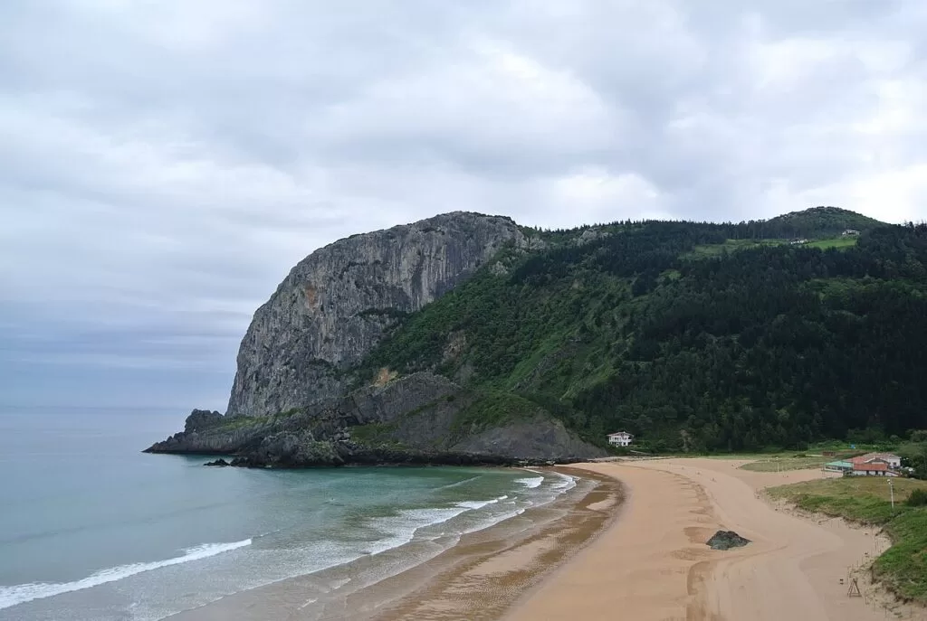
Laga beach and Cape Ogoño · Photo: Ben Bender, CC BY-SA 3.0
Part of the Costa Vasca guide · Urdaibai and Lea-Artibai
Urdaibai and Lea-Artibai is the eastern half of the Bizkaia coast in the Basque Country, from Bermeo and San Juan de Gaztelugatxe in the west to Ondarroa on the border with Gipuzkoa, about 32 km further east in a straight line. The western part is the Urdaibai Biosphere Reserve, listed by UNESCO in 1984, where the river Oka forms an estuary of marshes and sandbanks between Gernika and Mundaka (Basque tourism); the eastern part, Lea-Artibai, is a coast of fishing ports such as Lekeitio and Ondarroa. This guide covers each town from west to east, the beaches, what to do, where to base yourself, how to get there and a two-day route.
At a glance
- Where the eastern coast of Bizkaia, from Bermeo and Gaztelugatxe to the Artibai estuary at Ondarroa, with Gernika at the head of the Urdaibai estuary.
- Towns Bermeo, Mundaka, Gernika, Ibarrangelu, Elantxobe, Ea, Lekeitio and Ondarroa.
- Best for birdwatching in the estuary, surfing at Mundaka and Laga, fishing ports, cave art, and Basque history in Gernika.
- Getting there Bilbao Airport (BIO) is about 19 km from Gernika and 20 km from Bermeo in a straight line; Euskotren trains run from Bilbao to Gernika and Bermeo.
- On CostaMap guides to Bermeo, San Juan de Gaztelugatxe, Isla de Izaro, Mundaka, Gernika, Elantxobe and Lekeitio.
Map of Urdaibai and Lea-Artibai
The map shows the places between Bermeo and Ondarroa that have a CostaMap page. Tick a place type to filter, and click a marker to see the place in the panel.
Place type
Area · next level
 Area map
Urdaibai and Lea-Artibai
Click a marker to see the place here. From Bermeo and the Urdaibai estuary to Elantxobe, Lekeitio and Ondarroa.
Towns and villagesTowns and villages
From west to east, as described by the Basque Country’s official tourism site. Population figures are the ones it gives.
Bermeo
Bermeo is one of the main ports of Bizkaia, at the foot of Mount Sollube, with a coast of cliffs and rocks that includes San Juan de Gaztelugatxe, the islands of Aketx and Izaro and Cape Matxitxako (Basque tourism). Spain.info dates the town to 1239 and lists the monuments of Historic-Artistic Interest: the cloister of San Francisco from 1357, the Gothic Ercilla Tower with the Fishermen’s Museum, the churches of Santa María and Santa Eufemia, and the town hall of 1732 with two sundials. San Juan de Gaztelugatxe belongs to Bermeo and is 8 km from the centre. See our Bermeo guide, the San Juan de Gaztelugatxe guide and the Isla de Izaro guide.
Mundaka
Mundaka is a colourful fishing village of 1,878 people on the left bank of the estuary mouth, inside the Urdaibai reserve, and famous for its left-hand wave, which draws surfers from around the world (Basque tourism). Around the port are the library, a former hospital on the Way of St James, the town hall, the Renaissance-style church of Santa María and the Larrinaga palace. The hermitage of Santa Catalina, on a small hill by the sea, looks across to Cape Ogoño and Izaro. The village’s carnival is one of the oldest in the Basque Country. See our Mundaka guide.
Gernika-Lumo
Gernika lies up the estuary, about 10 km inland from Mundaka. It was founded in 1366 and is remembered for the bombing of 26 April 1937, the subject of its Peace Museum (Basque tourism). The Assembly House, with the Tree of Gernika behind it, is the seat of one of the oldest parliaments in Europe, and entry to its historic part is free (Basque tourism). The Monday market is the most important in Bizkaia. Gernika is the transport hub of Urdaibai and a good base without a car. See our Gernika guide.
Ibarrangelu
Ibarrangelu holds the two big beaches on the eastern side of the estuary. Laida is almost a kilometre of fine golden sand, the longest beach in the Mundaka estuary, with shallow water for children and a dune in the middle with views of Izaro (Basque tourism). Laga, 574 m long, lies under Cape Ogoño, 279 m high (Basque tourism). The chapel of San Pedro de Atxarre, in Ibarrangelu, is one of the reserve’s natural viewpoints (Basque tourism).
Elantxobe
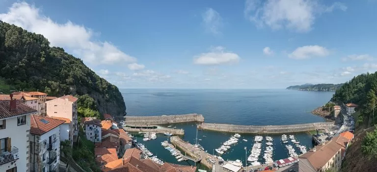
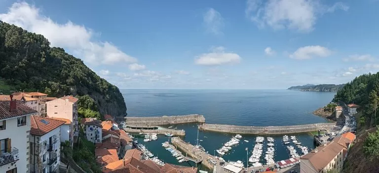
Elantxobe, with 346 residents, clings to the eastern side of Cape Ogoño. Its harbour piers were built in 1783 to stop the waves, the church of San Nicolás de Bari is dedicated to the patron saint of sailors, and the houses are stacked one above the other facing the sea (Basque tourism). The port still works as a fishing port, though many boats are now pleasure craft (Basque tourism). The village is so steep that buses turn round on a turntable in the upper square. See our Elantxobe guide.
Ea
Ea is a small municipality of 843 people made up of three villages: Natxitua, Bedarona and Ea itself (Basque tourism). Ea has a small beach and two Romanesque-style bridges in the centre, with the Renaissance church of San Juan Bautista and the Baroque church of Santa María de Jesús. Natxitua and Bedarona have sea views and coves, with a church in Natxitua and the hermitage of San Bartolomé in Bedarona. The main fiesta, San Juan, is in the second half of June.
Lekeitio and Mendexa
Lekeitio, with 7,243 residents, is the largest town on the eastern stretch, where the Lea meets the sea between Isuntza and Karraspio beaches (Basque tourism). San Nicolás Island can be reached on foot along the breakwater at low tide. The basilica of the Asunción de Santa María has a gilded Gothic altarpiece that the tourism board calls the third largest in Spain, and the Santa Catalina lighthouse is the first in the Basque Country open to visitors. Karraspio belongs to neighbouring Mendexa. The San Antolín fiestas run from 1 to 8 September. See our Lekeitio guide.
Ondarroa
Ondarroa, with 8,451 residents, closes the stretch on the estuary of the Artibai, in a rugged spot dominated by the Peña del Fraile (Basque tourism). The Itsasaurre bridge by Santiago Calatrava leads to the port, while the old quarter has steep, narrow streets, the old bridge, the 15th-century Likona tower and the Gothic church of Santa María, from 1462. Spain.info calls it a fishing and canning port and notes that Saturraran beach, to the east, marks the boundary between Bizkaia and Gipuzkoa. The fiestas start on 14 August.
Beaches and coves
From west to east. Lengths, services and lifeguard hours are as the Basque tourism board lists them; lifeguards work from 11:00 to 20:00 in summer at Laga, Laida, Isuntza and Karraspio.
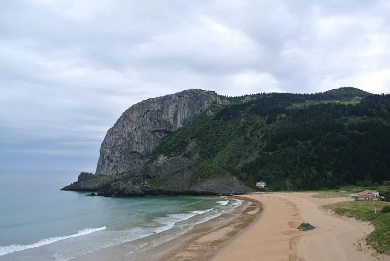
Laga
574 m of fine golden sand next to Cape Ogoño, open to the sea. Short, intense waves with rights and lefts; the surf centre for Gernika and around, with a surf club and school (Basque tourism).
See the Elantxobe guide →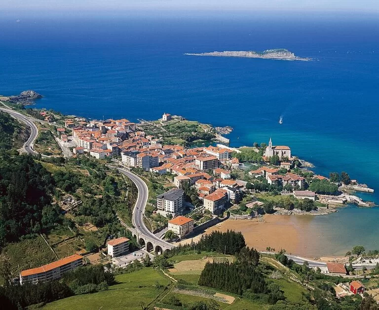
Laida
Almost a kilometre of golden sand in the Mundaka estuary, with shallow water and long, gentle waves for longboards; Mundaka’s surf schools work here. Watch the currents (Basque tourism).
See the Mundaka guide →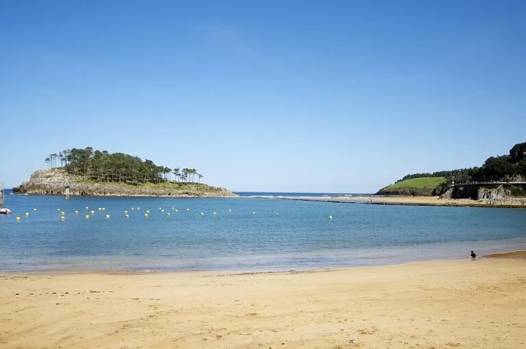
Isuntza
The town beach, next to the port and the park, with toilets, showers, changing rooms and canoe hire. San Nicolás Island can be reached along the breakwater at low tide (Basque tourism).
See the Lekeitio guide →- Karraspio (Mendexa) – across the Lea from Lekeitio; a beginner surf beach that needs a big swell to break, with surf courses and a promenade back to Lekeitio (Basque tourism).
- Ea – a small beach in the village (Basque tourism).
- Arrigorri (Ondarroa) – the town’s beach, from which you can walk to Saturraran beach in Mutriku (Basque tourism).
- San Juan de Gaztelugatxe – no sand, but in summer people swim from the small stony beaches at the foot of the steps (Basque tourism).
Things to do
Nature: the Urdaibai estuary and its birds
The river Oka rises on Monte Oiz and flows out into an estuary at Mundaka, creating wetlands that are best seen at both high and low tide. Ospreys, spoonbills and Eurasian bitterns, rare elsewhere in Iberia, can be seen here, and Cape Ogoño, San Pedro de Atxarre in Ibarrangelu and San Miguel de Ereñozar in Ereño are natural viewpoints (Basque tourism). The Urdaibai Bird Center in Gautegiz Arteaga is a museum, research centre and observatory over the marsh; in July and August it opens every day from 11:00 to 19:00, with shorter hours the rest of the year (Basque tourism, checked November 2026).
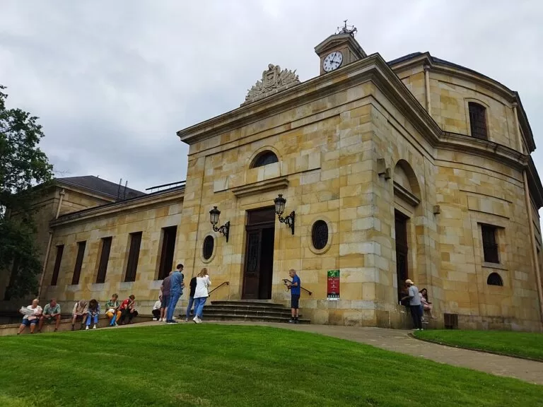
History and art: Gaztelugatxe, Gernika, Santimamiñe and Oma
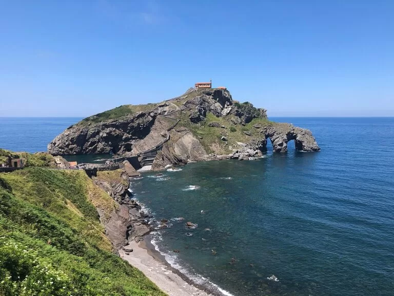
San Juan de Gaztelugatxe is joined to the coast by a stone bridge and 241 steps; the first hermitage is believed to date from the 9th century, and a free access ticket is required (Basque tourism). The Santimamiñe cave in Kortezubi has Magdalenian paintings of horses, goats, deer and bears, found in 1916; it has been closed to the public since 2006, but guided visits of about an hour and a half include the entrance and a virtual tour in the chapel of San Mamés (Basque tourism). From there a 2.8 km walk, about 50 minutes, leads to the Oma Forest, Agustín Ibarrola’s painted forest of 1984, now on a new 12-hectare site; free and guided visits must be booked, and the forest cannot be reached by car (Basque tourism, checked November 2026).
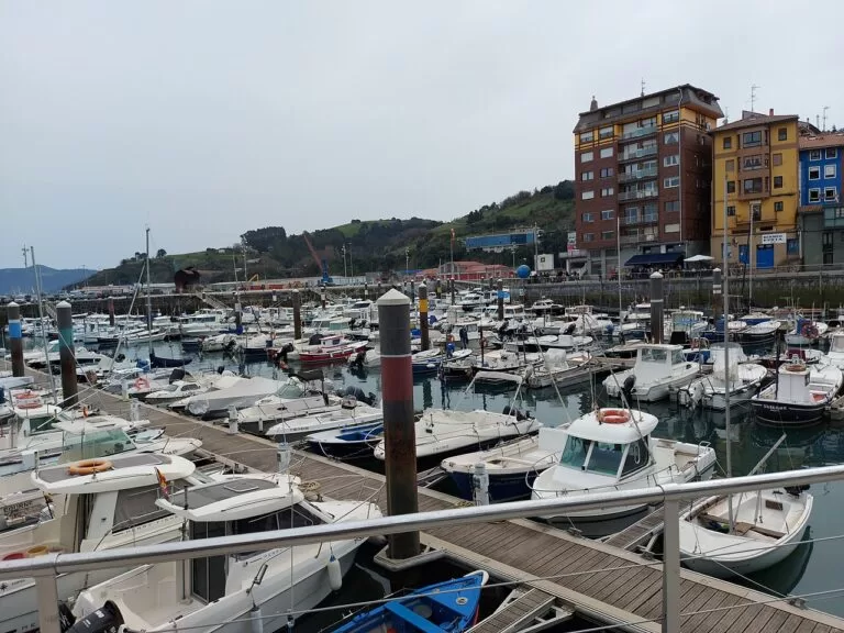
Ports and markets: fishing, canning and Monday in Gernika
The Fishermen’s Museum in Bermeo’s 15th-century Ercilla Tower covers Basque fishing from prehistory to today, with tackle, boats and other objects; it opens Tuesday to Saturday 10:00–14:00 and 16:00–19:00 and Sunday 10:00–14:00 (Basque tourism, checked November 2026). Bermeo celebrates Fishermen’s Day on 9 September (Basque tourism). Ondarroa is a fishing and canning port (Spain.info), and Gernika’s Monday market is the biggest in Bizkaia, with a large cattle and farm fair on the last Monday of October (Basque tourism).
Where to stay by town
The towns we would base a trip in, west to east.
Bermeo
The biggest port of the stretch, at the end of the Euskotren line from Bilbao, 8 km from Gaztelugatxe and close to Mundaka.
Port and trainGernika
Inland, but the hub for trains and buses, with the museums, the Monday market and short drives to Santimamiñe, Laida and Laga.
Car-free base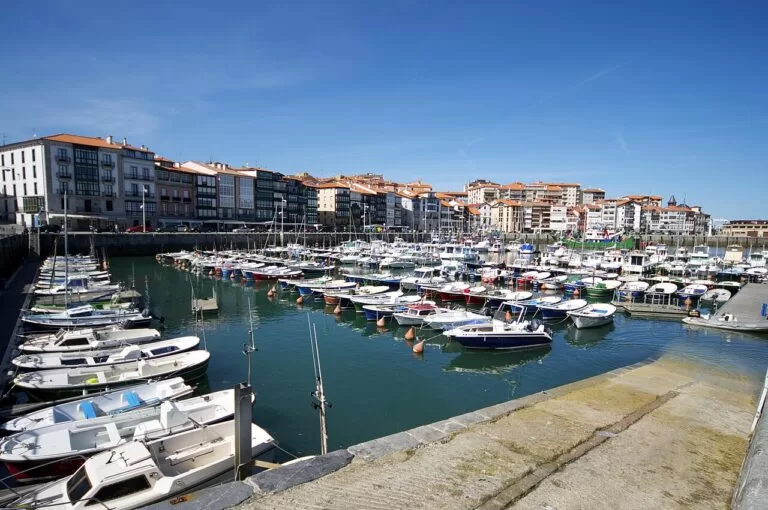
Lekeitio
The beach town of the stretch, with two beaches, the island walk and the old town, and Ondarroa 8 km away.
Beaches and harbourGetting there and around
By air
Bilbao Airport (BIO) is the nearest. In a straight line it is about 19 km from Gernika, 20 km from Bermeo, 33 km from Lekeitio and 40 km from Ondarroa (OpenStreetMap). For the eastern end, San Sebastián Airport in Hondarribia is the alternative, as the Costa Vasca guide explains.
By train
Euskotren runs from Bilbao (Zazpi Kaleak) to Gernika every 30 minutes on weekdays and every 60 minutes on winter weekends, and on to Bermeo at about the same frequency (Basque tourism). The line also stops at Mundaka. East of the estuary there is no railway.
By bus
Bizkaibus A3513, A3514, A3515 and A3523 link Bilbao’s Termibus with Gernika about every 15 minutes, A3515 continues to Bermeo, and Lurraldebus DB03 runs from San Sebastián to Lekeitio (Basque tourism). Line A3527 Bilbao–Mungia–Bermeo stops at San Juan de Gaztelugatxe (Basque tourism). Check Bizkaibus timetables before you travel.
A two-day route
By car, west to east. Day 1 stays around the estuary; day 2 covers about 18 km in a straight line from Kortezubi to Ondarroa.
Day 1
Gaztelugatxe, Bermeo, Mundaka and Gernika
Book your free Gaztelugatxe ticket in advance and go early, then climb the 241 steps to the hermitage. Drive on to Bermeo for the port and the Fishermen’s Museum (closed on Mondays), and walk out to the Santa Catalina hermitage in Mundaka for the view over the estuary to Izaro and Ogoño. Finish in Gernika with the Assembly House and the Peace Museum.
Day 2
Santimamiñe, Laga, Elantxobe, Ea and Lekeitio
Start with a booked visit to Santimamiñe and walk on to the Oma Forest. Swim or watch the surf at Laga, then drop down into Elantxobe, parking at the top. Stop in Ea for its bridges, and spend the late afternoon in Lekeitio, crossing to San Nicolás Island if the tide is low. Ondarroa, 8 km further, is a short evening detour.
FAQ
Where is Urdaibai?
On the coast of Bizkaia, about 20 km north-east of Bilbao, around the estuary of the river Oka between Gernika and Mundaka. UNESCO listed it as a Biosphere Reserve in 1984.
Do I need a ticket for San Juan de Gaztelugatxe?
Yes. A free access ticket is required, per the Basque tourism board. Wear sensible shoes for the 241 steps.
Can you go inside the Santimamiñe cave?
The cave has been closed to the public since 2006. Guided visits show the entrance and a virtual tour of the paintings in the nearby chapel of San Mamés.
What are the best beaches in Urdaibai?
Laga for open sand under Cape Ogoño and surf, and Laida for shallow water and gentle waves for families and longboards. Further east, Isuntza and Karraspio at Lekeitio.
How do I get from Bilbao to Gernika or Bermeo without a car?
By Euskotren from Zazpi Kaleak, every 30 minutes on weekdays, or by Bizkaibus from Termibus, about every 15 minutes to Gernika.
Where should I stay to see Urdaibai and Lekeitio?
Gernika if you travel by train or bus, Bermeo for the port and Gaztelugatxe, and Lekeitio for beaches.
Other areas of the Costa Vasca
Costa Vasca
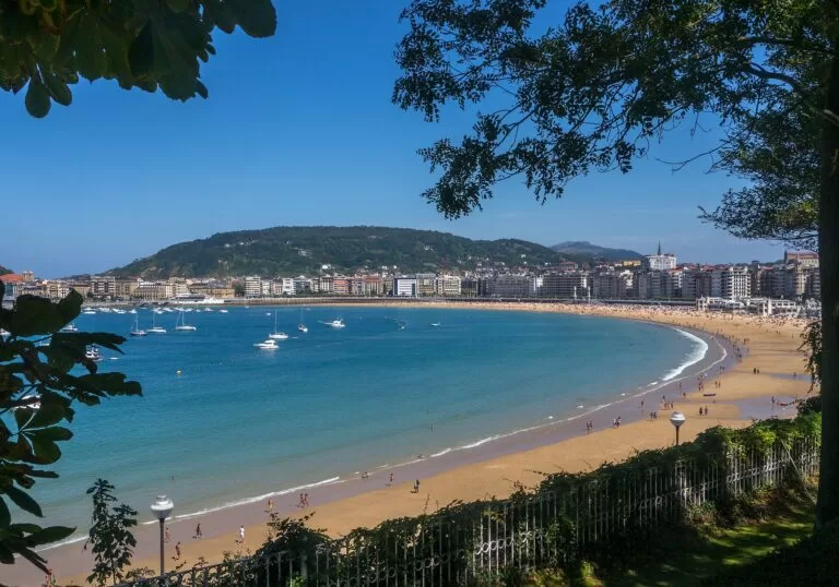
The whole coast of the Basque Country, from Muskiz to Hondarribia, with the map, weather and routes.
Costa Vasca guide →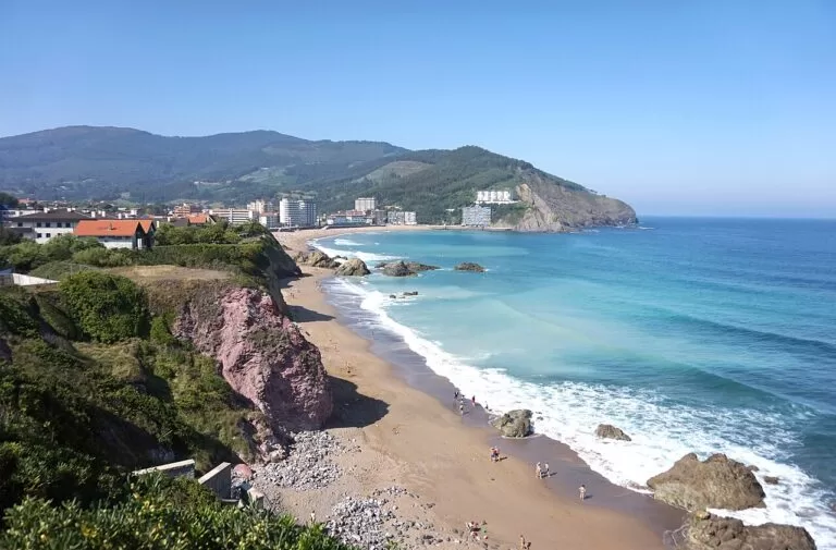
West: Muskiz to Bakio
The Bizkaia Bridge, Getxo, the surf beaches of Sopela, Plentzia and Bakio.
Western Bizkaia guide →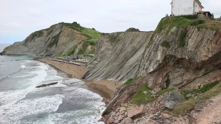
Gipuzkoa coast: Mutriku to Orio
The flysch of the Basque Coast Geopark, Getaria and Zarautz.
Gipuzkoa coast guide →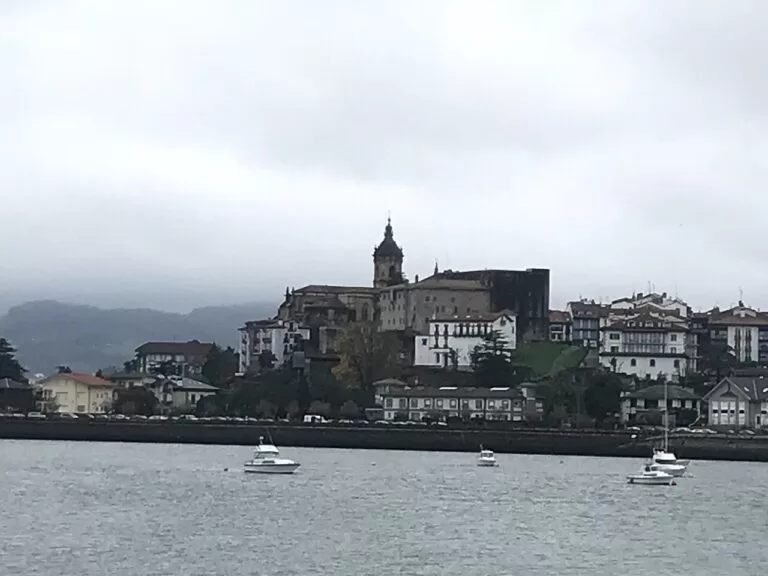
East: San Sebastián to Hondarribia
La Concha and Zurriola, Pasaia and the walled town of Hondarribia.
San Sebastián coast guide →Inland, Bilbao is about 21 km south-west of Gernika.
Sources and freshness
Checked 9 November 2026. Basque tourism board on the towns of Bermeo, Mundaka, Gernika-Lumo, Elantxobe, Ea, Lekeitio and Ondarroa; the beaches of Laga, Laida, Isuntza and Karraspio; Urdaibai Biosphere Reserve; San Juan de Gaztelugatxe; the Assembly House of Gernika; Santimamiñe caves; Oma Forest; Urdaibai Bird Center; Fishermen’s Museum; Port of Elantxobe. Spain.info on Bermeo and Ondarroa. Map data and straight-line distances: OpenStreetMap. Photos from Wikimedia Commons: Laga by Ben Bender (CC BY-SA 3.0), Mundaka by Mikel Arrazola (CC BY 3.0 ES), Lekeitio by Marisol Murua (CC BY-SA 3.0), Gernika by MiguelAlanCS (CC BY-SA 4.0), Bermeo by Quahadi (CC BY-SA 4.0), Elantxobe by Giorgio Galeotti (CC BY-SA 4.0), San Juan de Gaztelugatxe by Einaz80 (CC BY-SA 4.0), San Sebastián by Ermell (CC BY-SA 4.0), Bakio by Tiia Monto (CC BY-SA 3.0), Zumaia by Pomfuttge (CC BY-SA 4.0), Hondarribia by Txo (CC BY-SA 4.0). Not confirmed: Bizkaibus timetables beyond the frequencies quoted, ticket prices for the Peace Museum, Santimamiñe and the lighthouse, and the summer ferry across the estuary.