
Costa Vasca · Gipuzkoa coast
Gipuzkoa coast: Mutriku to Orio travel guide: flysch, fishing ports and surf
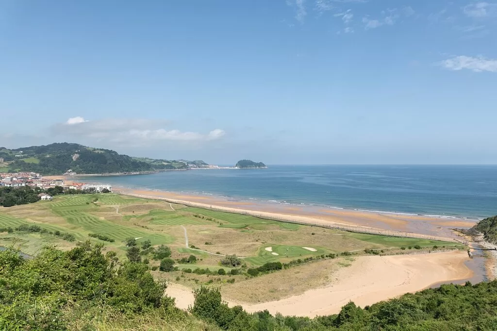
The western coast of Gipuzkoa: the harbour of Mutriku, the flysch cliffs of Deba and Zumaia, the fishing town of Getaria, the long surf beach of Zarautz and the river mouth at Orio.
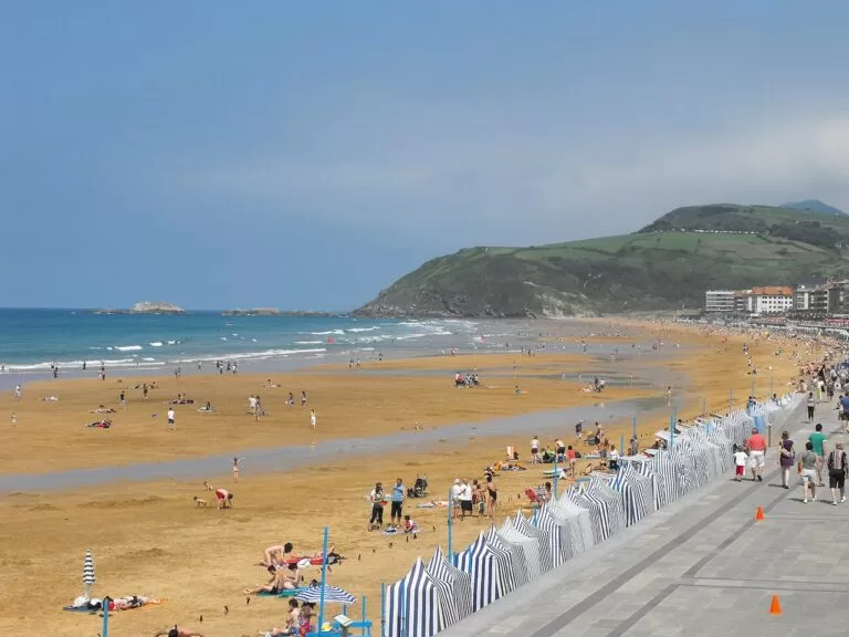
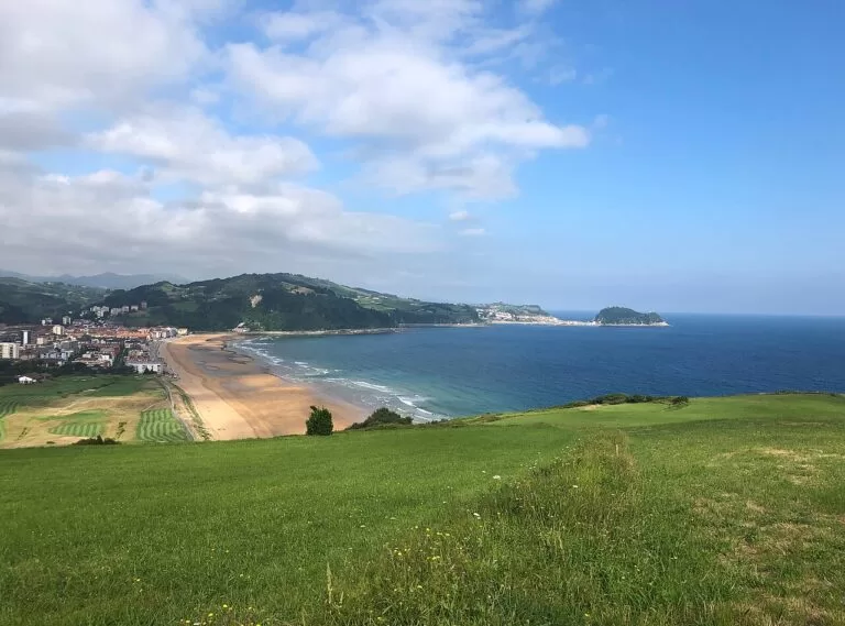
Zarautz and the coast towards Getaria · Photo: Giorgio Galeotti, CC BY-SA 4.0
Part of the Costa Vasca guide ←
The Gipuzkoa coast from Mutriku to Orio is the western half of the Basque province of Gipuzkoa’s shoreline, from Saturraran beach on the border with Bizkaia to the mouth of the Oria river, about 12 km west of San Sebastián. It strings together six small towns, Mutriku, Deba, Zumaia, Getaria, Zarautz and Orio, linked by the Euskotren railway, the coastal path and the N-634 road, with the flysch cliffs of the Basque Coast UNESCO Global Geopark between Mutriku and Zumaia and the txakoli vineyards of Getaria behind.
At a glance
- Where the western coast of Gipuzkoa, from Saturraran (Mutriku) to the Oria estuary at Orio: about 21 km in a straight line from Mutriku to Orio.
- Towns Mutriku, Deba, Zumaia, Getaria, Zarautz and Orio; Itziar and Aia inland.
- Best for the flysch cliffs and coastal walks, surfing at Zarautz, Deba and Zumaia, grilled fish and txakoli in Getaria and Orio, and car-free trips by train.
- Getting there San Sebastián Airport is 28 km east of Orio and Bilbao Airport 43 km west of Mutriku in a straight line; Euskotren trains stop at Deba, Zumaia, Zarautz and Aia-Orio.
Map of the Gipuzkoa coast
The map shows the places in this stretch that have a CostaMap page, from the fishing towns and beaches to the flysch walk. Tick a place type to filter it, and click a marker to see the place in the panel.
Place type
Area · next level
 Area map
Gipuzkoa coast: Mutriku to Orio
Click a marker to see the place here. From the harbour of Mutriku past the flysch cliffs of Deba and Zumaia to Getaria, Zarautz and Orio.
Towns and villagesTowns and villages
From west to east. Facts are from the Basque tourism board (Tourism Euskadi) unless another source is named, checked in November 2026.
Mutriku
Mutriku is the westernmost town on the Gipuzkoa coast, built on the slope of Mount Arno (628 m) above one of the oldest harbours in the province, where people once lived from whaling. It was founded at the beginning of the 13th century and its old quarter, a historic monument site since 1995, keeps a medieval street plan, palaces and tower houses from the 15th to 17th centuries, and the neoclassical church of the Asunción on Churruca square. Beside the harbour are a small beach and two natural sea pools, one of them Olympic size; the Nautilus centre shows fossils found in the town. Westwards, the cliffs of the “Seven Beaches” lead to Saturraran on the border with Bizkaia. Mutriku has about 5,000 inhabitants and no railway.
Deba and Itziar
Deba sits on the right bank of the Deba estuary, 3 km east of Mutriku, with a 400 m surf beach in front of the town and a Euskotren station in the centre. The church of Santa María is a listed monument and, in the tourism board’s words, a jewel of Basque Gothic; spain.info adds its Gothic cloister and the Baroque town hall. The municipality also takes in the villages of Itziar and Lastur and more than fifty caves and prehistoric sites, among them Ekain, whose cave paintings are a UNESCO World Heritage site; its replica, Ekainberri, is visited from Zestoa. Deba is the western end of the Flysch Route and celebrates San Roque from 14 to 20 August.
Zumaia
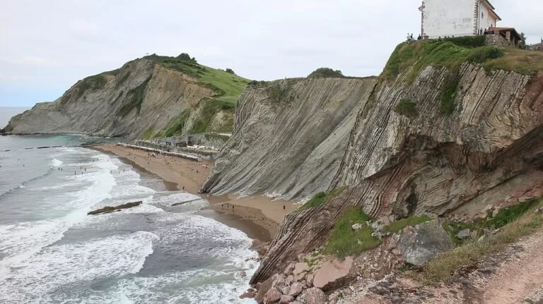
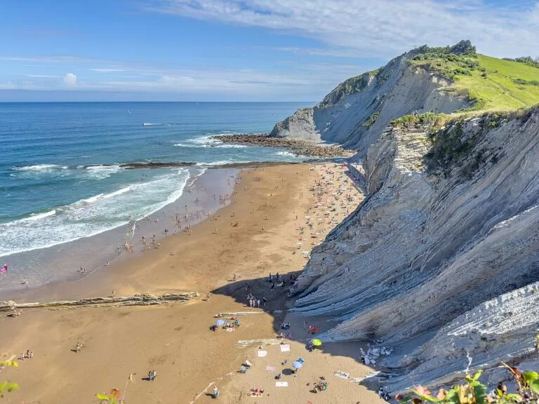
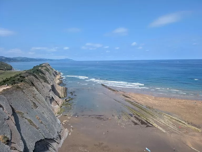
Zumaia stands on a bay where the Urola and Narrondo rivers meet, 7.8 km east of Deba. Its medieval centre is dominated by the 13th-century Gothic church of San Pedro, built like a fortress, with an altarpiece by Juan de Antxieta that is a listed monument. The town has two beaches: Santiago, by the Urola marshes and close to the Zuloaga museum, the house and studio of the painter Ignacio Zuloaga; and Itzurun, below the San Telmo hermitage, framed by cliffs up to 150 m high. Those cliffs are the famous Zumaia flysch, layers of limestone and sandstone that the sea has worn into a rock platform visible at low tide. Zumaia has about 9,300 inhabitants and a modern marina.
Getaria
Getaria is a walled medieval fishing town on a hillside 4.5 km east of Zumaia, below Mount San Antón, the headland locals call the “mouse” for its shape. It was the birthplace of Juan Sebastián Elcano, who completed the first voyage around the world in 1522, and of the couturier Cristóbal Balenciaga, born in 1895, whose museum the tourism board calls one of the most important fashion collections in the world. spain.info adds the 15th-century Gothic church of San Salvador and the Getariako Txakolina denomination of origin for the local white wine. Fish is grilled in the streets by the port. Every four years, on 7 August, the town re-enacts Elcano’s landing.
Zarautz
Zarautz, with about 22,700 inhabitants, is the largest town of the stretch and its main base, 3 km east of Getaria. Its 2,500 m beach, framed by the Santa Bárbara and Mollarri cliffs, is the longest on the Basque coast, with striped awnings, a lively promenade and waves that draw surfers: the town hosts a world-circuit surf contest every September. At the eastern end, the Iñurritza protected biotope holds the largest and best-preserved dune field on the Basque coast, crossed by a boardwalk. The old quarter has the church of Santa María la Real, the Narros palace, the Torre Luzea and the Portu house, today the town hall. spain.info also lists a photography museum and an art and history museum.
Orio
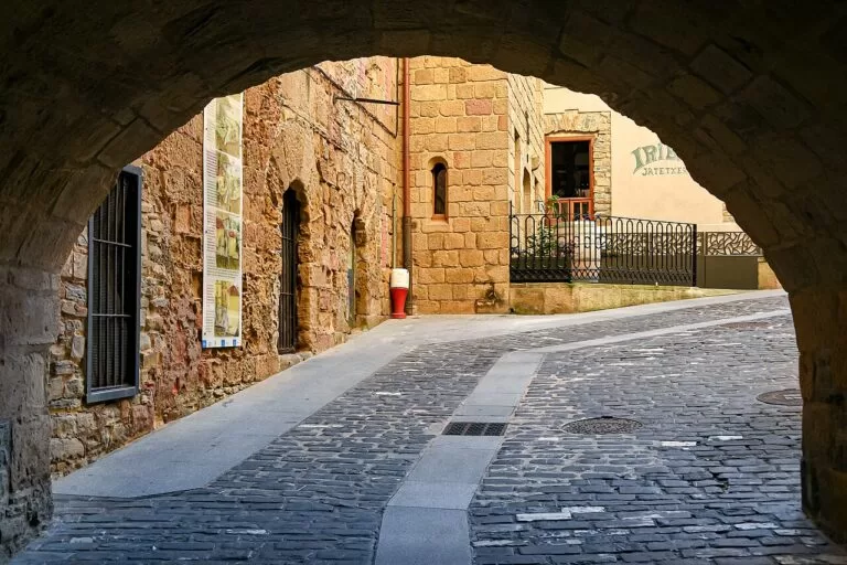
Orio is a fishing village on the Oria estuary, 4 km east of Zarautz and 12 km west of San Sebastián, with its own Euskotren station. Its old town, Goiko Kale, is a maze of steep cobbled streets that runs from the Baroque church of San Nicolás de Bari to the chapel of San Martín, both on the Camino de Santiago. Near the port, sea bream is grilled in the street, and in winter the eel fishermen catch elvers on the river. Antilla beach lies at the river mouth, sheltered by Mount Kukuarri, with a campsite and a playground; Oribarzar, on the other bank, is quieter. Orio is also a rowing town: its yellow trainera has won many races over the years.
Beaches and coves
Our pick from west to east. Lengths, waves and lifeguard hours are from Tourism Euskadi, checked November 2026; lifeguards are seasonal, so swim inside the season and the flags.
Itzurun
270 m of golden sand below flysch cliffs up to 150 m high, with strong waves for surf and bodyboard; lifeguards 10:30–19:30. Zumaia flysch guide.
Zarautz
2,500 m of fine golden sand, the longest beach on the Basque coast, with five surf schools and many peaks; lifeguards 10:00–20:00. Zarautz beach guide.
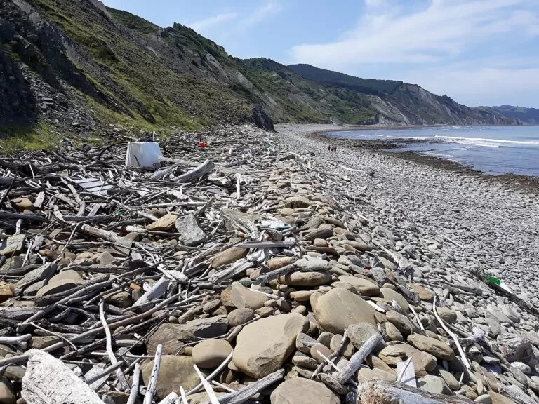
Saturraran
300 m of golden sand on the border with Bizkaia, with powerful waves, rock stacks, a campsite nearby and a nudist area; lifeguards 11:00–19:00. Mutriku guide.
- Mutriku harbour beach – 180 m of golden sand by the port, with strong waves and two natural sea pools next to it, one of them Olympic size; lifeguards 11:00–19:00.
- Ondarbeltz (Mutriku) – 120 m of fine dark sand with calm water on the left bank of the Deba estuary, closer to Deba than to Mutriku; play area and pelota court.
- Santiago (Deba) – 400 m including Lapari, open to the sea with heavy swell and the powerful Sorgin-Zulo right-hander for experts; lifeguards 10:00–20:00. Deba guide.
- Mendata, Aitzuri and Sakoneta (Deba) – quiet coves below the flysch cliffs between Deba and Zumaia; Sakoneta is on the Flysch Route. Watch the tide.
- Santiago (Zumaia) – 350 m long and 175 m wide, by the Urola marshes, with calm water, a play area and pedal boats; lifeguards 10:30–19:30.
- Gaztetape (Getaria) – west of Mount San Antón, open to the sea and popular with surfers, with a local surf club; lifeguards 10:00–20:00 in summer.
- Malkorbe (Getaria) – 420 m by the marina, calm, with access for people with disabilities; lifeguards 10:00–20:00 in summer.
- Antilla (Orio) – about 3,500 m² at the mouth of the Oria, with a campsite, a playground and surf peaks; lifeguards 10:30–19:30.
Things to do
The flysch and the Geopark
Mutriku, Deba and Zumaia make up the Basque Coast Geopark, one of UNESCO’s Global Geoparks: 89 km² with 13 km of cliffs whose rock layers record more than 60 million years of the Earth’s history. Between Deba and Zumaia, about 8 km of cliffs and tidal platform are a protected biotope; the steepest cliffs are at Mendata, Sakoneta and Pikote, and the cliff at Itzurun is, says the tourism board, the best place in the world to study two key moments of the Paleocene. Walk the Flysch Route (13.5 km, about 4 h 45 min), book a guided walk or boat trip through the Algorri centre or Zumaia tourist office, or visit Nautilus in Mutriku for the fossils.
Coastal walks
The coastal path (Sendero Litoral, the Basque part of the European E9, waymarked here as the GR 121) covers the whole stretch in three stages, according to the official leaflets: Orio to Zumaia, 16.5 km via the vineyards of Talaimendi, the Iñurritza dunes, Zarautz and the Garate pass; Zumaia to Deba, the Flysch Route; and Deba to Ondarroa, 10.5 km via Mutriku harbour and Saturraran. Euskotren stations at Orio, Zarautz, Zumaia and Deba make one-way walks easy.
Towns, museums and history
See the old quarters of Mutriku and Orio, the Gothic churches of Santa María in Deba, San Pedro in Zumaia and San Salvador in Getaria, the Elcano monument and the Cristóbal Balenciaga Museoa in Getaria, and the Zuloaga museum in Zumaia. Inland, the Pagoeta Natural Park in Aia, near Zarautz and Orio, covers 1,335 ha of farms and woods, with a visitor centre in a 15th-century farmhouse, a botanical garden and the Agorregi ironworks.
Food and drink
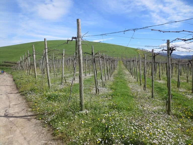
This is grilled-fish country. In Getaria and Orio, fish is cooked on grills set up in the streets near the harbour; Orio’s signature dish is sea bream and it holds a Sea Bream Day in the third week of July, while Mutriku celebrates mackerel on the first Saturday of April. Drink txakoli: the hillsides between Getaria and Zarautz are covered with its vines, and Getariako Txakolina is a denomination of origin.
Where to stay by town
We do not list hotels. These are the bases we would choose, with what each suits.
Zarautz
The biggest choice of places to stay and eat, a long beach with surf schools, a campsite and two Euskotren stations. The best base without a car.
Beach and surfZumaia
A real town with a station, a marina and two beaches, right at the start of the Flysch Route and the geology tours.
Walkers and geology
Getaria
A small walled fishing town for food lovers, with grill restaurants by the harbour and vineyards behind; no railway, so come by bus or car.
Food and wine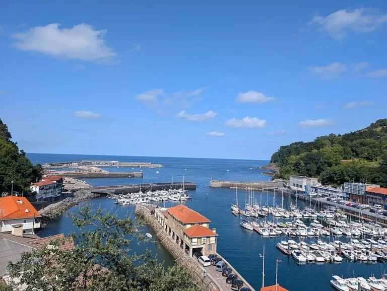
Mutriku and Deba
Quieter towns at the western end: Deba for the train and a big beach, Mutriku for its harbour, sea pools and campsites near Saturraran.
Quiet harbourGetting there and around
By air: San Sebastián Airport, at Hondarribia, is about 28 km east of Orio in a straight line, and Bilbao Airport about 43 km west of Mutriku (OpenStreetMap).
By train: the Euskotren E1 line between Bilbao and San Sebastián stops at Deba, Zumaia, Zarautz (two stations, Zarautz and San Pelaio) and Aia-Orio (OpenStreetMap). Mutriku and Getaria have no station.
By bus: Lurraldebus, the Gipuzkoa bus network, serves the coast. OpenStreetMap shows line UK09 between Zumaia and San Sebastián via Orio, and lines DB03 (San Sebastián – Lekeitio) and DB04 through Mutriku; Tourism Euskadi recommends Lurraldebus for Getaria, about 25 km from San Sebastián. Check timetables before you rely on a bus.
By car: the A-8 motorway passes Zarautz, and the N-634 road follows the coast between the towns, past Santiago beach between Zumaia and Getaria. Parking is tight in the old quarters of Mutriku, Getaria and Orio in summer; use the car parks at the edge of town.
A two-day route
Two days
Day 1
Zumaia, the Flysch Route and Mutriku
Start in Zumaia at Itzurun beach and the San Telmo hermitage, checking the tide table first. Walk the Flysch Route to Deba (13.5 km, about 4 h 45 min), timing it so you pass Sakoneta near low water. In Deba, see the church of Santa María and the beach, then follow the seafront promenade 3 km west to Mutriku for the harbour, the sea pools and dinner in the old quarter. If you do not want the long walk, take the train to Deba and spend the day between Deba and Mutriku instead.
Day 2
Getaria, Zarautz and Orio
Spend the morning in Getaria: the old town, the church of San Salvador, the harbour and the Balenciaga museum, with grilled fish and txakoli for lunch. Follow the seafront promenade beside the N-634, about 3 km, to Zarautz for the beach and the boardwalk over the Iñurritza dunes. In the late afternoon, continue to Orio for a walk up Goiko Kale and a look at Antilla beach at the river mouth, then take the train from Aia-Orio towards San Sebastián.
FAQ
Where is the flysch in the Basque Country?
On the coast of Mutriku, Deba and Zumaia, the Basque Coast Geopark. The best-known spot is Itzurun beach in Zumaia; the Flysch Route follows the cliffs to Deba.
Can you visit the Gipuzkoa coast without a car?
Mostly yes. Euskotren trains stop at Deba, Zumaia, Zarautz and Orio, and Lurraldebus buses reach Getaria and Mutriku.
Which is the best beach between Zarautz and Mutriku?
For a long town beach and surf schools, Zarautz (2,500 m). For the cliffs, Itzurun in Zumaia. For calm water, Malkorbe in Getaria or Santiago in Zumaia.
How far is Zarautz from San Sebastián?
About 16 km in a straight line, with Euskotren trains between them. Orio, on the way, is 12 km from San Sebastián.
Is Getaria worth visiting?
Yes, for its walled old town, the Gothic church of San Salvador, the Balenciaga museum, the harbour and its grilled fish, and the txakoli vineyards around it.
When is the best time to see the flysch?
At low tide, when the rock platform below the cliffs is exposed. The official leaflet for the Flysch Route advises checking the tide table before you set off.
Other areas of the Costa Vasca
Urdaibai and Lea-Artibai
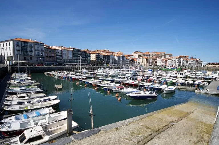
Across the border in Bizkaia, from Ondarroa, a short walk from Saturraran, to Lekeitio, Mundaka and Bermeo.
Urdaibai and Lea-Artibai guide →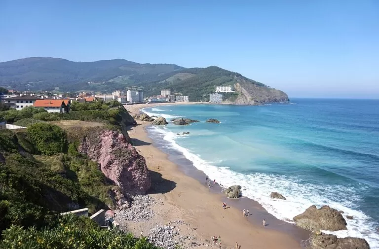
Bilbao and the Bizkaia coast
Bilbao and the beaches and cliffs of western Bizkaia, from Muskiz to Bakio and San Juan de Gaztelugatxe.
Muskiz to Bakio guide →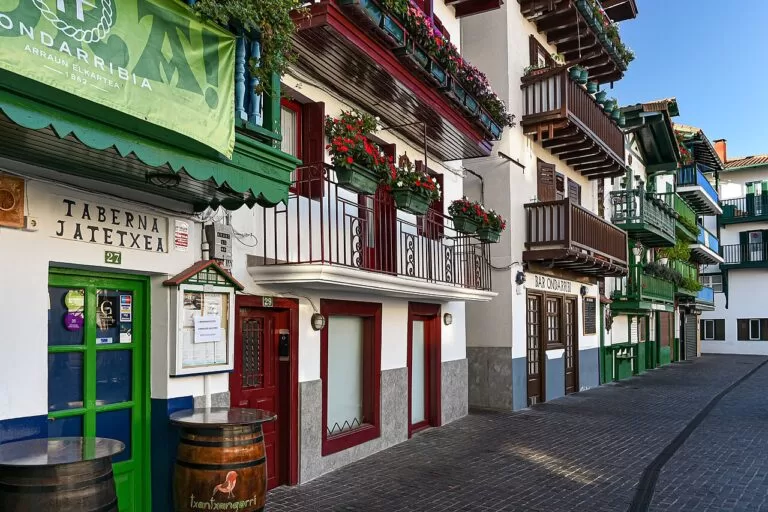
San Sebastián and Hondarribia
East of Orio: San Sebastián and La Concha, Monte Igueldo, Pasaia and Hondarribia on the French border.
San Sebastián to Hondarribia guide →Costa Vasca
The full guide to the Basque coast: all four areas, beaches, campsites, food, transport and routes.
Costa Vasca guide →Sources and freshness
Checked 9 November 2026. Tourism Euskadi, the Basque Government’s tourism board, on the towns of Mutriku, Deba, Zumaia, Getaria, Zarautz and Orio; on the beaches of Saturraran, Mutriku harbour, Ondarbeltz, Santiago (Deba), Itzurun, Santiago (Zumaia), Gaztetape, Malkorbe, Zarautz and Antilla; on the Basque Coast Geopark, the tidal platform and flysch cliffs, the Iñurritza biotope, Pagoeta Natural Park and Nautilus; and the Sendero Litoral leaflets, edition 2025, for stages 4, 5 and 6. spain.info on Mutriku, Deba, Getaria, Zarautz and Orio. Stations, bus lines, airports and straight-line distances: OpenStreetMap contributors (ODbL). The municipal tourism websites and the Geopark website could not be reached from our research tools.
Photo credits · 14 photos from Wikimedia Commons Show
Photos from Wikimedia Commons, not altered except for cropping: Zarautz by Giorgio Galeotti (CC BY-SA 4.0); Mutriku by Андрей Романенко (CC BY-SA 4.0); Itzurun, Zumaia by Kent Wang (CC BY-SA 4.0); Zarautz by diego_cue (CC BY-SA 3.0); Mutriku by Pacopac (CC BY-SA 4.0); Gipuzkoa coast by Iñaki LL (CC BY-SA 4.0); Zarautz by Einaz80 (CC BY-SA 4.0); Zumaia by Pomfuttge (CC BY-SA 4.0); Getaria by Marisol Murua (CC BY-SA 3.0); Itzurun, Zumaia by Андрей Романенко (CC BY-SA 4.0); Getaria by Jorge Franganillo (CC BY 2.0); Lekeitio by Marisol Murua (CC BY-SA 3.0); Bakio by Tiia Monto (CC BY-SA 3.0); Hondarribia by Jorge Franganillo (CC BY 2.0).