
Bahía de Cádiz Natural Park
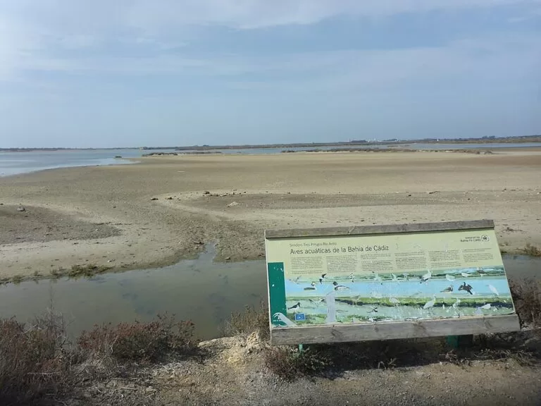
Natural parkThe Bahía de Cádiz Natural Park protects 10,522 hectares of tidal marsh, salt pans, channels, beaches and pine woods around the Bay of Cádiz, spread over Cádiz, San Fernando, Puerto Real, Chiclana and El Puerto de Santa María. The easiest way in is the park’s visitor centre at the Salina de la Leocadia in San Fernando, opposite Camposoto beach, which has a rooftop viewpoint and free parking nearby. It suits birdwatchers, cyclists and walkers who like flat, open country; skip it if you want hills, shade or a wild coast far from towns, because the park sits inside a built-up bay.
Quick facts
- Names: Parque Natural Bahía de Cádiz; in English also Bay of Cádiz Natural Park.
- Where: around the inner and outer Bay of Cádiz, in the municipalities of Cádiz, San Fernando, Puerto Real, Chiclana de la Frontera and El Puerto de Santa María.
- Coordinates: 36.4957, -6.1603 (the marshes between Puerto Real and San Fernando). Visitor centre: 36.4317, -6.2258.
- Size and status: 10,522 ha, protected since 1989; also a Special Protection Area for birds (ZEPA) and a Site of Community Importance.
- Inside the park: two smaller protected sites, Isla del Trocadero (525 ha) and the Marismas de Sancti Petri (156.4 ha) (spain.info).
- Park office: Calle Coghen 3, San Fernando; phone +34 856 580 010.
- Entry: the park is open countryside; we found no entry fee.
Access and parking
Visitor centre: the Centro de Visitantes is at Calle Buen Pastor 507, on the Camposoto road next to the beach access in San Fernando (Andalusia tourism board). OpenStreetMap shows a small car park beside it and a free 500-space surface car park for Camposoto beach about 400 m away. The tram-train stop “Playa – Acceso 1” is about 400 m from the centre.
By road: spain.info notes that the A-4 and AP-4 roads link the park’s different sectors and the towns around the bay. Because the park is split into pieces by towns, roads and the bay itself, decide which part you want before you set off: Camposoto and Sancti Petri in the south, the Puerto Real and San Fernando marshes in the middle, or Los Toruños in the north.
Other centres: Spanish Wikipedia lists three visitor reception points: San Fernando (Camposoto), Valdelagrana in El Puerto de Santa María, which is the gateway to the Los Toruños metropolitan park, and a salt-pan interpretation centre in Chiclana.
What to expect
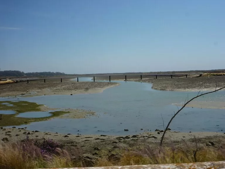
The Andalusia tourism board describes the bay as a shallow former estuary of the Guadalete and San Pedro rivers. It is a maze of intertidal marsh at Los Toruños, Sancti Petri and the Isla del Trocadero, ringed by salt pans along the Río Arillo and tidal channels such as the Caño de Sancti Petri, the Zurraque and the Trocadero. It is a flat, open landscape of water and sky, with the cities of Cádiz and San Fernando always on the horizon.
- Birds: the bay lies on the migration route between Doñana and the Strait of Gibraltar. Spain.info names flamingos and spoonbills, and breeding colonies of common terns, Kentish plovers, avocets and black-winged stilts. The tourism board says the colonies of common and little terns are the largest in the Iberian Peninsula, and that ospreys and a growing number of cormorants winter here.
- Salt pans: salt-making in the bay goes back to the Phoenicians, and the salt marsh once covered more than 5,000 ha (spain.info). Sea water still flows in on the tide through channels and sluices and evaporates in the summer wind and sun.
- Beaches and dunes: the park takes in Levante, Camposoto and La Cachucha beaches and the dune strip between Cortadura and La Barrosa.
- Pine woods: the stone-pine woods of La Algaida and Los Toruños shelter chameleons, hedgehogs and small birds.
Practical details
The visitor centre is a recent, low-energy building with information on the park and its activities, and a viewpoint on the second floor over the salt pans. Spanish Wikipedia notes that the park manager has added picnic areas, rest areas and nature trails, and that bikes and canoes can regularly be hired. Shellfish gathering, fishing and salt-making are still done here under the park’s management plan, so keep to marked paths and stay out of working salt pans.
We could not confirm the visitor centre’s current opening hours from an official page we could open. Phone +34 856 580 010 before you go.
Accessibility and safety
The tourism board lists the San Fernando visitor centre as accessible for people with disabilities. Out in the park the ground is flat, but paths along salt-pan walls can be narrow, muddy after rain and exposed to wind. There is very little shade: in summer take water and a hat, and avoid the middle of the day. The marsh channels are tidal; do not wade across them.
Best time to visit
For birds, spring and autumn bring the migrants passing between Africa and Europe, and winter brings the wintering waders, gulls and ducks. Summer is the season for the beaches and for tern colonies, but the heat is strong. Go at low tide to see waders feeding on the mud, and early or late in the day for the best light over the salt pans.
Nearby alternatives
- San Fernando, 4.8 km away: the town at the heart of the park, with the visitor centre and Camposoto beach.
- Puerto Real, 4.5 km away: the bay town next to the Trocadero and Río San Pedro marshes.
- Chiclana de la Frontera, 8.6 km away: salt-pan town by the Sancti Petri marshes.
- Cádiz, 12.4 km away: the old city at the mouth of the bay.
- Puerto Sherry, 12.7 km away: the marina at El Puerto de Santa María, near Los Toruños.
- Alcázar of Jerez, 20.7 km away: the Almohad fortress-palace in Jerez, for a cultural half-day.
Distances are in a straight line from the park point given above.
FAQ
Where is the Bahía de Cádiz Natural Park visitor centre?
At Calle Buen Pastor 507, on the Camposoto road in San Fernando, next to the access to Camposoto beach, in the Salina de la Leocadia.
Can you see flamingos in the Bay of Cádiz?
Yes. Spain.info lists flamingos and spoonbills among the park’s notable birds, with breeding avocets, black-winged stilts, Kentish plovers and terns.
Is there parking at the Bahía de Cádiz Natural Park?
At the San Fernando visitor centre there is a small car park beside the building and a free 500-space beach car park about 400 m away, according to OpenStreetMap.
Do you need tickets for the Bahía de Cádiz Natural Park?
We found no entry fee for the park itself. It is open countryside crossed by roads, trails and the EuroVelo 8 cycle route.
When is the best time to visit the Bay of Cádiz for birds?
Spring and autumn migration and the winter months, ideally at low tide in the early morning or late afternoon.
Sources and freshness
Checked 6 November 2026 · 5 sources Show
Checked 6 November 2026. Official: Andalusia tourism board listings for the Bahía de Cádiz natural park (landscape, wildlife, park office) and the park visitor centre (location, viewpoint, phone, accessibility); spain.info (habitats, protected sites, birds, roads). The park’s own website could not be reached. Background: Spanish Wikipedia (area, date, municipalities, visitor points, activities). Location, parking, tram stop and distances: OpenStreetMap contributors (ODbL). Photos: Wikimedia Commons, licences as credited.
This place is part of our Costa de la Luz, Spain: beaches, towns, sherry and map — see every town, beach and cove we have mapped on that coast.
How this page is made. CostaMap is written with an AI editorial system run by Ebizapple. This page is based on the sources listed above. Last updated 6 November 2026. Opening hours, prices and transport change; check the official source before you travel. How we work · Partner links and ads