
Playa de Zahara de los Atunes (Barbate)
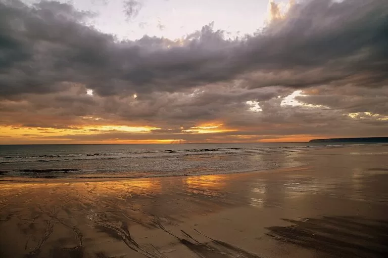
BeachPlaya de Zahara de los Atunes is the long sand beach right in front of the village of Zahara de los Atunes, in the municipality of Barbate (Cádiz), on the Atlantic coast between Barbate and Tarifa. You can walk onto it from the village streets, and car parks and buses from the Bahía de Cádiz network serve the village. Spain’s official tourism portal lists 1,600 m of golden sand, 70 m wide, with sunbed hire, toilets and showers, and calls it lively in summer. It suits families and people who want a beach with bars and restaurants a few steps away; skip it in August if you dislike crowds and hunting for parking.
Quick facts
- Names: Playa de Zahara de los Atunes or simply Playa de Zahara (Spanish playa is beach). The village name refers to tuna, atunes.
- Where: Zahara de los Atunes, municipality of Barbate (Cádiz), Costa de la Luz. South of the village the sand continues as the Playa de Atlanterra, in Tarifa municipality.
- Coordinates: 36.1366, -5.8491.
- Size: 1,600 m long and 70 m wide (spain.info). On OpenStreetMap the sand mapped as Playa de Zahara runs on for about 8 km north-west of the village.
- Surface: golden sand.
- Water: moderate waves and windy (spain.info).
- Facilities: umbrella and sunbed hire, toilets, showers, footwash, tourist office, litter bins, cleaning, telephone, sports area and a surf practice zone (spain.info).
- Entry: free.
Access and parking
On foot: the beach runs along the front of the village, and spain.info lists easy access on foot as well as by car. The nearest road it names is the one to the Atlanterra urbanisation, south of the village.
Parking: OpenStreetMap maps several car parks in and around the village. Two are tagged as paid, one with about 35 spaces and one with about 300, about 500 to 650 m from the village beach. Others include an asphalt car park of about 250 spaces about 1.1 km south towards Atlanterra and an unpaved one of about 100 spaces. We could not confirm 2026 prices.
By bus: OpenStreetMap shows stops of the Consorcio Metropolitano de Transportes de la Bahía de Cádiz, served by Transportes Generales Comes, in the village (Maestra Dª Angelines – Centro de Salud) and on the Atlanterra side (Playa de Zahara de los Atunes). Check the consortium’s timetable before you travel; services vary by season.
What to expect
spain.info describes a wide beach that stretches from the fishing village towards Cabo de Plata, with clear water and fine sand that invite long walks. It lists facilities for sailing, windsurfing, diving and fishing, and notes that the beach is especially lively in summer; its occupancy is rated high.
Unlike the wild beaches around Tarifa, this is a village beach. OpenStreetMap maps dozens of restaurants, bars and cafés within about a kilometre, a tourist information office close to the sand and public toilets near the main access. North-west of the village the sand continues for kilometres with far fewer buildings; south of it lies the Playa de Atlanterra with its hotels and villas.
Two landmarks sit close to the beach. Right by the village is the ruined Castillo de Zahara de los Atunes, mapped on OpenStreetMap as a defensive castle. And about 300 m from our map point lies the wreck of the Gladiator, a ship that OpenStreetMap records as sunk on 12 December 1893 with a cargo of sugar; it is tagged as visible at low tide.
The tourist office on OpenStreetMap is tagged as open Monday, Wednesday, Thursday and Sunday 09:00–15:00, and Friday and Saturday 09:00–15:00 and 18:00–20:00 (checked November 2026; confirm locally, hours change).
Practical details
- Sunbeds and umbrellas: for hire in the season (spain.info).
- Water sports: a surf practice zone is listed by spain.info; it also mentions sailing, windsurfing and diving.
- Walking: a GR 145 information board for stage 3 of the Arco Atlántico European path is mapped near the beach, so the coast here is part of a long-distance route.
- Nearest marina: Barbate, 8 km away (spain.info).
- Drinking water: fountains are mapped near the main access.
Accessibility and safety
The beach is open to the Atlantic and spain.info lists moderate waves and wind, so follow the flags. We could not confirm the 2026 lifeguard season or hours. The wreck of the Gladiator lies close to the shore and is exposed at low tide: do not climb on it, and take care when swimming or surfing near it. The tourist office is tagged as wheelchair accessible on OpenStreetMap, but we could not confirm step-free walkways onto the sand.
Best time to visit
June and September are a good balance of warm weather and space. July and August are the busiest months, when the village fills, parking is hard and the beach is crowded close to the village; walk a little north-west along the sand to find more room. In spring and autumn the beach is quiet, but some restaurants keep shorter hours.
Nearby alternatives
- Barbate, 9 km away: the fishing town and its port, north-west along the coast.
- Playa de Bolonia, 9.7 km away: a long natural beach to the south-east.
- Playa de Valdevaqueros, 15.3 km away: the big kitesurfing bay near Tarifa.
- Vejer de la Frontera, 16.5 km away: the white hill town inland.
- Playa El Palmar, 20 km away: the long surf beach of Vejer.
Distances are in a straight line from the beach.
FAQ
Is there parking at Zahara de los Atunes beach?
Yes, in several car parks in and around the village, some of them paid. In July and August they fill early, so arrive in the morning.
How do I get to Zahara de los Atunes by bus?
Buses of the Bahía de Cádiz transport consortium, run by Transportes Generales Comes, stop in the village and on the Atlanterra side. Check the current timetable before you travel.
Can you swim at Zahara de los Atunes?
Yes. It is an open Atlantic beach with moderate waves and wind, so check the flags and keep away from the Gladiator wreck near the shore.
How long is Zahara de los Atunes beach?
spain.info lists 1,600 m for the village beach, 70 m wide. The sand continues for several kilometres north-west, and south into Atlanterra.
Are there toilets and showers?
Yes. spain.info lists toilets, showers and a footwash, and OpenStreetMap maps public toilets near the main access.
Sources and freshness
Checked 6 November 2026 · 2 sources Show
Checked 6 November 2026. Official: spain.info, Playa de Zahara de los Atunes (size, sand, waves, services, access, marina, description). Location, car parks, bus stops, tourist office hours, castle, the Gladiator wreck and distances: OpenStreetMap contributors (ODbL). The Barbate town hall website could not be reached from our research tools. Photos: Wikimedia Commons, licences as credited.
This place is part of our Costa de la Luz, Spain: beaches, towns, sherry and map — see every town, beach and cove we have mapped on that coast.
How this page is made. CostaMap is written with an AI editorial system run by Ebizapple. This page is based on the sources listed above. Last updated 6 November 2026. Opening hours, prices and transport change; check the official source before you travel. How we work · Partner links and ads