
Isla Perdiguera (Mar Menor, San Javier)
IslandIsla Perdiguera is a small volcanic island of 25.8 hectares in the middle of the Mar Menor lagoon, in the municipality of San Javier (Murcia). There is no bridge: you reach it by boat, and the nearest shore, at Los Urrutias, is about 3.5 km away. It is the most visited of the lagoon’s five islands, a protected landscape, and anchoring around it is banned to protect the fan mussel. It suits boaters and people who like to look at volcanic islands from the shore; skip it if you want a beach day without planning a boat.
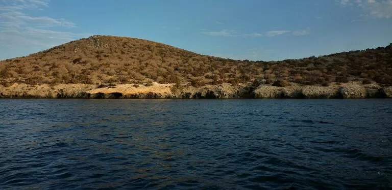
Quick facts
- Names: Isla Perdiguera in Spanish, Illa Perdiguera in Catalan. Its south-eastern tip, joined by a narrow neck of sand and stone, is often called Isla Esparteña, after the esparto grass that grows there.
- Where: the centre of the Mar Menor, municipality of San Javier, Region of Murcia. Isla Mayor (Isla del Barón) lies about 2.5 km east.
- Coordinates: 37.6999, -0.7994.
- Size: 25.8 hectares, the second-largest island in the lagoon; highest point 24 m (Wikipedia).
- Origin: three worn-down volcanic cones, two on the main island and a smaller one on the Esparteña tip.
- Protection: part of the Espacios Abiertos e Islas del Mar Menor protected landscape (created 1992), also a Site of Community Importance and a Special Protection Area for birds.
- Anchoring: banned around the island by the Cartagena maritime authority to protect the fan mussel (Pinna nobilis).
- Distances by water: about 3.5 km from Los Urrutias, 7.9 km from Los Alcázares and 10.4 km from Santiago de la Ribera, in a straight line.
Access and getting there
By boat only: there is no bridge, causeway or official visitor service on the island. OpenStreetMap shows a small pier at El Puertecico on the south-east side, facing the Esparteña tip, and marks the island itself as private access. We found no official page from San Javier or the regional government that says whether, when or where the public may land, so treat landing as unconfirmed and check with your boat operator.
Boat trips: Catalan Wikipedia mentions boat services to the island from Santiago de la Ribera and Los Alcázares. We could not confirm a 2026 operator, timetable or price: the Murcia regional tourism site, San Javier town hall and the local boat operators were not reachable when we checked. Ask at the tourist office in Santiago de la Ribera or Los Alcázares before you plan around a trip.
Your own boat or kayak: the island sits in open water, about 3.5 km from the nearest mainland shore. Read the anchoring rules below before you go.
Seeing it from land: the island is visible from most of the lagoon shore. The closest viewpoints are on the west side, at Los Urrutias and the El Carmolí volcano, which Spanish Wikipedia describes as facing Isla Perdiguera.
What to expect
A low, dry, rocky island. Spanish Wikipedia describes it as three volcanic cones worn down by wind and sea. The two larger cones form the main island; the third, smaller one forms the Esparteña tip, linked to the rest by a tombolo, a natural bar of sediment. OpenStreetMap maps a cliff called Peña Blanca on the north-west corner and patches of bare rock on the slopes.
OpenStreetMap also marks more than a dozen ruined buildings, most of them near the pier on the south-east side and along the north shore. We could not find an official source on what they were or whether they are safe to approach, so keep away from them.
The island belongs to the lagoon’s protected landscape, which covers the five volcanic islands and several wetlands and salt flats around the shore. The protection aims to preserve the lagoon’s habitats, including those of the fartet, a small fish found in the Mar Menor (Spanish Wikipedia). Leave plants, rocks and animals as you find them.
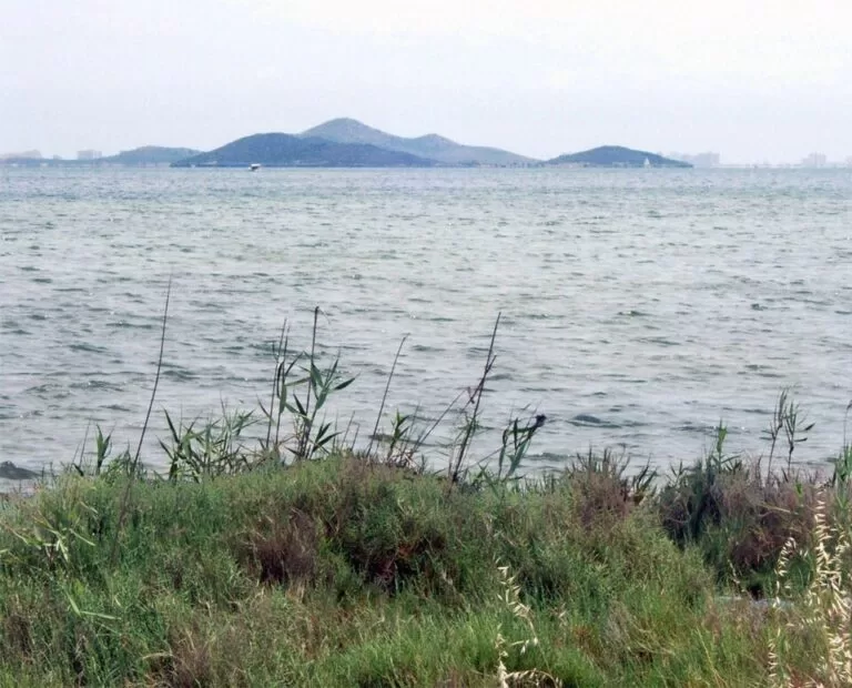
Practical details and boating rules
- No anchoring around the island. The Capitanía Marítima de Cartagena has banned anchoring in four zones of the Mar Menor to protect the fan mussel. Isla Perdiguera is one of them; the others are Isla Mayor, Punta del Galán–El Pedruchillo and Matasgordas.
- General lagoon rules: the Mar Menor protection law, as quoted on Spanish Wikipedia, limits traditional summer day anchoring to 24 hours. It bans anchoring on seagrass meadows, rocky bottoms, areas with fan mussels and bird protection areas, and long-stay anchoring is allowed only in authorised mooring fields.
- Services: we found no confirmed shop, bar, water point or toilet on the island. Take water, shade and a bag for your rubbish.
- Entry: there is no ticket or official visitor service.
Accessibility and safety
The island is reached only by boat, and the only landing point we could confirm on OpenStreetMap is a small pier. The ground is uneven volcanic rock with no step-free paths that we know of. There are no lifeguards or confirmed services. The Mar Menor has suffered serious pollution events: Spanish Wikipedia records the “green soup” algae bloom of 2016 and mass fish deaths from lack of oxygen in 2019 and 2021. Check the current water conditions before you swim.
Best time to visit
Choose a calm day: a small boat or kayak is exposed in the middle of the lagoon. Be wary of the days after heavy rain: Spanish Wikipedia records that fertiliser run-off after the September 2019 storm clouded the lagoon with algae. Boat services, where they run, are a summer business, so outside the season you will need your own boat or a private charter.
Nearby alternatives
- Los Alcázares, 6.7 km away: the nearest town guide on the lagoon’s west shore.
- La Manga del Mar Menor, 9.1 km away: the 22 km sandbar that separates the lagoon from the Mediterranean.
- Cabo de Palos, 11.3 km away: the fishing village and lighthouse at the south-east end of La Manga.
- San Pedro del Pinatar, 13.0 km away: the town at the north end of the lagoon, by the San Pedro salt pans.
- Calblanque, 13.4 km away: the protected coast south of La Manga, on the open Mediterranean.
Distances are in a straight line from the island.
FAQ
How do I get to Isla Perdiguera?
Only by boat. Catalan Wikipedia mentions boat services from Santiago de la Ribera and Los Alcázares, but we could not confirm a 2026 timetable or price. Otherwise you need your own boat or a charter.
Can you visit Isla Perdiguera?
It is the most visited of the five Mar Menor islands, according to Spanish Wikipedia. OpenStreetMap, however, marks the island as private access, and we found no official rule on landing. Ask your boat operator before you go ashore.
Can you anchor near Isla Perdiguera?
No. The Capitanía Marítima de Cartagena has banned anchoring around Isla Perdiguera to protect the fan mussel. Use a pier or a mooring where one is authorised.
Can you swim at Isla Perdiguera?
Nothing we found forbids it, but there are no lifeguards or confirmed services. The Mar Menor has had serious pollution and low-oxygen events since 2016, so check current water conditions first.
How big is Isla Perdiguera?
25.8 hectares, with a highest point of 24 m. It is the second-largest island in the Mar Menor after Isla Mayor, which is 93.8 hectares.
Sources and freshness
Checked 6 November 2026 · 3 sources Show
- Checked 6 November 2026. The Murcia regional tourism site (murciaturistica.es), San Javier town hall and local boat operators could not be reached, so practical details rely on the sources below. Background: Spanish Wikipedia on Isla Perdiguera (cones, height, Esparteña), Espacios abiertos e islas del Mar Menor (size, protection, 1992), San Javier (LIC and ZEPA), Capitanía Marítima de Cartagena (anchoring ban), Mar Menor (anchoring rules, pollution events) and El Carmolí
- Catalan Wikipedia on Illa Perdiguera (boat services)
- English Wikipedia on the Mar Menor (La Manga). Location, pier, ruins and distances: OpenStreetMap contributors (ODbL). Photos: Wikimedia Commons, licences as credited
This place is part of our Costa Cálida — the honest guide to Spain's warm coast — see every town, beach and cove we have mapped on that coast.
How this page is made. CostaMap is written with an AI editorial system run by Ebizapple. This page is based on the sources listed above. Last updated 6 November 2026. Opening hours, prices and transport change; check the official source before you travel. How we work · Partner links and ads