
Costa de Almería · Natural park
Cabo de Gata-Níjar travel guide: San José, Mónsul, Las Negras and Carboneras
Volcanic cliffs, dark-sand coves and small fishing villages in Andalusia’s first land-and-sea protected area, from the salt pans and lighthouse of Cabo de Gata to Agua Amarga and Carboneras.
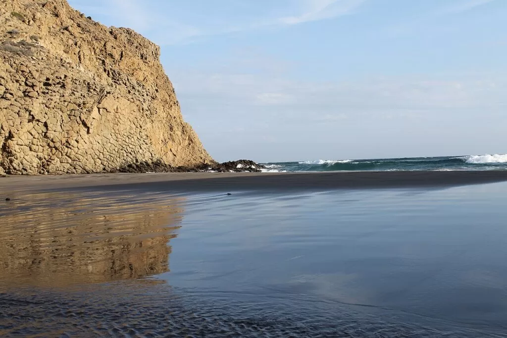
Playa de Mónsul, Cabo de Gata · Photo: efepunto, CC BY 3.0
Part of the Costa de Almería guide · Cabo de Gata-Níjar
Cabo de Gata-Níjar is the protected volcanic coast of Almería province, in the south-east corner of Spain: about 40 km in a straight line from the Cabo de Gata lighthouse and salt pans in the south-west to Carboneras in the north-east, almost all of it inside the Cabo de Gata-Níjar Natural Park. Andalucía’s tourism board describes it as the largest protected area on the Mediterranean coast, with fifty kilometres of the best-preserved cliff coast in Mediterranean Europe (Andalucía.org); the villages along it belong to the municipalities of Almería, Níjar and Carboneras.
At a glance
- Where the coast of the Cabo de Gata-Níjar Natural Park, from San Miguel de Cabo de Gata and the lighthouse to Mesa Roldán and Carboneras, with the town of Níjar inland.
- Towns San Miguel de Cabo de Gata, San José, Los Escullos, La Isleta del Moro, Rodalquilar, Las Negras, Agua Amarga and Carboneras; inland Pozo de los Frailes and Níjar.
- Best for wild beaches such as Mónsul and Los Genoveses, snorkelling and diving, coastal walks, birdwatching at the salt pans and quiet fishing villages.
- Getting there Almería airport is about 25 km from San José and 46 km from Carboneras in a straight line; there is no train, so a car is the practical choice, with intercity buses from Almería.
- On CostaMap 22 places: villages, beaches, coves, viewpoints and campsites.
Map of the Cabo de Gata-Níjar coast
The map shows the places on this stretch that have a CostaMap page. Tick a place type to filter, and click a marker to see the place in the panel.
Place type
Area · next level
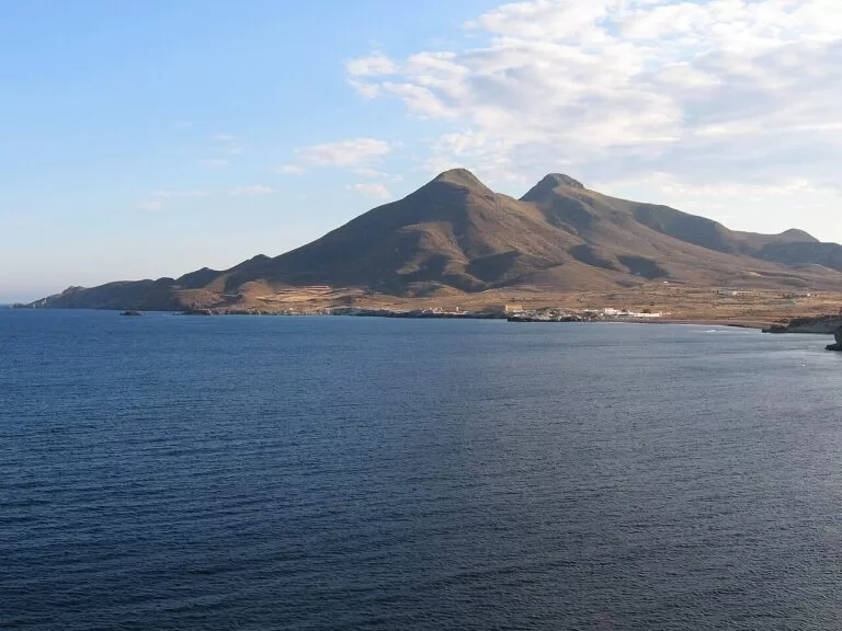 Area map
Cabo de Gata-Níjar
Click a marker to see the place here. From the Cabo de Gata salt pans and lighthouse past San José, Rodalquilar and Las Negras to Agua Amarga and Carboneras.
Towns and villagesTowns and villages
From south-west to north-east, following the park’s coast as spain.info describes it, from San Miguel de Cabo de Gata to Carboneras (spain.info). Descriptions are from Andalucía.org, the Junta de Andalucía’s tourism site.
San Miguel de Cabo de Gata and La Almadraba de Monteleva
The south-western end of the park belongs to the municipality of Almería. San Miguel de Cabo de Gata has a 2,500 m beach of dark sand with full services and a good choice of restaurants (spain.info). South of it, La Almadraba de Monteleva grew up around the salt works (Andalucía.org). The salt pans cover 400 hectares, are the only ones in eastern Andalusia, and have been worked since Roman times; the workers’ quarter and the church, opened in 1907, were built for the salt workers (Andalucía.org). The road ends at the lighthouse above the Arrecife de las Sirenas, named after monk seals whose cries sailors took for sirens (Andalucía.org). See our guides to Cabo de Gata and the Mirador de las Sirenas, and the Camper Área Cabo de Gata on the road in.
San José
San José is the main resort of the park: a former fishing village that has grown into a tourist centre in keeping with its surroundings, with a marina. It grew around an 18th-century coastal battery that watched the bays used by Barbary pirates (Andalucía.org). The town beach is 850 m of golden sand with calm water and a Blue Flag, amphibious chairs and adapted toilets (Andalucía.org, spain.info). The natural beaches of Mónsul and Los Genoveses lie south-west along an unpaved road. See our San José guide.
Pozo de los Frailes
A village just inland from San José, inside the park, with a small old centre and a restored 14th-century water wheel (noria); it has grown a good deal with tourism (Andalucía.org). Camper Park Olivares lies in the farmland to the north.
Los Escullos
A small fishing and tourist settlement on its bay below the Cerro del Fraile, beside Playa del Arco, among cliffs carved by erosion (Andalucía.org). The Castillo de San Felipe, an 18th-century coastal battery, stands on an 8 m cliff of limestone above the sea (Andalucía.org). Spain.info notes that scenes of the James Bond film Never Say Never Again were shot here (spain.info).
La Isleta del Moro
A tiny fishing village of white houses beside a large rock and the islet that gives it its name, close to Los Escullos (Andalucía.org). It has a small harbour, fish restaurants and a sandy beach. North along the road, the Mirador de la Amatista looks down a high cliff. See our new La Isleta del Moro guide.
Rodalquilar
A former mining village in a round valley closed by old mining hills. Inside the park, some of its houses have been restored next to others in ruins; the mine ruins and a coastal castle from the time of Carlos III are the sights (Andalucía.org). The Casa de los Volcanes geotourism ecomuseum opened in October 2007 and explains the geology of the park (Andalucía.org), and the miners’ old social club is now a park information point (Andalucía.org). The Playazo de Rodalquilar is a 400 m beach of fine sand reached from near the village (spain.info). See our Rodalquilar guide.
Las Negras
A fishing village of simple white houses and a few hotels by the sea, in a setting of striking geology (Andalucía.org). Its 650 m beach of dark pebbles and sand has lifeguards, toilets and showers (spain.info), and it is the starting point for Cala de San Pedro, a cove with no road. Wecamp Cabo de Gata is just outside. See our new Las Negras guide.
Agua Amarga
A small fishing hamlet, now with holiday houses but still quiet, among high cliffs dotted with coves (Andalucía.org). It is in the municipality of Carboneras. Walks lead to Cala del Plomo, 260 m of golden sand, and Cala de Enmedio, 130 m (spain.info, spain.info). See our Agua Amarga guide and the walk to Cala de Enmedio.
Carboneras
Carboneras grew around the Castillo de San Andrés: Felipe II approved the fort in 1583 to guard the coast against Barbary raids, it was built in 1621, and land given to its soldiers drew settlers. A second castle followed on Mesa Roldán in 1776, and Carboneras became independent of Sorbas in 1813. Today it mixes fishing, industry, a port and tourism (Andalucía.org). The tourist office is in the castle (spain.info). South of the town lies Playa de los Muertos, and offshore the Isla de San Andrés, a natural monument (Andalucía.org). See our Carboneras guide and Camper Park Carboneras.
Níjar
The town of Níjar sits at the foot of the Sierra Alhamilla, 25 km in a straight line from Cabo de Gata. Its municipality is the fourth largest in Spain. The town keeps a maze-like street plan of Arab origin, a Mudéjar church and a tradition of pottery and weaving (Andalucía.org); spain.info names its ceramics and jarapas, rag rugs (spain.info). See our Níjar town guide and the Níjar place page. In the hills north of town is the Oasis Al Hamam ecocamping.
Beaches and coves
From the long town beaches at each end to coves you reach on foot. Sizes are from spain.info’s beach sheets.
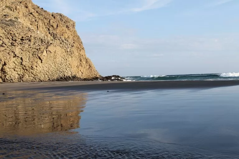
Mónsul
300 m of fine dark sand with a large rock in the middle, one of the two busiest natural beaches of the park; car access is limited in summer (spain.info).
See the Mónsul guide →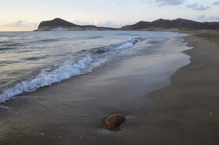
Los Genoveses
1,180 m of golden sand reached through low dunes, with cliffs at the Morrón de los Genoveses and some nudist-friendly areas (spain.info).
See the Los Genoveses walk →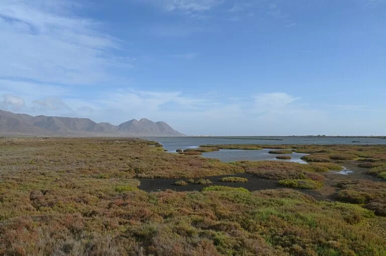
Las Salinas
2,500 m of white sand in front of the salt pans, often windy (spain.info).
See the Cabo de Gata guide →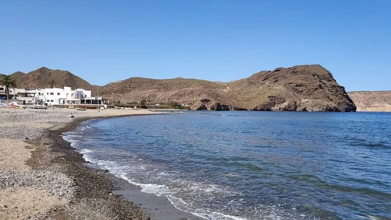
Las Negras and San Pedro
The village beach is 650 m of pebbles with services; Cala de San Pedro, with no road, is a walk or boat ride north (spain.info).
See the Cala de San Pedro guide →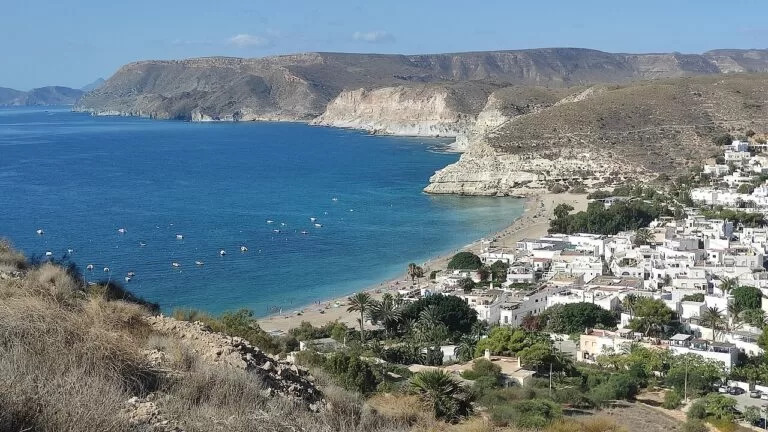
Agua Amarga coves
Cala del Plomo, 260 m, and Cala de Enmedio, 130 m of golden sand and gravel, on rough tracks and paths around Agua Amarga (spain.info).
See the Cala del Plomo guide →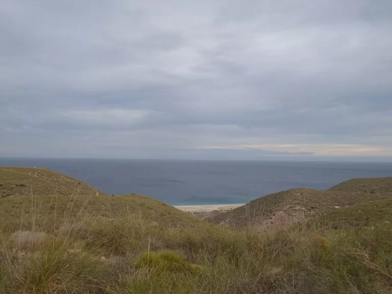
Playa de los Muertos
1,160 m by 70 m of white gravel and sand, reached only on foot, at the northern edge of the park (spain.info).
See the Playa de los Muertos guide →Also worth a look: Cala Rajá, 120 m, on a difficult path (spain.info); Cala Higuera, 1 km from San José marina (spain.info); and La Galera, 800 m, near Carboneras (spain.info). Access to some coves may be restricted in summer (spain.info).
Things to do
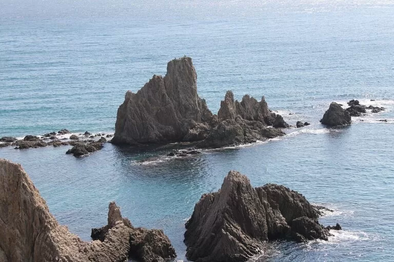
Nature: volcanoes, birds and the sea
The Cabo de Gata range is volcanic, with domes, calderas and dikes, and the park was declared a biosphere reserve in 1997; it covers 49,512 hectares and is also a Special Protection Area for birds and a Ramsar wetland (spain.info). The salt pans are a key site for breeding, wintering and migrating waterbirds, flamingos among them, and the Rambla Morales lagoon has more than eighty species (Andalucía.org). Start at the Las Amoladeras visitor centre on the AL-3115, km 7, and see the natural park guide.
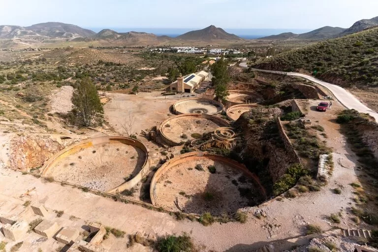
History: gold, castles and Lorca
Rodalquilar’s gold mines, the most important in Europe until they closed in the 1950s according to Andalucía.org, left leaching tanks and ruins above the village; the Cortijo del Fraile nearby inspired Lorca’s play Blood Wedding (Andalucía.org). Coastal forts line the shore: the Castillo de San Andrés in Carboneras (Andalucía.org), San Felipe at Los Escullos and the battery that gave San José its name. Mesa Roldán was a Game of Thrones location (spain.info).
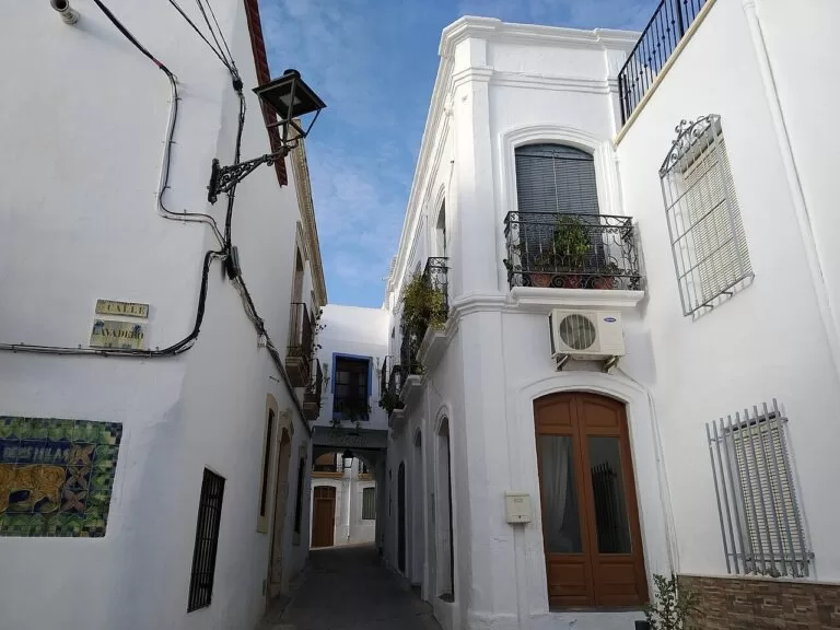
Food and crafts
Andalucía.org suggests rock red mullet, line-caught squid, John Dory, red prawns and lenguado de estero, sole from the Cabo de Gata salt pans, served in restaurants near the Salinas (Andalucía.org). In Níjar, look for pottery and jarapas, woven rag rugs (Andalucía.org).
Where to stay by town
Spain.info lists small hotels, rural houses, farms turned eco-lodges, hostels in fishing houses and campsites across the park (spain.info).
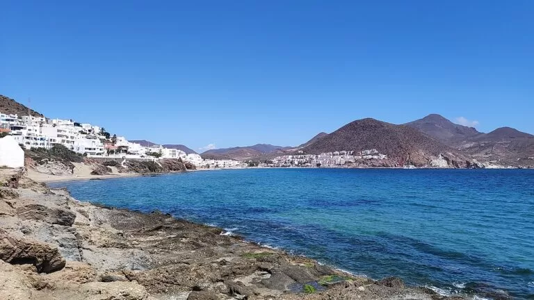
San José
The most services: marina, shops, a Blue Flag beach with adapted facilities, and Mónsul and Los Genoveses close by. Busiest in July and August.
Beaches and servicesLas Negras
A small village with bars open all year, a beach with lifeguards and the walk to Cala de San Pedro. Good for walkers and divers.
Village and covesLa Isleta del Moro and Los Escullos
The quietest bases, in the middle of the park, with fish restaurants and the Amatista lookout nearby. You will want a car.
Quiet and central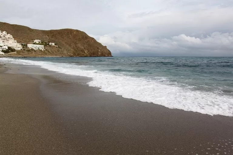
Carboneras and Agua Amarga
Carboneras is a working town with a castle, port and long beaches; Agua Amarga is a small, quieter village among cliffs. Both are closest to Mojácar.
Town or hideawayGetting there and around
By air
Almería airport is the nearest: about 25 km from San José, 33 km from Las Negras and 46 km from Carboneras in a straight line (OpenStreetMap). Road distances are longer.
By car
The AL-3115 runs from Almería to Cabo de Gata past the visitor centre (spain.info); San José is on the AL-3108, Las Negras on the AL-3106, and Carboneras and Playa de los Muertos are reached on the AL-5106 from the N-341 (Andalucía.org). Some tracks to the natural beaches close to cars in summer.
By bus
Intercity buses leave from the Almería intermodal station, run by the Almería transport consortium (CTAL), tel. +34 950 186 570 (spain.info). Bus stops are mapped in the villages; check timetables before you travel, as services are thin outside summer.
A two-day route
By car, south-west to north-east, with a night in San José or Las Negras.
Day 1
Salinas, the lighthouse and San José
Visit the Las Amoladeras visitor centre and the Salinas, then drive to the lighthouse and the Mirador de las Sirenas. In the afternoon go from San José to Los Genoveses and Mónsul; check the summer access rules first.
Day 2
Los Escullos to Carboneras
Drive north via Los Escullos, La Isleta del Moro and the Mirador de la Amatista to Rodalquilar’s Casa de los Volcanes. Lunch in Las Negras, then end in Agua Amarga or at the castle in Carboneras.
FAQ
Where is Cabo de Gata?
In the south-east corner of Spain, in Almería province, Andalusia, 25 to 50 km east of Almería city. The natural park runs from the Rambla de Retamar to Mesa Roldán near Carboneras.
What is the best beach in Cabo de Gata?
Mónsul and Los Genoveses are the best known and busiest. For fewer people, try the Barronal coves, Cala de San Pedro or Cala de Enmedio, which you reach on foot.
Can you drive to Mónsul and Los Genoveses?
Yes, outside high summer. In July and August car access is restricted and a shuttle bus runs from San José; check the current rules locally.
San José or Las Negras: where should I stay?
San José for services and the big natural beaches; Las Negras for a village feel and coves to the north.
Do I need a car in Cabo de Gata?
Mostly yes. Buses run from Almería to the main villages, but the beaches and viewpoints are spread out and services are limited outside summer.
Is Cabo de Gata worth visiting?
For natural beaches, walking and snorkelling, yes. For big resorts and nightlife, Roquetas de Mar or Mojácar suit better.
Other areas of the Costa de Almería
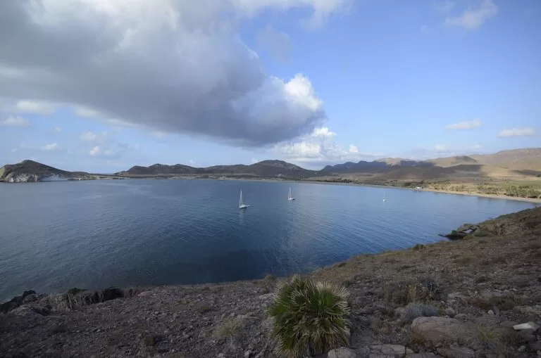
Costa de Almería
The whole coast of Almería province, with the map, the four areas, weather and inland day trips.
Costa de Almería guide →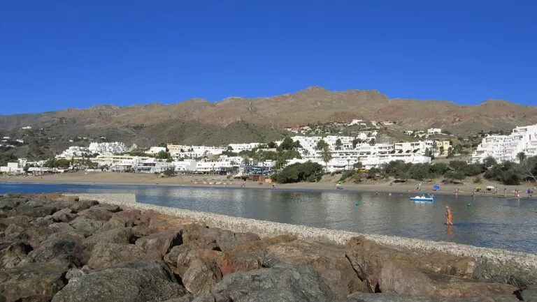
Levante: Mojácar, Garrucha and Vera
The resort beaches below the white village of Mojácar, the fishing port of Garrucha and the coast of Vera.
Mojácar, Garrucha and Vera guide →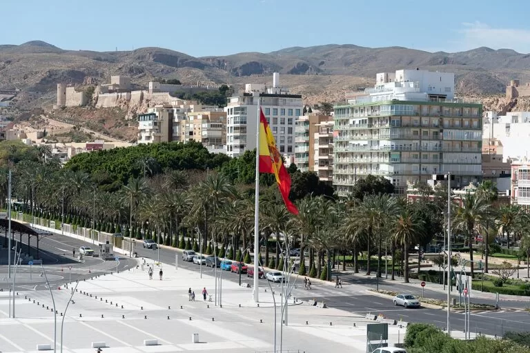
Almería city
The provincial capital on its bay, with the Alcazaba, the cathedral, the museum and the port.
Almería city guide →
Poniente: Roquetas de Mar to Adra
Big beaches at Roquetas and Aguadulce, the Punta Entinas-Sabinar wetlands and the coast to Adra.
Poniente guide →Sources and freshness
Checked 7 November 2026. Andalucía.org (Junta de Andalucía tourism) on the Cabo de Gata-Níjar geopark, Cabo de Gata, La Almadraba de Monteleva, the Salinas, San José, Playa de San José, Pozo de los Frailes, Los Escullos, Castillo de San Felipe, La Isleta del Moro, Rodalquilar, Casa de los Volcanes, the Rodalquilar information point, Las Negras, Agua Amarga, Carboneras, Castillo de San Andrés, the Los Muertos information point, Níjar and walks with Carmen de Burgos. Spain.info (Turespaña) on the natural park, unspoilt coves, film locations, Almería bus station, Carboneras tourist office and its beach sheets for Mónsul, Los Genoveses, Las Salinas, San Miguel, San José, Las Negras, Playazo de Rodalquilar, Cala del Plomo, Cala de Enmedio, Los Muertos, Cala Rajá, Cala Higuera and La Galera. Map data and straight-line distances: OpenStreetMap (ODbL). Not confirmed: bus timetables and the 2026 summer access rules for Mónsul and Los Genoveses. The Junta de Andalucía park pages, Níjar town hall and turismodealmeria.org could not be reached when we checked. Photos from Wikimedia Commons: Mónsul, Cala Rajá and Arrecife de las Sirenas by efepunto (CC BY 3.0); Los Genoveses by Javier Pérez López (CC BY 3.0); Los Escullos from La Isleta by isol (CC BY-SA 3.0); Las Negras and San José by Josi (CC BY-SA 4.0); Salinas by Krzysztof Ziarnek, Kenraiz (CC BY-SA 4.0); Agua Amarga by MdeVicente (CC0); Playa de los Muertos by Millars (CC BY-SA 4.0); Rodalquilar and Almería by Paul Colin Hennig firstdorsal.eu (CC BY-SA 4.0); Níjar by Eduardo Milla (CC BY-SA 4.0); Carboneras by Roy Luck (CC BY 2.0); Mojácar Playa by INDALOMANIA (CC BY-SA 3.0); Roquetas de Mar by Roquex (CC0).
Every place we have mapped on the Cabo de Gata-Níjar
22 towns, beaches, coves and landmarks, kept up to date automatically.
- Agua Amarga
- Agua Amarga to Cala de Enmedio walk (Cabo de Gata)
- Cabo de Gata
- Cabo de Gata-Níjar Natural Park
- Cala de San Pedro (Níjar)
- Cala del Plomo (Níjar)
- Camper Área Cabo de Gata
- Camper Park Carboneras
- Camper Park Olivares
- Ecocamping Oasis Al Hamam Wellnesscamp
- Isla de San Andrés (Carboneras)
- La Isleta del Moro (Cabo de Gata)
- Las Negras (Cabo de Gata)
- Mirador de la Amatista (Cabo de Gata)
- Mirador de las Sirenas (Cabo de Gata)
- Níjar
- Playa de los Genoveses walk from San José (Cabo de Gata)
- Playa de los Muertos
- Playa de Mónsul (Cabo de Gata)
- Rodalquilar
- San José
- Wecamp Cabo de Gata