
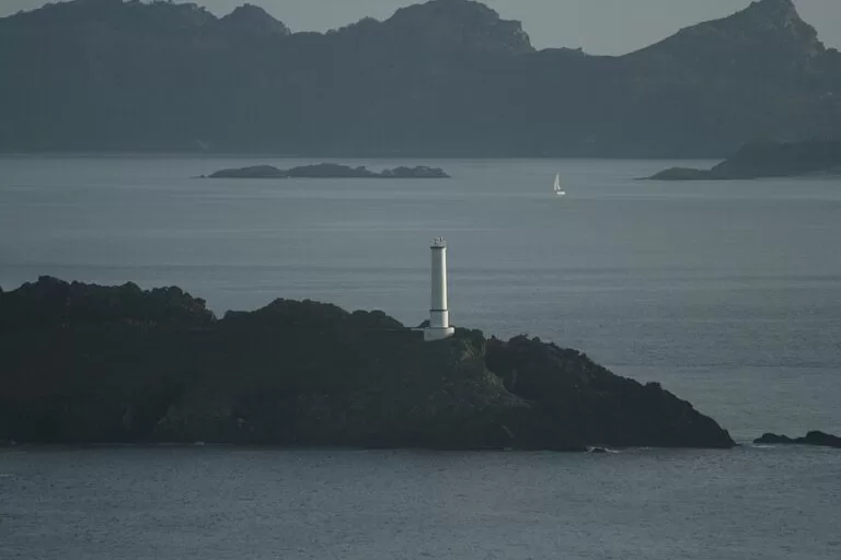
Cabo Home is the headland at the western tip of the Morrazo peninsula in Cangas, where the Costa da Vela looks straight across to the Cíes Islands and the open Atlantic. A white lighthouse of 1853 marks the entrance to the Ría de Vigo here, and from the free car park above Praia de Melide short paths lead to the lighthouses, the cliffs and, 2.8 km north, the hillfort and Roman-era sanctuary on Monte do Facho. You get here by car on the road from Cangas towards Nerga and Donón. It suits walkers, photographers and sunset watchers; skip it in strong wind or fog if you want the views, and do not come for a sheltered family beach day.
Quick facts
- Names: Cabo Home (also Cabo do Home) in Galician and Castilian; the coast around it is the Costa da Vela, which OpenStreetMap also records as Costa de Soavela.
- Where: Santo André de O Hío, Cangas de Morrazo (Pontevedra), between the rías of Vigo and Pontevedra.
- Coordinates: 42.2532, -8.8733 (Cabo Home lighthouse).
- Protection: Natura 2000 network, Site of Community Importance; the Costa da Vela protected area covers 1,419 ha (Turismo Rías Baixas).
- Cliffs: over 150 m high between the Cabo Home lighthouse, Punta Couso and Monte do Facho (Turismo Rías Baixas).
- Lighthouse: built in 1853, white and cylindrical; the tourist board gives 18 m above sea level and a light range of 12 km.
- Entry and parking: free (Turismo Rías Baixas).
Access and parking
By car: Cabo Home is at the end of the road that runs west from Cangas through O Hío past the beaches of Nerga and Barra. The tourist board lists the Cangas bus station about 12 km away. OpenStreetMap shows a free, compacted car park on the hillside above Praia de Melide, about 850 m in a straight line from the lighthouse; the tourist board confirms free parking for the Costa da Vela.
By ferry and bus: ferries cross the ría from Vigo’s maritime station to Cangas (spain.info). From Cangas you need a car, a bike or a taxi; we could not confirm a bus that runs to the cape.
On foot: two marked trails cross the headland. The council’s Roteiro de Donón, a waymarked “Blue Trail” (SA 39-03), is a loop around Donón and the cape, and the long-distance GR 59 Roteiro Ecolóxico do Morrazo also passes here (OpenStreetMap).
What to expect
The tourist board calls Cabo Home a great lookout over the Atlantic, with panoramic views over the Ons and Cíes islands (Turismo Rías Baixas). The Cíes are only about 4 km away in a straight line, so the Monte Faro lighthouse and the cliffs of the islands are close. Near the tip OpenStreetMap maps the main Cabo Home lighthouse and a second light on Punta Robaleira just to the south, and the tourist board describes Melide beach as flanked by three lighthouses.
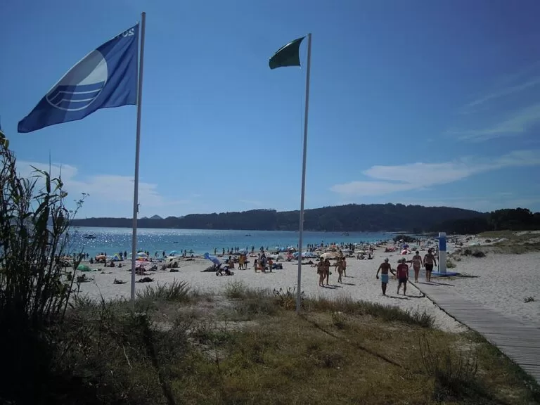
Between the rocks are small sandy inlets. The best known is Praia de Melide, a fine white-sand beach that opens into the Ría de Vigo, in the heart of the protected site; its southern end splits into two sections (Turismo Rías Baixas). OpenStreetMap also maps smaller coves on the west side, such as Praia das Margaridas, and a petroglyph inland of the cape.
North of the cape the coast becomes the Costa da Vela proper: the beaches of Nerga, Viñó and Barra with dunes and pine woods, the high cliffs, and Monte do Facho with its old hillfort and sanctuary (Turismo Rías Baixas). Barra is about 750 m of fine white sand and is a nudist beach, where the tourist board asks visitors to respect nudism; it rates the water quality as excellent and the beach as windy (Turismo Rías Baixas).
Monte do Facho
Monte do Facho is a 184 m hill above the Costa da Vela, named after the lookout post on its summit. Excavations found a first settlement from the Bronze Age, around the 9th century BC; a hillfort and pre-Roman sanctuary from the 4th to the 1st century BC; a Gallaecian-Roman sanctuary of the 3rd and 4th centuries AD; and a military lookout of the 17th century (Turismo Rías Baixas). The tourist board says 161 votive altars once stood on the top, dedicated to the god Berobreo, and that many of the inscribed stones are now in the Quiñones de León Museum in Vigo (Turismo Rías Baixas). From the summit you see the Cíes, Ons and a large part of the Rías Baixas. The board’s Costa da Vela page gives the sanctuary as 160 m above sea level, so the two figures differ slightly.
Practical details
- Toilets and shelter: OpenStreetMap shows public toilets and a shelter above Praia de Melide, near the car park, and a beach bar, the Chiringuito de Melide; we could not confirm its season.
- Other services: the tourist board lists a bird observatory, a restaurant or café, signage it rates as adequate and boating and anchoring for the Costa da Vela.
- Diving: the tourist board lists Cabo Home as a diving area and allows sport fishing.
Accessibility and safety
Cabo Home is a natural site on cliffs. The paths are rough tracks and slopes, not suitable for wheelchairs, and we found no information on adapted access. Keep back from the cliff edges, which are over 150 m high in places, and stay on marked paths to protect the dunes and scrub. Barra is rated windy by the tourist board, and the Atlantic side is exposed; we could not confirm lifeguards on any of the cape beaches.
Best time to visit
Any clear day works for the views; the light is best in the late afternoon and at sunset, when the sun goes down behind the Cíes. Summer brings beach visitors to Nerga and Barra. In winter and in westerly gales the cape is dramatic but exposed; check the forecast for wind and fog before you set out.
Nearby alternatives
- Cíes Islands, 4 km west across the channel: the national park islands you see from the cape, by ferry with a free Xunta permit in high season.
- Samil Beach (Vigo), 9 km south-east across the ría: Vigo’s longest city beach, with pools and a promenade.
- Vigo Old Town and Monte do Castro, 12 km east: the city’s old quarter and its hill-top fort, a ferry ride from Cangas.
- Ons Island, 15 km north-west: the inhabited island of the national park, at the mouth of the Ría de Pontevedra.
- Sanxenxo and Praia de Silgar, 17 km north across the Ría de Pontevedra.
Distances are in a straight line from the Cabo Home lighthouse.
FAQ
How do I get to Cabo Home?
Drive west from Cangas through O Hío towards Nerga and Donón and follow the road to the cape. There is a free car park above Praia de Melide; the last stretch to the lighthouse is on foot along a track.
Is there parking at Cabo Home?
Yes. The tourist board lists free parking, and OpenStreetMap shows an unpaved car park on the slope above Melide beach.
Can you swim near Cabo Home?
Yes, at Melide, Nerga and Barra, but the sea is open Atlantic and can be windy and rough, and we could not confirm lifeguards. Barra is a nudist beach.
Can you see the Cíes Islands from Cabo Home?
Yes. The islands are about 4 km away across the channel at the mouth of the Ría de Vigo; Ons is visible to the north-west.
What is on Monte do Facho?
The remains of an Iron Age hillfort and a Gallaecian-Roman sanctuary where 161 votive altars once stood, with a 17th-century lookout on the summit and wide views over the rías.
Sources and freshness
Checked 9 November 2026 · 10 sources Show
Checked 9 November 2026. Official: Turismo Rías Baixas pages on Cabo Home, the Costa da Vela (also the Spanish page), the Cabo Home lighthouse, Playa de Melide, Playa de Barra, Monte de O Facho and the Castro del Monte do Facho; spain.info, Vigo (ferries). Car park, toilets, lights, coves, trails and distances: OpenStreetMap contributors (ODbL). The Cangas council site could not be reached. Photos: Wikimedia Commons, licences as credited.
How this page is made. CostaMap is written with an AI editorial system run by Ebizapple. This page is based on the sources listed above. Last updated 9 November 2026. Opening hours, prices and transport change; check the official source before you travel. How we work · Partner links and ads