
Senda del Oso (Bear Trail), Asturias
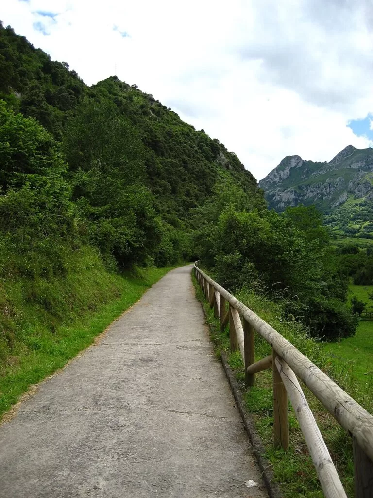
Hiking trailThe Senda del Oso (Bear Trail) is a greenway on an old mining railway in central Asturias, about 14 km south-west of Oviedo. Its best-known section runs 11.5 km from the car park at Tuñón (Santo Adriano) to Caranga Baxu (Proaza) beside the River Trubia, past a fenced enclosure where a brown bear called Molina lives. The Asturias tourist board rates it easy, with 170 m of gentle climbing and 3 to 5 hours on foot. From Caranga two more branches continue to Quirós and Teverga. It suits families, cyclists and anyone who wants a flat valley walk; skip it if you are after mountain summits or a quiet path: the tourist board calls Section I the busiest part of the trail.
Quick facts
- Names: Senda del Oso in Spanish, usually “Bear Trail” or “Bear Path” in English; the official pages also call it the Vía Verde de la Senda del Oso.
- Where: the valleys of the Trubia, Teverga and Quirós rivers in central Asturias, through the councils of Santo Adriano, Proaza, Teverga and Quirós.
- Start coordinates: 43.2915, -5.9827 (Tuñón car park, from OpenStreetMap).
- Section I, Tuñón–Caranga: 11.5 km one way, +170 m / −74 m, between 148 m and 284 m altitude, 3–5 hours, easy.
- Caranga–Santa Marina (Quirós): 11.96 km, +250 m / −28 m, 3–5 hours, easy.
- Caranga–Cueva Huerta (Teverga): 19.1 km, +588 m / −149 m, more than 5 hours, moderate.
- Whole trail: more than 40 km there and back, in three sections that meet at Caranga Baxu.
- Season: all year (official sheets).
- Entry: free; it is a public path.
Access and parking
By car: the official start of Section I is the Tuñón car park. On OpenStreetMap it is a free surface car park beside the trail, with a free motorhome area for 30 vehicles next to it, a drinking fountain and a bike hire centre. A second free car park, the Aparcamiento de Villanueva by the Buyera picnic area, lies about 3.6 km further up the valley in a straight line and is the closest one to the bear enclosure.
By bus: OpenStreetMap shows bus stops at Tuñón, Buyera and Caranga Baxu on the valley road. The tourist board’s sheet for Section I links the ALSA timetables on the Asturias transport consortium site (CTA) for the return. Check times before you rely on a bus back. The sheet for the Quirós branch says it has no return by public transport.
One way or there and back: Section I is a one-way route. Walking back the same way doubles it to about 23 km, so plan to turn back part way, use the bus, or go by bike.
What to expect
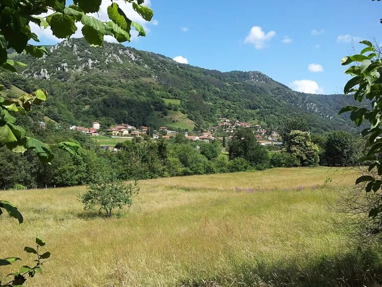
Section I follows the old railway bed along the River Trubia. The tourist board describes riverside woods of poplar, ash and alder, small tunnels cut in the rock and a medieval bridge with a fountain at Villanueva. Just before the walk you can see the pre-Romanesque church of Santo Adriano at Tuñón.
Next to the Buyera picnic area, with its play area and car park, is the bear enclosure. The official page says it is home to Molina, a brown bear found injured in 2013 at Rimolín (Cangas del Narcea). She could not readapt to the wild after release in the Muniellos reserve and now lives in the enclosure, cared for by the Fundación Oso de Asturias. Sightings are not guaranteed: the enclosure is large and fenced.
After Proaza the path enters the Peñas Juntas gorge, where limestone walls close in on the river, and ends at Caranga Baxu, where the trail forks.
The Quirós branch passes through the Cuevafurada gorge and along the Valdemurio reservoir, where you can hire a canoe, crosses it on a wooden bridge and ends at the restored El Cribu coal loading bay in Santa Marina. The Teverga branch goes through the Valdecerezales gorge to Entrago, past the Teverga Prehistoric Park, and ends at the Cueva Huerta recreation area. Cueva Huerta is a Natural Monument with 14.5 km of mapped galleries.
Practical details
- Surface: a prepared greenway (the official page calls Section I fully prepared), shared by walkers and cyclists.
- Bikes: the official pages describe the trail as ideal on foot or by bicycle. OpenStreetMap shows bike hire at Tuñón (Centro BTT Valles del Oso) and at Villanueva and Buyera. We did not check prices.
- Dogs: the tourist board asks you to keep dogs on a lead and to keep away from livestock and from mastiffs guarding herds.
- Protected area: the trail crosses Natura 2000 sites (Caldoveiro and Río Trubia), and the upper branches enter the Las Ubiñas–La Mesa Natural Park and Biosphere Reserve.
- Food and water: there is a bar at Tuñón, a hotel restaurant at Buyera and drinking water at the Tuñón start (OpenStreetMap). Take your own water for the longer branches.
- Waymarking: a short part of the trail is shared with the GR-109.
Accessibility and safety
Section I has a gentle profile. The tourist board publishes an accessibility document for it on the Section I page, which we did not review in detail, so check it before you go with a wheelchair or pushchair. The tunnels on Section I are small and cut in the rock. The Teverga branch is longer and climbs 588 m, so it is rated moderate. Bikes and walkers share the path, so keep children close.
Best time to visit
The official sheets give every section as suitable all year round. Because Section I is the busiest part of the trail, an early start helps if you want the path to yourself.
Nearby alternatives
- Oviedo, 14 km away: the regional capital and the nearest city to the trail.
- Cudillero, 33 km away: the fishing village of coloured houses on the coast.
- Isla de la Deva (Castrillón), 34 km away: a small island off the coast near Salinas.
- Gijón, 38 km away: the largest town on the Asturian coast.
- Llanes Coastal Path: another CostaMap walking guide in Asturias, on the cliffs of the east coast.
Distances are in a straight line from the Tuñón car park.
FAQ
How long is the Senda del Oso?
The whole trail is more than 40 km there and back. The most popular section, Tuñón to Caranga, is 11.5 km one way and takes 3 to 5 hours on foot.
Where does the Senda del Oso start?
Section I starts at the Tuñón car park in Santo Adriano (43.2915, -5.9827). The other two branches start at Caranga Baxu in Proaza.
Is there parking on the Senda del Oso?
Yes. OpenStreetMap shows free car parks at Tuñón and at Villanueva by the Buyera picnic area, near the bear enclosure.
Can you see the bears on the Senda del Oso?
The enclosure by the Buyera picnic area is home to Molina, a brown bear that could not return to the wild. She lives in a large fenced area, so you may or may not see her.
Is the Senda del Oso suitable for children and bikes?
Yes. The tourist board rates Section I and the Quirós branch easy and suitable for families, on foot or by bike. The Teverga branch is longer and rated moderate.
Sources and freshness
Checked 6 November 2026 · 5 sources Show
Checked 6 November 2026. Official: Turismo Asturias pages for Section I, Tuñón–Caranga (distance, height gain, time, start, bear enclosure, tips), Caranga–Bárzana (Quirós) and Caranga–Cueva Huerta (Teverga); bus timetables: CTA Asturias (link given by the tourist board, not opened). Location, car parks, bus stops, bike hire and distances: OpenStreetMap contributors (ODbL). Photos: Wikimedia Commons, licences as credited.
How this page is made. CostaMap is written with an AI editorial system run by Ebizapple. This page is based on the sources listed above. Last updated 6 November 2026. Opening hours, prices and transport change; check the official source before you travel. How we work · Partner links and ads