
A very small Mediterranean island with famously white sand and a long, layered past. Expect pristine beaches and a dry climate, and — if history fascinates you — a surprising sequence of occupations and upheavals that left few large modern settlements. This guide gives honest, verifiable context so you know what the place really is: an intimate, low-rise island in the Balearics whose main draw is its coastline and sun, not urban nightlife or extensive infrastructure.
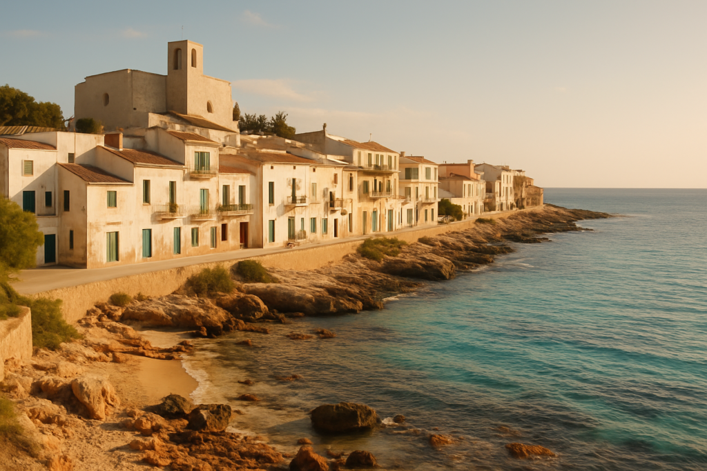
Formentera at a glance
- Small Spanish island in the Mediterranean, part of the Balearic Islands autonomous community.
- Area: 83.24 square kilometres (32.14 sq mi).
- Population (2011 Census): 10,583 — a very small resident base compared with larger Balearic islands.
- Geography: the smallest and most southerly of the Pityusic Islands group.
- Climate: semi‑arid — hot, very dry summers and warm, dry winters.
- Famous for pristine white-sand beaches; public nude sunbathing is permitted.
Before you plan
Nothing in our verified sources indicates closures or major redevelopment projects that affect visitor access to beaches or the island as a whole. This guide uses only confirmed facts; always check local notices for any temporary restrictions on beach access or protected-area rules before travel.
Things to do in the area
The core reason visitors come here is simple: the coastline. Beyond that, the island rewards people who enjoy low-density, open-air exploration and historical curiosity. Read these sections to set expectations — don’t expect large museums or big-city services; expect landscape, shoreline, and history that stretches back thousands of years.
| Attraction | What it is | Price/entry | Best for |
|---|---|---|---|
| White-sand beaches | Long stretches of pale sand and clear water | — | Beachgoers; sunbathers (including those who practice nudism) |
| Historic sites and archaeological remains | Evidence of prehistoric occupation and later Mediterranean powers | — | History buffs and archaeology-minded visitors |
| Scenic island landscapes | Coastal and inland semi-arid terrain | — | Walkers and people seeking quiet coastal views |
Beaches and shoreline
The shoreline is the island’s primary attraction. The beaches are widely noted for their white sand and clear water; nude sunbathing is allowed in public areas. Expect stretches of sand rather than dramatic cliffs, and a strong emphasis on outdoor relaxation. The semi-arid climate contributes to long, dry beach seasons and generally stable weather for sunbathing.
Archaeology and deep history
This is a place with a long human record. Occupation goes back to prehistoric times — with evidence dated to roughly 2,000–1,600 BC — so the island contains traces of very early Mediterranean societies. Over the centuries it was held or visited by many different peoples: Carthaginians, Romans, Visigoths, Byzantines, Vandals and Arabs all figure in the island’s story. If you enjoy imagining long timelines and layered cultural influence, there is much to appreciate even if remains are often small-scale.
Medieval upheavals and abandonment
The medieval history includes violent and disruptive episodes. The island was attacked by Norwegian king Sigurd I in 1109. Later, it was conquered by James I and incorporated into the Crown of Aragon — a key transition that tied the island to mainland Iberian politics. For several centuries the island’s fortunes ebbed and flowed; notably, from 1403 until the early 18th century it was effectively uninhabitable because of persistent pirate attacks. That long period of depopulation shaped settlement patterns and left the modern island with fewer large historical urban centres than you might expect elsewhere in the Mediterranean.
Best beaches in the area
Beaches are the default reason to visit. The island is famous for pale sands and clear seas; nudity is permitted on the public beaches, which attracts a particular kind of visitor. Facilities and exact beach names are beyond the claims we can verify here, so the focus remains on character and user expectations.
| Beach | Character | Facilities / Blue Flag |
|---|---|---|
| White-sand shorelines | Long, pale-sand beaches ideal for sunbathing and swimming | — |
| Coastal coves | Smaller inlets and quieter spots for privacy and naturist beachgoers | — |
How to get to the island and get around
Geographically, the island is a Spanish Mediterranean island in the Balearic Islands community and the smallest and most southerly member of the Pityusic Islands. Practical transport details such as ferry routes, frequencies or road networks are not covered by the verified facts used in this guide, so we don’t present specific schedules or transit times here. Visitors should expect a small-island experience: lower population density, limited large-scale infrastructure, and travel arrangements that typically reflect islands of this size.
Best time to visit the island
Climate should guide timing. The island has a semi‑arid climate with hot, very dry summers and warm, dry winters. That means dry, sunny weather dominates much of the year and summers are particularly hot and dry — ideal for beach-focused travel but potentially less comfortable for those seeking cooler conditions. Winters remain warm and dry compared with many mainland European locations, so shoulder seasons will still be favorable if you prefer milder heat with fewer crowds.
| Season | Months | What to expect |
|---|---|---|
| Summer | — | Very hot and very dry — prime beach weather |
| Winter | — | Warm and dry compared with mainland Europe — quieter island conditions |
History of the island
The island’s human story spans millennia. Prehistoric occupation dates to around 2,000–1,600 BC, indicating a long-standing Mediterranean presence. Over the classical and late antique eras the island experienced successionary control and influence: Carthaginians and Romans left their imprint, followed by Visigothic and Byzantine periods, and later incursions by Vandals and Arabs. In 1109 the island was attacked by the Norwegian king Sigurd I, an episode that highlights the wide-ranging medieval interactions across the Mediterranean. Later, conquest by James I brought the island into the Crown of Aragon, integrating it into Iberian medieval structures. Between 1403 and the early 18th century the island was effectively uninhabitable due to frequent pirate attacks, a prolonged depopulation that influenced later settlement patterns and the island’s sparse modern footprint.
Practical info
- Jurisdiction: The island belongs to Spain and is part of the Balearic Islands autonomous community.
- Scale: With an area of 83.24 sq km and a small resident population (10,583 at the 2011 Census), expect compact settlements and limited urban sprawl.
- Climate implications: The semi‑arid climate means limited rainfall — plan for strong sun protection and hydrate, especially in summer.
- Beach culture: Public nude sunbathing is permitted on the island’s beaches; be mindful of local customs and signage.
Worth it for: people seeking exceptional white‑sand beaches, clear Mediterranean sea and a quiet island atmosphere with a deep and varied history. Less so if: you want big-city nightlife, an extensive museum circuit or heavily urbanised attractions — this is a low-density island experience.
How we assess this guide
This article is assembled from verified facts about the island’s geography, climate and history. We cross-checked claims and included only information substantiated by reliable sources. We flag any closures or material changes when supported by our sources; we do not invent schedules, prices or operational details. This is a synthesis of authoritative background information rather than first‑hand, on-the-ground reporting.
Frequently asked questions
Where is this island located?
It is a Spanish island in the Mediterranean Sea and part of the Balearic Islands autonomous community.
What makes the beaches special?
The island is renowned for its white-sand beaches and clear coastal waters; this is the main natural attraction highlighted in verified sources.
Is nude sunbathing allowed?
Yes — public nude sunbathing is permitted on the island’s beaches according to verified information.
What is the climate like?
The climate is semi-arid: expect hot, very dry summers and warm, dry winters.
How big is the island?
The island covers 83.24 square kilometres (32.14 sq mi), making it compact and easy to cross compared with larger Mediterranean islands.
How many people live there?
At the 2011 Census the resident population was 10,583. That small population contributes to a low-density, relaxed atmosphere.
Is the island part of a larger island group?
Yes. It is the smallest and most southerly island of the Pityusic Islands group.
Does the island have a long history?
Yes — evidence shows prehistoric occupation dating to about 2,000–1,600 BC, and the island has been successively occupied or influenced by Carthaginians, Romans, Visigoths, Byzantines, Vandals and Arabs.
Was the island ever depopulated?
Yes. From 1403 to the early 18th century the island was effectively uninhabitable because of sustained pirate attacks.
Was the island ever conquered by a major medieval power?
It was conquered by James I and added to the Crown of Aragon, an important medieval political integration.
Did any famous medieval leaders attack the island?
One notable episode is the attack by the Norwegian king Sigurd I in 1109, recorded in the island’s medieval history.
Where does the island’s name come from?
The name is said to derive from the Latin word frumentarium, reflecting historical linguistic roots.
Is it a good destination in winter?
Winters are warm and dry relative to many European locations because of the semi‑arid climate, so the shoulder and off-seasons can be pleasant for visitors seeking milder conditions.
Are there large urban centres or heavy infrastructure?
No — the island’s small area and modest population mean fewer large urban centres; expect a more intimate, low-rise environment.
Where can I read about nearby Balearic destinations?
See the related regional guides below for broader trip planning and comparisons.
Plan the wider trip
- Palma de Mallorca city guide
- Manacor guide
- Mahón (Menorca) guide
- Fornalutx: stone village in the Sóller valley
- Llubí: caper village in the Pla de Mallorca
- Maria de la Salut: Pla de Mallorca farm town
Formentera on the map
This place is part of our Balearic Islands Guide: Mallorca, Menorca, Ibiza & Formentera — see every town, beach and cove we have mapped on that coast.
How this page is maintained. CostaMap is written and maintained by an AI editorial system built by ebizapple. Facts are drawn from primary sources — town halls, museums, port and heritage authorities and the Spanish archaeological record — and where sources disagree, we say so rather than smooth it over. Photographs marked as ours are taken on location. This page was last reviewed on 15 August 2026. Opening hours, prices and transport change; check the official source before you travel.