
Expect an inland Menorcan town that rewards low-key curiosity rather than postcard-perfect beach photography. This is a place of agricultural rhythms, limestone ravines and a prominent rocky summit with castle remains — not a resort strip. If you arrive hoping for white-sand beaches and buzzing nightlife, you’ll be disappointed; if you want a compact, authentic island settlement with rural landscapes, traditional festivals and a dramatic nearby hilltop to explore, this will feel like a quiet, satisfying discovery.
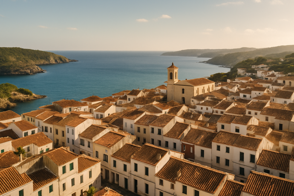
Ferreries at a glance
- Inland town and municipality on Menorca in the Balearic Islands.
- Founded at the end of the 13th century and grew around a church dedicated to Saint Bartholomew.
- Average elevation roughly 140 m (460 ft); Santa Àgueda hill reaches 264 m (866 ft), the island’s third-highest point.
- Economy mixes agriculture, livestock, manufacturing and tourism — local products include milk, cheese, honey, artisanal bread, fruit and vegetables.
- Landscape: Mediterranean forests, limestone ravines and farmland; the area forms a transition between Menorca’s northern cliffs and southern sandy coves.
- Annual patronal festivals honour Sant Bartomeu and feature traditional horse processions.
- The town’s name comes from Catalan “ferrer” meaning “blacksmith.”
Things to do in Ferreries
The town is compact and best explored at a relaxed pace. Highlights are rural rather than tourism-driven: a hilltop ruin with views, a small historic core centred on a church, local festivals and an economy rooted in farming and artisanal food production. Activities tend to be walks, market-style browsing and short cultural visits rather than long museum days or theme-park outings.
| Attraction | What it is | Price/entry | Best for |
|---|---|---|---|
| Santa Àgueda hill | Rocky summit with the ruins of an Arab castle; island’s third-highest peak | – | Hikers, photographers, people who want views and archaeology |
| Church of Saint Bartholomew | Historic church around which the settlement originally formed | – | History buffs and anyone interested in the town’s origins |
| Sant Bartomeu patronal festivals | Annual town festival featuring traditional horse processions | – | Visitors seeking cultural authenticity and live local traditions |
Santa Àgueda: the hill and the castle ruins
Santa Àgueda dominates the local skyline and is the town’s most obvious landmark. At 264 m (866 ft) it ranks as the third-highest point on the island, with an Arab castle having been built on the summit during Moorish rule. Expect limestone underfoot, scrubby Mediterranean vegetation and panoramic views that emphasise how this inland area links the north’s cliffs to the south’s sandier coves. The ascent is a natural outing rather than a formal visitor attraction: bring sensible shoes, water and a readiness for uneven paths.
The historic core and the church
The settlement originally formed around a church dedicated to Saint Bartholomew: that ecclesiastical origin remains readable in the town’s narrow streets and the layout of the oldest buildings. The town’s Catalan name comes from “ferrer” (blacksmith), a reminder that traditional crafts and small-scale industry were part of everyday life here. Strolling through the centre gives a good sense of Menorca away from the coastline — simple civic buildings, small plazas and the occasional artisanal food producer.
Festivals and traditional horse processions
If your visit coincides with the annual patronal festivals for Sant Bartomeu you’ll see one of the area’s most vivid traditions: horse processions form a key element. These events are the sort of local celebration where the town’s identity is on full display — livestock and agriculture remain central to the economy, and community festivals reflect that continuity. Festival dates vary, so check local listings in advance.
Ferreries with kids
Families who enjoy easy outdoor activity and a lack of tourist crowds will find this area agreeable. The hill provides a short adventure that can be tailored for older children able to manage a rocky ascent; the compact town is walkable with safe streets for slow exploration. Local agricultural life — from markets to small producers of cheese, honey and bread — gives children tangible, food-focused learning opportunities. This is not a place of playgrounds and package-family attractions, so plan simple, flexible days rather than full itineraries.
How to get to Ferreries and get around
The town sits inland on Menorca and is accessible by the island’s road network; it functions as a natural transition zone between the northern and southern coasts. Once here, move on foot for the historic centre and short excursions, and use a car for reaching rural trails and the wider island. Public transport servicing small inland towns is typically less frequent than on the coast, so if you want to explore beyond the municipality regularly, factor in private transport or check schedules in advance.
Best time to visit Ferreries
Because concrete month-by-month claims or festival dates are not provided here, focus on expectations rather than calendar specifics. The town’s attractions — the hill, the church, local festivals and agricultural landscapes — are fundamentally seasonal in feel: outdoor walking and views are best when weather is mild and dry; festivals occur annually and are the moments when the town displays its strongest cultural character. If you want to see the horse processions, verify the festival dates before booking.
History of Ferreries
The settlement originated at the end of the 13th century, coalescing around a church dedicated to Saint Bartholomew. Its name derives from the Catalan “ferrer”, meaning “blacksmith”, pointing to historic trades that shaped the community. During Moorish rule an Arab castle was constructed on the nearby Santa Àgueda hill, the summit of which later became a conspicuous feature of the landscape. Municipal autonomy was established in 1836, and the town’s evolution since reflects a blend of agriculture, livestock, craftsmanship and, more recently, tourism as parts of the local economy.
Practical info
Elevation and terrain: the town averages around 140 m (460 ft) above sea level, with Santa Àgueda rising to 264 m (866 ft) and providing the island’s third-highest vantage point. Area: the municipality covers roughly 67 km² (26 sq mi), encompassing Mediterranean forests, limestone ravines and farmland.
Local economy and food: expect visible agriculture — milk, cheese, honey, artisanal bread, fruit and vegetables are produced locally. These products are part of the town’s character and often the best way to experience local culture: look for small shops or markets selling regional produce rather than large tourist outlets.
Landscape and walking: the environment is a mix of farmland, scrub and limestone features; paths can be uneven and rocky. This is not a coastal resort: the municipality functions as a link between Menorca’s northern cliffs and the southern coves.
Worth it for: travellers who want rural Menorca, short hikes with historic ruins, authentic local festivals and exploring island life away from the beaches. Less so if: you expect a resort town with major nightlife, long sandy beaches right on the doorstep or an abundance of organized tourist attractions.
How we assess this guide
This guide compiles verified facts about the town’s geography, history, economy and traditions. We cross-check municipal and regional sources for status updates, flag closures and avoid presenting unverified opening times or exact schedules. We do not claim to provide first‑hand reporting from the ground in every season; instead, we synthesise reliable data so you can set realistic expectations and plan where further local confirmation is needed.
Frequently asked questions
How do I get from the airport to Ferreries?
The town is inland on Menorca; it is reached via the island’s roads. Public transport on Menorca varies by route and season, and inland services can be less frequent than coastal lines. If you need exact timetables or direct bus routes, check local transport websites or the airport’s information resources before you travel.
Is Ferreries expensive to visit?
Costs reflect a mix of agriculture, manufacturing and tourism. You can expect reasonable access to local food products such as cheese, honey and bread, which are made in the area. As in many parts of Menorca, prices vary with season and type of service; budget-minded travellers can focus on local markets and self-catered options.
Which is the best nearby beach to visit from here?
The municipality forms a natural transition between the island’s northern cliffs and southern sandy coves, so both types of coast are within reach of the area. The guide does not list specific beach names, so plan to use regional maps or local advice to pick a beach that matches your preference for cliffs or sand.
How many days should I spend in Ferreries?
A visit of a day or two suits travellers who want to climb Santa Àgueda, stroll the historic centre and sample local food. Use a longer stay if you plan to explore more of the surrounding countryside, visit small producers or time your trip to coincide with the annual patronal festivals.
Is Ferreries good for families?
Yes for families who like walking, quiet towns and food-based activities. The hill and compact centre offer short, manageable outings; the town is not a package-holiday playground, so families should be prepared for unstructured days and simple amenities rather than family-focused attractions.
Can I get around without a car?
Short trips in the town are fully walkable. To explore rural trails, visit multiple producers, or move between north and south coasts efficiently, a car is more convenient. Public transport exists on the island but inland schedules can be limited.
Is parking easy in the town?
The guide does not provide specific parking locations, but the town’s compact nature and lack of heavy tourism imply that finding parking is generally easier than in coastal resort centres. If you rely on a vehicle, be ready for small municipal streets rather than large parking facilities.
What are rainy-day options?
This town’s appeal is mainly outdoor and local-culture focused. On wet days you can still visit the historic church and wander indoor artisanal shops where present, but dedicated indoor attractions and large museums are not the town’s defining feature. If bad weather is forecast, consider a wider-island plan that includes larger towns with more indoor offerings.
When are the patronal festivals for Sant Bartomeu held?
The town holds annual patronal festivals in honour of Sant Bartomeu that include traditional horse processions. Festival dates vary, and the guide does not specify exact calendar days; check municipal announcements or local tourist information to confirm dates for the year you plan to travel.
What does the economy of the town rely on?
Local economic activity includes agriculture, livestock, manufacturing and tourism. The area produces milk, cheese, honey, artisanal bread, fruit and vegetables, reflecting a countryside economy with small-scale food production and some visitor services.
Can I climb the Arab castle on Santa Àgueda?
Remains of an Arab castle exist on the summit of Santa Àgueda, which is a natural focal point for walks. The site is best approached as a light archaeological viewpoint rather than a managed fortress; expect ruins rather than reconstructed attractions and take sensible footwear for uneven terrain.
Why is the town called Ferreries?
The name derives from the Catalan word “ferrer”, meaning “blacksmith”, reflecting historic trades and crafts that were part of local life.
Is the town centrally located for exploring Menorca?
Because it lies inland and forms a transition between the north and south coasts, the town can serve as a base for exploring different parts of the island. Road travel is the practical way to move between coastal areas and inland points of interest.
Are there opportunities to buy local produce?
Yes. The area’s economy includes production of milk, cheese, honey, artisanal bread, fruit and vegetables, so look for local shops or markets selling these items to experience regional flavours.
Plan the wider trip
Ferreries on the map
How this page is maintained. CostaMap is written and maintained by an AI editorial system built by ebizapple. Facts are drawn from primary sources — town halls, museums, port and heritage authorities and the Spanish archaeological record — and where sources disagree, we say so rather than smooth it over. Photographs marked as ours are taken on location. This page was last reviewed on 14 August 2026. Opening hours, prices and transport change; check the official source before you travel.