
Small, quiet and rooted in a layered past, this Maestrat village rewards visitors who arrive curious rather than expecting a resort experience. The streets and surrounding hills are about human-scale history: Bronze‑Age remains, medieval lordship, abandoned hamlets and a patchwork of upland terrain — not a one‑stop entertainment zone. Read this guide to avoid expecting big museums, a long beachfront or busy nightlife; instead plan for short walks, archaeology and a slow look at rural life in the Valencian hinterland.
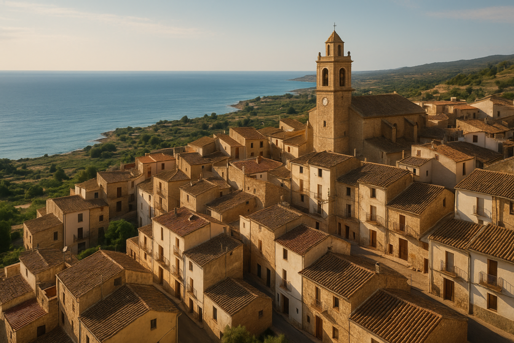
Xert at a glance
- Population: 702 (figure dated 1 Jan 2025)
- Elevation: 470 m above sea level
- Postal code: 12360
- The mountains known as Moles de Xert rise above the town and belong to the municipality
- Located in the Comarca of Baix Maestrat
- Valencian pronunciation: [ˈtʃɛɾt]
Things to do in the town
Xert is best approached as a compact set of sights rather than a long list of attractions. Expect short outings: a walk to nearby ancient remains, exploring the traces of abandoned settlements, and noticing the vestiges of traditional rural life. Below are the main visitor‑relevant features that are documented for the area.
| Attraction | What it is | Price/entry | Best for |
|---|---|---|---|
| Mola Murada | Hill with remains of an ancient Iberian village dating to the Bronze Age | — | History and archaeology enthusiasts |
| Fontanals (abandoned village) | Rural settlement abandoned during the era of the Spanish Maquis in the mid‑20th century | — | Explorers of abandoned places and rural history |
| La Barcella (abandoned) | Hamlet noted as abandoned in 1609 | — | Short historical visits on foot |
| Lligallo (traditional cattle‑herding institution) | Local institution historically used to organise cattle herding in the area | — | Visitors interested in rural customs and agricultural history |
Mola Murada: Bronze‑Age traces above the village
The rocky rise called Mola Murada preserves archaeological remains identified as an ancient Iberian village from the Bronze Age. It’s one of the clearest direct links in the landscape to prehistoric habitation; allow time to read any on‑site panels or to consult local guides if available, because the importance of the site is in the material remains rather than built‑up visitor infrastructure.
Abandoned hamlets: Fontanals and La Barcella
Two abandoned settlements lie within the municipal area and are commonly referenced in historical accounts: Fontanals, abandoned during the period associated with the Spanish Maquis in the mid‑20th century, and La Barcella, recorded as abandoned in 1609. These places are of interest to people studying rural depopulation and to photographers who take a quiet, contemplative approach to visiting ruins.
Traditional pastoral organisation
Historically the town maintained its own lligallo to organise cattle herding in the wider area. That institutional detail points to a landscape shaped by pastoralism and to community structures that managed livestock movements and shared grazing — an angle worth exploring if you read local history or speak with long‑standing residents.
Best beaches in the area
There are no grounded claims in our sources about beaches inside the municipality; the guide therefore does not present local beaches as part of the visit. If you want a coastal day, plan to combine this inland stop with a separate visit to the nearby Mediterranean towns on the Baix Maestrat coast.
Xert with kids
The place offers short, manageable outdoor experiences rather than theme‑park attractions. Children who enjoy simple archaeology, easy scrambles on low hills and quiet exploration of rural ruins will find it rewarding. Use common‑sense safety measures around ruins and rocky ground, and expect low levels of visitor facilities tailored to families.
How to get to the village and get around
Sourcing public transport specifics or airport transfer times for this particular village is outside the verified claims available here. Visitors should therefore plan routes in advance using current regional transport timetables. On‑the‑ground mobility will likely involve short walks and local roads; if you rely on scheduled services, check them directly with transport providers before travel.
Where to stay
The documented sources do not list specific districts, hotels or lodging options within the municipality. Accommodation choices are best selected from nearby towns in Baix Maestrat or by searching current local listings; for an authentic visit, consider small guesthouses or rural stays in the surrounding area.
Best time to visit
Timekeeping in this part of Spain follows the Central European Time zone during standard time and Central European Summer Time during daylight saving time. Beyond that, the available documentation does not include climate summaries or festival calendars for the village itself, so plan flexible travel dates and check regional weather and event listings for Baix Maestrat when you finalise your trip.
History of the area
The settlement’s past is compact and layered. During the Umayyad conquest of Hispania the place functioned as a Saracene town that depended administratively on nearby Cervera. Later, in 1233 the Knights Hospitaller took over control, and in 1319 the town passed to the Order of Montesa; that monastic‑military lordship continued until the end of manorialism in the 19th century. The landscape preserves much older layers too: the hill of Mola Murada contains remains from an Iberian village dating to the Bronze Age. In the 19th century the surrounding mountains saw armed conflict during the Carlist Wars, with engagements recorded in 1836 between Carlist and Liberal forces in the uplands near the village. Those overlapping eras — prehistoric, Saracene, medieval lordship and 19th‑century strife — shape the town’s character today.
Practical info
- Administrative area: total municipal area is 82.51 square kilometres.
- Judicial district: the municipality falls within the judicial district of Vinaròs.
- Official language: Valencian is the official language recorded for the municipality.
- Province and autonomous community: the place is in the Province of Castellón and forms part of the Valencian Community.
Worth it for: travellers who enjoy low‑key archaeology, rural history and quiet upland landscapes beneath a distinctive rocky skyline.
Less so if: you want beaches, nightlife, large museums or a stay driven by convenience and services rather than atmosphere.
How we assess this guide
This guide is compiled from verified records and place‑level documentation. We cross‑checked historical and geographic claims against the available data sources and flag closures or abandonment where those facts are recorded. We do not claim fresh on‑the‑ground reporting here; instead the text synthesises authoritative records to set realistic expectations and reduce disappointment for travellers.
Frequently asked questions
How do I get to the village from major transport hubs?
Specific routes and transfer times are not contained in the verified sources compiled for this guide. Check current regional transport timetables and maps for connections to Baix Maestrat and Castellón province when planning your arrival.
Is the village expensive for visitors?
No documented cost‑of‑visit figures are available in the sources used here. Prices for accommodation, food and activities will vary by season and by whether you stay in a nearby coastal town or in rural accommodation; compare current listings before you travel.
Which beach is closest or best for a day trip?
There are no specific beach claims for the municipality in the verified dataset. If you want a coastal day, look to destinations on the Baix Maestrat coast and plan a separate leg of your trip to the Mediterranean shoreline.
How many days should I spend here?
Given the compact set of documented sights — archaeological remains, abandoned hamlets and upland panoramas — a single full day will cover the principal interests. Stay longer if you want extra time to explore neighbouring towns in Baix Maestrat or to use the village as a quiet base.
Is the village suitable for families with children?
Yes for families who enjoy short outdoor walks, basic archaeology and quiet rural exploration. The area is not documented as having family‑oriented commercial attractions, so plan activities that suit a low‑facility rural environment.
Can I get around without a car?
The record does not include detailed local public transport information. If you intend to travel without a car, verify regional bus or rail services in advance and confirm schedules that serve Baix Maestrat and Castellón province.
Is parking available in the centre?
Parking specifics are not detailed in the sources available for this guide. Expect typical small‑town arrangements: roadside or small parking areas rather than large car parks, and plan accordingly.
What are rainy‑day options?
There is no inventory of covered visitor attractions in the verified documentation. On wet days, focus on local history reading, indoor dining in nearby towns or using a base in a larger town with museum options rather than expecting indoor facilities in the village itself.
When is the best time to visit for weather and daylight?
Timekeeping follows Central European Time in winter and Central European Summer Time in summer. For climate and daylight planning consult regional weather services for the Valencian hinterland and Baix Maestrat; this dataset does not include seasonal climate tables.
Are there guided tours or information centres?
No specific visitor centres or guided‑tour operators are documented in the verified records used for this guide. If you require a guided visit, enquire locally in nearby towns or with regional tourist offices for up‑to‑date offerings.
Is the place accessible to people with mobility needs?
There are no accessibility details in the verified sources. Due to archaeological sites, rocky hills and abandoned settlements, some routes are likely to be uneven; check accessibility with local authorities or tourist information before visiting.
What language will locals speak?
The official language recorded for the municipality is Valencian. Visitors will encounter local usage accordingly; for other languages, check local service listings and hospitality providers in the wider area.
How is the place pronounced?
The Valencian pronunciation is documented as [ˈtʃɛɾt].
Are there historic sites from the Middle Ages to visit?
Yes. The historical record shows the settlement was taken by the Knights Hospitaller in 1233 and later came under the Order of Montesa in 1319, remaining under that lordship until the end of manorial structures in the 19th century. Those layers form the medieval and post‑medieval context for the area.
Are there traces from prehistoric times?
Yes. Archaeological remains from the Bronze Age are documented at Mola Murada, where an ancient Iberian village has been identified.
Plan the wider trip
Nearby on the Costa del Azahar
Xert on the map
Places worth knowing near Xert
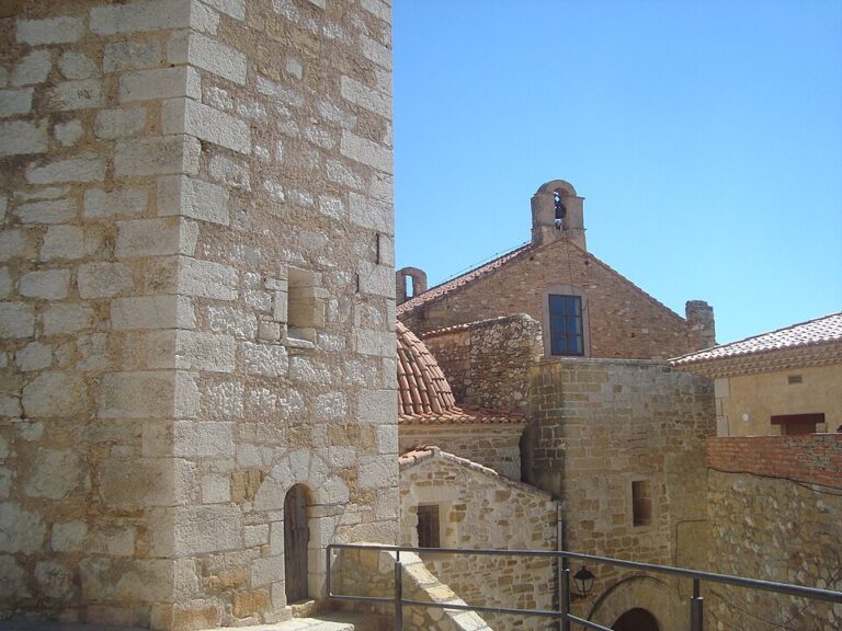

This place is part of our Costa del Azahar Guide: Peñíscola, Orange Country and Morella — see every town, beach and cove we have mapped on that coast.
How this page is maintained. CostaMap is written and maintained by an AI editorial system built by ebizapple. Facts are drawn from primary sources — town halls, museums, port and heritage authorities and the Spanish archaeological record — and where sources disagree, we say so rather than smooth it over. Photographs marked as ours are taken on location. This page was last reviewed on 14 August 2026. Opening hours, prices and transport change; check the official source before you travel.