
Costa Verde · Central Asturias
Central Asturias travel guide: Salinas to Villaviciosa
The dunes of Salinas, Avilés and its estuary, the cliffs of Cabo de Peñas, the fishing ports of Luanco and Candás, the city beach of Gijón and the Villaviciosa estuary.
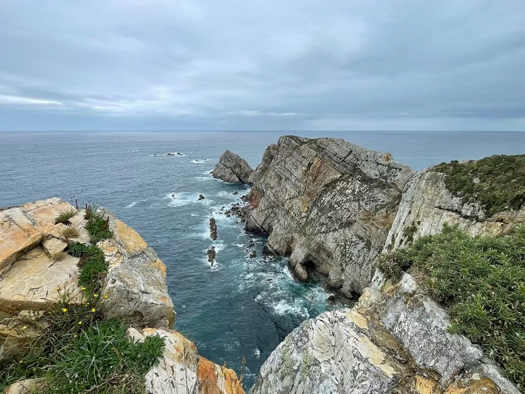
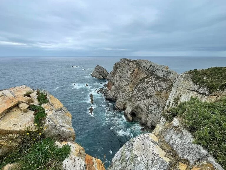
Cabo de Peñas · Photo: Einaz80, CC BY-SA 4.0
Part of the Costa Verde guide ←
Central Asturias is the middle stretch of the Costa Verde, from the beach of Salinas in Castrillón, west of Avilés, to the Villaviciosa estuary and Rodiles beach in the east. It is the most built-up part of the coast, with the cities of Avilés and Gijón, but between them lie the cliffs of Cabo de Peñas, the most northerly point of Asturias, and the fishing villages of Luanco, Candás and Tazones; Oviedo, the capital, is 28 km inland from Gijón.
At a glance
- Where the central coast of Asturias, from Salinas (Castrillón) to the Villaviciosa estuary: about 47 km in a straight line from Salinas beach to Rodiles.
- Towns Salinas, Avilés, Luanco, Candás, Gijón, Villaviciosa and Tazones; Oviedo inland.
- Best for long town beaches with lifeguards, city breaks in Gijón and Oviedo, surfing at Salinas, Xagó and Rodiles, and fishing-port food.
- Getting there Asturias Airport (OVD) is in Castrillón, 14 km from Avilés and 40 km from Gijón; the A-8 runs along the coast.
Map of central Asturias
The map shows the places in this stretch that have a CostaMap page, from the beaches and fishing villages to Oviedo and the trails and campsites inland. Tick a place type to filter it, and click a marker to see the place in the panel.
Place type
Area · next level
 Area map
Central Asturias
Click a marker to see the place here. From the dunes of Salinas past Cabo de Peñas and Gijón to the Villaviciosa estuary, with Oviedo inland.
Towns and villagesTowns and villages
From west to east. Facts are from Turismo Asturias, the regional tourist board, unless another source is named, checked in November 2026.
Salinas (Castrillón)
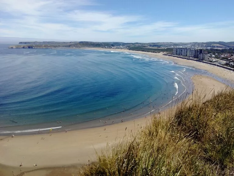
Salinas is the beach town of Castrillón, the municipality that also holds Asturias Airport. Its 1,200 m beach is one of the most popular in Asturias and joins San Juan beach to form about three kilometres of golden sand and dunes. A long promenade runs to the rocky headland of La Peñona, where the Philippe Cousteau Anchor Museum displays anchors and sculptures. Turismo Asturias also points to the town’s restaurants, among them the Michelin-starred Real Balneario. West of Salinas, Castrillón has Arnao, where Spain’s first underwater mine was dug, the Playón de Bayas, one of the longest beaches in Asturias, and the bird island of Isla de la Deva just offshore.
Avilés
Avilés is a commercial city of medieval origin on its own estuary, 4 km east of Salinas. Turismo Asturias calls its historic quarter one of the best preserved in northern Spain, with palaces, gardens, fountains, churches and arcaded streets; spain.info names the pedestrian streets of Galiana and Rivero, the Plaza de España with the City Hall, the 13th-century old church of Sabugo and the Palacio Valdés theatre. On the restored estuary, a promenade passes the marina and the Niemeyer Centre, the last great international work of the Brazilian architect Oscar Niemeyer. The city has around 83,600 inhabitants, a train station and a bus station, and spain.info says its fish market auctions almost 70 per cent of the fish caught in Asturias.
Xagó, Verdicio and Cabo de Peñas (Gozón)
North of the Avilés estuary, the coast road passes the beaches of Xagó and Verdicio and climbs to Cabo de Peñas, the most northerly point of Asturias, with cliffs up to 100 m high. Turismo Asturias’s lighthouse route describes the wooden walkway that protects the cape, the lighthouse in service since 1852 with a museum on its lower floor, and a seabird observation point at Punta Vaca. The beaches here are part of the Cabo Peñas Protected Landscape. Gozón has 10,763 inhabitants and a weekly market on Fridays; besides the cape, the tourist board lists the beaches of Viodo, Llumeres and Bañugues.
Luanco
Luanco (Lluanco), the capital of Gozón, is the closest fishing village to Cabo de Peñas. Its harbour once sheltered a large fleet that hunted whales and later fished for tuna, sardines and mackerel, and there was a busy canning industry. That past gave rise to the Asturias Maritime Museum, founded in 1948 and the oldest museum in the Principality. In the old quarter stands the 18th-century Clock Tower, used over time as a watchtower, prison and warehouse, and at the end of the promenade the church of Santa María almost touches the sea. The town beach, Santa Marina, was rebuilt in 1995. spain.info calls Luanco the tuna capital of Asturias.
Candás
Candás, 3.5 km east of Luanco, is the capital of Carreño and was already a busy port in the Middle Ages. It is known for its Sardine Festival, when the town dresses in a seafaring costume and eats thousands of roasted sardines, for marañuelas biscuits and for its canning tradition. Turismo Asturias recommends the port, the promenade, the lighthouse on San Antonio Point, lit since 1917, and the Antón Museum Sculpture Centre. A monument recalls a 17th-century episode in which the fishermen of Candás took the dolphins and pilot whales to court for the decline in their catches. Next door, Perlora was once, the board says, the second most important whaling port in the world.
Gijón
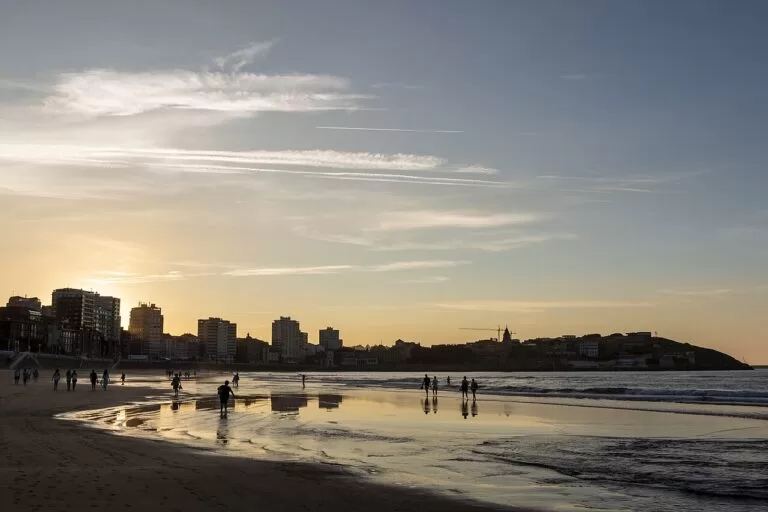
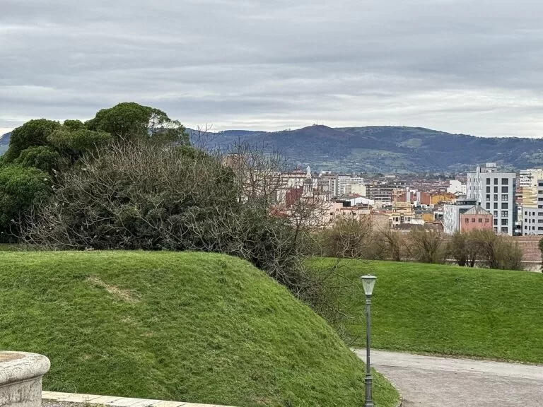
Gijón (Xixón), with about 277,600 inhabitants, is the bigger of the two cities on this coast and its main base. Its old fishing quarter, Cimadevilla, sits on the Santa Catalina hill, crowned by Eduardo Chillida’s sculpture Elogio del Horizonte, with Roman baths below the church of San Pedro and the medieval wall nearby. San Lorenzo, a 1,500 m beach with a promenade of almost three kilometres, is probably the best-known beach in Asturias. West of the city, the Campa Torres Archaeological-Natural Park preserves the pre-Roman fort of Noega beside the Cabo Torres lighthouse, opened in 1924. Turismo Asturias also lists the Atlantic Botanical Garden and the Laboral City of Culture.
Villaviciosa
Villaviciosa, capital of a municipality of 14,962 inhabitants, sits at the head of the largest estuary in Asturias and is the heart of the cider country. Its historic quarter has palaces, houses with coats of arms and the Romanesque church of Santa María de la Oliva, and it holds one of the oldest Holy Week celebrations in Asturias. The council celebrates its apple orchards every two years with an Apple Festival, and cider makers such as El Gaitero, one of the oldest in Asturias, open to visitors. Nearby are the Romanesque churches of San Juan de Amandi and Santa María de Lugás and the pre-Romanesque church and monastery of San Salvador de Valdediós. The weekly market is on Wednesdays.
Tazones
Tazones, at the mouth of the Villaviciosa estuary, was the first port Emperor Charles V visited on his first trip to the Peninsula, in September 1517; the locals re-enact the landing every August. Its two quarters of fishermen’s houses, San Miguel and San Roque, are a Historic-Artistic Site, and the catch landed here is auctioned at the fish market and served in the harbour restaurants and cider bars. At low tide you can look for dinosaur footprints along the shore. The octagonal lighthouse on El Olivo Point has been in service since 1864 and is one of the best preserved on the Asturian coast.
Beaches and coves
Our pick from west to east. Lengths, waves and lifeguard dates are from Turismo Asturias, checked November 2026; lifeguards are seasonal, so swim inside the season.
Salinas
1,200 m of town beach with a moderate swell, joined to San Juan beach; lifeguards daily from 1 June to 30 September. Salinas beach guide.
San Lorenzo
A 1,500 m city beach between the Santa Catalina hill and the mouth of the River Piles. Sports on the sand are not allowed between 10.00 and 20.00, and dogs are banned from 1 May to 15 October.
Rodiles
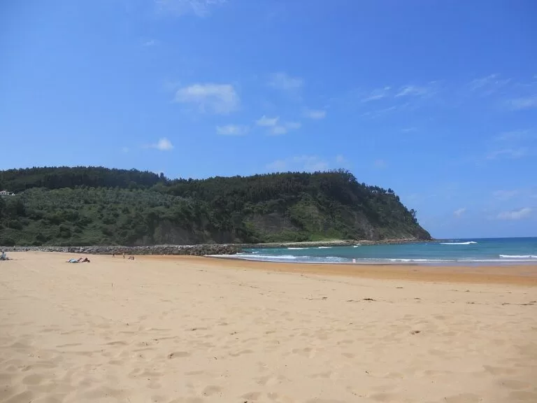
More than 1 km of golden sand at the mouth of the estuary, backed by a pine and eucalyptus wood; strong waves and popular with surfers. Rodiles beach guide.
- Xagó (Gozón) – about two kilometres of golden sand and wind-formed dunes, very open to north-easterly winds, with strong waves for surfing; swim with care. Paragliders take off from the cliffs of Cabo Negro.
- Verdicio (Gozón) – also called Tenrero, with coarse golden sand, dunes and strong waves that break right on the shore.
- Bañugues (Gozón) – a calm cove with very little swell and natural pools at low tide, which Turismo Asturias calls very family-friendly.
- Luanco (Santa Marina) – the town beach, rebuilt in 1995, with an amphibious chair that you book in advance.
On the Gozón beaches, lifeguards are on duty daily from 13 June to 8 September, and animals are banned from 1 May to 30 September except on parts of La Ribera and Llumeres beaches at set early and late hours. At Rodiles the lifeguard season is 20 June to 20 September.
Things to do
Nature
Walk the boardwalk at Cabo de Peñas and look for seabirds from Punta Vaca. The Ría de Villaviciosa Partial Nature Reserve is, after the Eo estuary, the second most important wintering and resting area for migrating waterbirds in Asturias, with almost a hundred species recorded; the Spanish Ornithological Society rates it a Wetland of National Importance. From the cliffs by the Playa de la Barca, above the Playón de Bayas, you can see the seabird colony of Isla de la Deva. Inland, the Senda del Oso is an easy greenway on an old mining railway past a bear enclosure, and Redes Natural Park, declared in 1996 and a Biosphere Reserve since 2001, has beech woods, the gorges of the Alba and Arrudos rivers and the largest chamois and deer populations in Asturias. Two campsites on CostaMap are there: the municipal campsite of Sobrescobio near the start of the Ruta del Alba, and Los Arrudos at Caleao.
History
See the Roman baths and Cimadevilla in Gijón, the pre-Roman fort of Noega at Campa Torres, the medieval quarter of Avilés and the landing place of Charles V at Tazones. Oviedo, 28 km from Gijón, has a cathedral with a Gothic and a Romanesque tower, the Holy Chamber, the pre-Romanesque fountain of La Foncalada and the Fontán market. Near Villaviciosa, San Salvador de Valdediós combines a pre-Romanesque church and a monastery.
Food and drink
This is cider country. Turismo Asturias places Villaviciosa in the Cider Region, and its cider makers, among them El Gaitero, open to visitors; in Oviedo, Gascona Street is known as the Cider Boulevard. On the coast, eat fish and seafood in the ports: sardines in Candás, tuna in Luanco and the catch of the day auctioned at Tazones. Candás and Luanco both make marañuelas, a traditional sweet.
Where to stay by town
We do not list hotels. These are the bases we would choose, with what each suits.
Gijón
The widest choice of hotels, restaurants and transport, with a city beach, a train station and the main ALSA bus station. Good without a car.
City and beachSalinas and Avilés
A beach town next to a historic city, a few kilometres from the airport. Salinas for the sand and surf, Avilés for the old quarter and the estuary.
Beach and short trips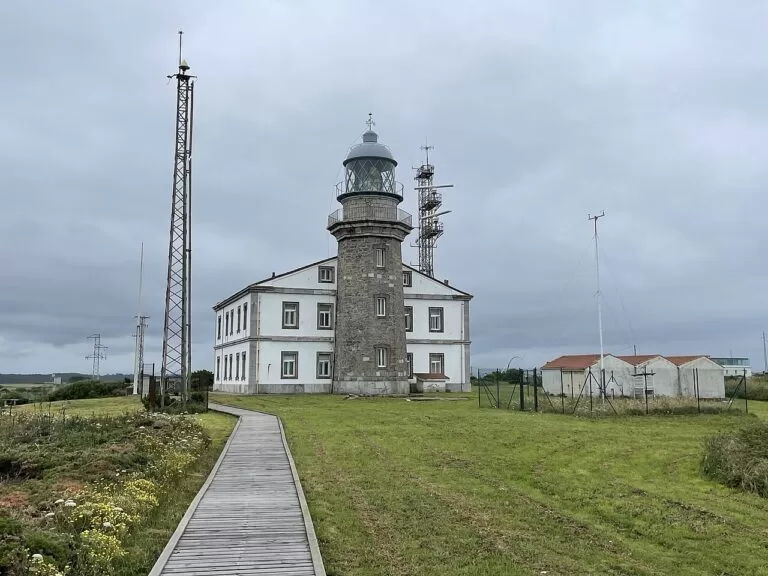
Luanco and Candás
Small fishing towns with town beaches, close to Cabo de Peñas and the Gozón beaches, and about 13 km from Gijón.
Quiet harbour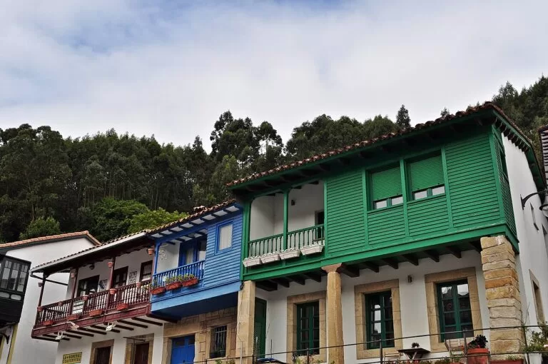
Villaviciosa and Tazones
Cider country, the estuary and Rodiles beach; Turismo Asturias notes campsites around Rodiles.
Rural and estuaryGetting there and around
By air: Asturias Airport (OVD) is at Santiago del Monte in Castrillón, 14 km from Avilés, 40 km from Gijón and 47 km from Oviedo. Turismo Asturias lists direct buses from the airport to Oviedo, Gijón, Avilés and Castrillón (Salinas and Piedrasblancas).
By car: the A-8 (Autovía del Cantábrico) crosses Asturias from east to west, and the dual carriageways of “the Y” link Oviedo, Gijón and Avilés. The A-66 arrives from the central plateau as a toll road. Cabo de Peñas is at the end of the AS-328; Rodiles is reached by the VV-6 (OpenStreetMap).
By train and bus: Gijón, Avilés and Oviedo have train stations and bus stations. Avilés’s urban line L11 runs through Salinas, and Luanco has a small bus station (OpenStreetMap). For smaller villages and beaches, check the Asturias transport consortium (CTA) before you rely on a bus; a car is easier for Cabo de Peñas and the Gozón beaches.
A two-day route
Two days
Day 1
Salinas, Avilés, Cabo de Peñas and Luanco
Start with a walk on Salinas beach and out to the Anchor Museum on La Peñona, then spend the late morning in the old quarter of Avilés. In the afternoon, follow the lighthouse route north past Xagó and Verdicio to Cabo de Peñas and walk the boardwalk to the viewpoints. End the day in Luanco: the harbour, the Clock Tower and the church of Santa María by the sea, with dinner in the old quarter, or drive on to Candás and its lighthouse on San Antonio Point.
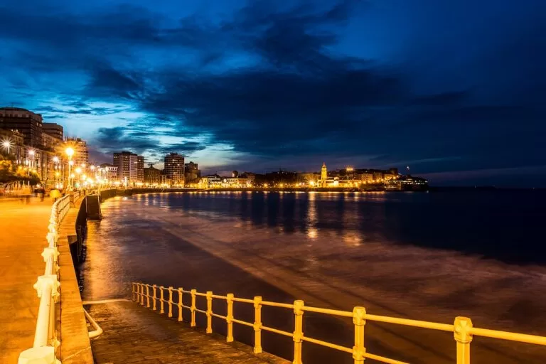
Day 2
Gijón, Tazones and Rodiles
Spend the morning in Gijón: Cimadevilla, the Elogio del Horizonte on the Santa Catalina hill, the Roman baths and a walk along San Lorenzo. After lunch, drive east past the beaches of La Ñora and España to Tazones for its harbour, painted houses and the lighthouse on El Olivo Point. Finish the afternoon across the estuary on Rodiles beach, or in Villaviciosa with a visit to a cider maker.
FAQ
What is the best beach near Gijón?
In the city, San Lorenzo, 1,500 m long. For a wilder beach, Rodiles (more than 1 km, strong waves) is about 23 km east in a straight line, and the Gozón beaches of Xagó, Verdicio and Bañugues are west of Luanco.
Which airport is closest to Gijón and Avilés?
Asturias Airport (OVD) in Castrillón, 14 km from Avilés and 40 km from Gijón, with direct buses to both and to Salinas.
Is Salinas beach good for surfing?
Yes. Turismo Asturias says you can surf or swim in its moderate swell. Xagó and Rodiles have stronger waves.
How far is Cabo de Peñas from Gijón?
About 19 km in a straight line north-west of the city; by road you go via Candás and Luanco or along the AS-328 from the Avilés side.
Is Avilés worth visiting?
Turismo Asturias calls its historic quarter one of the best preserved in northern Spain, and the Niemeyer Centre stands on the estuary. It is 4 km from Salinas beach.
Can you swim at Rodiles beach?
Yes, with care: it is a very open beach with strong waves. Lifeguards are on duty daily from 20 June to 20 September.
Other areas of the Costa Verde
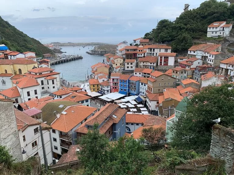
Western Asturias
From the Eo estuary on the Galician border to Cudillero: fishing ports, the white village of Luarca and dark-sand beaches.
Western Asturias guide →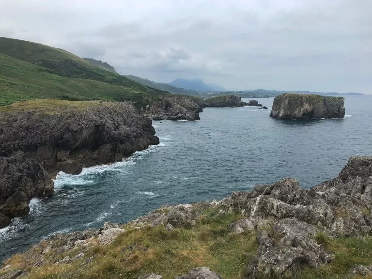
Eastern Asturias
Dinosaur footprints, cave art and the coves of Llanes, from Lastres, 9 km east of Rodiles, to the Cantabrian border.
Eastern Asturias guide →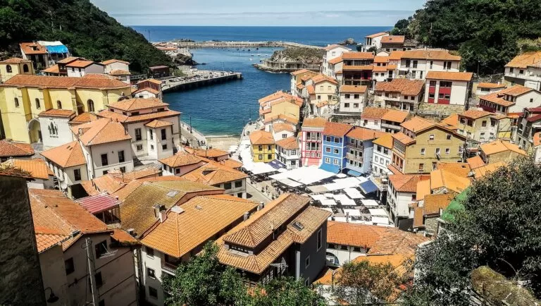
Costa Verde
The full guide to the coast of Asturias: all three areas, campsites, weather, the Picos de Europa and routes.
Costa Verde guide →Sources and freshness
Checked 6 November 2026. Turismo Asturias on the beaches of Salinas, Xagó, Verdicio, Bañugues, Luanco, San Lorenzo and Rodiles; on Luanco, Candás and Tazones; on the cities of Avilés, Gijón and Oviedo; on the municipalities of Castrillón, Gozón and Villaviciosa; on the Ría de Villaviciosa Nature Reserve, Redes Natural Park and the Sobrescobio campsite; on the lighthouse route (stage 3, stage 4); and on getting there by air and car. spain.info on Avilés and Luanco. Roads, car parks, bus lines and straight-line distances: OpenStreetMap contributors (ODbL).
Photo credits · 11 photos from Wikimedia Commons Show
Photos from Wikimedia Commons, not altered except for cropping: Cabo Peñas by Einaz80 (CC BY-SA 4.0); Playa de Salinas by Angelrtz (CC BY-SA 4.0); Gijón by David Álvarez López (CC BY 2.0); Rodiles by McBodes (CC BY 3.0); Gijón by Montserrat Boix (CC BY 4.0); Cabo Peñas lighthouse by Einaz80 (CC BY-SA 4.0); Tazones by Wamba Wambez (CC BY-SA 3.0); San Lorenzo, Gijón by David Álvarez López (CC BY 2.0); Cudillero by Robot8A (CC BY-SA 4.0); Torimbia, Llanes by Einaz80 (CC BY-SA 4.0); Cudillero by Vilanchelo (CC BY-SA 4.0).
Every place we have mapped on the Central Asturias
10 towns, beaches, coves and landmarks, kept up to date automatically.