
Benahavís (Costa del Sol)
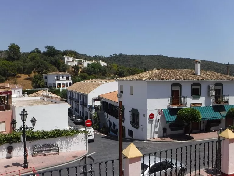
VillageBenahavís is a small white village in the hills behind San Pedro Alcántara and Puerto Banús, on the western Costa del Sol, about 7 km from the sea in the valley of the Guadalmina river. You reach it by car from San Pedro, about 6.3 km away in a straight line, or on Avanza bus line 33. The Andalusian tourist board calls it the most mountainous municipality of the western Costa del Sol, and the village centre is packed with restaurants. It suits a half-day of walking and a long lunch; skip it if you want a beach or big monuments.
Quick facts
- Names: Benahavís (often written Benahavis in English). The name is usually linked to the Arabic ben, “son of”, and a ruler of the Montemayor castle, or to the Berber tribe of the Banu Habis (Andalucía tourist board; Spanish Wikipedia).
- Where: on the southern slope of the Serranía de Ronda, between Marbella, Estepona and Ronda, in the province of Málaga.
- Coordinates: 36.5223, -5.0441 (the village centre in OpenStreetMap).
- Altitude: 150 m according to the tourist board; OpenStreetMap puts the centre at 181 m.
- Municipality: 145 km², crossed by the Guadalmina, Guadaiza and Guadalmansa rivers (tourist board).
- Distances in a straight line: San Pedro Alcántara 6.3 km, Puerto Banús 9.1 km, Estepona 13.9 km, Marbella old town 14.5 km, Ronda 26.8 km, Málaga airport 51.5 km (our calculation from coordinates).
- Bus: Avanza line 33, San Pedro Alcántara–Benahavís, to the Av. Andalucía stop at the edge of the centre (OpenStreetMap).
- Entry: the village and its trails are free.
Getting there and parking
By car: from the A-7 coast road at San Pedro Alcántara, follow the signs inland, north up the Guadalmina valley, to the village. From Ronda, the A-397 comes down to the coast at San Pedro, so Benahavís fits a Ronda day trip. Spanish Wikipedia notes a geological site, banded peridotite rocks at the Puerto del Madroño, on the edge of the A-397 within the municipality.
Parking: OpenStreetMap shows several small car parks and street-side bays around the centre, including two underground car parks by the Policía Local building on the south side, about 230 m from the centre, and a free surface car park near the Daidín school on the north side, about 270 m away. Spaces near the restaurant streets fill up at lunch and dinner time; we could not confirm prices for the underground car parks.
By bus: line 33 of Avanza runs between San Pedro Alcántara and Benahavís, according to OpenStreetMap route data. We could not open the operator’s timetable, so check times with Avanza before you rely on it, especially for an evening meal.
Taxi: from Puerto Banús or San Pedro it is a short ride; there is no taxi rank mapped in the village.
What to expect
The tourist board describes a village that keeps traces of its Arab origin in the style of the white villages, with mountains around it. To the south, towards the coast, the municipality is mostly luxury housing estates and golf courses; Spanish Wikipedia counts about ten golf courses in the municipality. The old village is small: most of the centre lies within 300 m of the main square.
The reason most visitors come is food. OpenStreetMap maps 17 restaurants and six bars and cafés within about 350 m of the centre, from Spanish grills and tapas to Italian and French cooking. Expect busy terraces at weekends and in summer evenings, and prices aimed at visitors from the coast.
Castillo de Montemayor: the ruins of a castle from the Muslim period stand on a hill near the village. The tourist board says the fortress was an important military post, with a view of more than 100 km of coast and of the African shore; only remains survive. It was fought over by the rulers of Málaga and Algeciras in the 11th century and taken by the Marinids in 1273. The castle is reached on foot by a signed trail (see below).
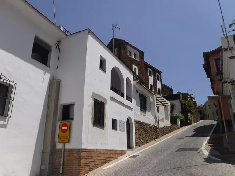
In the village: the tourist board mentions an old 16th-century palace among the monuments. On the south edge of the centre, OpenStreetMap maps the ruins of the Torre de la Leonera in a small park. The parish church of the Virgen del Rosario stands on the west side of the centre.
Walking and nature
The Guadalmina river emerges at Benahavís through a karst gorge called the Angosturas del Guadalmina. Benahavís holds half the area of the Special Areas of Conservation of the Guadalmansa, Guadaiza and Guadalmina rivers (Spanish Wikipedia). The tourist board lists the Cerro del Duque, Daidín, Las Máquinas, the Charco de las Mozas and the La Leche reservoir as places of natural interest in the municipality.
- Castillo de Montemayor trail: Spanish Wikipedia gives it as 2.6 km from Benahavís to the castle; OpenStreetMap lists it as the PR-A 165, signed by the town hall. It climbs, so take water and avoid the middle of a summer day.
- Las Libélulas del Guadalmina (SL-A 252): a short local route along the river, mapped in OpenStreetMap; Spanish Wikipedia describes the SL-A 252 as a 2.8 km circular route.
- Acequia del río Guadalmina: a 4.6 km circular walk along an irrigation channel, according to Spanish Wikipedia.
We could not open an official route sheet for these trails, so check the signposts at the start and do not rely on these lengths for timing.
Accessibility and safety
The centre is compact but hilly, with some steep lanes; the restaurant streets are the flattest part. The trails are mountain paths with no shade on parts of the way. From 1 June to 15 October all use of fire is banned in Andalusia’s forests and the land around them, and summer heat in the valley is strong. After heavy rain, stay away from the river gorge.
Best time to visit
Spring and autumn suit walking best. In summer, come for dinner, when the terraces fill and the heat drops. Weekday lunchtimes are the quietest time to find a table and a parking space.
Nearby alternatives
- Basílica de Vega del Mar – early Christian remains near the beach at San Pedro Alcántara, 7.4 km.
- Selwo Aventura – the safari park in the hills above Estepona, 7.6 km.
- Puerto Banús – Marbella’s best-known marina, 9.1 km.
- Estepona – the old town and La Rada beach, 13.9 km.
- Ojén – the white village above Marbella, 17.4 km.
- Ronda – the gorge town, 26.8 km, reached by the A-397.
FAQ
How do I get to Benahavís from Marbella?
Drive west to San Pedro Alcántara and turn inland up the Guadalmina valley; the village is about 6.3 km from San Pedro in a straight line. Without a car, take a town bus or taxi to San Pedro and then Avanza line 33.
Is there parking in Benahavís?
Yes. OpenStreetMap maps small surface car parks, street bays and two underground car parks around the centre, but spaces near the restaurants fill at meal times.
What is Benahavís known for?
Its restaurants, its setting as a white village in the mountains, and walks to the Castillo de Montemayor and along the Guadalmina river.
Is Benahavís worth visiting?
For a meal and a short walk, yes. The village is small, with no big monuments, so it is a half-day trip rather than a base for a beach holiday.
Is there a beach in Benahavís?
No. The nearest beaches are at San Pedro Alcántara and Puerto Banús on the coast below.
Sources and freshness
Checked 7 November 2026 · 4 sources Show
Checked 7 November 2026. Official: Andalucía tourist board, Benahavís (setting, rivers, natural sites, Montemayor castle, history, altitude, area). Background: Spanish Wikipedia, Benahavís (name, distance to the coast, golf, protected areas, trails, Puerto del Madroño). Location, car parks, bus stop, bus line 33, restaurants, trail references and distances: OpenStreetMap contributors (ODbL). Fire ban: Andalusian forest fire rules as given in the CostaMap Costa del Sol guide. The town hall and bus operator websites could not be reached from our research tools, so bus times and car park prices are not confirmed. Photos: Wikimedia Commons, licences as credited.
How this page is made. CostaMap is written with an AI editorial system run by Ebizapple. This page is based on the sources listed above. Last updated 6 November 2026. Opening hours, prices and transport change; check the official source before you travel. How we work · Partner links and ads